Sherwood Manor, Connecticut

Last updated

Sherwood Manor, Connecticut
Shaker Farm, Sherwood Manor CT.jpg
Shaker Farm
USA Connecticut location map.svg
Red pog.svg
Sherwood Manor
Usa edcp location map.svg
Red pog.svg
Sherwood Manor
Coordinates: 42°0′48″N72°33′51″W / 42.01333°N 72.56417°W / 42.01333; -72.56417
CountryUnited States
State Connecticut
County Hartford
Town Enfield
Area
  Total3.1 sq mi (8.1 km2)
  Land3.1 sq mi (8.1 km2)
  Water0 sq mi (0 km2)
Elevation
140 ft (40 m)
Population
 (2010)
  Total5,410
  Density1,700/sq mi (670/km2)
Time zone UTC-5 (Eastern)
  Summer (DST) UTC-4 (Eastern)
ZIP code
06082 [1]
Area code 860
FIPS code 09-68450
GNIS feature ID2377860

Sherwood Manor is a census-designated place (CDP) within the town of Enfield in Hartford County, Connecticut, United States. The population was 5,410 at the 2010 census. [2]

Contents

Geography

The CDP is in the northern part of the town of Enfield, bordered to the west by Interstate 91, to the north partially by Brainard Road, to the east by Connecticut Route 192 (N. Maple Street), and to the south by Connecticut Route 220 (Elm Street/Shaker Road). Thompsonville borders Sherwood Manor to the west, across I-91. Hazardville is 2 miles (3 km) to the southeast, and Longmeadow, Massachusetts, is 3 miles (5 km) to the north.

According to the United States Census Bureau, the CDP has a total area of 3.1 square miles (8.1 km2), all of it land.

Demographics

As of the census [3] of 2000, there were 5,689 people, 2,184 households, and 1,644 families residing in the CDP. The population density was 1,818.5 inhabitants per square mile (702.1/km2). There were 2,230 housing units at an average density of 712.8 per square mile (275.2/km2). The racial makeup of the CDP was 96.47% White, 1.14% African American, 0.05% Native American, 1.07% Asian, 0.47% from other races, and 0.79% from two or more races. Hispanic or Latino of any race were 1.83% of the population.

There were 2,184 households, out of which 28.5% had children under the age of 18 living with them, 65.0% were married couples living together, 7.4% had a female householder with no husband present, and 24.7% were non-families. 19.6% of all households were made up of individuals, and 8.4% had someone living alone who was 65 years of age or older. The average household size was 2.60 and the average family size was 3.01.

In the CDP, the population was spread out, with 22.6% under the age of 18, 6.0% from 18 to 24, 28.9% from 25 to 44, 26.9% from 45 to 64, and 15.5% who were 65 years of age or older. The median age was 40 years. For every 100 females, there were 94.4 males. For every 100 females age 18 and over, there were 93.2 males.

The median income for a household in the CDP was $56,641, and the median income for a family was $62,019. Males had a median income of $46,118 versus $32,500 for females. The per capita income for the CDP was $24,839. About 1.1% of families and 1.6% of the population were below the poverty line, including 0.5% of those under age 18 and 3.3% of those age 65 or over.

Related Research Articles

<span class="mw-page-title-main">Bayview-Montalvin, California</span> Former CDP in California, United States

Bayview-Montalvin is a former census-designated place (CDP) in Contra Costa County, California, United States. The population was 5,004 at the 2000 census.

<span class="mw-page-title-main">Broad Brook, Connecticut</span> Census-designated place in Connecticut, United States

Broad Brook is a neighborhood and census-designated place (CDP) in the town of East Windsor, Hartford County, Connecticut, United States. As of the 2010 census, the CDP population was 4,069.

<span class="mw-page-title-main">Hazardville, Connecticut</span> Census-designated place in Connecticut, United States

Hazardville is a section of the town of Enfield, Connecticut, in Hartford County. It is a census-designated place (CDP) that had a total population of 4,599 as of the 2010 census.

<span class="mw-page-title-main">Kensington, Connecticut</span> Census-designated place in Connecticut, United States

Kensington is a census-designated place (CDP) and section of the town of Berlin in Hartford County, Connecticut, United States. The Berlin town offices are located in Kensington. The population was 8,459 at the 2010 census.

<span class="mw-page-title-main">North Granby, Connecticut</span> Census-designated place in Connecticut, United States

North Granby is a village and census-designated place (CDP) in Hartford County, Connecticut, United States. It is part of the town of Granby. The population was 1,944 at the 2010 census.

Tariffville is a neighborhood and census-designated place (CDP) in the town of Simsbury in Hartford County, Connecticut, United States. The population was 1,324 at the 2010 census. It is a popular location for whitewater paddlers who use the Farmington River.

<span class="mw-page-title-main">Terramuggus, Connecticut</span> Census-designated place in Connecticut, United States

Terramuggus is a census-designated place (CDP) in the town of Marlborough, Hartford County, Connecticut, United States. It contains the town center village and surrounding areas. The population was 1,025 at the 2010 census.

<span class="mw-page-title-main">Thompsonville, Connecticut</span> Census-designated place in Connecticut, United States

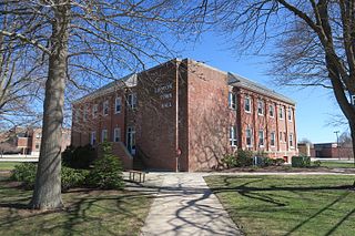
Thompsonville is a census-designated place (CDP) in the town of Enfield in Hartford County, Connecticut, United States. The population of the CDP was 8,577 at the 2010 census.

Saybrook Manor is a community and census-designated place (CDP) in Old Saybrook, a town in Middlesex County, Connecticut, United States. The population was 1,127 at the 2020 census. The Saybrook Manor section is generally the area south of U.S. Route 1 between the Westbrook town line and the Oyster River.

Heritage Village is a census-designated place (CDP) in the town of Southbury in New Haven County, Connecticut, United States. The population was 3,736 at the 2010 census.

<span class="mw-page-title-main">Long Hill, Groton, Connecticut</span> Census-designated place in Connecticut, United States

Long Hill is a census-designated place (CDP) in the town of Groton in New London County, Connecticut, United States. The population was 4,205 at the 2010 census.

<span class="mw-page-title-main">Old Mystic, Connecticut</span> Census-designated place in Connecticut, United States

Old Mystic is a village and census-designated place (CDP) located in the town of Groton, Connecticut. The population was 3,554 at the 2010 census.

<span class="mw-page-title-main">Poquonock Bridge, Connecticut</span> Census-designated place in Connecticut, United States

Poquonock Bridge is a village and census-designated place (CDP) in the town of Groton in New London County, Connecticut, United States. The population was 1,686 at the 2020 census.

<span class="mw-page-title-main">Somers, Connecticut</span> Town in Connecticut, United States

Somers is a town in Tolland County, Connecticut. The town is part of the Capitol Planning Region. The population was 10,255 at the 2020 census. The town center is listed by the U.S. Census Bureau as a census-designated place (CDP). In 2007, Money Magazine listed Somers 53rd on its "100 Best Places to Live", based on "economic opportunity, good schools, safe streets, things to do and a real sense of community."

<span class="mw-page-title-main">Moosup, Connecticut</span> Village in Connecticut, United States

Moosup is a village and census-designated place (CDP) in the town of Plainfield, Connecticut in the United States. The population was 3,231 at the 2010 census.

<span class="mw-page-title-main">Southwood Acres, Connecticut</span> Census-designated place in Connecticut, United States

Southwood Acres is a suburban neighborhood within the town of Enfield in northern Hartford County, Connecticut, United States. The neighborhood is listed as a census-designated place (CDP) by the U.S. Census Bureau and had a population of 7,657 at the 2010 census.

<span class="mw-page-title-main">South Woodstock, Connecticut</span> Census-designated place in Connecticut, United States

South Woodstock is a village and census-designated place (CDP) in Woodstock, Windham County, Connecticut, United States. The population was 1,291 at the 2010 census.

<span class="mw-page-title-main">Sherwood, Hamilton County, Ohio</span> Census-designated place in Ohio, United States

Sherwood is a census-designated place (CDP) in Hamilton County, Ohio, United States. The population was 3,633 at the 2020 census.

Enfield is a census-designated place (CDP) and the main village in the town of Enfield in Grafton County, New Hampshire, United States. The population of the CDP was 1,571 at the 2020 census, out of 4,465 in the entire town.

<span class="mw-page-title-main">Clinton, Connecticut</span> Town in Connecticut, United States

Clinton is a town in Middlesex County, Connecticut, United States. The town is part of the Lower Connecticut River Valley Planning Region. The population of the town was 13,185 at the 2020 census. The town center along the shore line was listed as a census-designated place (CDP) by the U.S. Census Bureau in the 2020 census.

References

  1. "Sherwood Manor CT ZIP Code". zipdatamaps.com. 2023. Retrieved January 26, 2023.
  2. "Geographic Identifiers: 2010 Demographic Profile Data (G001): Sherwood Manor CDP, Connecticut". U.S. Census Bureau, American Factfinder. Archived from the original on February 12, 2020. Retrieved November 30, 2012.
  3. "U.S. Census website". United States Census Bureau . Retrieved January 31, 2008.