Canton Valley, Connecticut

Last updated

Canton Valley, Connecticut
Gallery on the Green, Canton CT.jpg
Gallery on the Green
USA Connecticut location map.svg
Red pog.svg
Canton Valley
Usa edcp location map.svg
Red pog.svg
Canton Valley
Coordinates: 41°49′27″N72°53′36″W / 41.82417°N 72.89333°W / 41.82417; -72.89333
CountryUnited States
State Connecticut
County Hartford
Town Canton
Area
  Total1.8 sq mi (4.6 km2)
  Land1.8 sq mi (4.6 km2)
  Water0.0 sq mi (0.0 km2)
Elevation
342 ft (104 m)
Population
 (2017)
  Total1,489
  Density840/sq mi (320/km2)
Time zone UTC-5 (Eastern)
  Summer (DST) UTC-4 (Eastern)
ZIP code
06019
Area code 860
FIPS code 09-12370
GNIS feature ID2378341

Canton Valley [1] (commonly known simply as Canton [2] ) is a village and census-designated place (CDP) in the town of Canton in Hartford County, Connecticut, United States. The population was 1,580 at the 2010 census. [3] As of the 2017 census the population was 1,489. [4]

Contents

Geography

Canton Valley ("Canton") is located in the southern part of the town of Canton. U.S. Route 202 and U.S. Route 44 run in a concurrency as the Albany Turnpike, the main road through the center of the village, leading east to Avon and west to Torrington (US 202) and northwest to Winsted (US 44). Connecticut Route 177 (Lovely Street) leads south from Canton Valley to Unionville. Dowd Avenue leads southwest from Canton Valley to Collinsville, the largest community in the town of Canton.

According to the United States Census Bureau, the Canton Valley CDP has a total area of 1.8 square miles (4.6 km2), all land. [3]

Demographics

As of the census [5] of 2000, there were 1,565 people, 749 households, and 409 families residing in the CDP. The population density was 886.7 inhabitants per square mile (342.4/km2). There were 764 housing units at an average density of 432.9 per square mile (167.1/km2). The racial makeup of the CDP was 96.93% White, 0.58% African American, 0.32% Asian, 1.09% from other races, and 1.09% from two or more races. Hispanic or Latino of any race were 1.15% of the population.

There were 749 households, out of which 25.0% had children under the age of 18 living with them, 43.4% were married couples living together, 9.3% had a female householder with no husband present, and 45.3% were non-families. 40.5% of all households were made up of individuals, and 18.8% had someone living alone who was 65 years of age or older. The average household size was 2.09 and the average family size was 2.84.

In the CDP, the population was spread out, with 22.2% under the age of 18, 3.9% from 18 to 24, 33.0% from 25 to 44, 24.3% from 45 to 64, and 16.5% who were 65 years of age or older. The median age was 40 years. For every 100 females, there were 88.1 males. For every 100 females age 18 and over, there were 82.2 males.

The median income for a household in the CDP was $46,543, and the median income for a family was $64,028. Males had a median income of $45,938 versus $32,298 for females. The per capita income for the CDP was $25,206. About 6.6% of families and 7.4% of the population were below the poverty line, including 7.8% of those under age 18 and 1.7% of those age 65 or over.

Related Research Articles

<span class="mw-page-title-main">Blue Hills, Connecticut</span> Place in Connecticut, United States

Blue Hills is a community in Hartford County, Connecticut, United States, encompassing the northwestern corner of the city of Hartford and the southeastern corner of the town of Bloomfield. The Bloomfield portion is listed by the U.S. Census Bureau as a census-designated place (CDP), with a population of 2,762 at the 2020 census.

<span class="mw-page-title-main">Broad Brook, Connecticut</span> Census-designated place in Connecticut, United States

Broad Brook is a neighborhood and census-designated place (CDP) in the town of East Windsor, Hartford County, Connecticut, United States. As of the 2010 census, the CDP population was 4,069.

<span class="mw-page-title-main">Kensington, Connecticut</span> Census-designated place in Connecticut, United States

Kensington is a census-designated place (CDP) and section of the town of Berlin in Hartford County, Connecticut, United States. The Berlin town offices are located in Kensington. The population was 8,459 at the 2010 census.

<span class="mw-page-title-main">Terramuggus, Connecticut</span> Census-designated place in Connecticut, United States

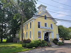
Terramuggus is a census-designated place (CDP) in the town of Marlborough, Hartford County, Connecticut, United States. It contains the town center village and surrounding areas. The population was 1,025 at the 2010 census.

<span class="mw-page-title-main">Thompsonville, Connecticut</span> Census-designated place in Connecticut, United States

Thompsonville is a census-designated place (CDP) in the town of Enfield in Hartford County, Connecticut, United States. The population of the CDP was 8,577 at the 2010 census.

<span class="mw-page-title-main">Weatogue, Connecticut</span> Census-designated place in Connecticut, United States

Weatogue is a village and census-designated place in Simsbury, Hartford County, Connecticut, United States. The population was 2,776 at the 2010 census.

<span class="mw-page-title-main">West Simsbury, Connecticut</span> Census-designated place in Connecticut, United States

West Simsbury is a census-designated place (CDP) and section of the town of Simsbury in Hartford County, Connecticut, United States. The population of the CDP was 2,447 at the 2010 census.

<span class="mw-page-title-main">Essex Village, Connecticut</span> Census-designated place in Connecticut, United States

Essex Village is a village and census-designated place (CDP) in the town of Essex, Connecticut, in the United States. The population was 2,583 at the 2020 census, out of 6,733 in the entire town of Essex. The government offices of the town are located within the village.

<span class="mw-page-title-main">Simsbury Center, Connecticut</span> Census-designated place in Connecticut, United States

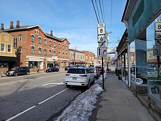
Simsbury Center is a census-designated place (CDP) that consists of the central settlement, and the neighborhoods immediately surrounding it, in the town of Simsbury, Connecticut, United States. As of the 2010 census, the CDP had a population of 5,836. The core area of the CDP is listed as the Simsbury Center Historic District on the National Register of Historic Places.

<span class="mw-page-title-main">West Canton, North Carolina</span> Census-designated place in North Carolina, United States

West Canton is an unincorporated community and census-designated place (CDP) in Haywood County, North Carolina, United States. The population was 1,247 at the 2010 census. It is part of the Asheville Metropolitan Statistical Area.

<span class="mw-page-title-main">Adams (CDP), Massachusetts</span> Census-designated place in Massachusetts, United States

Adams is a census-designated place (CDP) located in the town of Adams in Berkshire County, Massachusetts, United States. The population was 5,515 at the 2010 census, out of 8,485 in the entire town of Adams.

<span class="mw-page-title-main">Williamstown (CDP), Massachusetts</span> Census-designated place in Massachusetts, United States

Williamstown is a census-designated place (CDP) in the town of Williamstown in Berkshire County, Massachusetts, United States. The population of the CDP was 4,325 at the 2010 census, out of 7,754 in the entire town.

Lancaster is a census-designated place (CDP) and the main village in the town of Lancaster in Coos County, New Hampshire, United States. The population of the CDP was 1,941 at the 2020 census, out of 3,218 in the entire town of Lancaster.

Hanover is a census-designated place (CDP) and the main village in the town of Hanover in Grafton County, New Hampshire, United States. The population of the CDP was 9,078 at the 2020 census, out of 11,870 in the entire town. The CDP includes the campus of Dartmouth College.

Lisbon is a census-designated place (CDP) and the main village in the town of Lisbon in Grafton County, New Hampshire, United States. The population of the CDP was 965 at the 2020 census, out of 1,621 in the entire town.

<span class="mw-page-title-main">Amenia (CDP), New York</span> Hamlet in the state of New York, United States

Amenia is a hamlet and census-designated place (CDP) in Dutchess County, New York, United States. The population was 725 at the 2020 census. It is part of the Poughkeepsie–Newburgh–Middletown, NY Metropolitan Statistical Area as well as the larger New York–Newark–Bridgeport, NY-NJ-CT-PA Combined Statistical Area.

<span class="mw-page-title-main">Suffield Depot, Connecticut</span> Census-designated place in Connecticut, United States

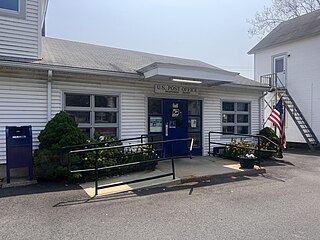
Suffield Depot is the name of a census-designated place (CDP) corresponding to the village of Suffield, the primary settlement of the town of Suffield, Connecticut, United States, in Hartford County. The population of the CDP was 1,325 as of the 2010 census.

<span class="mw-page-title-main">Walpole (CDP), New Hampshire</span> Census-designated place in New Hampshire, United States

Walpole is a census-designated place (CDP) and the central village in the town of Walpole in Cheshire County, New Hampshire, United States. The population of the CDP was 573 at the 2020 census, compared to 3,633 in the entire town.

<span class="mw-page-title-main">Washoe Valley, Nevada</span> Census-designated place in Nevada, United States

Washoe Valley is a census-designated place (CDP) in Washoe County, Nevada, United States. It corresponds closely to the unincorporated community of New Washoe City. The population was 3,019 at the 2010 census. It is part of the Reno–Sparks Metropolitan Statistical Area. The CDP takes its name from the Washoe Valley, a region between Reno and Carson City centered on Washoe Lake.

<span class="mw-page-title-main">Thomaston (CDP), Connecticut</span> Census-designated place in Connecticut, United States

Thomaston is a census-designated place (CDP) in Litchfield County, Connecticut, United States. It comprises the downtown portion of the town of Thomaston. As of the 2010 census, the population of the CDP was 1,910, out of 7,887 in the entire town.

References

  1. U.S. Geological Survey Geographic Names Information System: Canton Valley, Connecticut
  2. U.S. Geological Survey Geographic Names Information System: Canton, Connecticut
  3. 1 2 "Geographic Identifiers: 2010 Demographic Profile Data (G001): Canton Valley CDP, Connecticut". U.S. Census Bureau, American Factfinder. Archived from the original on February 12, 2020. Retrieved November 29, 2012.
  4. "2013-2017 American Community Survey 5-Year Estimates". U.S. Census Bureau, American Factfinder. Archived from the original on February 14, 2020. Retrieved May 24, 2019.
  5. "U.S. Census website". United States Census Bureau . Retrieved January 31, 2008.