In 2017, SafeWise ranked Weston the safest town in Connecticut and the 6th safest town in the country.[4]
Weston is the closest Connecticut town to New York City without a train station. Aside from a handful of stores that form the town's center, Weston has little commercial development and residential development is limited by two-acre zoning.[5] Most of Devil's Den Preserve, a 1,746-acre (707ha) nature reserve, which gets 40,000 visits a year, is located in the town.
History
Town sign for Weston (front)
In the 17th century, Weston's first English settlers were mostly farmers living in the town of Fairfield, Connecticut, the boundaries of which extended to Weston until the late 18th century.[6] The Norfield Parish was created in the area now occupied by the towns of Weston and Easton. In 1787, the area was formally incorporated as the Town of Weston. It is believed to be named after Weston-super-Mare, which was a small fishing village surrounded by countryside farmland, which many of the early British farming settlers originated from.[7] In 1845, the Town of Easton was split off from Weston.
A meteor exploded above the town on December 14, 1807.[8] Six pieces, totaling 28 pounds (13kg), were recovered and examined by scientists, who issued a report. This experience provided information that expanded the contemporary thinking about meteors for many.[9][10]
Despite rocky soil, farmers in town grew apples, onions, and potatoes. Grist, cider, lumber, and fulling mills were built. The town had nine manufacturers by 1850, but two decades later only the Bradley Edge Tool Company still thrived. That factory burned down in 1911.[11]
Unlike other nearby towns, Weston never had a railroad built through it, which stifled the development of non-agricultural businesses. Between the Civil War and the Great Depression, the town's population dropped from approximately 1,000 to a low of 670, by 1930. Artists, writers, and actors from New York became attracted to the community in the 1930s and began settling in it. Construction of the Merritt Parkway, which arrived to the south of Weston in 1938, resulted in further population growth.[11]
Geography
According to the United States Census Bureau, the town has a total area of 20.7 square miles (54km2), of which 19.8 square miles (51km2) is land and 0.9 square miles (2.3km2), or 4.39%, is water.
As of the 2010 census,[13] there were 10,025 people, 3,289 households, and 2,811 families residing in the town. The population density was 506.0 inhabitants per square mile (195.4/km2). There were 3,629 housing units at an average density of 178.4 per square mile (68.9/km2). The racial makeup of the town was 95.75% White, 0.88% African American, 0.11% Native American, 1.94% Asian, 0.10% Pacific Islander, 0.25% from other races, and 0.98% from two or more races. Hispanic or Latino of any race were 2.05% of the population.
There were 3,289 households, out of which 49.8% had children under the age of 18 living with them, 78.4% were married couples living together, 5.0% had a female householder with no husband present, and 15.1% were non-families. 11.2% of all households were made up of individuals, and 4.9% had someone living alone who was 65 years of age or older. The average household size was 3.03 and the average family size was 3.28.
In the town, the population was spread out, with 31% under the age of 18, 4% from 18 to 24, 31% from 25 to 49, 23% from 50 to 64, and 11% who were 65 years of age or older. The median age was 42 years. For every 100 females, there were 96.5 males. For every 100 females age 18 and over, there were 92.9 males.
As of 2017[update], the median income for a household in the town was $219,868. Males had a median income of $168,472 versus $103,345 for females. The per capita income for the town was $95,534. About 2.6% of the population were below the poverty line.[14]
In 2019, The National Council for Home Safety and Security ranked Weston the 4th safest town in the state of Connecticut. The National Council for Home Safety and Security ranked the safest towns and cities in Connecticut based on the most recent FBI Uniform Crime Report statistics and population sizes.[15]
Government
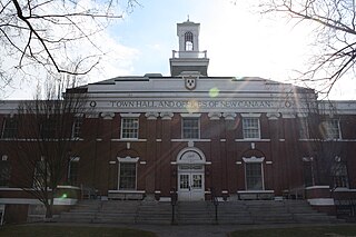
Entrance to Town Hall
Like many other New England towns, the government of Weston consists of the Town Meeting, and elective and appointive boards. First among the elective boards is the Board of Selectmen. Samantha Nestor is the First Selectwoman. By charter, the First Selectman is the Chief Executive and Administrative Officer of the town. The town's legislative powers are divided between the Board of Selectmen and the Town Meeting. Among other elective boards are the Board of Education, the Board of Finance, the Planning and Zoning Commission, and the Board of Police Commissioners.[16]
On August 19, 2021, Martin Mohabeer became the first African-American to become a member of the Board of Selectmen when the Board voted to appoint him to fill a vacant seat. His subsequent election to a new two year term in November 2021 marked the first time an African-American was elected in Weston.
For the fiscal year of 2023-2024, the Town of Weston’s net budget is about $80-million. About 73% of the town’s budget is spent on the Weston Public Schools.[19] Weston raises taxes on the basis of property value. With real estate assessed at 70% of market value, the mill rate evolved as follows:
To make the mill rates comparable, the asterisked numbers are adjusted to account for the real estate revaluation of 2018-2019. The revaluation decreased the grand list by 6.3 percent.[25] The numbers for 2013-2014 and prior years are also adjusted for revaluations in 2014 and 2009, respectively.[26][27]
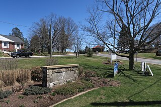
Town Center
Commercial development in Weston is limited to the Town Center area located at the intersection of Weston Road and Norfield Road. The Town Center contains a grocery store, community bank, liquor store, casual restaurant, dry cleaner, realtor, gas station, pharmacy and a post office.[28][29]
Norfield Historic District – Roughly, at the junction of Weston and Norfield Rds. northeast to Hedgerow Common (added August 31, 1991)
Education
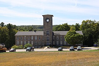
Weston Intermediate School entrance
There are four public schools in the Weston Public Schools district,[30] all located on School Road:
Weston High School (WHS) – grades 9–12, with about 800 students. Most Weston High School (WHS) seniors go on to attend selective colleges and universities. Recently the high school underwent a significant building expansion, which included construction of a new science department and playing fields. The high school auditorium was also updated in 2008.
Weston Middle School (WMS) – grades 6–8, with about 600 students.
Weston Intermediate School (WIS) – grades 3–5, with about 600 students. The school opened in September 2005 as the town's newest school.
Hurlbutt Elementary School (HES) – pre-kindergarten-grade 2, with about 600 students
In June 2012, 24/7 Wall St. ranked Weston as the second wealthiest school district in the United States.[31]
In 2013 and 2014, U.S. News & World Report ranked Weston High School as the third best high school in Connecticut and the 240th best high school in the United States.[32]
Weston High School was awarded the gold medal for its high level of student performance. The methodology of ranking this honor is based on student performance on standardized tests as well as participation in Advanced Placement (AP) and International Baccalaureate (IB) programs. AP programs are offered across a variety of subject matters, with sixty percent of WHS students participating.
In August 2015, Newsweek ranked Weston High School number 47 for America's Top High Schools in the country, public and private.[33]
In August 2015, Weston High School was ranked the best in the state and 47th best in the country according to a survey conducted by Newsweek magazine. Each year, the magazine ranks the top 500 high schools in the country based on which institutions do the best job of preparing students for college. According to the study, Weston High School has a 97.2% college enrollment rate, a 100% graduation rate, an AP/IB/Dual Enrollment Composite of 73, a weighted SAT/ACT score composite of 69.4, a student retention rate of 91.7% and a counselor-to-student ratio of 1:156. In addition, the average SAT score at Weston High School is 1784, the average ACT score is 26.6, and the average AP test score is 3.87. [[34]
In April 2019, U.S. News & World Report ranked Weston High School second best high school in the state and 169th best high school in the country out of 17,245 high schools ranked. In addition, Weston High School was also ranked 65th in STEM High Schools with a town graduation rate of 100%. U.S. News gave Weston a scorecard of 99.02% out of a possible 100. The Best High Schools rankings identify the country's top-performing public high schools. The goal is to provide a clear, unbiased picture of how well public schools serve all of their students—from the highest to lowest achieving—in preparing them to demonstrate proficiency in basic skills as well as readiness for college-level work.[35]
The Connecticut State Department of Education has ranked the Weston schools in District Reference Group A (formerly the Educational Reference Group A), the nine most affluent and low-need-for-extra-assistance districts among the 162 school districts in Connecticut.[36]
Several pre-schools in town are run by various churches, including Emmanuel Nursery School and Norfield Nursery School.
Parks
The landscape of Weston is characterized by open spaces. Almost one quarter of the town is permanently devoted to open space use,[37] including:
Devil's Den Preserve, with a wide variety of flora and fauna, and with a 20-mile (32km) trail system that connects with the extended 70-mile (110km) Saugatuck Valley Trails System;
Bisceglie Park, with baseball fields, a swimming hole, a two-mile (3km) jogging trail and fitness stations, along the west branch of the Saugatuck River;[38]
Morehouse Farm Park, with eight, partially overlapping ball fields;[39]
Sixteen preserves of the Aspetuck Land Trust, for a total of 645 acres (2.61km2), scattered all around town;[40]
Katherine Ordway Preserve, with 62 acres (250,000m2) of woodland, three miles (5km) of trails and an arboretum;[41]
Keene Park, with 6 acres (24,000m2), with a small playground and park is along the each branch of the Saugatuck River;[41]
Lachat Town Farm
Open land around the Saugatuck Reservoir, with trails and opportunities for fishing.[42]
Politics
Weston town vote by party in presidential elections[43]
Easton is a town in Fairfield County, Connecticut, United States. As of the 2020 census, the population was 7,605. Easton contains the historic district of Aspetuck and the Plattsville census-designated place. It is a part of the Greater Bridgeport Planning Region, the New York metropolitan statistical area, and is bordered by the towns of Fairfield to the south, Redding to the north, Weston to the west, and Monroe and Trumbull to the east.
Fairfield is a town in Fairfield County, Connecticut, United States. It borders the city of Bridgeport and towns of Trumbull, Easton, Weston, and Westport along the Gold Coast of Connecticut. As of 2020, the town had a population of 61,512. The town is part of the Greater Bridgeport Planning Region.
New Canaan is a town in Fairfield County, Connecticut, United States. The population was 20,622 according to the 2020 census. The town is part of the Western Connecticut Planning Region.
Redding is a town in Fairfield County, Connecticut, United States. The population was 8,765 at the 2020 census. The town is part of the Western Connecticut Planning Region.
Wilton is a town in Fairfield County, Connecticut, United States. As of the 2020 census, the town population was 18,503. The town is part of the Western Connecticut Planning Region.
Hamden is a town in New Haven County, Connecticut, United States. The town's nickname is "The Land of the Sleeping Giant". The town is part of the South Central Connecticut Planning Region. The population was 61,169 at the 2020 census.
Prospect is a town in the Naugatuck Valley Planning Region, Connecticut, United States. It is a suburb of the nearby city of Waterbury to its north, and is on the north-eastern fringes of the New York metropolitan area. The population was estimated to be 9,401 in 2020. Prospect is part of the Waterbury NECTA and of the historical New Haven County. Prospect is also a member of the regional health district Chesprocott, along with Cheshire and Wolcott.
Woodbridge is a town in New Haven County, Connecticut, United States. The town is part of the South Central Connecticut Planning Region. The population was 9,087 at the 2020 census. The town center is listed on the National Register of Historic Places as Woodbridge Green Historic District. Woodbridge is part of the Amity Regional School District #5, rated the #1 school district in New Haven County and the 10th best school district in CT by Niche in 2021. As of 2019 Woodbridge has the 7th highest median household income in CT.
Mansfield is a town in Tolland County, Connecticut, United States. The town is part of the Capitol Planning Region. The population was 25,892 at the 2020 census.
Willington is a town in Tolland County, Connecticut, United States. The town is part of the Capitol Planning Region. The population was 5,566 at the 2020 census.
Brooklyn is a town in Windham County, Connecticut, United States. The town is part of the Northeastern Connecticut Planning Region. The population was 8,450 at the 2020 census. The town center village is listed by the U.S. Census Bureau as a census-designated place. The district of East Brooklyn is listed as a separate census-designated place.
Amherst is a town in Erie County, New York, United States. It is a suburb of Buffalo. As of 2020, the town had a total population of 129,595. This represents an increase from 122,366 as reported in the 2010 census. It is the 14th most populated City/Town in New York.
Carmel is a town in Putnam County, New York, United States. As of the 2020 United States census, the town had a population of 33,576. The town may have been named after Mount Carmel in Israel.
Darien is a coastal town in Fairfield County, Connecticut, United States. With a population of 21,499 and a land area of just under 13 square miles (34 km2), it is the smallest town on Connecticut's Gold Coast. The town is part of the Western Connecticut Planning Region. It has a high rate of marriage, and high average number of children per household.
Westport is a town in Fairfield County, Connecticut, United States, along the Long Island Sound within Connecticut's Gold Coast. It is 48 miles (77 km) northeast of New York City. The town is part of the Western Connecticut Planning Region. Westport's public school system is ranked as the top public school district in Connecticut and 17th best school district in the United States.
Naugatuck is a consolidated borough and town in New Haven County, Connecticut, United States. The town, part of the Naugatuck Valley Planning Region, had a population of 31,519 as of the 2020 Census.
Adams is a town in northern Berkshire County, Massachusetts, United States. It is part of the Pittsfield, Massachusetts Metropolitan Statistical Area. The population was 8,166 at the 2020 census.
Cannondale is a census-designated place (CDP) within the town of Wilton in Fairfield County, Connecticut. It had a population of 141 at the 2010 census. The neighborhood consists of many old homes on large, almost rural lots now largely wooded. The English first settled the land in the 17th century. At the center of Cannondale is Cannon Crossing, a small shopping village of boutiques and restaurants made up of 19th-century buildings restored by actress June Havoc in the late 1970s on the east side of Cannondale Railroad Station. Both are part of Cannondale Historic District, which encompasses the central part of Cannondale and most of its significant historical buildings.
The Gold Coast, also known as Lower Fairfield County or Southwestern Connecticut not limited to the Connecticut panhandle, is an affluent part of Western Connecticut that includes the entire southern portion of Fairfield County as defined by the U.S. Census Bureau, Super-Public Use Microdata Area (Super-PUMA) Region 09600. The area is about 50 miles (80 km) northeast of New York City, and is home to many wealthy Manhattan business executives. Parts of the region are served by the Western Connecticut Council of Governments.
Weston is a census-designated place (CDP) in the town of Weston, Fairfield County, Connecticut, United States. It comprises the center of town government and surrounding residential areas. The area was known as "Norfield" from 1795 to 1920, and the Norfield Historic District, which occupies the center of the CDP, around the intersection of Norfield Road and Weston Road, preserves the older name.
↑ "Weston - Connecticut History | a CTHumanities Project". Connecticut History | a CTHumanities Project - Stories about the people, traditions, innovations, and events that make up Connecticut's rich history. October 31, 2011. Retrieved May 2, 2022.
↑ "No Mill Rate Increase, Budgets Approved". Weston Today. June 9, 2020. Retrieved June 16, 2020. In a 4–3 vote on Thursday evening, Weston's Board of Finance left the mill rate unchanged and approved the Town and Board of Education operating budget requests as presented.
↑ "Grand List Falls". Retrieved February 10, 2019. After a 2018 town-wide revaluation, Weston's Grand List — the total taxable value of properties in town — has fallen 6.3 percent, according to figures presented to the Board of Selectmen and Board of Finance at a joint meeting on January 28th. The unadjusted mill rates are: 28.24 (2014-2015), 28.67 (2015-2016), 28.56 (2016-2017), 28.91 (2017-2018), and 29.39 (2018-2019).
↑ The 2014 revaluation caused a 12.43 percent decrease in the grand list. Source: The Weston Forum, 2014-01-30, 2013 grand list shrinks by 12.43%. The unadjusted mill rates are: 23.61 (2009-2010), 23.86 (2010-2011), 23.94 (2011-2012), 24.02 (2012-2013), and 23.89 (2013-2014).
↑ "Because of [the 2009] revaluation, the grand list (the total assessed value of taxable property in town) will change by 3.67%. However, the 'normalized' grand list – what the change would have been if the town had not done a revaluation this year – is just a 0.75% increase." Source: The Weston Forum, 2009-02-05, Officials expect the mill rate to dip. The 2.92 percent adjustment is the difference between 3.67 percent and 0.75 percent. The unadjusted mill rates are: 20.25 (2004-2005), 22.05 (2005-2006), 22.75 (2006-2007), 23.39 (2007-2008), and 24.05 (2008-2009).
↑ Dannatt, Adrian, "Obituary: Paul Cadmus" The Independent of London, February 4, 2000 ("Paul Cadmus, artist: born New York December 17, 1904; died Weston, Connecticut December 19, 1999")
1 2 3 4 Elder, Janet, "If you're thinking of living in: Weston, Connecticut", article, The New York Times Real Estate section, July 7, 1985, ("Perhaps it is Weston's discreet anonymity that has attracted such entertainment figures as Robert Redford, Bette Davis, Rodney Dangerfield and Brent Musburger, as well as Erica Jong") accessed March 30, 2008
↑ Google cache of Home page, "News Around Our Town" feature, Town of Weston website("World-renowned guitarist, composer, singer, and long-time Weston resident, Jose Feliciano, will perform a benefit concert Sunday"), accessed September 25, 2007
↑ Yarbrough, Tinsley E., "John Marshall Harlan, Great Dissenter of the Warren Court" Oxford University Press, 1992
↑ Kelly, Kevin, "Mariette Hartley takes a turn at Center Stage", article in The Boston Globe, January 23, 1994 ("Hartley was born in Weston, Conn., on June 20, 1940")
↑ "Transitions: Passings", feature in The San Diego Union-Tribune, July 10, 2005 ("EVAN HUNTER, 78: Also writing under the name Ed McBain, died Wednesday at his home in Weston, Conn."), accessed September 24, 2007
↑ Google Books page for Sagolla, Lisa Jo, The Girl Who Fell Down: A Biography of Joan McCracken, published 2003, UPNE, ISBN1-55553-573-9 page 160 ("Lawrence Langner and his wife, Armina Marshall. Residing in the nearby town of Weston, Connecticut, Langner and Marshall purchased "), accessed September 25, 2007
↑ Jon Bowermaster (Winter 1989). "The Graphic Genius of Paul Rand". Connecticut's Finest. Photography by Michael O’Brien. Whittle Communications. Archived from the original on December 6, 2011 – via www.paul-rand.com.
↑ "Record of sale". Land records. Town of Weston. June 15, 1998. Archived from the original on July 18, 2011. Retrieved November 15, 2008.
↑ Hart, Philip (July 28, 1994). "Fritz Reiner: a biography". Evanston, Ill. Northwestern Univ. Press. Retrieved July 28, 2023– via Internet Archive.
↑ Landman, Beth, "Johnny Depp: Suburbanite? Weston, ho!" brief article in New York Magazine, November 14, 2005 ("Weston’s top-ranked schools attracted Depp Depp apparently fell in love with the town when he was visiting Keith Richards"), accessed September 24, 2007
↑ "People & Places" column, Business section, The Advocate of Stamford, Connecticut, July 22, 2008, p A7 (both Stamford and Norwalk editions; Greenwich Time newspaper publishes the same business section: "John Seigenthaler of Weston has joined Seigenthaler Public Relations Inc."
↑ Hill, W. (2014). Living World War II, One Family in Weston Connecticut. Thistlefield Books. p.82. ISBN9780981690650.
This page is based on this Wikipedia article Text is available under the CC BY-SA 4.0 license; additional terms may apply. Images, videos and audio are available under their respective licenses.