New Fairfield is a town in Fairfield County, Connecticut, United States. The population was 13,579 at the 2020 census. New Fairfield is one of five towns that surround Candlewood Lake, the largest lake in Connecticut. The town is located 55 miles (89 km) northeast of New York City, making it part of the New York metropolitan area. The town is part of the Western Connecticut Planning Region.
Clinton is a census-designated place (CDP) comprising the primary village in the town of Clinton, Middlesex County, Connecticut, United States. It is in the southwest corner of the town, bordered to the west, across the Hammonasset River, by the town of Madison in New Haven County, to the north by Interstate 95, and to the south by Clinton Harbor, an inlet of Long Island Sound. As of the 2020 census, the CDP had a population of 3,441, out of 13,185 in the entire town of Clinton.

Greenwich is a census-designated place (CDP) in Fairfield County, Connecticut, United States. It is one of several CDPs within the town of Greenwich and corresponds to the historic municipal center of the town and surrounding residential and commercial areas. As of the 2010 census, the population of the Greenwich CDP was 12,942, out of 61,171 in the entire town.
Indian Field is a census-designated place (CDP) in the town of Greenwich, Fairfield County, Connecticut, United States. It is in the southern part of the town, on a peninsula between Indian Harbor to the west and Cos Cob Harbor to the east. It extends south into Captain Harbor, an inlet of Long Island Sound, and it extends north as far as U.S. Route 1. Interstate 95 crosses the CDP, with access from Exit 4.
Poplar Plains is a census-designated place (CDP) in the town of Westport, Fairfield County, Connecticut, United States. It occupies the northwest corner of the town and is bordered to the southwest by the city of Norwalk, to the northwest by the town of Wilton, to the northeast by the town of Weston, to the east by the Saugatuck River, and to the south by the Merritt Parkway.
Coleytown is a census-designated place (CDP) in the town of Westport, Fairfield County, Connecticut, United States. It occupies the northeast corner of the town and is bordered to the north by the town of Weston and to the east by the town of Fairfield.
Mill Plain is a census-designated place (CDP) in the town of Fairfield, Fairfield County, Connecticut, United States. It is in the southern part of the town, directly north of the downtown area of Fairfield and northeast of Southport. It is bordered to the west by the Mill River, to the south by Interstate 95, to the east by Mill Plain Road, and to the north by Duck Farm Road.
Murray is a census-designated place (CDP) in the town of Fairfield, Fairfield County, Connecticut, United States. It is in the northern part of Fairfield, with Burr Street running north–south through the center of the CDP. The Merritt Parkway crosses the CDP from east to west, with access from Exit 44 at the eastern edge of the community.
Tashua is a census-designated place (CDP) in the town of Trumbull, Fairfield County, Connecticut, United States. It occupies the northwest corner of Trumbull.
West Mountain is a census-designated place (CDP) in the town of Ridgefield, Fairfield County, Connecticut, United States. It is on the west side of Ridgefield and is bordered to the west by the towns of North Salem and Lewisboro in Westchester County, New York. The West Mountain Historic District occupies 425 acres (172 ha) at the center of the CDP, and newer residences occupy portions of the remainder of the CDP.

Candlewood Orchards is a private residential community and census-designated place (CDP) in the town of Brookfield, Fairfield County, Connecticut, United States. It is in the northwest part of the town, on the east shore of Candlewood Lake. It is bordered to the north by Candlewood Shores and to the west and south by the town of New Fairfield.

Candlewood Shores is a private residential community and census-designated place (CDP) in the town of Brookfield, Fairfield County, Connecticut, United States. It is in the northwest part of the town, on the east shore of Candlewood Lake. It is bordered to the south by Candlewood Orchrads, to the north by Candlewood Lake Club, and to the west by the town of New Fairfield.

Candlewood Lake Club is a private residential community and census-designated place (CDP) in the town of Brookfield, Fairfield County, and in the town of New Milford, Litchfield County, in the U.S. state of Connecticut. It is in the northwest corner of Brookfield and the southwest corner of New Milford, on the east shore of Candlewood Lake. It is bordered to the south by Candlewood Shores, to the north by Chimney Point, and to the west by the town of New Fairfield.

Taylor Corners is a census-designated place (CDP) in the town of New Fairfield, Fairfield County, Connecticut, United States. It is in the southwest corner of the town, bordered to the south by the city of Danbury, to the north by Ball Pond, and to the west by the town of Southeast in Putnam County, New York.

Ball Pond is a census-designated place (CDP) in the town of New Fairfield, Fairfield County, Connecticut, United States. It is in the southwest part of the town, with the pond of the same name in the central part of the CDP. The community is bordered to the south by Taylor Corners and to the west by Putnam Lake in Putnam County, New York.

Bigelow Corners is a census-designated place (CDP) in the town of New Fairfield, Fairfield County, Connecticut, United States. It is in the southwest quadrant of the town, northwest of the village of New Fairfield and east of Ball Pond.

Candlewood Isle is a census-designated place (CDP) on an island of the same name in Candlewood Lake, in the town of New Fairfield, Fairfield County, Connecticut, United States. It is in the southeast part of the town, with Candlewood Knolls and Kellogg Point on the mainland to the west and Candlewood Lake Club, Candlewood Shores and Candlewood Orchards across the lake to the east.

Inglenook is a census-designated place (CDP) in the town of New Fairfield, Fairfield County, Connecticut, United States. It is in the northeast part of the town, atop a broad peninsula in Candlewood Lake. It is bordered to the east by Sail Harbor and to the north by the town of Sherman.
Lakeside Woods is a census-designated place (CDP) in the town of Sherman, Fairfield County, Connecticut, United States. It is in the southern part of the town, on the western shore of Candlewood Lake. It is bordered to the north by the main village of Sherman.
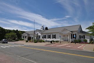
Sherman is a census-designated place (CDP) comprising the central community in the town of Sherman, Fairfield County, Connecticut, United States. It is in the central part of the town, at the north end of Candlewood Lake. The Sherman Historic District covers 85 acres (34 ha) in the northern part of the CDP, at the intersection of Connecticut Routes 37 and 39, containing many of the oldest buildings in the town.


