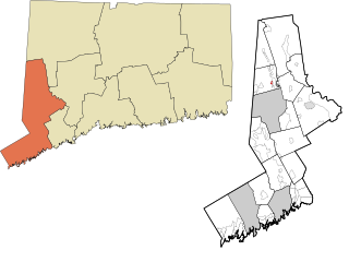
Saugatuck is a census-designated place (CDP) in the town of Westport, Fairfield County, Connecticut, United States. It is in the southwest part of the town, on both sides of the Saugatuck River, extending south to where it enters Long Island Sound. North of Interstate 95, it occupies just the west side of the Saugatuck and continues north as far as U.S. Route 1. It is bordered to the north by Westport Village and to the west by the city of Norwalk. The CDP includes the communities of Owenoke and Saugatuck Shores, as well as the Metro-North Railroad Westport station.
Redding Center is a census-designated place (CDP) in the town of Redding, Fairfield County, Connecticut, United States, comprising the central village in the town. Connecticut Route 107 passes through the community, leading north toward Bethel and southwest toward Georgetown. The Redding Center Historic District is at the center of the CDP, around the intersections of Cross Highway, Sanfordtown Road, Lonetown Road, and Hill Road.
Compo is a census-designated place (CDP) in the town of Westport, Fairfield County, Connecticut, United States. It is in the south-central part of the town, lying between the Saugatuck River and the neighborhood of Saugatuck to the west, and Compo Cove, Sherwood Millpond, and the neighborhood of Greens Farms to the east. The CDP extends south to Compo Beach on Long Island Sound and north to U.S. Route 1. Interstate 95 crosses the middle of the CDP from east to west, with access from either Saugatuck or Greens Farms.

Wilton Center is a neighborhood/section and census-designated place (CDP) in the town of Wilton in Fairfield County, Connecticut, United States. As of the 2010 census it had a population of 732. The CDP partially overlaps the Wilton Center Historic District.
Indian Field is a census-designated place (CDP) in the town of Greenwich, Fairfield County, Connecticut, United States. It is in the southern part of the town, on a peninsula between Indian Harbor to the west and Cos Cob Harbor to the east. It extends south into Captain Harbor, an inlet of Long Island Sound, and it extends north as far as U.S. Route 1. Interstate 95 crosses the CDP, with access from Exit 4.
Darien Downtown is a census-designated place (CDP) in the town of Darien, Fairfield County, Connecticut, United States. It represents the built-up center of town around the intersections of U.S. Route 1, Connecticut Route 124, and Connecticut Route 136. Interstate 95 passes through the southern part of the CDP, with access from Exit 11 and Exit 12. It was first listed as a CDP prior to the 2020 census.
Coleytown is a census-designated place (CDP) in the town of Westport, Fairfield County, Connecticut, United States. It occupies the northeast corner of the town and is bordered to the north by the town of Weston and to the east by the town of Fairfield.
Mill Plain is a census-designated place (CDP) in the town of Fairfield, Fairfield County, Connecticut, United States. It is in the southern part of the town, directly north of the downtown area of Fairfield and northeast of Southport. It is bordered to the west by the Mill River, to the south by Interstate 95, to the east by Mill Plain Road, and to the north by Duck Farm Road.
Murray is a census-designated place (CDP) in the town of Fairfield, Fairfield County, Connecticut, United States. It is in the northern part of Fairfield, with Burr Street running north–south through the center of the CDP. The Merritt Parkway crosses the CDP from east to west, with access from Exit 44 at the eastern edge of the community.
Plattsville is a census-designated place (CDP) in the towns of Easton and Fairfield, Fairfield County, Connecticut, United States. It is primarily in the town of Easton, with a portion extending south across the Mill River into Fairfield. The Merritt Parkway forms the southeast border of the CDP, and Connecticut Route 59 runs north–south through it.
Weston is a census-designated place (CDP) in the town of Weston, Fairfield County, Connecticut, United States. It comprises the center of town government and surrounding residential areas. The area was known as "Norfield" from 1795 to 1920, and the Norfield Historic District, which occupies the center of the CDP, around the intersection of Norfield Road and Weston Road, preserves the older name.
Daniels Farm is a census-designated place (CDP) in the town of Trumbull, Fairfield County, Connecticut, United States. It is in the northeast part of Trumbull and is bordered to the northeast by the city of Shelton. The Connecticut Route 25 expressway forms the southwest edge of the CDP, and Route 111 forms the short northwest edge. The CDP extends south as far as Hedgehog Road, Old Dike Road, and Pinewood Trail. To the south is the Trumbull Center CDP.

Candlewood Orchards is a private residential community and census-designated place (CDP) in the town of Brookfield, Fairfield County, Connecticut, United States. It is in the northwest part of the town, on the east shore of Candlewood Lake. It is bordered to the north by Candlewood Shores and to the west and south by the town of New Fairfield.

Candlewood Shores is a private residential community and census-designated place (CDP) in the town of Brookfield, Fairfield County, Connecticut, United States. It is in the northwest part of the town, on the east shore of Candlewood Lake. It is bordered to the south by Candlewood Orchrads, to the north by Candlewood Lake Club, and to the west by the town of New Fairfield.

Taylor Corners is a census-designated place (CDP) in the town of New Fairfield, Fairfield County, Connecticut, United States. It is in the southwest corner of the town, bordered to the south by the city of Danbury, to the north by Ball Pond, and to the west by the town of Southeast in Putnam County, New York.

Ball Pond is a census-designated place (CDP) in the town of New Fairfield, Fairfield County, Connecticut, United States. It is in the southwest part of the town, with the pond of the same name in the central part of the CDP. The community is bordered to the south by Taylor Corners and to the west by Putnam Lake in Putnam County, New York.

Bigelow Corners is a census-designated place (CDP) in the town of New Fairfield, Fairfield County, Connecticut, United States. It is in the southwest quadrant of the town, northwest of the village of New Fairfield and east of Ball Pond.

Kellogg Point is a census-designated place (CDP) in the town of New Fairfield, Fairfield County, Connecticut, United States. It is in the southeast part of the town, on the western shore of Candlewood Lake. It is 6 miles (10 km) north of the center of Danbury, Connecticut.
Candlewood Knolls is a census-designated place (CDP) in the town of New Fairfield, Fairfield County, Connecticut, United States. It is in the southeast part of the town, on the western shore of Candlewood Lake.

Inglenook is a census-designated place (CDP) in the town of New Fairfield, Fairfield County, Connecticut, United States. It is in the northeast part of the town, atop a broad peninsula in Candlewood Lake. It is bordered to the east by Sail Harbor and to the north by the town of Sherman.


