Demographics
As of the census [7] of 2000, there were 1,671 people, 673 households, and 495 families living in the CDP. The population density was 132.5/km2 (343.4/mi2). There were 698 housing units at an average density of 55.3/km2 (143.4/mi2). The racial makeup of the CDP was 97.19% White, 1.08% African American, 0.12% Native American, 0.66% Asian, 0.12% from other races, and 0.84% from two or more races. Hispanic or Latino of any race were 0.96% of the population.
There were 673 households, out of which 30.6% had children under the age of 18 living with them, 62.4% were married couples living together, 8.0% had a female householder with no husband present, and 26.4% were non-families. 21.5% of all households were made up of individuals, and 9.1% had someone living alone who was 65 years of age or older. The average household size was 2.48 and the average family size was 2.89.
In the CDP the population was spread out, with 22.4% under the age of 18, 5.3% from 18 to 24, 31.1% from 25 to 44, 28.8% from 45 to 64, and 12.4% who were 65 years of age or older. The median age was 41 years. For every 100 females, there were 96.6 males. For every 100 females age 18 and over, there were 93.3 males.
The median income for a household in the CDP was $60,405, and the median income for a family was $80,998. Males had a median income of $48,125 versus $36,131 for females. The per capita income for the CDP was $31,238. About 1.5% of families and 3.9% of the population were below the poverty line, including 4.3% of those under age 18 and 9.6% of those age 65 or over.

Oakville is a census-designated place (CDP) and neighborhood section of Watertown, in Litchfield County, Connecticut, United States. The population was 9,047 as of the 2010 census. It is the most populous community in Watertown, with more than twice as many people as the center village of Watertown. The ZIP code for Oakville is 06779.

Chester is a town in Middlesex County, Connecticut, United States. The town is part of the Lower Connecticut River Valley Planning Region. The population was 3,749 at the 2020 census. The town center is defined by the U.S. Census Bureau as a census-designated place (CDP). The name is a transfer from Chester, in England.
Haddam is a town in Middlesex County, Connecticut, United States. The town is part of the Lower Connecticut River Valley Planning Region. The population was 8,452 at the time of the 2020 census. The town was also home to the now-decommissioned Connecticut Yankee Nuclear Power Plant.

Moodus is a village in the town of East Haddam, Connecticut, United States. The village is the basis of a census-designated place (CDP) of the same name. The population of the CDP was 1,982 as of the census of 2020.

Conning Towers Nautilus Park is a census-designated place (CDP) in the town of Groton in New London County, Connecticut, United States. The population was 9,828 at the 2010 census. The statistical area consists of the portion of the town in the vicinity of Route 12 and includes Naval Submarine Base New London.

Oxoboxo River is a census-designated place (CDP) in the town of Montville in New London County, Connecticut, United States. The population was 2,938 at the 2000 census, 3,165 at the 2010 census, and 2,955 at the 2020 census. The statistical area encompasses the town center of Montville, as well as the adjacent villages of Palmertown and Uncasville. The name of the statistical area is from the river of the same name running through the CDP.
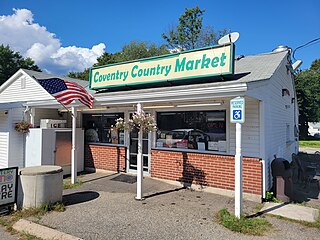
Coventry Lake is a village and census-designated place in the town of Coventry, Connecticut in Tolland County, Connecticut, United States. The population was 2,990 at the 2010 census. The CDP includes the residential areas around Wangumbaug Lake.

Crystal Lake is a village, census-designated place, and part of the town of Ellington, in Tolland County, Connecticut, United States. The population was 1,945 at the 2010 census. The CDP includes an eponymous lake.

Mansfield Center is a village within the town of Mansfield in Tolland County, Connecticut, United States. The village is the basis of a census-designated place (CDP) of the same name with a population of 947 at the 2010 census. The CDP includes the original settlement of Mansfield, Mansfield Center or Mansfield Village, as well as the village of Mansfield Hollow. Mansfield Hollow State Park is also located within the boundaries of the CDP.

South Coventry is a census-designated place and part of the town of Coventry, Connecticut in Tolland County, Connecticut, United States. The population was 1,483 at the 2010 census.

East Brooklyn is a census-designated place (CDP) located within the town of Brooklyn in Windham County, Connecticut. It is the portion of the Danielson urban cluster within the town of Brooklyn. The population was 2,205 at the 2020 census. US 6 runs through the town and severs the town.

Quinebaug is a village and census-designated place (CDP) in Thompson, a town in Windham County, Connecticut, United States. The population was 1,133 at the 2010 census.

South Windham is a village and census-designated place (CDP) in Windham County, Connecticut, United States. It is located within the town of Windham, Connecticut. The population was 1,421 at the 2010 census.

Lake Pocotopaug is an unincorporated village and census-designated place (CDP) in the town of East Hampton in Middlesex County, Connecticut, United States. As of the 2020 census, it had a population of 4,901, up from 3,436 in 2010.

Wilder is an unincorporated village and census-designated place (CDP) within the town of Hartford in Windsor County, Vermont, United States. It is the location of the Wilder Dam on the Connecticut River. The population of the CDP was 1,690 at the 2010 census. The village center is an early example of a planned mill community, and was listed on the National Register of Historic Places as the Wilder Village Historic District in 1999.

Great Barrington is a census-designated place (CDP) located in the town of Great Barrington in Berkshire County, Massachusetts, United States. The population was 2,231 at the 2010 census, out of 7,104 in the entire town of Great Barrington.

Williamstown is a census-designated place (CDP) in the town of Williamstown in Berkshire County, Massachusetts, United States. The population of the CDP was 4,325 at the 2010 census, out of 7,754 in the entire town.

Hatfield is a census-designated place (CDP) comprising the main village in the town of Hatfield in Hampshire County, Massachusetts, United States. The population of the CDP was 1,318 at the 2010 census, out of a total town population of 3,279. It is part of the Springfield, Massachusetts Metropolitan Statistical Area.

Brattleboro is a census-designated place (CDP) corresponding to the densely populated core of the town of Brattleboro in Windham County, Vermont, United States. The population was 8,289 at the 2000 census.
East Hampton is a town in Middlesex County, Connecticut, United States. The town is part of the Lower Connecticut River Valley Planning Region. The population was 12,717 at the 2020 census. The town center village is listed as a census-designated place (CDP). East Hampton includes the communities of Cobalt, Middle Haddam, and Lake Pocotopaug.


