Kericho

Last updated

Location of Kericho, Kenya KE-Kericho.png
Location of Kericho, Kenya
Tea country surrounding Kericho Kenya-Tealand-Near-Kericho-2012.JPG
Tea country surrounding Kericho

Kericho is the biggest town in Kericho County located in the highlands west of the Kenyan Rift Valley. Standing on the edge of the Mau Forest, Kericho has a warm and temperate climate making it an ideal location for agriculture and in particular, the large scale cultivation of tea. [1]

Contents

The town is strategically located along Kenya's western tourism circuit with access to Lake Victoria, the Maasai Mara National Reserve and Ruma National Park.

As of the 1999 census, the town has a population of 150,000. [2] Kericho is the home town of the Kipsigis, who are a part of the Kalenjin people.

Kericho is home to the world's single largest tea plantation. Teapickers-near-kericho.JPG
Kericho is home to the world's single largest tea plantation.

Etymology

The etymology of Kericho is unclear. One theory has it that it was home to the region's first hospital, built by the colonial British at the start of the 20th century. This is in reference to kerichek, the word for medicine in the Kipsigis language. Other theories have it that the town was named for a local medicine man called Kipkerich or after a Maasai chief, Ole Kericho who was killed in the 18th century by the Abagusii. [3]

History

The settlement at Kericho was founded in 1902 by British settlers. [4]

Kericho hosts Africa's largest Sikh Gurudwara [5] and the second largest Catholic cathedral in Kenya. [6]

Gurdwara Sahib is built on the site of the home and workshop of Kericho Wagon Works founder Sant Baba Puran Singh Ji of Kericho. The site is currently a place of worship for the Sikh community and a museum gazetted by the Government of Kenya as a place of spiritual significance.

It is dedicated to the memory of Sant Baba Puran Singh Ji, founder of the international charitable organization, Guru Nanak Nishkam Sewak Jatha which promotes the spirit and practice of selfless service ("nishkam sewa") in the name of Guru Nanak Dev Ji, the founder of the Sikh faith.

Chandarana Records a pioneer of Benga music and the Kenyan music recording industry is based in Kericho town.

Kericho is home to Olympic-winning long-distance athletes and hosts Zoo Kericho F.C. a football club competing in the Kenyan Premier League and Kericho R.F.C. competing in the Nationwide League. [7]

Other notable places of interest include Chagaik Arboretum, Chelimo Arboretum, Tagabi Arboretum, Uhuru Garden and the vast scenic tea estates with high ground view points.

Geography

Kericho is reputed to hold the record for the highest number of hail occurrences in a year, either at 132 days with hail [8] or 113 days in 1965. Kericho has up to 50 days of hail each year, [9] but large hail is rare. [8]

Government

Kericho town is the headquarters of Kericho county, which is itself made up of six constituencies/sub-counties including Bureti, Belgut, Ainamoi, Soin/ Sigowet, Kipkelion East, and Kipkelion West.

Transport

Kericho is accessible by road through the B1 road (Kenya) that links Mau-Summit, Kericho to Kisumu and Busia. In addition, the C25 Kapsoit-Sondu road connects Kericho to the A1 road linking Isebania to Lokichoggio through Kisumu and Kitale. [10]

The Nakuru-Kisumu railway line passes through Kericho County with railway stations at Mau Summit, Londiani, Kedowa, Lumbwa, Kipkelion and Fort Ternan. Fort Ternan was previously used as a halfway point for passenger and goods trains between Nakuru and Kisumu. [11]

Private airstrips operated by tea estates have a more regular use for purposes of crop spraying. [12]

Communication and media

Kericho town has access to a high-speed fiber-optic Internet connection, fixed line, and mobile telecommunications.

There are several local FM radio stations including Kass FM, Chamgei FM, KBC Kitwek FM, Radio Injili, Sayare Radio, Light and Life FM, Sema Radio and The Just FM.

Tertiary education

Kericho hosts several satellite campuses and colleges providing certificate, diploma and degree courses.

Secondary education

Kericho is home to: 1.Litein High School, 2.Taita Towett Boys High School, 3.Kipkelion Girls High school, 4.Kapsoit high school, 5.Kabianga Boys High School, 6.Kericho High school, 7.Moi Tea Secondary, 8.Kipsigis Girls High School, 9.Cheptenye Boys High School, 10.Kericho Tea Boys, 11.Tengecha schools 12. Moi Sitotwet 13. Getumbe Secondary school 14. Poiywek Secondary School 15. Kericho Day Secondary school 16. Kipchimchim Secondary school 17. Kaptebeswet secondary school 18. Kabianga Girls High School and others

Religion

Kericho is home to followers of the Africa Gospel Church, Full Gospel Church, Seventh-day Adventists, Catholics, Sikhs, Muslims, Hindus, African Inland Church, Jehovah's Witnesses and Anglicans.

Notable people

Related Research Articles

<span class="mw-page-title-main">Kipsigis people</span> Sub-Tribe in Kenya

The Kipsigis or Kipsigiis are a Nilotic group contingent of the Kalenjin ethnic group and speak a dialect of the Kalenjin language identified by their community eponym, Kipsigis. It is observed that the Kipsigis and another aboriginal group native to Kenya known as Ogiek have a merged identity. The Kipsigis are the biggest of the Kalenjin. The latest census population in Kenya put the Kipsigis at 1,972,000 speakers, accounting for 45% of all Kalenjin speaking people. They occupy the highlands of Kericho stretching from Timboroa to the Mara River in the south and the Mau Escarpment in the east to Kebeneti. They also occupy parts of Laikipia, Kitale, Nakuru, Narok, the Trans Mara District, Eldoret and the Nandi Hills.

<span class="mw-page-title-main">Daniel arap Moi</span> President of Kenya from 1988 to 2002

Daniel Toroitich arap Moi was a Kenyan politician who served as the second president of Kenya from 1978 to 2002. He is the country's longest-serving president to date. Moi previously served as the third vice president of Kenya from 1967 to 1978 under President Jomo Kenyatta, becoming the president following the latter's death.

<span class="mw-page-title-main">Kalenjin people</span> Group of Southern Nilotic peoples indigenous to East Africa

The Kalenjin are a group of tribes indigenous to East Africa, residing mainly in what was formerly the Rift Valley Province in Kenya and the Eastern slopes of Mount Elgon in Uganda. They number 6,358,113 individuals per the Kenyan 2019 census and an estimated 273,839 in Uganda according to the 2014 census mainly in Kapchorwa, Kween and Bukwo districts.

<span class="mw-page-title-main">Kericho County</span> County in Kenya

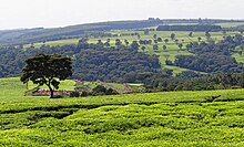
Kericho County is one of the 47 counties in Kenya. The county seats between longitude 35°02' and 35°40' East and between the equator and latitude 0°23' South with an altitude of about 2002m above sea level. It borders Uasin Gishu County to the North West, Baringo County to the North-East, Nandi County to the North-West, Nakuru County to the East and Bomet County to the South, Kisumu County to the Northwest and Nyamira County to the West. It has a population of 901,777 and an area of 2,111 km². Its capital and largest town is Kericho.

Kapsabet is a town in Kenya. It is the capital of Nandi County and is located 40 kilometres southwest of Eldoret on the way to Chavakali.

Litein is a town located in the Kericho County, Kenya. It was previously the capital of the former Buret District. Litein has an urban population of 4,000. The town is along the Kericho-Sotik road. It also has a road link to Bomet.

<span class="mw-page-title-main">Bomet</span> Municipality in Bomet County, Kenya

Bomet is the capital and largest town of Bomet County, Kenya. Bomet town has a total population of 110,963. It is located along the B3 Mai Mahiu-Narok-Kisii road. Bomet city is one of the eight sister cities to Milwaukee.

Londiani is a Kenyan town in the Kericho County. It is 49 km from Kericho, which is about a 50-minute drive. As of 2009, it had a total population of 44,953.

<span class="mw-page-title-main">Sikhism in England</span>

English Sikhs number over 520,000 people and account for 0.9% of England's population in 2021, forming the country's fourth-largest religious group. In 2006 there were 352 gurdwaras in England. The largest Sikh populations in the U.K. are in the West Midlands and Greater London.

Zakayo Cheruiyot is a Kenyan politician who was born in 1954 at Kapsogut village in Bureti Constituency, Kericho County. His father, Arap Komuilong, was an Assistant Chief to Arap Tengecha, the Chief, during the colonial period. Cheruiyot attended Kapsogut Primary School prior to joining Litein High School and later Chesamis High School for his A-level education. The revered administrator holds a bachelor's degree in Literature and Governance from the University of Nairobi and a Postgraduate Diploma in Development Studies from Birmingham University in the UK. He is widely trained in public administration and has undergone major short courses on administration and management at the Kenya School of Government.

Fort Ternan is a small town in Kericho County, Kenya, located 50 kilometres east of Kisumu and five kilometres east of Koru. It is named after Col. Trevor Ternan C.M.G.D.S.O. Fort Ternan is located at the western border of the former Rift Valley Province. Fort Ternan forms a ward of Kipkelion West Constituency and Kipsigis town council. Fort Ternan is also a location in the Chilchila division.

Dr. Elisha Kipyegon Taaitta Arap Toweett, also known as Taaitta Arap Toweett, was a scholar, writer, linguist and a Kenyan politician.

The University of Kabianga is located in Kabianga, Belgut constituency, Kericho county in Kenya. The university is situated in the Kabianga Complex, along with the Kabianga Boys High School and Primary School as well as the Kabianga Tea Farm. The Kabianga Complex has a long history.

Lily Chepkorir Koros Tare is a Kenyan medical administrator, who serves as Administration Secretary in the Kenya Ministry of Health, effective December 2018.

Mau Summit is a town in the Nakuru County of Kenya. At Google Maps, Mau Summit sits adjacent to Londiani in Kericho County.

<span class="mw-page-title-main">Davy Kiprotich Koech</span> Kenyan scientist (born 1951)

Davy Kiprotich Koech is a Kenyan scientist. He is currently the Chief Executive Officer Centre for Clinical & Molecular Sciences; Professor of Immunology & Molecular Medicine; Distinguished Professor, The Australian-Asian Institute of Civil Leadership.

Amos Kipng'eno Misik is a retired Kenya Prisons Commander.

Sotik town is an urban centre situated in Sotik Sub-county within Bomet County in the Western region of Kenya and managed by Sotik Town Council. Initially, it was the home of Mugenik Barngetuny Araap Sitonik, a prominent Kipsigis prophet of the late 19th century. Sotik is a metropolitan town with a majority of the residents from the Kipsigis ethnicity and a minority being from other ethnicities from Kenya including notably, Somalis and Indians. The town is home to Kalenjin music artist Philip Yegon, Kenyan athletes: Paul Kipsiele Koech and Mercy Cherono; and Kenyan politicians: Lorna Laboso and the late Joyce Cherono Laboso.

Zipporah Jepchirchir Kittony, better known as Zipporah Kittony, is a former Kenyan politician and women's and children's rights activist. She served as nominated Member of Parliament between 1988 and 2007 and as a KANU nominated Senator between 2013 and 2018. She also served as the Chairperson of the Maendeleo ya Wanawake Organization (MYWO) from 1996 to 2006.

References

  1. "Investing in Kericho County". Soko Directory. 2015-12-08. Retrieved 2020-05-28.
  2. "The National Treasury" (PDF). Treasury.go.ke. 2015-07-09. Retrieved 2015-12-06.[ permanent dead link ]
  3. paukwastories (2023-03-29). "8 South Rift Town Names with Fascinating Roots". Paukwa. Retrieved 2024-03-22.
  4. United Nations Centre for Human Settlements, Regional Development Planning and Management of Urbanization: Experiences from Developing Countries, UN-HABITAT, 1997, p.189
  5. "Guru Nanak Nishkam Sewak Jatha. Kericho, Kenya". 26 August 2007.
  6. "The Star".
  7. "About Kericho RFC | Shujaa Pride".
  8. 1 2 Linacre, E.; Geerts, B. (May 1998). "More on hail". University of Wyoming. Retrieved 15 July 2019.
  9. Burt, Christopher C. (30 April 2011). "World's Largest Hailstones | Weather Extremes". Weather Underground. Retrieved 15 July 2019.
  10. "Classification". Archived from the original on 2016-01-30. Retrieved 2016-01-25.
  11. "Kenya Branches".
  12. http://aeroclubairfields.com/go.php?mod=public&loco=airstrips

00°22′09″S35°17′02″E / 0.36917°S 35.28389°E / -0.36917; 35.28389