
Fife is a council area, historic county, registration county and lieutenancy area of Scotland. It is situated between the Firth of Tay and the Firth of Forth, with inland boundaries with Perth and Kinross and Clackmannanshire. By custom it is widely held to have been one of the major Pictish kingdoms, known as Fib, and is still commonly known as the Kingdom of Fife within Scotland. A person from Fife is known as a Fifer. In older documents the county was very occasionally known by the anglicisation Fifeshire.

Sanquhar is a village on the River Nith in Dumfries and Galloway, Scotland, north of Thornhill and west of Moffat. It is a former Royal Burgh.
Jordanhill is an affluent area of the West End of the city of Glasgow, Scotland. The area consists largely of terraced housing dating from the early to mid 20th century, with some detached and semi-detached homes and some modern apartments.

Kilmarnock is a large town and former burgh in East Ayrshire, Scotland and is the administrative centre of East Ayrshire Council. With a population of 46,770, Kilmarnock is the 14th most populated settlement in Scotland and the largest town in Ayrshire. The town is continuous to nearby neighbouring villages Crookedholm and Hurlford to the east, and Kilmaurs to the west of the town. It includes former villages subsumed by the expansion of the town such as Bonnyton and new purpose built suburbs such as New Farm Loch. The town and the surrounding Greater Kilmarnock area is home to 32 listed buildings and structures designated by Historic Environment Scotland.
Bearsden is a town in East Dunbartonshire, Scotland, on the northwestern fringe of Greater Glasgow. Approximately 6 miles (10 km) from Glasgow City Centre, the town is effectively a suburb, and its housing development coincided with the 1863 introduction of a railway line. The town was named after Bearsden railway station, which was named after a nearby cottage.

Dumfriesshire or the County of Dumfries or Shire of Dumfries is a historic county and registration county in southern Scotland. The Dumfries lieutenancy area covers a similar area to the historic county.

Baillieston is a working class suburb of Glasgow, Scotland. It is about 7 miles (11 km) east of the city centre.

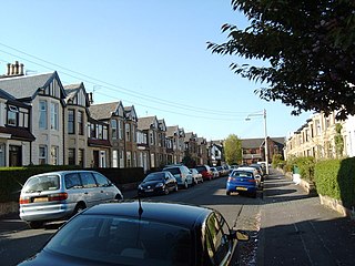
Hurlford is a village in East Ayrshire, Scotland. It has a population of 4,968. Hurlford's former names include Whirlford and Hurdleford. The village was named Whirlford as a result of a ford crossing the River Irvine east of Hurlford Cross, near Shawhill. It shares its name in Gaelic, Baile Àtha Cliath with the Irish capital Dublin. The census locality is called Hurlford and Crookedholm.

St Anthony's Football Club is a Scottish non-league football club based in Glasgow. Nicknamed the Ants, they play in green-and-white hooped kits and currently operate in the West of Scotland League Second Division.
Burnbank is an area in the town of Hamilton, South Lanarkshire, Scotland. It was formerly a separate mining village before being absorbed into the town.
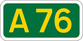
The A76 is a major trunk road in south west Scotland.
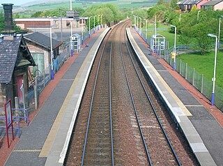
Sanquhar railway station is a railway station in the village of Sanquhar, Dumfries and Galloway, Scotland. The station is owned by Network Rail and managed by ScotRail and is on the Glasgow South Western Line. The old station buildings are in use as a holiday home. The station was re-opened together with Gretna Green, Auchinleck, New Cumnock, Kilmaurs and Dunlop after initially falling victim to the Beeching Axe in December 1965. Kirkconnel remained open but has also seen significant investment in its infrastructure.
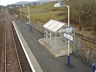
Kirkconnel railway station is a railway station in the town of Kirkconnel, Dumfries and Galloway, Scotland. The station is unstaffed, owned by Network Rail and managed by ScotRail.

New Cumnock railway station is a railway station serving the town of New Cumnock, East Ayrshire, Scotland. The station is managed by ScotRail and is on the Glasgow South Western Line, 45.5 miles (73.2 km) south west of Glasgow Central.
William Copeland Ferguson was a Scottish footballer and manager best known for his time at Chelsea and Dumfries side Queen of the South. His position was usually as a left winger.

The Carsphairn and Scaur Hills are the western and eastern hills respectively of a hill range in the Southern Uplands of Scotland. Ordnance Survey maps don't have a general name for the hill area as a whole. Also, Ordnance Survey use "Scar" rather than the local spelling of "Scaur" - the word is pronounced as "Scar" however. In their Landranger Series of maps, it requires four separate sheets to cover the area.
Kris Haddow is a Scottish playwright, poet and performer, originally from Kirkconnel in Dumfries and Galloway.
Kelloholm is a village in Dumfries and Galloway, Scotland. It has a primary school, a public house and several shops. Kelloholm lies next to Kirkconnel and the two have begun to merge. Kelloholm was originally constructed to serve the many mines in the area, all of which have now closed.


