Brazil
See also Parque Arqueológico do Solstício. [2]

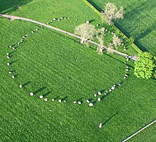
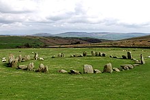
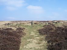
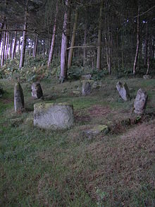
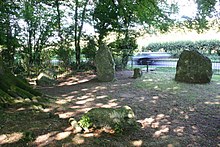
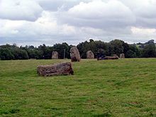
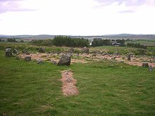
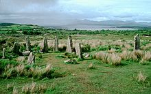
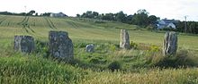
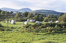
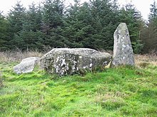
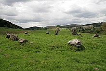
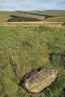
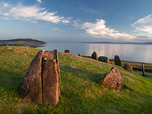
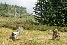
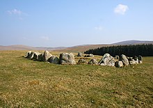
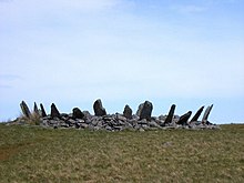
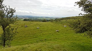
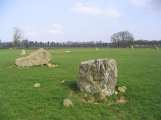
This is an incomplete photographic list of stone circles.
See also Aboriginal stone arrangement Stone circles in Australia are sometimes revered as sacred sites by Australian Aboriginal people's. While often small, there are some large stones comparable to their European counterparts, particularly in Victoria. While some are small and not well attended, others are well-known, for instance the stone arrangements in Victoria at Carisbrook and Lake Bolac. [1]
See also Parque Arqueológico do Solstício. [2]
Aubrey Burl's gazetteer lists 1,303 stone circles in Britain, Ireland and Brittany ( France). Most of these are found in Scotland, with 508 sites recorded. There are 343 on the island of Ireland;316 in England; 81 in Wales; 49 in Brittany (France); and 6 in the Channel Isles. [3]
Aubrey Burl records six sites in the Channel Islands, four on Guernsey and two on Jersey. All six are Cist-in-Circle monuments, which are influenced by chambered tomb design. Their relationship with the stone circle tradition of Britain, Ireland and Brittany is unclear. [4]
 | La Plate Mare |
 | Ville-ès-Nouaux |
 | Boscawen-Un – Stone circle with a leaning pillar in its interior. |
 | Boskednan – a partially restored stone circle near Boskednan, around 6 kilometres (4 miles) northwest of the town of Penzance. |
 | Craddock Moor – near Minions on Bodmin Moor, 800 m (1⁄2 mi) northwest of The Hurlers. |
 | Duloe – in the village of Duloe, 8 km (5 mi) from Looe. |
 | Emblance Downs stone circles – a pair of circles located in the parish of St. Breward on Bodmin Moor. |
 | Fernacre – located on the slopes of the De Lank River, 2 km (1+1⁄4 mi) northeast of St Breward on Bodmin Moor. |
 | The Hurlers are a group of three stone circles on Bodmin Moor. |
 | The Merry Maidens – near St Buryan in West Penwith. |
 | Nine Stones, Altarnun –3 km (2 mi) south southeast of Altarnun, 11 km (7 mi) west of Launceston on Bodmin Moor. |
 | Stannon – near St Breward on Bodmin Moor. |
 | Tregeseal East – also known as the Tregeseal Dancing Stones, near St Just in West Penwith. |
 | Trippet stones – Manor Common in Blisland, 9 km (5.6 mi) north northeast of Bodmin on Bodmin Moor. |
 | Birkrigg – Two non-concentric circles, 3 km (2 mi) south of Ulverston: grid reference SD 29247396 |
 | Brat's Hill – The largest of the Burnmoor stone circles: 1.6 km (1 mi) south of Boot. |
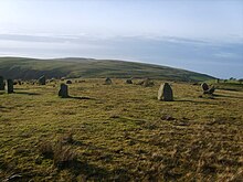
 | Castlerigg – A 33-metre-diameter (108 ft) ring consisting of 38 stones. |
 | Gamelands – Near Orton, Eden: grid reference NY640081 . |
 | Kinniside – A reconstructed stone circle of 11 stones, grid reference NY060140 . |
 | Long Meg and Her Daughters – Around 51 stones set in an oval shape measuring 100 m (330 ft) on its long axis. |
 | Low Longrigg circles – Two of the Burnmoor stone circles: 2 km (1 mi) south of Boot. |
 | Oddendale – Part of the Shap Stone Avenue monuments: (grid reference NY59201290 ). |
 | Swinside – A near perfect circle located in Lake District. |
 | White Moss stone circles – Two of the Burnmoor stone circles: 1.6 km (1 mi) south of Boot. |
 | Arbor Low – near Youlgreave in Derbyshire. |
 | Barbrook One – on Ramsley Moor in the Peak District: grid reference SK27857558 . |
 | Doll Tor – near Birchover in Derbyshire. |
 | Hordron Edge – on the edge of Moscar Moor: grid reference SK2152486851 . |
 | Nine Ladies – Nine stones located on Stanton Moor. |
 | Nine Stones Close – between Alport and winster: grid reference SK225626 . |
 | Brisworthy stone circle |
 | Grey Wethers stone circles |
 | Ringmoor Down |
 | Scorhill |
 | Shovel Down |
| Tottiford Reservoir |
 | Yellowmead stone circle |
 | Kingston Russell – An 18-stone Bronze Age circle near Abbotsbury. | 50°41′18.7″N2°35′56.2″W / 50.688528°N 2.598944°W |
 | Rempstone stone circle – a damaged stone circle near Corfe Castle in Dorset. It is located next to the B3351 road on the Isle of Purbeck: grid reference SY994820 . | |
 | The Nine Stones – A small nine stone circle near Winterbourne Abbas. |
 | Cheetham Close – Image of one of the remaining stones at this Druidic, Bronze Age site on the picturesque moors of Egerton, Bolton. |
 | Duddo Five Stones –6 km (4 mi) south of the Scottish border, formerly known as the Four Stones. |
 | The Goatstones – a Bronze-age four-poster near the village of Wark on Tyne. |
 | Threestoneburn Stone Circle – a circle of 16 stones in Threestoneburn Wood, near the village of Ilderton. |
 | The King's Men – one of three monuments that make up the Rollright Stones, found near the village of Long Compton. |
 | Mitchell's Fold – A 30 stone ring (15 still standing). |
 | Stanton Drew – One of three circles located near the village of Stanton Drew. |
 | Withypool Stone Circle – Located on the Exmoor moorland, near the village of Withypool. Only the stones present on the two ends of the circle are visible. |
 | Twelve Apostles, West Yorkshire – grid reference SE12614506 |
 | Avebury – A large stone circle surround the village of Avebury. |
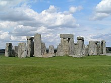 | Stonehenge – A World Heritage site. |
 | Ballynoe stone circle |
 | Drumskinny stone circle |
 | Beaghmore – Located outside Cookstown. Seven circles, along with cairns and stone rows. One circle, known as the Dragon's Teeth, is filled with more than 800 small stones. |
There are 187 stone circles in the Republic of Ireland. The vast majority of these are in County Cork, which has 103 circles. There are 20 circles in County Kerry and 11 in County Mayo. [5] There is also a large fully intact stone circle in Grange in County Limerick, near Lough Gur [6] Grange [7]
 | Ardgroom SW – Known locally as "Canfea", located southwest of the village of Ardgroom on the Beara peninsula. |
| Breeny More Stone Circle | |
 | Carrigagulla – About 18 stones located to the north of the village of Ballinagree. |
| Carrigaphooca stone circle – 3 stones located next to Carrigaphooca Castle. | |
 | Derreenataggart stone circle |
 | Drombeg stone circle – Located west of Rosscarbery. |
 | Kealkill stone circle – Located overlooking Bantry Bay. |
 | Knocknakilla – Located between Macroom and Millstreet. |
 | Glantane east – Located between Macroom and Millstreet. |
 | Templebryan Stone Circle – Located between Bandon and Millstreet. |
 | Beltany stone circle |
 | Kenmare stone circle |
 | Lissyvigeen stone circle |
 | Shronebirrane stone circle |
 | Uragh Stone Circle |
 | Cashelkeelty Stone Circles |
 | Tyrebagger stone circle grid reference NJ 85950 13217 . |
 | Cullerlie stone circle near Echt, Aberdeenshire. |
 | Easter Aquhorthies recumbent stone circle, near Inverurie, Aberdeenshire. |
 | Kirkton of Bourtie recumbent stone circle , Aberdeenshire: grid reference NJ 80091 24883 . |
 | Hill of Fiddes recumbent stone circle, Aberdeenshire: grid reference NJ 9350 2432 . |
 | Inschfield recumbent stone circle, Aberdeenshire: grid reference NJ 6233 2934 . |
 | Loanhead of Daviot recumbent stone circle , Aberdeenshire. |
 | Loudon Wood recumbent stone circle, Aberdeenshire: grid reference NJ 96105 49740 . |
 | Midmar Kirk recumbent stone circle, Aberdeenshire: grid reference NJ 69940 06493 . |
 | Old Keig stone circle, Aberdeenshire: grid reference NJ 5965 1939 . |
 | New Craig recumbent stone circle, Aberdeenshire: grid reference NJ 7455 2966 . |
 | The Nine Stanes, Aberdeenshire: grid reference NO 7233 9122 . |
 | Potterton recumbent stone circle, Aberdeenshire: grid reference NJ95291636 . |
 | South Ley Lodge recumbent stone circle, Aberdeenshire: grid reference NJ76671325 . |
 | St Brandan's Stanes, Aberdeenshire: grid reference NJ60756105 . |
 | Strichen stone circle , Aberdeenshire: grid reference NJ9367454479 . |
 | Stonehead recumbent stone circle, Aberdeenshire: grid reference NJ60102869 . |
 | Sunhoney , Aberdeenshire: grid reference NJ7159205701 . |
 | Tillyfourie recumbent stone circle, Aberdeenshire: grid reference NJ64311350 . |
 | Tomnaverie recumbent stone circle , Aberdeenshire. |
 | Balkemback stone circle, Tealing: grid reference NO38183844 . |
 | Colmeallie stone circle , grid reference NO56567811 . |
 | Cultoon stone circle, Islay: grid reference NR19565697 . |
 | Ettrick Bay stone circle, Bute: grid reference NS0443466794 . |
 | Lochbuie stone circle, Mull: grid reference NM6178025117 . |
 | Temple Wood stone circles, grid reference NR82639782 . |
Aubrey Burl lists 43 stone circles in Dumfries and Galloway: 15 in Dumfriesshire; 19 in Kirkcudbrightshire; and 9 in Wigtonshire. [5] The Royal Commission on the Ancient and Historical Monuments of Scotland records 49 stone circles in the region. Of these 49, 24 are listed as 'possible'; one is an 18th-century construction; and a number have been destroyed. [8]
 | The Girdle Stanes Near Eskdalemuir:grid reference NY2535196153 |
 | Glenquicken Near Creetown:grid reference NX50965821 |
 | Lochmaben Stone Just south of Gretna |
 | The Loupin Stanes Near Eskdalemuir:grid reference NY25709663 |
 | Seven Brethren Near Lockerbie: grid reference NY21718269 |
 | Standing Stones of Glenterrow Between Stranraer and New Luce:grid reference NX14536251 |
 | Twelve Apostles Stone Circle , situated between Holywood and Newbridge, near Dumfries. |
 | Torhouskie |
 | Whitcastles stone circle 10.5 km (6+1⁄2 mi) northeast of Lockerbie: grid reference NY 2240 8806 |
 | Balbirnie Stone Circle near Glenrothes |
The Royal Commission on the Ancient and Historical Monuments of Scotland records 20 stone circles in North Ayrshire, all on Arran. [9] Five of these are listed as 'possible'. [9] Aubrey Burrel's gazetteer records 19 stone circles on Arran. [5]
 | Auchagallon Stone Circle Arran grid reference NR89283464 |
 | Aucheleffan Arran grid reference NR 9784 2505 |
 | Machrie Moor 1 Arran grid reference NR9119832393 |
 | Machrie Moor 2 Arran grid reference NR9113032420 |
 | Machrie Moor 3 Arran grid reference NR9100632457 |
 | Machrie Moor 4 Arran grid reference NR9100132355 |
 | Machrie Moor 5 Arran grid reference NR9087832353 |
 | Machrie Moor 11 Arran grid reference NR9121232416 |
There are two stone circles on Orkney, both on the Mainland. [10] The Royal Commission on the Ancient and Historical Monuments of Scotland records a possible third at Stoneyhill, also on the Mainland. [11]
 | Ring of Brodgar – A 60 stone ring (27 still standing). |
 | Standing Stones of Stenness , Orkney |
 | Croft Moraig –6 km (4 mi) southwest of Aberfeldy, Scotland (grid reference NN79754726 ). |
The Royal Commission on the Ancient and Historical Monuments of Scotland records 16 stone circles in the Scottish Borders. Of these, three are marked as 'possible'. [12] Aubrey Burl's gazetteer lists the same number: 2 in Berwickshire; 2 in Peebleshire; 10 in Roxburghshire; and 2 in Selkirkshire. [5]
 | Five Stanes grid reference NT75261686 |
 | Harestanes grid reference NT12404432 |
 | Ninestane Rig |
Aubrey Burl's gazetteer lists seven sites in Shetland, but notes that all are dubious. [13] The Royal Commission on the Ancient and Historical Monuments of Scotland records three stone circles. [14] It does not include Hjaltadans, which is instead categorised as a 'stone setting'. [15]
 | Hjaltadans Fetlar |
 | Killin – at the western end of Loch Tay (grid reference NN576327 ). |
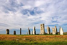 | Callanish I Lewis. |
 | Callanish II Lewis, a smaller stone circle. |
 | Callanish III Lewis, a smaller stone circle. |
 | Callanish IV Lewis, a smaller stone circle. |
 | Callanish VIII Lewis, a smaller stone semicircle. |
 | Pobull Fhinn North Uist, grid reference NF8427465010 . |
 | Moel Tŷ Uchaf Llandrillo, Denbighshire. | 52°55′N3°24′W / 52.92°N 3.40°W |
 | Bryn Cader Faner , Gwynedd | 52°53′54″N4°00′41″W / 52.8982°N 4.0114°W |
 | Bryn Gwyn stones , Anglesey | 52°53′54″N4°00′41″W / 52.8982°N 4.0114°W |

Dolni Glavanak Cromlech (8th-7th century BCE)

fr.wikipedia.org/wiki/Cromlech_de_Kergenan
 | Mzoura Cromlech (5th to 4th century BC) |
The Ōyu Stone Circles (大湯環状列石 Ōyu Kanjyō Resseki) is a late Jōmon period (approx. 2,000 – 1,500 BC) archaeological site in the city of Kazuno, Akita Prefecture, in the Tōhoku region of northern Japan. The site consists of two large stone circles located on an artificially flattened plateau on the left bank of the Oyu River, a tributary of the Yoneshiro River in northeastern Akita Prefecture. The site was discovered in 1931, with detailed archaeological excavations taking place in 1946, and in 1951–1952.
The larger circle, named the “Manza” circle has a diameter of 46 meters, and is the largest stone circle found in Japan. A number of reconstructions of Jomon period dwellings have been built around the site. The slightly smaller circle, named the “Nonakado” circle, is 42 meters in diameter and is located around 90 meters away, separated from the “Manza” circle by Akita Prefectural Route 66. Each circle is made from rounded river stones brought from another river approximately 7 kilometers away. Each circle in concentric, with and inner and an outer ring separated by an open strip approximately 8 meters wide. [16] Each circle contains smaller clusters of stone, including standing stones surrounded by elongated stones in a radiating orientation, forming a sundial which points toward the sunset on the summer solstice and allows for calculation of the winter solstice, the vernal equinox and the sun's movements. [17]
Each circle is surrounded by the remains of buildings, storage pits and garbage dumps, and clay figurines, clayware and stoneware (including everyday pottery), stone swords and objects have been discovered. Although the form of the stone circles made have been based on the shape of circular settlements, there is no indication of permanent settlement on the site.
The site has been submitted for inscription on the UNESCO World Heritage List as one of the Jōmon Archaeological Sites in Hokkaidō, Northern Tōhoku, and other regions.
 | Odry– Odry in Poland. |
 | Rujm el-Hiri (4~3000 BCE)– Located northeast of the Sea of Galilee. |
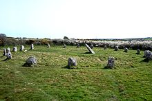
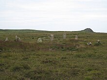
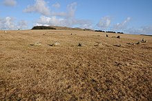
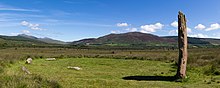
A stone circle is a ring of standing stones. They are found all over the world dating from 9,500BCE, though most are in Northwestern Europe – especially Britain, Ireland, and Brittany dating from 3000 BCE.
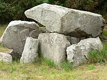
A cromlech is a megalithic construction made of large stone blocks. The word applies to two different megalithic forms in English, the first being an altar tomb, as William Borlase first denoted in 1769. A good example is at Carn Llechart. The second meaning of the name "cromlech" in English refers to large stone circles such as those found among the Carnac stones in Brittany, France.
Harry Aubrey Woodruff Burl HonFSA Scot was a British archaeologist best known for his studies into megalithic monuments and the nature of prehistoric rituals associated with them. Before retirement he was Principal Lecturer in Archaeology, Hull College, East Riding of Yorkshire. Burl received a volume edited in his honour. He was called by The New York Times, "the leading authority on British stone circles".

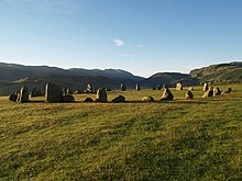
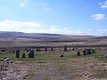
Swinside, which is also known as Sunkenkirk and Swineshead, is a stone circle lying beside Swinside Fell, part of Black Combe in southern Cumbria, North West England. One of around 1,300 recorded stone circles in the British Isles and Brittany, it was constructed as a part of a megalithic tradition that lasted from 3,300 to 900 BC, during what archaeologists categorise as the Late Neolithic and Early Bronze Ages.

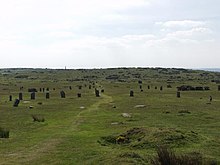
The Twelve Apostles is a large stone circle located between the villages of Holywood and Newbridge, near Dumfries, Scotland. It is the seventh largest stone circle in Britain and the largest on the mainland of Scotland. It is similar in design to the stone circles of Cumbria, and is considered to be an outlier of this group. Its south-westerly arrangement aligns it with the midwinder sunset.
The Whetstones are, or were, a stone circle beneath Corndon Hill in the parish of Church Stoke, Montgomeryshire, Wales, near the border with Shropshire, England. They lie immediately to the west of the village of White Grit and close to Priestweston. The site is also a short distance from the better-known Hoarstones and Mitchell's Fold circles.

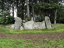
Craddock Moor Stone Circle or Craddock Moor Circle is a stone circle located near Minions on Bodmin Moor in Cornwall, UK. It is situated around half a mile Northwest of The Hurlers.

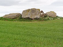
Duloe stone circle or Duloe circle is a stone circle near the village of Duloe, located 5 miles (8.0 km) from Looe in southeast Cornwall, England, UK.

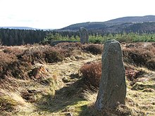
Fernacre, also known as Fernacre stone circle or Fernacre circle, is a stone circle located on the slopes of the De Lank River, 1.25 miles (2.01 km) northeast of St Breward on Bodmin Moor in Cornwall in the United Kingdom.

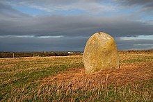
The Nine Stones is a stone circle 3 kilometres (1.9 mi) south southeast of Altarnun, 11 kilometres (6.8 mi) west of Launceston on Bodmin Moor in Cornwall, UK.

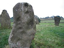
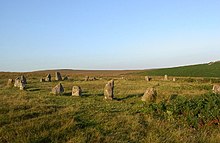
The stone circles in the British Isles and Brittany are a megalithic tradition of monuments consisting of standing stones arranged in rings. These were constructed from 3300 to 900 BCE in Britain, Ireland and Brittany. It has been estimated that around 4,000 of these monuments were originally constructed in this part of north-western Europe during this period. Around 1,300 of them are recorded, the others having been destroyed.

The Nine Stones, also known as the Devil's Nine Stones, the Nine Ladies, or Lady Williams and her Dog, is a stone circle located near to the village of Winterbourne Abbas in the southwestern English county of Dorset. Archaeologists believe that it was likely erected during the Bronze Age.
Easthill stone circle, also known as the Seven Grey Stanes, is a small oval stone circle 3¾ miles south-west of Dumfries. Eight stones of a probable nine remain. Despite being considerably smaller, the shape and orientation of the circle link it to the nearby Twelve Apostles and the other large ovals of Dumfriesshire. It is a scheduled monument.

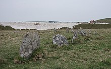
The Loupin Stanes is a stone circle near Eskdalemuir, Dumfries and Galloway. Oval in shape, it consists of twelve stones set on an artificial platform. At the WSW of the circle are two large pillars, which are typical of the 'entrance circles' of south-west Scotland. The circle takes its name from the tradition of leaping between the tops of these two stones.

Glenquicken stone circle or Billy Diamond's Bridge stone circle is an oval stone circle with a central pillar, two miles east of Creetown, Dumfries and Galloway. The outer ring is formed of 29 stones. Aubrey Burl has called it "the finest of all centre-stone circles." It is a scheduled monument.

The Girdle Stanes is a stone circle near Eskdalemuir, Dumfries and Galloway. The western portion of the circle has been washed away by the White Esk, leaving 26 of an original 40 to 45 stones in a crescent. Unlike the majority of such sites in Dumfriesshire, the Girdle Stanes forms a true circle rather than an oval. When complete, its diameter would have been 39m.
Holywood is a village and civil parish in the historical county of Dumfriesshire in Dumfries and Galloway, Scotland. The village of Holywood was developed in the mid twentieth century. In 1949 eighteen houses were built by the county council and followed shortly after by another 38.
{{cite journal}}: Cite journal requires |journal= (help)The Stone Circles of Britain, Ireland and Brittany.
The Stone Circles of Britain, Ireland and Brittany.
{{cite book}}: CS1 maint: multiple names: authors list (link)