M26 motorway

Last updated

UK-Motorway-M26.svg
M26
M26 motorway
M26 highlighted in blue
Route information
Maintained by National Highways
Length9.9 mi (15.9 km)
Existed1980–present
Major junctions
West end Chevening
Major intersections UK-Motorway-M25.svg
M25 motorway Junction 5
UK-Motorway-M20.svg
M20 motorway Junction 3
East end Addington
Location
Country United Kingdom
Primary
destinations
Sevenoaks
Road network
UK-Motorway-M25.svg M25 UK-Motorway-M27.svg M27
M26 looking east at junction 5. The A21 from Sevenoaks is crossing on the bridge in the foreground. M25 and M26 near Chevening and Chipstead - geograph.org.uk - 25228.jpg
M26 looking east at junction 5. The A21 from Sevenoaks is crossing on the bridge in the foreground.

The M26 is a motorway in Kent, England. It is a short link between the M25 at Sevenoaks and the M20 near West Malling, which provides connectivity between southern England and the Channel ports in Kent.

Contents

Route

The motorway starts at junction 3 of the M20 and heads west, encountering almost immediately the single junction along its length where it has an interchange with the A20. This junction is numbered 2a to reflect its proximity to the M20's nearby junction 2 (also connecting with the A20) a short distance to the north-west.

8 miles (13 km) to the west the M26 merges with the M25 at junction 5. There is no exit from the M26 at junction 5 and all traffic must join the clockwise (westbound) M25. The next M25 junction, number 6, is 10 miles (16 km) west at Godstone so traffic joining the M26 at Junction 2a cannot leave the motorway for 18 miles (29 km), the longest distance between motorway exits in the UK. [1]

On the anti-clockwise direction of the M25, the main carriageway continues directly onto the M26 at junction 5. To remain on the M25, traffic must turn on to the slip road which connects to the M25 spur coming north from Sevenoaks, which is multiplexed with the A21. The awkwardness of junction 5 is a result of the history of the two motorways' planning and construction.

History

Map of Ringway 4 showing M26 as part of a single route with the M25 London Ringway 4 1960s Plan.png
Map of Ringway 4 showing M26 as part of a single route with the M25

Construction of the first part of the M25 began in 1972 but before it opened, plans for the London Orbital motorway were modified to combine the southern and western part of Ringway 4 with the northern and eastern part of Ringway 3. To connect the two separate routes, which together were numbered as the M25, an additional section of road needed to be planned and the M25 route was diverted northwards from junction 5 to meet Ringway 3 at Swanley (M25 junction 3).

The remaining section of Ringway 4 became the M26. [2] Until February 1986, the anticlockwise M25 simply became the M26 at Junction 5, as the M25 between Junction 5 and Junction 3 was not opened until then.

A few hundred metres of the eastern end is the former A20(M).

Construction

Construction of the M26 began in October 1977, although a route on a similar alignment was originally proposed in the Greater London Plan in 1944 as part of proposed post war improvements to London area transport network. Those proposals were developed further in the 1960s as part of the London Ringways plan and the route of the M26 at that time formed part of Ringway 4 and would have been designated as part of the M25. Construction was slowed down by three wet summers and Gault clay. [3]

It was built by Cementation Ltd, with chief engineer was Ian Watts. [4] [5] It cost £18m. [6] There were 300 people on the project; John Oldham was project manager for the Dunton Green to Wrotham section. There was good weather in 1979. The nearby M20, the West Kingsdown to Addington section, was being built at the same time, by Dowsett. [7] But it would be many years before the nearby M25 was built.

Opening

It was opened on Tuesday 18 November 1980 at 11am at Wrotham by Norman Fowler, Baron Fowler and Mark Wolfson.

Proposed developments

New junction

Kent County Council has been in talks with the Highways Agency over a possible new junction with the A225, allowing direct access to Sevenoaks – or access to the A21 at the M25 junction. [8]

Brexit contingency planning

Plans to modify the M26 to hold large numbers of lorries in the event of a no-deal Brexit were publicly revealed in October 2018. [9] [10]

Junctions

CountyLocationmikmJunctionDestinationsNotes
Kent Sevenoaks 0.00.0 [coord 1] UK-Motorway-M25.svg M25   - Gatwick, Heathrow, Redhill, Bromley

UK road A21.svg A21   - Sevenoaks, Hastings

No access to M25 Anticlockwise or A21 Southbound. No access from A21 Northbound or M25 Clockwise
Wrotham Heath 8.6
9.3
13.9
15.0
2a [coord 2] UK road A20.svg A20   - Wrotham

B2016 - Paddock Wood

10.316.6 [coord 3] UK-Motorway-M20.svg M20   - Maidstone, Channel Tunnel, Dover No access to M20 Northwestbound, no exit from M20 Southeastbound
1.000 mi = 1.609 km; 1.000 km = 0.621 mi
Notes
Coordinate list
  1. 51°17′29″N0°08′34″E / 51.29145°N 0.14282°E
  2. 51°18′07″N0°20′06″E / 51.30207°N 0.33508°E
  3. 51°18′26″N0°21′32″E / 51.30733°N 0.35877°E

See also

Related Research Articles

<span class="mw-page-title-main">M25 motorway</span> Circular motorway around Greater London

The M25 or London Orbital Motorway is a major road encircling most of Greater London. The 117-mile (188-kilometre) motorway is one of the most important roads in the UK and one of the busiest. Margaret Thatcher opened the final section in 1986, making the M25 the longest ring road in Europe upon opening. The Dartford Crossing completes the orbital route but is not classed as motorway; it is classed as a trunk road and designated as the A282. In some cases, including notable legal contexts such as the Communications Act 2003, the M25 is used as a de facto alternative boundary for Greater London.

<span class="mw-page-title-main">M11 motorway</span> Motorway in England

The M11 is a 55 miles (89 km) motorway that runs north from the North Circular Road (A406) in South Woodford to the A14, northwest of Cambridge, England. Originally proposed as a trunk road as early as 1915, various plans were considered throughout the 1960s, with final construction being undertaken between 1975 and 1980. The motorway was opened in stages, with the first stage between junctions 7 and 8 opening in June 1975, and the completed motorway becoming fully operational in February 1980. Running from Woodford to Girton, the motorway provides direct access to Harlow, Cambridge and since 2002, greatly improved access to London Stansted Airport.

<span class="mw-page-title-main">M2 motorway (Great Britain)</span> Road in Kent, England

The M2 is a 26-mile (42 km) long motorway in Kent, England, and was built to bypass a section of the A2 road in Kent, which goes through the Medway Towns, Sittingbourne, and Faversham. It provides an alternative route to the Port of Dover, which supplements the M20 motorway located further to the south. The terminal junctions of the M2 intersect with the A2, which come together to form a 62-mile (100 km) long trunk road from London to Dover.

<span class="mw-page-title-main">M20 motorway</span> Motorway in Kent, England

The M20 is a motorway in Kent, England. It follows on from the A20 at Swanley, meeting the M25, and continuing on to Folkestone, providing a link to the Channel Tunnel and the ports at Dover. It is 50.6 miles (81.4 km) long. Although not signposted in England, this road is part of the European route E15. It is also used as a holding area for goods traffic when traffic across the English Channel is disrupted, such as Operation Stack and Operation Brock.

<span class="mw-page-title-main">A20 road (England)</span> Road in England

The A20 is a major road in south-east England, carrying traffic from London to Dover in Kent. Parts of the route date back to turnpikes established in the early part of the 18th century. The line of the road throughout Kent runs closely in parallel with the M20 motorway.

<span class="mw-page-title-main">M23 motorway</span> Road in Surrey and Sussex, England

The M23 is a motorway in the United Kingdom, running from the south of Hooley in Surrey, where it splits from the A23, to Pease Pottage, south of Crawley in West Sussex where it rejoins the A23. The northern end of the motorway starts on what is effectively a 2-mile (3.2 km) spur north of junction 7 of the M25 motorway. From Hooley it runs for 17 miles (27 km) past Redhill, Gatwick Airport and Crawley. A spur runs from junction 9 to Gatwick Airport.

<span class="mw-page-title-main">A25 road</span> Road in southern England

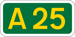
The A25 road is an east–west main road in the South-East of England. Its carries traffic east from Guildford, Surrey, eastward through Surrey and into mid-west Kent, to the town of Sevenoaks, and then on to Wrotham Heath where it connects with the A20.

Wrotham Heath is a settlement in the borough of Tonbridge and Malling in Kent, England. It is part of the civil parish of Wrotham, and is approximately 2 miles (3.2 km) south-east of the village of Wrotham, 7 miles (11 km) east of Sevenoaks, and 7 miles (11 km) west of Maidstone. It is located on the A20 road, close to the junction between the M20 and M26 motorways. Wrotham Heath Golf Club was founded in 1906.

<span class="mw-page-title-main">London Ringways</span> Series of proposed ring roads around London

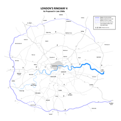
The London Ringways were a series of four ring roads planned in the 1960s to circle London at various distances from the city centre. They were part of a comprehensive scheme developed by the Greater London Council (GLC) to alleviate traffic congestion on the city's road system by providing high speed motorway-standard roads within the capital, linking a series of radial roads taking traffic into and out of the city.

<span class="mw-page-title-main">A405 road</span> Road in Hertfordshire

The A405 is a 4.8 miles dual carriageway road in Hertfordshire, England, from the A41 at Leavesden Green, near Watford, to the A414 at Park Street Roundabout near St Albans.

<span class="mw-page-title-main">M31 motorway</span> Proposed road in England

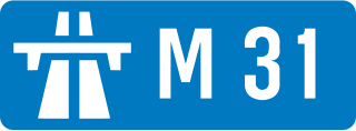
The M31 was planned as a Reading to M3 motorway which was dubbed the 'M3 – M4 link motorway'. It would have provided a direct high-speed route between the two motorways. The motorway was planned at the same time as the largely unrealised London Ringways scheme and an additional section was planned that would have taken the M31 south and east from the M3 to connect to the scheme's Ringway 4 providing a shorter route for traffic travelling between the west and Surrey and Kent.

<span class="mw-page-title-main">Crouch, Tonbridge and Malling</span> Human settlement in England

Crouch is a hamlet in the civil parish of Platt, in the Tonbridge and Malling district, in the county of Kent, England. In 2020 it had an estimated population of 555.

Comp is a hamlet in the Tonbridge and Malling district, in the English county of Kent.

Basted is a hamlet in the Tonbridge and Malling district, in the county of Kent, England.

Dryhill is a small hamlet in the Sevenoaks district, in the county of Kent, England.

East Hill is a hamlet in the civil parish of West Kingsdown, in the Sevenoaks District, in the county of Kent in England.

Heaverham is a hamlet in the Sevenoaks district, in the county of Kent, England. Nearby is the country estate of St Clere.

Romney Street is a hamlet in the civil parish of Shoreham, in the Sevenoaks district, in the English county of Kent.

Maplescombe is a hamlet in the West Kingsdown civil parish, in the Sevenoaks District, in the county of Kent, England.

<span class="mw-page-title-main">Operation Brock</span> Traffic management system to mitigate the effects of Brexit

Operation Brock is the traffic management system in Kent, England, used to supplement Operation Stack during cross-Channel traffic problems. It was originally developed for use in the event of a no-deal Brexit and the name is derived from Brexit Operations across Kent.

References

  1. "Motorway Database – M26". CBRD. Retrieved 27 January 2007.
  2. "The Motorway Archive – M26". Motorway Archive Trust. Archived from the original on 2 January 2007. Retrieved 27 January 2007.
  3. Kentish Advertiser Saturday 22 November 1980, page 10
  4. Kentish Advertiser Saturday 15 November 1980, page 1
  5. Times Wednesday November 19 1980, page 4
  6. Kentish Advertiser Saturday 21 July 1979, page 19
  7. Kentish Advertiser Saturday 20 October 1979, page 1
  8. "Local Transport Plan". Kent County Council. Archived from the original on 10 March 2007. Retrieved 27 January 2006. See 8.37 Improvement
  9. "UK plan to use motorway as 'parking lot' if no Brexit deal". 11 October 2018.
  10. Edgington, Tom; Schraer, Rachel (8 April 2019). "No-deal Brexit: What is the UK government doing to prepare?". BBC News. Retrieved 8 April 2019.
Template:Attached KML/M26 motorway
KML is from Wikidata