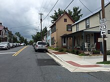
Maryland Route 213 (MD 213) is a 68.25-mile (109.84 km) state highway located on the Eastern Shore of Maryland in the United States. The route runs from MD 662 in Wye Mills, Queen Anne's County, north to the Pennsylvania border in Cecil County, where the road continues into that state as Pennsylvania Route 841 (PA 841). The route, which is a two-lane undivided highway most of its length, passes through mainly rural areas as well as the towns of Centreville, Chestertown, Galena, Cecilton, Chesapeake City, and Elkton. MD 213 intersects many routes including U.S. Route 50 (US 50) near Wye Mills, US 301 near Centreville, and US 40 in Elkton. It crosses over the Chesapeake & Delaware Canal in Chesapeake City on the Chesapeake City Bridge. MD 213 is designated by the state as the Chesapeake Country Scenic Byway between the southern terminus and Chesapeake City with the portion north of MD 18 in Centreville a National Scenic Byway. In addition, the route is also considered part of the Atlantic to Appalachians Scenic Byway between Chesapeake City and MD 273 in Fair Hill.

Maryland Route 7 (MD 7) is a collection of state highways in the U.S. state of Maryland. Known for much of their length as Philadelphia Road, there are five disjoint mainline sections of the highway totaling 40.23 miles (64.74 km) that parallel U.S. Route 40 (US 40) in Baltimore, Harford, and Cecil counties in northeastern Maryland. The longest section of MD 7 begins at US 40 just east of the city of Baltimore in Rosedale and extends through eastern Baltimore County and southern Harford County to US 40 in Aberdeen. The next segment of the state highway is a C-shaped route through Havre de Grace on the west bank of the Susquehanna River. The third mainline section of MD 7 begins in Perryville on the east bank of the Susquehanna River and ends at US 40 a short distance west of the start of the fourth section, which passes through Charlestown and North East before ending at US 40, just west of Elkton. The fifth segment of the highway begins at South Street and passes through the eastern part of Elkton before reconnecting with US 40 east of Elkton and west of the Delaware state line.
Maryland Route 313 (MD 313) is a state highway located on the Eastern Shore of Maryland in the United States. The 75.72-mile (121.86 km) route runs from U.S. Route 50 (US 50) in Mardela Springs, Wicomico County north to MD 213 and MD 290 in Galena, Kent County. It is predominantly a rural two-lane undivided road that runs through agricultural areas a short distance west of the Delaware state line, with the exception of a four-lane divided bypass of Denton that is concurrent with MD 404. MD 313 serves many communities, including Sharptown, Eldorado, Federalsburg, Denton, Greensboro, Goldsboro, Barclay, Sudlersville, Millington, and Massey. The route intersects many major roads, including MD 54 in Mardela Springs, MD 404 in the Denton area, MD 302 in Barclay, MD 300 in Sudlersville, and US 301 near Massey.

Maryland Route 342 is a state highway in the U.S. state of Maryland. Known as St. Augustine Road, the highway runs 2.82 miles (4.54 km) from MD 310 at St. Augustine north to unsigned MD 537 in Chesapeake City in southern Cecil County. MD 342 was constructed in its entirety by 1915.
Maryland Route 310 is a state highway in the U.S. state of Maryland. Known as Cayots Corner Road, the highway runs 3.96 miles (6.37 km) from MD 213 at Cayots east to the Delaware state line east of St. Augustine in southern Cecil County. MD 310 was built east of St. Augustine by 1921 and west to what was then U.S. Route 213 in the early 1940s. MD 310 was extended west when US 213 was relocated at Cayots in the early 1950s.
Maryland Route 286 is a state highway in the U.S. state of Maryland. Known for most of its length as Bethel Road, the highway runs 2.09 miles (3.36 km) from George Street, which is one of the segments of unsigned MD 537, east through Chesapeake City to the Delaware state line, where the highway continues east as Delaware Route 286. MD 286 roughly parallels the south side of the Chesapeake & Delaware Canal in southern Cecil County. The highway was constructed around 1930 and originally served the former community of Bethel instead of crossing the state line. A connection to Delaware was added in the late 1940s, and the segment to Bethel was removed in the late 1950s. MD 286's course within Chesapeake City was changed to its present routing in the mid-1960s.

Maryland Route 285 is a state highway in the U.S. state of Maryland. The highway runs 2.43 miles (3.91 km) from MD 213 east through Chesapeake City to the Delaware state line in southern Cecil County. MD 285 consists of two sections. The first section parallels the north side of the Chesapeake & Delaware Canal; this portion was constructed around 1930. The other segment included sections of the main north–south highway through Chesapeake City, U.S. Route 213. Sections of the main highway were constructed in the mid-1910s and then in the mid-1920s concurrent with the second bridge across the canal. After US 213 was moved to MD 213's present course using the Chesapeake City Bridge in 1949, the old highway became part of MD 537. That portion of MD 537 was replaced by an extension of MD 285 to MD 213 in 1983.

Maryland Route 282 is a state highway in the U.S. state of Maryland. The highway runs 12.43 miles (20.00 km) from Crystal Beach east to the Delaware state line in Warwick, where the highway continues east as Delaware Route 299. MD 282 is the primary east–west highway of the Sassafras Neck between the Sassafras River and Bohemia River, connecting Crystal Beach, Earleville, and Warwick with MD 213 in Cecilton in southern Cecil County. The state highway was paved in Warwick by 1910 and constructed from Warwick to Cecilton in the late 1910s. West of Cecilton, what is today MD 282 consists of part of former MD 283, which ran from Crystal Beach to Earleville. MD 282 was constructed to Earleville in the early 1920s and extended a short distance west of Earleville in the late 1920s. MD 283 was constructed in the late 1920s and early 1930s. MD 282 was extended west to Crystal Beach along MD 283 in 1959. The highway from Cecilton to Crystal Beach was reconstructed in the late 1960s.

Maryland Route 281 is a state highway in the U.S. state of Maryland. Known for most of its length as Red Hill Road, the state highway runs 2.12 miles (3.41 km) from MD 7 east to the Delaware state line in Elkton in northeastern Cecil County. MD 281 and its continuation in Delaware were originally blazed in the 18th century as part of the Old Post Road between Baltimore and Philadelphia. The route was part of the Elk and Christiana Turnpike in the early 19th century and later the Old Baltimore Pike, but it was replaced as the main highway east from Elkton by U.S. Route 40 in the early 20th century. MD 281 was constructed in Elkton in the early 1930s. The highway designation was extended east to the state line in the late 1950s; that extension was reconstructed in the early 1960s.
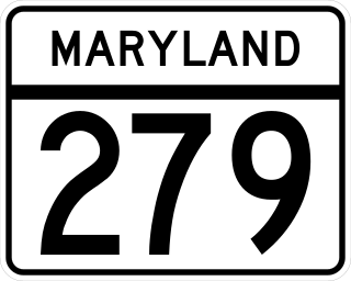
Maryland Route 279 is a state highway in the U.S. state of Maryland. Known for most of its length as Elkton Road, the highway runs 4.95 miles (7.97 km) from U.S. Route 40 and MD 7 west of Elkton to the Delaware state line north of Elkton in northeastern Cecil County. At the state line, the highway continues as Delaware Route 279. MD 279 functions as a northern bypass of Elkton and is the primary highway to Newark, Delaware, from Maryland. The road has an interchange with Interstate 95 (I-95) northeast of Elkton. The state highway was originally constructed in the early 1910s. MD 279 was reconstructed and placed on a new course north of Elkton in the early 1960s. MD 279 bypassed the center of Elkton with an extension to US 40 in the late 1960s; the old alignment to downtown Elkton was designated MD 268.
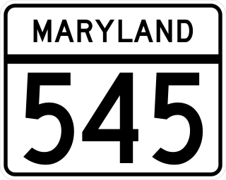
Maryland Route 545 is a state highway in the U.S. state of Maryland. Known for most of its length as Blue Ball Road, the state highway runs 5.92 miles (9.53 km) from MD 213 in Elkton north to Kirk Road and Warburton Road at Pleasant Hill in central Cecil County. MD 545 was constructed to Little Elk Creek near Childs in the early 1930s and extended to Pleasant Hill in the late 1940s.
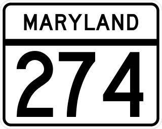
Maryland Route 274 is a state highway in the U.S. state of Maryland. Known for most of its length as Joseph Biggs Memorial Highway, the state highway runs 7.35 miles (11.83 km) from MD 273 in Rising Sun east to MD 272 in Bay View. In conjunction with MD 272, MD 274 connects Rising Sun with Interstate 95 (I-95) in central Cecil County. The highway was built near Rising Sun in two segments, one before 1910 and the other in the mid-1920s. MD 274 was completed to Bay View in the early 1940s. The highway was relocated at Bay View in the late 1960s and reconstructed the rest of the way to Rising Sun in the late 1970s and early 1980s. MD 274 had a truck bypass using MD 273 and MD 272 via Calvert.

Maryland Route 273 is a state highway in the U.S. state of Maryland. Known for most of its length as Telegraph Road, the highway runs 16.58 miles (26.68 km) from U.S. Route 1 near Harrisville east to the Delaware state line near Appleton, where the highway continues east as Delaware Route 273. MD 273 is the main east–west highway of northern Cecil County, connecting Conowingo, Port Deposit, and Rising Sun with Newark, Delaware, via the communities of Calvert and Fair Hill, where the highway intersects MD 272 and MD 213, respectively. The state highway also provides access to the Fair Hill Training Center and the Fair Hill Natural Resources Management Area.

Maryland Route 267 is a state highway in the U.S. state of Maryland. The highway runs 1.90 miles (3.06 km) through Charlestown between two intersections with MD 7 in southwestern Cecil County. MD 267, which follows the path of the Old Post Road between Baltimore and Philadelphia, was constructed as a modern highway along that main line in 1915. The highway was bypassed by what is now MD 7 in 1921 to avoid a pair of dangerous bridges across what is now Amtrak's Northeast Corridor railroad line. Those two bridges and adjacent sections of MD 267 were replaced west and east of Charlestown in the mid-1960s and mid-1970s, respectively.

Maryland Route 222 (MD 222) is a state highway in the U.S. state of Maryland. The highway runs 11.36 miles (18.28 km) from MD 7 in Perryville north to U.S. Route 1 (US 1) near Conowingo. MD 222 connects Perryville, Port Deposit, and Conowingo along its route paralleling the Susquehanna River in western Cecil County. Due to limitations in the highway in Port Deposit, including a steep hill and a low-clearance railroad bridge, trucks are directed to use MD 275, MD 276, and US 1 through Woodlawn and Rising Sun to connect Interstate 95 (I-95) with US 222 in Conowingo.

U.S. Route 40 in the U.S. state of Maryland runs from Garrett County in Western Maryland to Cecil County in the state's northeastern corner. With a total length of 221 miles (356 km), it is the longest numbered highway in Maryland. Almost half of the road overlaps or parallels with Interstate 68 (I-68) or I-70, while the old alignment is generally known as US 40 Alternate, US 40 Scenic, or Maryland Route 144. West of Baltimore, in the Piedmont and Appalachian Mountains / Blue Ridge region of the Western Maryland panhandle of the small state, the portions where it does not overlap an Interstate highway are mostly two-lane roads. The portion northeast of Baltimore going toward Wilmington in northern Delaware and Philadelphia in southeastern Pennsylvania is a four-lane divided highway, known as the Pulaski Highway. This section crosses the Susquehanna River at the north end of the Chesapeake Bay on the Thomas J. Hatem Memorial Bridge.
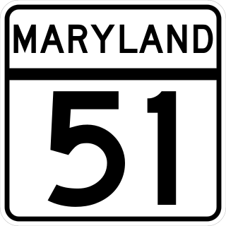
Maryland Route 51 is a state highway in the U.S. state of Maryland. Known for most of its length as Oldtown Road, the state highway runs 25.53 miles (41.09 km) from an interchange with Interstate 68 (I-68) in Cumberland south to the West Virginia state line at the Potomac River, where the highway continues east as West Virginia Route 9 toward Paw Paw. Around Cumberland, MD 51 is a major highway that provides a bypass of the South End neighborhood of that city and access to industrial areas along the North Branch Potomac River. South of North Branch, MD 51 is a rural highway connecting small communities along the river in southeastern Allegany County, including Oldtown. Documentation from the Maryland State Highway Administration depict the highway as following an east-west alignment, but all signage indicates a north-south road.


