Duluth is a major port city in the U.S. state of Minnesota and the county seat of Saint Louis County. Duluth has a population of 85,884 and is the 4th largest city in Minnesota. It is the 2nd largest city on Lake Superior, after Thunder Bay, Ontario. It has the largest metropolitan area on the lake, with a population of 279,771 in 2010, the second-largest in the state.

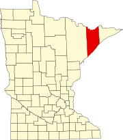
St. Louis County is a county located in the northeastern part of the U.S. state of Minnesota. As of the 2010 census, the population was 200,226. Its county seat is Duluth. It is the largest county by total area in Minnesota, and the largest in the United States east of the Mississippi River.

Rice Lake is a city in Saint Louis County, Minnesota, United States. The population was 4,095 at the 2010 census.

Brimson is an unincorporated community in Ault Township, Saint Louis County, Minnesota, United States.

Rollins is an unincorporated community in Ault Township, Saint Louis County, Minnesota, United States.

The Boundary Waters Canoe Area Wilderness, is a 1,090,000-acre (4,400 km2) wilderness area within the Superior National Forest in northeastern part of the US state of Minnesota under the administration of the U.S. Forest Service. A mixture of forests, glacial lakes, and streams, the BWCAW's preservation as a primitive wilderness began in the 1900s and culminated in the Boundary Waters Canoe Area Wilderness Act of 1978. It is a popular destination for canoeing, hiking, and fishing, and is one of the most visited wildernesses in the United States.
Minnesota State Highway 61 is a 148.843-mile-long (239.540 km) highway in northeast Minnesota, which runs from a junction with Interstate 35 (I-35) in Duluth at 26th Avenue East, and continues northeast to its northern terminus at the Canadian border near Grand Portage, connecting to Ontario Highway 61 at the Pigeon River Bridge. The route is a scenic highway, following the North Shore of Lake Superior, and is part of the Lake Superior Circle Tour designation that runs through Minnesota, Ontario, Michigan, and Wisconsin.

Knife River is an unincorporated community in Lake County, Minnesota, United States; located on the North Shore of Lake Superior.

Markham is an unincorporated community in Colvin Township, Saint Louis County, Minnesota, United States.

Saginaw is an unincorporated area in Saint Louis County, Minnesota, United States. Although unincorporated, Saginaw has a post office with the ZIP code 55779.

Central Lakes is an unincorporated community in Saint Louis County, Minnesota, United States.

Britt is an unincorporated area in Saint Louis County, Minnesota, United States.

Crane Lake is an unincorporated community in Crane Lake Township, Saint Louis County, Minnesota, United States; located within the Kabetogama State Forest.

Skibo is an unincorporated community in Bassett Township, Saint Louis County, Minnesota, United States.

French River is an unincorporated community in Duluth Township, Saint Louis County, Minnesota, United States; located on the North Shore of Lake Superior.

Palmers is an unincorporated community in Duluth Township, Saint Louis County, Minnesota, United States; located on the North Shore of Lake Superior.

Petrel is an unincorporated community in Fairbanks Township, Saint Louis County, Minnesota, United States; located within the Superior National Forest.

The Cloquet Valley State Forest encompasses 327,098 acres (1,323.7 km2); 48,384 acres (195.8 km2) of which are Minnesota Department of Natural Resources forestry administered lands.

Tofte is an unincorporated community in Tofte Township, Cook County, Minnesota, United States.

Toimi is an unincorporated community in Lake County, Minnesota, United States.


