Palm Harbor is a census-designated place and unincorporated community in Pinellas County, Florida, United States. As of the 2016 American Community Survey, the CDP had a population of 60,236.

Brimson is an unincorporated community in Ault Township, Saint Louis County, Minnesota, United States.
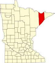
Rollins is an unincorporated community in Ault Township, Saint Louis County, Minnesota, United States.

Eagle Harbor is an unincorporated community and census-designated place located on the north side of the Keweenaw Peninsula within Eagle Harbor Township, Keweenaw County in the U.S. State of Michigan. Its population was 76 as of the 2010 census. M-26 passes through this community. This hamlet was especially popular with the sailors in days past, as it had a good steamboat landing and is about equally distant from Sault Sainte Marie, Michigan, and Duluth, Minnesota. It was the first stop for supplies for the many boats on Lake Superior.
Minnesota State Highway 61 is a 148.843-mile-long (239.540 km) highway in northeast Minnesota, which runs from a junction with Interstate 35 (I-35) in Duluth at 26th Avenue East, and continues northeast to its northern terminus at the Canadian border near Grand Portage, connecting to Ontario Highway 61 at the Pigeon River Bridge. The route is a scenic highway, following the North Shore of Lake Superior, and is part of the Lake Superior Circle Tour designation that runs through Minnesota, Ontario, Michigan, and Wisconsin.
Larsmont is an unincorporated community in Lake County, Minnesota, United States; located on the North Shore of Lake Superior.
Finland is an unincorporated community and census-designated place (CDP) in Crystal Bay and Beaver Bay townships, Lake County, Minnesota, United States. As of the 2010 census, its population was 195.
Knife River is an unincorporated community in Lake County, Minnesota, United States; located on the North Shore of Lake Superior.
Fairbanks is an unincorporated community in Fairbanks Township, Saint Louis County, Minnesota, United States; located within the Superior National Forest.
Bassett is an unincorporated community in Bassett Township, Saint Louis County, Minnesota, United States located within the Superior National Forest.

Pipe, Wisconsin is an unincorporated community in the Town of Calumet in Fond du Lac County, Wisconsin, United States. It is located approximately 1 mile (1.6 km) east of Lake Winnebago.
Lax Lake is an unincorporated community in Beaver Bay Township, Lake County, Minnesota, United States.
Little Marais is an unincorporated community in Lake County, Minnesota, United States; located on the North Shore of Lake Superior.

Tofte is an unincorporated community in Tofte Township, Cook County, Minnesota, United States.
Silver Creek is an unincorporated community in Silver Creek Township, Lake County, Minnesota, United States.
Highland is an unincorporated community in Lake County, Minnesota, United States.
McNair is an unincorporated community in Lake County, Minnesota, United States. The community is located 20 miles north of the city of Two Harbors at the intersection of Lake County Highway 2 and Langley River Road, Forest Road 122.
Toimi is an unincorporated community in Lake County, Minnesota, United States.
Wales is an unincorporated community in Lake County, Minnesota, United States.
Alger is an unincorporated community in Lake County, Minnesota, United States. It is 9 miles north of Two Harbors, near the intersection of Lake County Highway 2 and Alger Grade, Township Road 24.