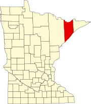
Lake County is a county in the U.S. state of Minnesota. As of the 2010 United States Census, the population was 10,866. Its county seat is Two Harbors.

Not to be confused with Cook, Minnesota in Saint Louis County.

Benzie County is a county in the U.S. state of Michigan. As of the 2010 census, the population was 17,525. The county seat is Beulah. The county was initially set off in 1863 and organized in 1869.

Grand Lake Township is a township in Saint Louis County, Minnesota, United States. The population was 2,779 at the 2010 census.
Morse Township is a township in Saint Louis County, Minnesota, United States. The population was 1,213 at the 2010 census.
Sandy Township is a township in Saint Louis County, Minnesota, United States. The population was 356 at the 2010 census.

Cicero is a town in Northern Onondaga County, New York, United States. The population was 31,632 at the 2010 census. The name of the town was assigned by a clerk interested in the classics, honoring Cicero, a Roman statesman.

Superior National Forest, part of the United States National Forest system, is located in the Arrowhead Region of the state of Minnesota between the Canada–United States border and the north shore of Lake Superior. The area is part of the greater Boundary Waters region along the border of Minnesota and the Canadian province of Ontario, a historic and important thoroughfare in the fur trading and exploring days of New France and British North America.

Sawbill Lake is a lake in Cook County, Minnesota. The closest town to Sawbill Lake is Tofte. It is a popular entry point to the Boundary Waters Canoe Area Wilderness in the Superior National Forest. Sawbill is a nickname of the common merganser duck. There is a United States Forest Service cabin, a canoe outfitter, and a campground located at the southern end of the lake. During the Great Depression there was a Civilian Conservation Corps camp six miles south of the lake.

Landing is a small settlement and unincorporated community located within Roxbury Township, in Morris County, New Jersey, United States. The community is located on the south shore of Lake Hopatcong near Hopatcong State Park. The area is served as United States Postal Service ZIP Code 07850.
Britt is an unincorporated area in Saint Louis County, Minnesota, United States.
Crane Lake is an unincorporated community in Crane Lake Township, Saint Louis County, Minnesota, United States; located within the Kabetogama State Forest.

Tofte is an unincorporated community in Tofte Township, Cook County, Minnesota, United States.

Poyntelle is a village in Preston Township, Wayne County, Pennsylvania, in the Lake Region of the Poconos. It was once a depot of the Scranton Division of the New York, Ontario & Western (O&W) Railway, but today, when it is known outside of its immediate vicinity, it is largely for being the location of Camps Westmont and Poyntelle Lewis Village, since the reputation and commercial reach of both, like those of most rural American summer camps, extend beyond the community in which the camps are physically located.
Reads Landing is an unincorporated community in Pepin Township, Wabasha County, Minnesota, United States, along the Mississippi River.
The Kelso River is a 4.0-mile-long (6.4 km) stream in northern Minnesota, the United States. It flows entirely within the Boundary Waters Canoe Area Wilderness of Superior National Forest, ending at Sawbill Lake. Water from the Kelso River flows via Sawbill Creek to the Temperance River and thence to Lake Superior.
The Isabella Ranger Station is a complex of 21 buildings in Stony River Township, Minnesota, United States, near the town of Isabella. It is located on Minnesota State Highway 1 about one mile east of Isabella. The complex is listed on the National Register of Historic Places for its association with New Deal federal relief construction.
Section Thirty is an unincorporated community in Fall Lake Township, Lake County, Minnesota, United States, located four miles east of Ely and two miles southeast of Winton. It takes its name from the survey section of the survey township in which it is located.
Jessie Lake is an unincorporated community in Lake Jessie Township, Itasca County, Minnesota, United States; located within the Chippewa National Forest. The community is located between Wirt and Talmoon; along Itasca County Road 4.
Smoke Lake is a lake in Cook County, Minnesota within Tofte Township. It is within the Boundary Waters Canoe Area Wilderness and the Superior National Forest. The lake can be accessed by a 100 rod portage from Sawbill Lake to the west and a 90 rod portage from Burnt Lake to the east, which in turn is accessed from Entry Point 39 at Baker Lake through Peterson and Kelly lakes.