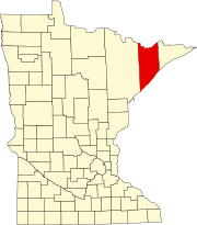
Bassett Township is a township in Saint Louis County, Minnesota, United States. The township was named for William Bassett, a businessperson in the lumber industry. The population was 41 at the 2010 census.
Brimson is an unincorporated community in Ault Township, Saint Louis County, Minnesota, United States.
Rollins is an unincorporated community in Ault Township, Saint Louis County, Minnesota, United States.
Bowstring is an unincorporated community in Bowstring Township, Itasca County, Minnesota, United States.
Fairbanks is an unincorporated community in Fairbanks Township, Saint Louis County, Minnesota, United States; located within the Superior National Forest.
Bassett is an unincorporated community in Bassett Township, Saint Louis County, Minnesota, United States located within the Superior National Forest.
Talmoon is an unincorporated community in Itasca County, Minnesota, United States.
Max is an unincorporated community in Max Township, Itasca County, Minnesota, United States; located within the Chippewa National Forest and the Leech Lake Indian Reservation.
Wirt is an unincorporated community in Wirt Township, Itasca County, Minnesota, United States; located within the Chippewa National Forest.
Mack is an unincorporated community in Itasca County, Minnesota, United States, located within the Chippewa National Forest. The community is located between Deer River and Talmoon, at the junction of State Highway 6 and Mac Road.
McNair is an unincorporated community in Lake County, Minnesota, United States. The community is located 20 miles north of the city of Two Harbors at the intersection of Lake County Highway 2 and Langley River Road, Forest Road 122.
Section Thirty is an unincorporated community in Fall Lake Township, Lake County, Minnesota, United States, located four miles east of Ely and two miles southeast of Winton. It takes its name from the survey section of the survey township in which it is located.
Wales is an unincorporated community in Lake County, Minnesota, United States.
Alvwood is an unincorporated community in Alvwood Township, Itasca County, Minnesota, United States.
Bergville is an unincorporated community in Ardenhurst Township, Itasca County, Minnesota, United States; located within the Chippewa National Forest.
Bramble is an unincorporated community in Koochiching County, Minnesota, United States; located in the southeast corner of the county.
Dora Lake is an unincorporated community in Kinghurst Township, Itasca County, Minnesota, United States; located within the Chippewa National Forest. The community is located near Wirt at the junction of Itasca County Roads 29 and 145.

Suomi is an unincorporated community in Itasca County, Minnesota, United States.
Jessie Lake is an unincorporated community in Lake Jessie Township, Itasca County, Minnesota, United States, located within the Chippewa National Forest. The community is located between Wirt and Talmoon; along Itasca County Road 4.
The Superior National Forest Scenic Byway (SNFSB), also known as Forest Highway 11, is a combination of state and county highways in Minnesota that travel between the historic communities of the Iron Range and Lake Superior's North Shore. The byway is 78 miles (126 km) of paved, two-lane roads and is marked by navigational signs with the SNFSB logo. The route was given State Scenic Byway status in 1999.