Millheim, Pennsylvania

Last updated
Millheim, Pennsylvania
USPO Milheim PA.jpg
Post office
Centre County Pennsylvania Incorporated and Unincorporated areas Millheim Highlighted.svg
Location of Millheim in Centre County, Pennsylvania.
Map of Pennsylvania highlighting Centre County.svg
Map showing Centre County in Pennsylvania
USA Pennsylvania location map.svg
Red pog.svg
Millheim
Usa edcp location map.svg
Red pog.svg
Millheim
Coordinates: 40°53′28″N77°28′33″W / 40.89111°N 77.47583°W / 40.89111; -77.47583
Country United States
State Pennsylvania
County Centre
Settled1797
Incorporated (borough)1879
Government
  MayorLauralee Snyder
Area
[1]
  Total1.33 sq mi (3.45 km2)
  Land1.33 sq mi (3.45 km2)
  Water0.00 sq mi (0.00 km2)
Elevation
696 ft (212 m)
Population
 (2020) [2]
  Total831
  Density624.34/sq mi (241.00/km2)
Time zone Eastern (EST)
  Summer (DST)EDT
Zip code
16854
Area code 814
FIPS code 42-49768
Website www.millheimborough.net

Millheim is a borough in Centre County, Pennsylvania, United States. It is part of the State College, Pennsylvania Metropolitan Statistical Area. The population was 904 at the 2010 census. The Millheim Historic District, which includes 176 contributing buildings, was listed on the National Register of Historic Places in 1986.

Contents

Geography

Millheim is located at 40°53′28″N77°28′33″W / 40.89111°N 77.47583°W / 40.89111; -77.47583 (40.890981, -77.475954). [3]

According to the United States Census Bureau, the borough has a total area of 1.3 square miles (3.4 km2), all land.

The town was named for having a millhouse situated along Elk Creek; the town still features the mill's raceway, which flows through the downtown area.

Demographics

Historical population
CensusPop.Note
1880 577
1890 70021.3%
1900 612−12.6%
1910 6262.3%
1920 515−17.7%
1930 65928.0%
1940 6823.5%
1950 75010.0%
1960 7804.0%
1970 87111.7%
1980 800−8.2%
1990 8475.9%
2000 749−11.6%
2010 90420.7%
2020 831−8.1%
Sources: [4] [5] [6] [2]

As of the census [5] of 2010, there were 904 people, 377 households, and 251 families residing in the borough. The population density was 684.8 inhabitants per square mile (264.4/km2). There were 417 housing units at an average density of 315.9 per square mile (122.0/km2). The racial makeup of the borough was 98.2% White, 0.1% Black or African American, 0.1% Native American, 0.1% other, and 1.5% from two or more races.

There were 377 households, out of which 31.6% had children under the age of 18 living with them, 47.7% were married couples living together, 5.6% had a male householder with no wife present, 13.3% had a female householder with no husband present, and 33.4% were non-families. 28.4% of all households were made up of individuals, and 14.0% had someone living alone who was 65 years of age or older. The average household size was 2.40 and the average family size was 2.94.

In the borough the population was spread out, with 25.1% under the age of 18, 6.7% from 18 to 24, 24.6% from 25 to 44, 25.8% from 45 to 64, and 17.8% who were 65 years of age or older. The median age was 40 years. For every 100 females there were 92.8 males. For every 100 females age 18 and over, there were 82.0 males.

The median income for a household in the borough was $43,077, and the median income for a family was $48,029. The per capita income for the borough was $17,335. About 9.9% of families and 10.7% of the population were below the poverty line, including 18.4% of those under age 18 and 3.8% of those age 65 or over.

Related Research Articles

<span class="mw-page-title-main">Midway, Adams County, Pennsylvania</span> Census-designated place in Pennsylvania, United States

Midway is an unincorporated census-designated place in Adams County, Pennsylvania, United States. The population was 1,059 at the 2020 census.

<span class="mw-page-title-main">Sewickley Hills, Pennsylvania</span> Borough in Pennsylvania, United States

Sewickley Hills is a borough in Allegheny County, Pennsylvania, United States. The population was 689 at the 2020 census.

<span class="mw-page-title-main">Verona, Pennsylvania</span> Borough in Pennsylvania, United States

Verona is a borough in Allegheny County, Pennsylvania, United States. It is 13 miles (21 km) northeast of downtown Pittsburgh, along the left bank of the Allegheny River. As of the 2020 census, the borough had a population of 2,492.

<span class="mw-page-title-main">St. Lawrence, Pennsylvania</span> Borough in Pennsylvania, United States

St. Lawrence is a borough in Berks County, Pennsylvania, United States. The population was 1,809 at the 2010 census.

<span class="mw-page-title-main">Seven Fields, Pennsylvania</span> Place in Pennsylvania, United States

Seven Fields is a borough in Butler County, Pennsylvania, United States. The population was 2,887 at the 2010 census, an increase from the figure of 1,986 tabulated in 2000.

<span class="mw-page-title-main">Madisonburg, Pennsylvania</span> Census designated place in Pennsylvania, United States

Madisonburg is an unincorporated community and census-designated place (CDP) in Miles Township, Centre County, Pennsylvania, United States. It is part of the State College, Pennsylvania Metropolitan Statistical Area. The population was 168 at the 2010 census.

<span class="mw-page-title-main">Penn Township, Centre County, Pennsylvania</span> Township in Pennsylvania, United States

Penn Township is a township in Centre County, Pennsylvania, United States. It is part of the State College, Pennsylvania Metropolitan Statistical Area. The population was 1,214 at the 2020 census. Poe Valley State Park is in Penn Township.

<span class="mw-page-title-main">Woodward, Pennsylvania</span> Census-designated place in Pennsylvania, United States

Woodward is an unincorporated community and census-designated place in Centre County, Pennsylvania, United States. It is part of the State College, Pennsylvania, Metropolitan Statistical Area. The population was 110 at the 2010 census.

<span class="mw-page-title-main">Springboro, Pennsylvania</span> Borough in Pennsylvania, United States

Springboro is a borough in Crawford County, Pennsylvania, United States, located 35 miles southwest of Erie. The population was 377 at the 2020 census, down from 477 at the 2010 census.

<span class="mw-page-title-main">Lykens, Pennsylvania</span> Borough in Pennsylvania, United States

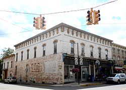
Lykens is a borough in Dauphin County, Pennsylvania, United States. Anthracite coal mining sustained a population of 2,762 in 1900 and 2,943 in 1910. The population was 1,865 at the 2020 census.

<span class="mw-page-title-main">Markleysburg, Pennsylvania</span> Borough in Pennsylvania, United States

Markleysburg is a borough in Fayette County, Pennsylvania, United States. The population was 246 at the 2020 census. The borough is served by the Uniontown Area School District.

<span class="mw-page-title-main">Shirleysburg, Pennsylvania</span> Borough in Pennsylvania, United States

Shirleysburg is a borough in Huntingdon County, Pennsylvania, United States. The population was 150 at the 2010 census.

<span class="mw-page-title-main">Mifflintown, Pennsylvania</span> Borough in Pennsylvania, United States

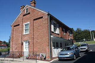
Mifflintown is a borough in and the county seat of Juniata County, Pennsylvania, United States. The population was 842 at the 2020 census.

<span class="mw-page-title-main">Bessemer, Lawrence County, Pennsylvania</span> Borough in Pennsylvania, United States

Bessemer is a borough in Lawrence County, Pennsylvania, United States. The population was 1,073 at the 2020 census. It is part of the New Castle micropolitan area.

<span class="mw-page-title-main">Pennsburg, Pennsylvania</span> Borough in Pennsylvania, United States

Pennsburg is a borough in Montgomery County, Pennsylvania. Its population was 3,889 at the 2020 census. It is part of the Upper Perkiomen School District. It is also part of the strip of small towns that run together along Route 29: Red Hill, Pennsburg, and East Greenville. The towns are collectively referred to as Upper Perk.

<span class="mw-page-title-main">Tatamy, Pennsylvania</span> Place in Pennsylvania, United States

Tatamy is a borough in Northampton County, Pennsylvania. The borough's population was 1,203 as of the 2020 census. Tatamy is part of the Lehigh Valley metropolitan area, which had a population of 861,899 and was the 68th most populous metropolitan area in the U.S. as of the 2020 census.

<span class="mw-page-title-main">Franklin Township, Snyder County, Pennsylvania</span> Township in Pennsylvania, United States

Franklin Township is a township in Snyder County, Pennsylvania, United States. The population was 2,202 at the 2020 census.

<span class="mw-page-title-main">Elco, Pennsylvania</span> Borough in Pennsylvania, United States

Elco is a borough in Washington County, Pennsylvania, United States. The population was 263 at the 2020 census.

<span class="mw-page-title-main">Carroll Township, York County, Pennsylvania</span> Township in Pennsylvania, United States

Carroll Township is a township in York County, Pennsylvania, United States. The population was 6,853 at the 2020 census.

<span class="mw-page-title-main">Franklintown, Pennsylvania</span> Borough in Pennsylvania, United States

Franklintown is a borough in York County, Pennsylvania, United States. The population was 511 at the 2020 census.

References

  1. "ArcGIS REST Services Directory". United States Census Bureau. Retrieved October 12, 2022.
  2. 1 2 "Census Population API". United States Census Bureau. Retrieved Oct 12, 2022.
  3. "US Gazetteer files: 2010, 2000, and 1990". United States Census Bureau. 2011-02-12. Retrieved 2011-04-23.
  4. "Census of Population and Housing". U.S. Census Bureau. Retrieved 11 December 2013.
  5. 1 2 "U.S. Census website". United States Census Bureau . Retrieved 2008-01-31.
  6. "Incorporated Places and Minor Civil Divisions Datasets: Subcounty Resident Population Estimates: April 1, 2010 to July 1, 2012". Population Estimates. U.S. Census Bureau. Archived from the original on 11 June 2013. Retrieved 11 December 2013.