Minneapolis Park and Recreation Board

Last updated

Minneapolis Park and Recreation Board
Minneapolis Park and Recreation Board logo.png
Minneapolis Park and Recreation Board headquarters.JPG
Minneapolis Park and Recreation Board headquarters, located across West River Road from North Mississippi Regional Park.
Local government board overview
Formed1883 (1883)
JurisdictionCity of Minneapolis
Employees500 full-time
1,300 part-time
Annual budget$111 million
Local government board executive
  • Al Bangoura, Superintendent [1]
Website minneapolisparks.org
Area6,804 acres (27.53 km2)
Visitors23 million
Paths102 miles (164 km)
Golf courses7
Facilities179

The Minneapolis Park and Recreation Board (MPRB) is an independent park district that owns, maintains, and programs activities in public parks in Minneapolis, Minnesota, United States. It has 500 full-time and 1,300 part-time employees and an $111 million operating and capital budget. [2] [3]

Contents

The Minneapolis park system has been called the best-designed, best-financed, and best-maintained in America. [4] Minneapolis was rated the #1 park system in the country for the sixth year in a row by The Trust for Public Land in 2018 and again in 2020. [5] [6]

History

Minnehaha Falls is part of Minnehaha Park, a 167-acre (68 ha) jewel of the Minneapolis park system. [7]

The Minneapolis Park and Recreation Board was created by an act of the Minnesota State Legislature and a vote of Minneapolis residents in 1883. Charles M. Loring was elected the first president of the board. Loring convinced landowners to donate property around Bde Maka Ska, Lake Harriet and Lake of the Isles, as well as on Minnehaha Creek. [8]

Loring hired Horace Cleveland to create the original plan for Minneapolis parks in 1883, Cleveland's finest landscape architecture, preserving geographical landmarks and linking them with boulevards and parkways. [9] [10] Loring and Cleveland were instrumental in creating Minnehaha Park, with its falls as a centerpiece. [8] [11]

Theodore Wirth was superintendent from 1906 to 1936 and managed the expansion of Minneapolis parks from 1,810 to 5,241 acres (732 to 2,121 ha). [12] Wirth was an advocate of active recreation in all city parks and put up signs saying "Please Walk on the Grass." Wirth also promoted neighborhood parks for the whole city, his plans called for a playground within one-quarter mile (400 m) of every child and a recreation center within one-half mile (800 m) of all residents, [13] however Wirth never built them. [14] [15] In was from 1966 to 1978, during the tenure of superintendent Robert W. Ruhe, when the board built the city's neighborhood parks and recreation centers in underserved areas. [16] In 2020, 98% of all residents lived within a 10-minute walk of a park, compared to the national median of 55%. [17]

In July 2020, the park board voted to allow encampments for people experiencing homelessness at up to 20 city parks with 25 tents each. The change in policy came after several hundred people took up residence in Powderhorn Park in the aftermath of the murder of George Floyd by a Minneapolis police officer. However, the Powderhorn situation became untenable after numerous sexual assaults, fights, and drug use reported at the encampment generated alarm for nearby residents, leading to the eviction of many people in tents. [18] Four people died in encampments in city parks in 2020, [19] [20] including a 38-year-old man who was stabbed to death on January 3, 2021, at an encampment in Minnehaha Park. [20] [21]

On November 18, 2020, the board legalized female topfreedom in the parks. [22]

Description

The park system's 6,084 acres (24.62 km2) make up 15% of the total area of Minneapolis, equal to the national median. [17]

The city's Chain of Lakes, consisting of seven lakes and Minnehaha Creek, is connected by bike, running, and walking paths and used for swimming, fishing, picnics, boating, and ice skating. A parkway for cars, a bikeway for riders, and a walkway for pedestrians runs parallel along the 52 miles (84 km) route of the Grand Rounds National Scenic Byway. [23] Parks are also connected through the Mississippi National River and Recreation Area regional parks and visitor centers.

Among the board's youth work programs, Teen Teamworks [24] has provided on-the-job training for green careers to ages 14 to 24, since 1986. [25] In 2022, the program recruited 500 participants. [26] Other youth programs are Recreation Plus and the Youthline Outreach Mentorship Program, founded in the 1980s and 1991. [25] The board is the city's largest employer of youth. [27]

The country's oldest public wildflower garden, the Eloise Butler Wildflower Garden and Bird Sanctuary, is located within Theodore Wirth Park. Wirth Park extends into Golden Valley and is almost 90% the size of Central Park in New York City. [28] Site of the 53-foot (16 m) Minnehaha Falls, Minnehaha Park is one of the city's oldest and most popular parks, receiving over 850,000 visitors each year. [7] Henry Wadsworth Longfellow named Hiawatha's wife Minnehaha for the Minneapolis waterfall in The Song of Hiawatha , a bestselling and often-parodied 19th century poem. [29]

The first natural swimming pool in the United States opened in Webber Park in 2015. The outdoor pool does not use any chemicals, rather it uses natural filters and plants in several container ponds to keep the water clean. [30]

Facilities

The Minneapolis Sculpture Garden Minneapolis Sculpture Garden 02.jpg
The Minneapolis Sculpture Garden

The Minneapolis Park and Recreation Board facilities include 6,804 acres (27.53 km2) of land and water, 179 properties, 102 miles (164 km) of biking and walking paths, 49 recreation centers, 22 lakes, 12 formal gardens, and seven golf courses. [31]

List of notable facilities

Governance

The Minneapolis Park and Recreation Board is an independently elected, semi-autonomous park district responsible for governing, maintaining, and developing the Minneapolis park system. [2] The jurisdiction of the park board is contiguous with the City of Minneapolis borders, although it owns four golf courses, Minneapolis–Saint Paul International Airport, [32] and its largest park, Theodore Wirth Park outside the city limits.

Minneapolis voters elect nine commissioners every four years: one from each of the six park districts, and three that serve at-large. [33] The district and at-large members are elected using ranked choice voting. [34] The Board of Commissioners appoints the superintendent and sets policy for the park board. [2]

Police

The Superintendent of the Parks has oversight of the Minneapolis Park Police Department—the law enforcement authority of the park board. Led by a park police chief, the force consists of 30 sworn officers and 20 part-time park patrol agents. The park police is a separate entity from the Minneapolis Police Department, but the two forces have shared training, support services, and authority to police in both parks and throughout the city. [35] The park board voted unanimously on June 3, 2020, to end its relationship with the Minneapolis Police Department following the murder of George Floyd by a city police officer. [36] The decision prohibited Minneapolis police officers from staffing park events and prohibited park police form assisting the Minneapolis Police Department. Nearly two years later, on May 4, 2022, the park board restored its relationship with the Minneapolis Police Department to allow the return of large events in parks that had been disrupted due to the COVID-19 pandemic. [37]

See also

Bibliography

Related Research Articles

<span class="mw-page-title-main">Minnehaha Park (Minneapolis)</span> United States historic place

Minnehaha Park is a city park in Minneapolis, Minnesota, United States, and home to Minnehaha Falls and the lower reaches of Minnehaha Creek. Officially named Minnehaha Regional Park, it is part of the Minneapolis Park and Recreation Board system and lies within the Mississippi National River and Recreation Area, a unit of the National Park Service. The park was designed by landscape architect Horace W.S. Cleveland in 1883 as part of the Grand Rounds Scenic Byway system, and was part of the popular steamboat Upper Mississippi River "Fashionable Tour" in the 1800s.

<span class="mw-page-title-main">50th Street/Minnehaha Park station</span>

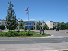
50th Street/Minnehaha Park is a light rail station on the Blue Line in Minneapolis, Minnesota, United States.

<span class="mw-page-title-main">Powderhorn Park, Minneapolis</span> Neighborhood in Hennepin, Minnesota, United States

The Powderhorn Park neighborhood of Minneapolis, Minnesota, United States is located approximately three miles south of downtown and is bordered by East Lake Street to the north, Cedar Avenue to the east, East 38th Street to the south, and Chicago Avenue to the west. Its namesake is the city's Powderhorn Park facility in the northwestern part of the neighborhood around Powderhorn Lake, which contains playing fields, playgrounds and a park building that hosts community education classes ranging from pottery to yoga. In winter, the Minneapolis Park and Recreation Board sets up a portable warming house and the lake is used for ice skating.

<span class="mw-page-title-main">Grand Rounds National Scenic Byway</span> Parkway system in Minneapolis

The Grand Rounds National Scenic Byway is a linked series of park areas in Minneapolis, Minnesota, United States, that takes a roughly circular path through the city. The Minneapolis Park and Recreation Board developed the system over many years. The corridors include roads for automobile traffic plus separate paths for pedestrians and bicycles, and extend slightly into neighboring cities. About 50 miles (80 km) of roadway and paths are in the system, and much of it was built in the 1930s as part of Civilian Conservation Corps projects.

<span class="mw-page-title-main">Theodore Wirth Park</span> Urban park in Minneapolis

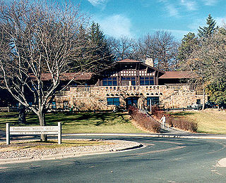
Theodore Wirth Park is the regional park managed by the Minneapolis Park and Recreation Board. The park land is shared by Minneapolis and the neighboring suburb of Golden Valley. Formally named Theodore Wirth Regional Park, it includes two golf courses, Wirth Lake, Birch Pond, cross-country ski trails, mountain biking trails, snow tubing hills, and other amenities. It forms a significant portion of the Grand Rounds Scenic Byway, linking the Chain of Lakes area with the Victory Memorial Parkway.

<span class="mw-page-title-main">Lake Hiawatha</span>

Lake Hiawatha is located just north of Lake Nokomis in Minneapolis, Minnesota. It was purchased by the Minneapolis Park and Recreation Board in 1922 for $550,000. At that time the lake was a marsh known as Rice Lake, but over four years, the park system transformed the wetland into a lake surrounded by a park.

<span class="mw-page-title-main">Lake Street (Minneapolis)</span>

Lake Street is a major east-west thoroughfare between 29th and 31st streets in Minneapolis, Minnesota United States. From its western most end at the city's limits, Lake Street reaches the Chain of Lakes, passing over a small channel linking Bde Maka Ska and Lake of the Isles, and at its eastern most end it reaches the Mississippi River. In May 2020, the Lake Street corridor suffered extensive damage during local unrest over the death of George Floyd. In August of the same year, city officials designated East Lake Street as one of seven cultural districts to promote racial equity, preserve cultural identity, and promote economic growth.

<span class="mw-page-title-main">Midtown Greenway</span> Shared-use path in Minneapolis, USA

The Midtown Greenway is a 5.7-mile (9.2 km) rail trail in Minneapolis, Minnesota that follows the path of an abandoned route of the Milwaukee Road railway. It is considered under segregated cycle facilities.

<span class="mw-page-title-main">Longfellow, Minneapolis</span> Community of Minneapolis

Longfellow is a defined community in Minneapolis, Minnesota which includes five smaller neighborhoods inside of it: Seward, Cooper, Hiawatha, Howe and Longfellow. The community is a mix of agri-industrial properties along the old Northern Pacific Railway, expansive parkland surrounding the famous Minnehaha Falls, and smaller residential areas.

<span class="mw-page-title-main">Lyndale Park</span>

Lyndale Park is a Minneapolis city park on the northeast side of Lake Harriet. It is next to Lakewood Cemetery, southeast of Bde Maka Ska. It is part of an enormous greenspace circling through Minneapolis called the Grand Rounds Scenic Byway, and is one of the seven districts within, called the Chain of Lakes. The other six districts within Grand Rounds are the Downtown Riverfront, Mississippi River, Minnehaha, Theodore Wirth, Victory Memorial Parkway, and Northeast. Managed by the Minneapolis Park and Recreation Board, the 53-mile (85 km) parkway system has numerous parks and parkways, lakes, streams and creeks, the Mississippi River, and the 53-foot (16 m) high Minnehaha Falls. The 6,400-acre (26 km2) park system is designed so that every home in Minneapolis is within six blocks of green space.

<span class="mw-page-title-main">Theodore Wirth</span> Swiss-born American architect (1863–1949)

Theodore Wirth (1863–1949) was instrumental in designing the Minneapolis system of parks. Swiss-born, he was widely regarded as the dean of the local parks movement in America. The various titles he was given included administrator of parks, horticulturalist, and park planner. Before emigrating to America in 1888, he worked as a florist and landscaper in Zurich, London, and Paris. He married Leonie Mense, the daughter of his employer in Glen Cove, Long Island, before taking a job as superintendent of parks in Hartford, Connecticut in 1896, where he developed the first municipal rose garden in the country.

Minneapolis is the largest city in the state of Minnesota in the United States, and the county seat of Hennepin County.

<span class="mw-page-title-main">Charles M. Loring</span> American businessperson, miller and publicist

Charles Morgridge Loring was an American businessman, miller and publicist. Raised in Maine to be a sea captain, Loring instead became a civic leader in Minneapolis, Minnesota where he was a wealthy flour miller and in Riverside, California where he helped to build the first city hall. He was a popular and generous man who enjoyed many friendships and business associations.

<i>Hiawatha and Minnehaha</i> Sculpture in Minneapolis, Minnesota

Hiawatha and Minnehaha is a sculpture by Jacob Fjelde that has stood in Minnehaha Park in Minneapolis since the early twentieth century. Now a popular fixture of the park, its placement there was originally controversial.

<span class="mw-page-title-main">Winchell Trail</span> Hiking area in Minneapolis

Winchell Trail is a five-mile (8 km) round trip, pedestrian-only trail in Minneapolis, Minnesota, United States, that runs along the west side of the Mississippi River between Franklin Avenue South and East 44th Street. Popular with bird watchers and naturalists, the rustic trail provides Upper Mississippi River gorge access and views. The trail is separate from the adjacent multi-use bicycle path, taking hikers past sandy beaches, an oak savanna restoration project, and the floodplain forest. The trail has multiple access points and the section from East 38th Street to East 44th Street is paved. Described as moderate and for all hiking skill levels, the out-and-back Winchell Trail has total elevation gain of 501 feet (153 m). Portions of the trail can be hiked in near solitude as its age and general destitute make it a widely forgotten place to explore.

<span class="mw-page-title-main">Hiawatha LRT Trail</span> Shared-use path in Minneapolis

Hiawatha LRT Trail is a 4.7-mile (7.6 km), multi-use path adjacent to a light-rail transit line in Minneapolis, Minnesota, United States, that is popular with bicycle commuters. Users travel along the Metro Blue Line and Hiawatha Avenue transit corridor, reaching downtown Minneapolis near an indoor sports stadium at the trail’s northern end, and reaching a bridge above Minnehaha Creek at the trail’s southern end. Hiawatha LRT Trail provides a vital link between several Minneapolis neighborhoods and the city’s downtown area.

<span class="mw-page-title-main">Trails in Minneapolis</span>

Minneapolis is often considered one of the top biking and walking cities in the United States due to its vast network of trails and dedicated pedestrian areas. In 2020, Walk Score rated Minneapolis as 13th highest among cities over 200,000 people. Some bicycling ratings list Minneapolis at the top of all United States cities, while others list Minneapolis in the top ten. There are over 80 miles (130 km) of paved, protected pathways in Minneapolis for use as transportation and recreation. The city's Grand Rounds National Scenic Byway parkway system accounts for the vast majority of the city's shared-use paths at approximately 50 miles (80 km) of dedicated biking and walking areas. By 2008, other city, county, and park board areas accounted for approximately 30 miles (48 km) of additional trails, for a city-wide total of approximately 80 miles (130 km) of protected pathways. The network of shared biking and walking paths continued to grow into the late 2010s with the additions of the Hiawatha LRT Trail gap remediation, Min Hi Line pilot projects, and Samatar Crossing. The city also features several natural-surface hiking trails, mountain-biking paths, groomed cross-country ski trails in winter, and other pedestrian walkways.

<span class="mw-page-title-main">Mississippi Gorge Regional Park</span> Urban park in Minnesota, United States

Mississippi Gorge Regional Park is a regional park along the east and west bluffs of the Mississippi River in the cities of Minneapolis and Saint Paul in the U.S. state of Minnesota. The two-city park area is between Mississippi river miles 848 and 852, from just south of Northern Pacific Bridge Number 9 to just north of Minnehaha Regional Park, and lies within the Mississippi National River and Recreation Area. The park area protects scenic and natural areas of the Mississippi River gorge, the only true gorge along the entire length of the 2,320-mile (3,730 km) river.

<span class="mw-page-title-main">2020 Minneapolis park encampments</span> Homeless encampments in city parks

The U.S. city of Minneapolis featured officially and unofficially designated camp sites in city parks for people experiencing homelessness that operated from June 10, 2020, to January 7, 2021. The emergence of encampments on public property in Minneapolis was the result of pervasive homelessness, mitigations measures related to the COVID-19 pandemic in Minnesota, local unrest after the murder of George Floyd, and local policies that permitted encampments. At its peak in the summer of 2020, there were thousands of people camping at dozens of park sites across the city. Many of the encampment residents came from outside of Minneapolis to live in the parks. By the end of the permit experiment, four people had died in the city's park encampments, including the city's first homicide victim of 2021, who was stabbed to death inside a tent at Minnehaha Park on January 3, 2021.

References

  1. Zamora, Karen (December 19, 2018). "Al Bangoura is new Minneapolis Park Board chief". Star Tribune. Retrieved February 8, 2019.
  2. 1 2 3 "Leadership and Structure". Minneapolis Park and Recreation Board. Retrieved January 4, 2018.
  3. Mahamud, Faiza (November 8, 2017). "Minneapolis Park Board: New faces coming". Star Tribune. Retrieved January 5, 2018.
  4. Garvin, Alexander (June 19, 2002). The American City : What Works, What Doesn't (2 ed.). McGraw-Hill Professional. p. 67. ISBN   978-0-07-137367-8.
  5. Best, Eric (May 23, 2018). "Minneapolis has nation's best park system 6 years running, study says". The Journal. Retrieved February 8, 2019.
  6. "ParkScore – Minneapolis". Trust for Public Land. Retrieved January 4, 2018.
  7. 1 2 "Minnehaha Regional Park". Minneapolis Park and Recreation Board. Retrieved January 5, 2018.
  8. 1 2 Smith, David C. (January 15, 2016). "Loring, Charles Morgridge (1833–1922)". MNopedia. Retrieved January 5, 2018.
  9. Loring, Charles M. (November 11, 1912). History of the Parks and Public Grounds of Minneapolis. Minnesota Historical Society. pp. 599–608.
  10. Nadenicek, Daniel J.; Neckar, Lance M. (April 2002). "Introduction to the Reprint Edition". Landscape Architecture, as Applied to the Wants of the West; with an Essay on Forest Planting on the Great Plains . By Cleveland, H. W. S. University of Massachusetts Press, ASLA Centennial Reprint Series. xli. ISBN   978-1-55849-330-8.
  11. Smith, David C. (January 21, 2016). "Cleveland, Horace William Shaler (1814–1900)". MNopedia. Retrieved January 5, 2018.
  12. Smith 2008, p. 73, "Today, many Minneapolitans think of Wirth as the man who created the Minneapolis park system. In fact, he did not—but he greatly improved it".
  13. "Theodore Wirth (1863–1949)". National Recreation and Park Association. Archived from the original on September 28, 2007. Retrieved April 24, 2007.
  14. Smith 2008, p. 74, "He was always an advocate of more playgrounds and recreation facilities, but judging him by his accomplishments instead of his words, it is evident that those facilities were not his highest priority".
  15. Smith 2008, p. 139, "As much as Wirth deserves credit for developing many outstanding features of the Minneapolis park system, especially in its finer neighborhoods, he must also bear some responsibility for neglecting to provide for the city's burgeoning recreational needs, especially in its poorer neighborhoods".
  16. Smith 2008, p. 175, "In the twelve years, from 1966 to 1978, the park board built thirty-seven recreation centers and developed fourteen new parks....The new parks were all acquired in neighborhoods that Weir and Brightbill had targeted as underserved, mostly in the central city".
  17. 1 2 "ParkScore". Trust for Public Land. Archived from the original on May 11, 2021. Retrieved May 5, 2023 via Internet Archive.
  18. Otárola, Miguel (22 July 2020). "Minneapolis Park Board clears one of the Powderhorn homeless encampments". Star Tribune. Retrieved 23 July 2020.
  19. Mohs, Marielle (January 2, 2020). "Minneapolis Park Board: Minnehaha Park Encampment Residents Must Vacate By Sunday". WCCO. Retrieved January 2, 2020.
  20. 1 2 Staff (January 3, 2021). "Man's death at Minneapolis homeless encampment under investigation". Star Tribune. Retrieved January 3, 2021.
  21. Walsh, Paul (January 6, 2021). "Authorities ID man fatally stabbed at homeless encampment in Minnehaha Regional Park". Star Tribune. Retrieved January 7, 2021.
  22. Chanen, David (19 Nov 2020). "Minneapolis Park Board no more citations for women going topless in the parks". Star Tribune. Retrieved 19 November 2020.
  23. "Grand Rounds Scenic Byway". Federal Highway Administration. Retrieved January 5, 2018.
  24. "Teen Teamworks". Minneapolis Park and Recreation Board . Retrieved July 31, 2023.
  25. 1 2 Smith 2008, p. 215.
  26. Keefer, Winter (May 11, 2023). "Have Teens Returned to the Workforce?". Twin Cities Business. MSP Communications. Retrieved July 31, 2023.
  27. Berg, Madison (March 24, 2023). "How Minneapolis Parks Hire Hundreds of Youth Workers Every Summer". Twin Cities Business. MSP Communications.
  28. "Theodore Wirth Park". Minneapolis Park and Recreation Board. Retrieved January 5, 2018.
  29. "Henry Wadsworth Longfellow". Encyclopædia Britannica. 2007. Retrieved April 30, 2007.
  30. Hirsi, Ibrahim (July 30, 2015). "North Minneapolis' Webber pool, the country's first natural public swimming pool, to hold another open house". MinnPost. Retrieved January 5, 2018.
  31. "About Us". Minneapolis Park and Recreation Board. Retrieved January 5, 2018.
  32. Smith 2008, p. 104.
  33. "Commissioners". Minneapolis Park and Recreation Board. Retrieved January 6, 2018.
  34. "What is Ranked-Choice Voting?". Minneapolis Elections & Voter Services. Retrieved January 5, 2018.
  35. "Park Police & Safety: About". Minneapolis Park & Recreation Board.
  36. Otárola, Miguel; Walsh, Paul (June 3, 2020). "Minneapolis Park Board votes to end relationship with Minneapolis police". Star Tribune.
  37. "Minneapolis Park Board Votes To Repeal Resolution Cutting Ties With MPD". WCCO-TV . May 4, 2022. Retrieved June 8, 2022.

Further reading