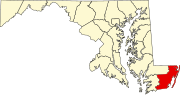
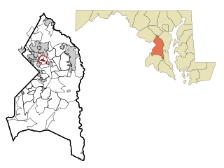
Prince George's County is located in the U.S. state of Maryland bordering the eastern portion of Washington, D.C. As of the 2020 U.S. census, the population was 967,201, making it the second-most populous county in Maryland, behind neighboring Montgomery County. The 2020 census counted an increase of nearly 104,000 in the previous ten years. Its county seat is Upper Marlboro. It is the largest and the second most affluent African American-majority county in the United States, with five of its communities identified in a 2015 top ten list.

Worcester County is the easternmost county of the U.S. state of Maryland. As of the 2020 census, the population was 52,460. Its county seat is Snow Hill.

Hillcrest Heights is an unincorporated area and census-designated place (CDP) in Prince George's County, Maryland, United States. The population was 15,793 at the 2020 census. For mailing address purposes, it is part of the smaller community of Temple Hills and is also near Suitland.
Landover Hills is a town in Prince George's County, Maryland, United States. Per the 2020 census, the population was 1,815. The town has a neighborhood named Defense Heights.

Snow Hill is a town and the county seat of Worcester County, Maryland, United States. The population was 2,103 at the 2010 census. It is part of the Salisbury, Maryland-Delaware Metropolitan Statistical Area.

Thomas Johnson was an 18th-century American lawyer, politician, and patriot. He was a delegate to the First Continental Congress in 1774, where he signed the Continental Association; commander of the Maryland militia in 1776; and elected first (non-Colonial) governor of Maryland in 1777. Throughout his career, Johnson maintained a personal and political friendship with George Washington, who gave him a recess appointment as an associate justice of the Supreme Court in August 1791. He served only briefly, resigning in January 1793, citing health issues.
Peppermill Village is an unincorporated community near Maryland Route 214 in Prince George's County, Maryland, United States. Per the 2020 census, the population was 5,264. FedExField, Metrorail's Blue Line, and Hampton Mall shopping center are all located nearby. Because it is not formally incorporated, it has no official boundaries, but the United States Census Bureau has defined a census-designated place (CDP) consisting of Peppermill Village and the adjacent community of Carmody Hills, for statistical purposes.

Oxon Hill is an unincorporated area and census-designated place (CDP) in southern Prince George's County, Maryland, United States. Oxon Hill is a suburb of Washington, located southeast of the downtown district and east of Alexandria, Virginia. It contains the new 300-acre (120 ha) National Harbor development on the shore of the Potomac River.
Glassmanor is an unincorporated community and census-designated place in Prince George's County, Maryland, United States. As of the 2020 census, it had a population of 18,430. In the 1990 and 2000 censuses, the United States Census Bureau had placed Glassmanor and the adjacent community of Oxon Hill in the "Oxon Hill-Glassmanor" census-designated place for statistical purposes. Glassmanor was last delineated separately in 1980, when the CDP recorded a population of 7,751.

The Pocomoke River stretches approximately 66 miles (106 km) from southern Delaware through southeastern Maryland in the United States. At its mouth, the river is essentially an arm of Chesapeake Bay, whereas the upper river flows through a series of relatively inaccessible wetlands called the Great Cypress Swamp, largely populated by Loblolly Pine, Red Maple and Bald Cypress. The river is the easternmost river that flows into Chesapeake Bay. "Pocomoke", though traditionally interpreted as "dark water" by local residents, is now agreed by scholars of the Algonquian languages to be derived from the words for "broken ground."

Maryland Route 354 is a state highway in the U.S. state of Maryland. The state highway runs 14.98 miles (24.11 km) from MD 12 near Snow Hill north to MD 346 in Willards. MD 354 parallels the Pocomoke River, connecting eastern Wicomico County and northwestern Worcester with Snow Hill. The state highway was first constructed from Willards in the mid-1910s. The remainder of MD 354 was completed in the late 1920s and early 1930s, with little change in the highway since.
Silver Hill is an unincorporated community and census-designated place (CDP) in Prince George's County, Maryland, United States, approximately 1 mile (1.6 km) southeast of Washington, D.C. Per the 2020 census, the population was 6,381. Prior to 2010, Silver Hill was part of the Suitland-Silver Hill census-designated place.
Trinidadian and Tobagonian Americans are people with Trinidadian and Tobagonian ancestry or immigrants who were born in Trinidad and Tobago. Trinidad and Tobago is home to people of many different national, ethnic and religious origins. As a result, people of Trinidadian and Tobagonian descent do not equate their nationality with ethnicity. The largest proportion of Trinidadians lives in the New York metropolitan area, with other large communities located in South Florida, Central Florida, Pennsylvania, Maryland, Texas, Minnesota, Georgia, and Massachusetts. There are more than 223,639 Trinbagonian Americans living in the United States.
The Old Furnace Town Heritage Museum is an outdoor museum near Snow Hill, Maryland that uses a living history format with live demonstrations to re-create a vanished 19th-century community. The museum contains various historic buildings, including most importantly the Nassawango Iron Furnace, an early 19th-century brick blast furnace that was used to smelt bog iron ore to make pig iron. Other buildings, all of which have been moved to the site, include a church, a store, and several houses, one of which is used as an information center.
Pocomoke State Forest is a state forest of Maryland that lies on both banks of the Pocomoke River in Worcester County. The portion north of the Pocomoke lies between Dividing and Nassawango Creeks. The Pocomoke River Wildlife Management Area borders the southern portion of the forest.

The Nassawango Iron Furnace was built in 1830 by the Maryland Iron Company to produce iron from bog ore deposits in its vicinity. It is notable for its innovative use of a "hot blast" technique for smelting the iron, which had been developed in England around 1828, and which may have been added to the Nassawango Furnace in 1837. Due to the variable nature of the bog ore deposits, the furnace stopped operations in 1849.
Ilia Fehrer was an environmentalist and member of the Maryland Women's Hall of Fame most widely known for fighting to preserve Assateague Island, Chincoteague Bay, and other Chesapeake Bay coastal regions from destructive urban development.