Snow Hill, Maryland

Last updated

Snow Hill, Maryland
Snow Hill business center (2008).jpg
Flag of Snow Hill, Maryland.png
Logo of Snow Hill, Maryland.png
Worcester County Maryland Incorporated and Unincorporated areas Snow Hill Highlighted.svg
Location in Worcester County and Maryland
USA Maryland location map.svg
Red pog.svg
Snow Hill
Location in Maryland
Usa edcp location map.svg
Red pog.svg
Snow Hill
Snow Hill (the United States)
Coordinates: 38°10′30″N75°23′27″W / 38.17500°N 75.39083°W / 38.17500; -75.39083
Country Flag of the United States.svg United States
State Flag of Maryland.svg  Maryland
County Flag of Worcester County, Maryland.svg Worcester
Incorporated 1812 [1]
Government
   Mayor Mike Pruitt
   Town Council
Member List
Area
[2]
  Total1.56 sq mi (4.04 km2)
  Land1.48 sq mi (3.83 km2)
  Water0.08 sq mi (0.21 km2)
Elevation
16 ft (5 m)
Population
 (2020)
  Total2,156
  Density1,456.76/sq mi (562.41/km2)
Time zone UTC-5 (Eastern (EST))
  Summer (DST) UTC-4 (EDT)
ZIP code
21863
Area code(s) 410, 443
FIPS code 24-73075
GNIS feature ID0587416
Website www.snowhillmd.gov

Snow Hill is a town and the county seat of Worcester County, Maryland, United States. [3] The population was 2,103 at the 2010 census. It is part of the Salisbury, Maryland-Delaware Metropolitan Statistical Area.

Contents

History

Snow Hill was founded in 1686 in Somerset County by English settlers, who may have named it after a street and neighborhood of the City of London called "Snow Hill" despite the location's elevation of just 16 feet (4.9 m) above sea level and the infrequency of snowfall. The town received its first charter on October 26, 1686, and was made a port of entry in 1694.[ citation needed ]

In 1742, Worcester County was carved out of the eastern half of old Somerset County and Snow Hill, centrally located in the new county and at the head of navigation on the Pocomoke River, was made the county seat.[ citation needed ]

Major fires in 1844 and 1893 destroyed the center of Snow Hill, including two successive court houses, but some 18th-century structures survived both fires. Following the second fire, much of the commercial area was rapidly rebuilt, so the downtown today contains many historic buildings of the late 19th and early 20th centuries. The Snow Hill Historic District, which includes approximately 80% of the town, was created in 2002.[ citation needed ]

In December 2010, a Snow Hill businessman started a petition to remove the town's incorporation and revert the area to county control. The reasons given were lower county taxes, better services provided to the town, and a need for revitalization. The push was abandoned in January 2011. [4]

The All Hallows Episcopal Church, Chanceford, Old Friendship United Methodist Church, Samuel Gunn House, Makemie Memorial Presbyterian Church, James Martin House, Nassawango Iron Furnace Site, Nun's Green, George Washington Purnell House, and Gov. John Walter Smith House are listed on the National Register of Historic Places. [5]

Geography

Snow Hill is located at 38°10′30″N75°23′27″W / 38.17500°N 75.39083°W / 38.17500; -75.39083 (38.175024, -75.390738). [6]

According to the United States Census Bureau, the town has a total area of 3.12 square miles (8.08 km2), of which 3.01 square miles (7.80 km2) is land and 0.11 square miles (0.28 km2) is water. [7]

Demographics

Historical population
CensusPop.Note
1850 714
1860 96635.3%
1870 960−0.6%
1880 1,27632.9%
1890 1,48316.2%
1900 1,5967.6%
1910 1,84415.5%
1920 1,684−8.7%
1930 1,604−4.8%
1940 1,92620.1%
1950 2,0918.6%
1960 2,31110.5%
1970 2,201−4.8%
1980 2,192−0.4%
1990 2,2171.1%
2000 2,4098.7%
2010 2,103−12.7%
2020 2,1562.5%
U.S. Decennial Census [8]

2010 census

As of the census [9] of 2010, there were 2,103 people, 871 households, and 557 families residing in the town. The population density was 698.7 inhabitants per square mile (269.8/km2). There were 1,005 housing units at an average density of 333.9 per square mile (128.9/km2). The racial makeup of the town was 57.0% White, 39.0% African American, 0.2% Native American, 1.3% Asian, 0.3% from other races, and 2.2% from two or more races. Hispanic or Latino of any race were 1.6% of the population.

There were 871 households, of which 31.3% had children under the age of 18 living with them, 36.7% were married couples living together, 21.9% had a female householder with no husband present, 5.3% had a male householder with no wife present, and 36.1% were non-families. 32.0% of all households were made up of individuals, and 16% had someone living alone who was 65 years of age or older. The average household size was 2.32 and the average family size was 2.90.

The median age in the town was 44.7 years. 23.2% of residents were under the age of 18; 7.9% were between the ages of 18 and 24; 19.3% were from 25 to 44; 29.4% were from 45 to 64; and 20.2% were 65 years of age or older. The gender makeup of the town was 45.9% male and 54.1% female.

2000 census

As of the census [10] of 2000, there were 2,409 people, 862 households, and 555 families residing in the town. The population density was 1,806.2 inhabitants per square mile (697.4/km2). There were 964 housing units at an average density of 722.8 per square mile (279.1/km2). The racial makeup of the town was 56.00% White, 42.34% African American, 0.08% Native American, 0.58% Asian, 0.04% Pacific Islander, 0.37% from other races, and 0.58% from two or more races. Hispanic or Latino of any race were 1.08% of the population.

There were 862 households, out of which 28.3% had children under the age of 18 living with them, 40.6% were married couples living together, 20.2% had a female householder with no husband present, and 35.5% were non-families. 31.4% of all households were made up of individuals, and 15.7% had someone living alone who was 65 years of age or older. The average household size was 2.37 and the average family size was 2.94.

In the town, the population was spread out, with 21.0% under the age of 18, 9.3% from 18 to 24, 29.6% from 25 to 44, 20.5% from 45 to 64, and 19.5% who were 65 years of age or older. The median age was 39 years. For every 100 females, there were 99.4 males. For every 100 females age 18 and over, there were 95.5 males.

The median income for a household in the town was $29,730, and the median income for a family was $38,657. Males had a median income of $25,439 versus $20,625 for females. The per capita income for the town was $15,560. About 14.8% of families and 15.9% of the population were below the poverty line, including 19.5% of those under age 18 and 13.1% of those age 65 or over.

Education

Worcester County Courthouse in Snow Hill. Worcester County Courthouse.jpg
Worcester County Courthouse in Snow Hill.

Snow Hill is the location of:

Religion

A number of Protestant religious denominations have churches in Snow Hill; several are listed on the National Register of Historic Places:

Notable people

In 1999, some scenes of the film Runaway Bride (starring Julia Roberts and Richard Gere) were shot at the Snow Hill High School. The scenes at the baseball and football games were filmed behind the school.

At the end of each episode of Adult Swim's Children Hospital is an old advertisement for The Corddry Co Snow Hill, MD. The lead actor, writer, and producer is comedian Rob Corddry, whose father is from Snow Hill. He uses the advertisement as his production banner.

See also

Related Research Articles

<span class="mw-page-title-main">Worcester County, Maryland</span> County in Maryland, United States

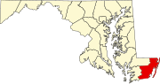
Worcester County is the easternmost county of the U.S. state of Maryland. As of the 2020 census, the population was 52,460. Its county seat is Snow Hill.

<span class="mw-page-title-main">Lamar County, Alabama</span> County in Alabama, United States

Lamar County is a county in the U.S. state of Alabama. As of the 2020 census, the population was 13,972. Its county seat is Vernon and it is a dry county. It is named in honor of Lucius Quintus Cincinnatus Lamar, a former Confederate officer and former member of both houses of the United States Congress from Mississippi.

<span class="mw-page-title-main">Fairview Shores, Florida</span> Census-designated place in Florida, United States

Fairview Shores is a census-designated place and an unincorporated area in Orange County, Florida, United States. The population was 10,239 at the 2010 census. It is part of the Orlando–Kissimmee–Sanford, Florida Metropolitan Statistical Area.

<span class="mw-page-title-main">Moores Hill, Indiana</span> Town in Indiana, United States

Moores Hill is a town in Sparta Township, Dearborn County, Indiana, United States. The population was 597 at the 2010 census.

<span class="mw-page-title-main">Buckfield, Maine</span> Town in Maine, United States

Buckfield is a town in Oxford County, Maine, United States. Buckfield is included in the Lewiston-Auburn, Maine metropolitan New England City and Town Area. It is a member of Regional School Unit 10 along with nearby Hartford and Sumner. The town had a population of 1,983 as of the 2020 census.

<span class="mw-page-title-main">Church Creek, Maryland</span> Town in Maryland, United States

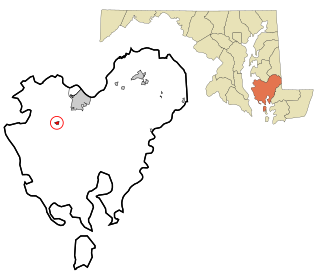
Church Creek is a town in Dorchester County, Maryland, United States, part of the state's Eastern Shore. The population was 125 at the 2010 census. Church Creek is located approximately six miles south of Cambridge.

<span class="mw-page-title-main">Chevy Chase Section Three, Maryland</span> Village in Maryland, United States

Chevy Chase Section Three is a village in Montgomery County, Maryland, United States. It was organized as a special tax district in 1916 and incorporated as a village in 1982. The population was 802 at the 2020 census.

<span class="mw-page-title-main">Church Hill, Maryland</span> Town in Maryland, United States

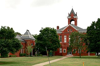
Church Hill is a town in Queen Anne's County, Maryland, United States. The population was 745 at the 2010 census.

<span class="mw-page-title-main">Princess Anne, Maryland</span> Town in Maryland, United States

Princess Anne is a town in Somerset County, Maryland, United States, that also serves as its county seat. Its population was 3,290 at the 2010 census. It is included in the Salisbury, Maryland–Delaware Metropolitan Statistical Area. It is home to the University of Maryland Eastern Shore and the Teackle Mansion.

<span class="mw-page-title-main">Hebron, Maryland</span> Town in Maryland, United States

Hebron is a town in Wicomico County, Maryland, United States. The population was 1,084 at the 2010 census. It is included in the Salisbury, Maryland-Delaware Metropolitan Statistical Area. It is the hometown of pro-wrestler Mark Hildreth and politician Scott Taylor.

<span class="mw-page-title-main">Stockton, Maryland</span> CDP in Maryland, United States

Stockton is a census-designated place (CDP) in Worcester County, Maryland, United States. The population was 92 at the 2010 census. It is part of the Salisbury, Maryland-Delaware Metropolitan Statistical Area.

Verdi Township is a township in Lincoln County, Minnesota, United States. The population was 240 at the 2000 census.

<span class="mw-page-title-main">Pleasant Hill, Missouri</span> City in Missouri, United States

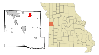
Pleasant Hill is a city in Cass and Jackson counties, Missouri, United States. The population was 8,113 at the 2010 census. It is part of the Kansas City metropolitan area.

<span class="mw-page-title-main">Maryland, New York</span> Town in New York, United States

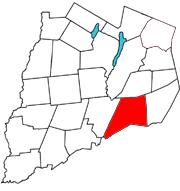
Maryland is a town in Otsego County, New York, United States. The population was 1,897 at the 2010 census. It was named for the U.S. state of the same name. The Town of Maryland is on the county's southern border. It is northeast of the City of Oneonta.

<span class="mw-page-title-main">Thompson, New York</span> Town in New York, United States

Thompson is a town in the southern part of Sullivan County, New York, United States. The population was 16,550 at the 2020 census. The town is named after William Thompson, an early settler.

<span class="mw-page-title-main">Plumcreek Township, Pennsylvania</span> Township in Pennsylvania, United States

Plumcreek Township is a township that is located in Armstrong County, Pennsylvania, United States. The population was 2,106 at the time of the 2020 census, a decrease from the figure of 2,375 that was tabulated in 2010.

<span class="mw-page-title-main">Stoneboro, Pennsylvania</span> Borough in Pennsylvania, United States

Stoneboro is a borough in eastern Mercer County, Pennsylvania, United States. The population was 946 at the 2020 census. It is part of the Hermitage micropolitan area.

<span class="mw-page-title-main">Coldspring, Texas</span> City in Texas, United States

Coldspring is a city in San Jacinto County, Texas, United States. It is the county seat of San Jacinto County, which is named after the river that traverses it and shares its name with the battle that gave Texas its independence. The population was 819 at the 2020 census.

<span class="mw-page-title-main">Accomac, Virginia</span> Town in Virginia, United States

Accomac is a town in and the county seat of Accomack County, Virginia, United States. The population was 526 at the 2020 census.

<span class="mw-page-title-main">Painter, Virginia</span> Town in Virginia, United States

Painter is a town in Accomack County, Virginia, United States. The population was recorded at 229 at the 2010 census.

References

  1. "Snow Hill". Maryland Manual. Archived from the original on July 9, 2017. Retrieved June 28, 2017.
  2. "2020 U.S. Gazetteer Files". United States Census Bureau. Retrieved April 26, 2022.
  3. "Find a County". National Association of Counties. Archived from the original on May 9, 2015. Retrieved June 7, 2011.
  4. "Effort to Disincorporate Snow Hill on Hold". Archived from the original on March 6, 2012. Retrieved January 31, 2011. The same "businessman" later was elected, and then abandoned his office, as the mayor.
  5. "National Register Information System". National Register of Historic Places . National Park Service. July 9, 2010.
  6. "US Gazetteer files: 2010, 2000, and 1990". United States Census Bureau. February 12, 2011. Archived from the original on July 13, 2020. Retrieved April 23, 2011.
  7. "US Gazetteer files 2010". United States Census Bureau. Archived from the original on January 25, 2012. Retrieved January 25, 2013.
  8. "Census of Population and Housing". Census.gov. Archived from the original on March 21, 2021. Retrieved June 4, 2015.
  9. "U.S. Census website". United States Census Bureau. Archived from the original on December 27, 1996. Retrieved January 25, 2013.
  10. "U.S. Census website". United States Census Bureau. Archived from the original on December 27, 1996. Retrieved January 31, 2008.
  11. Lynch, Heather (February 11, 1998). "Johnson recalled in a landside". The Daily Times. p. 1. Retrieved July 15, 2023 via Newspapers.com.
  12. "Birckhead Appointed Adjutant General By Governor; Snow Hill Alumna Becomes Nation's First Black Woman To Lead State Military In Country". News Ocean City Maryland Coast Dispatch Newspaper. April 11, 2023. Retrieved July 2, 2023.