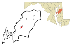
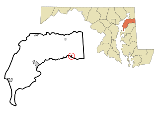
Centreville is an incorporated town in Queen Anne's County, Maryland, United States on the Delmarva Peninsula. Incorporated in 1794,[3] it is the county seat of Queen Anne's County.[4] The population was 4,285 at the 2010 census. The ZIP code is 21617 and the area codes are 410 and 443. The primary local telephone exchange is 758. It hosts the Queen Anne's County Fair each summer and was home to three franchises during the existence of the Eastern Shore Baseball League—the Colts, Red Sox, and Orioles.
The climate in this area is characterized by hot, humid summers and generally mild to cool winters. According to the Köppen climate classification system, Centreville has a humid subtropical climate, abbreviated "Cfa" on climate maps.[7]
As of the census[9] of 2010, there were 4,285 people, 1,568 households, and 1,102 families residing in the town. The population density was 1,749.0 inhabitants per square mile (675.3/km2). There were 1,694 housing units at an average density of 691.4 per square mile (267.0/km2). The racial makeup of the town was 85.0% White, 10.6% African American, 0.3% Native American, 1.4% Asian, 0.5% from other races, and 2.3% from two or more races. Hispanic or Latino of any race were 2.7% of the population.
There were 1,568 households, of which 38.0% had children under the age of 18 living with them, 55.6% were married couples living together, 11.4% had a female householder with no husband present, 3.3% had a male householder with no wife present, and 29.7% were non-families. 25.1% of all households were made up of individuals, and 10.8% had someone living alone who was 65 years of age or older. The average household size was 2.60 and the average family size was 3.12.
The median age in the town was 39.5 years. 27.5% of residents were under the age of 18; 5.2% were between the ages of 18 and 24; 26% were from 25 to 44; 23.4% were from 45 to 64; and 17.9% were 65 years of age or older. The gender makeup of the town was 47.6% male and 52.4% female.
2000 census
As of the census[10] of 2000, there were 1,970 people, 807 households, and 497 families residing in the town. The population density was 937.9 inhabitants per square mile (362.1/km2). There were 866 housing units at an average density of 412.3 per square mile (159.2/km2). The racial makeup of the town was 78.68% White, 19.24% African American, 0.10% Native American, 0.56% Asian, 0.15% from other races, and 1.27% from two or more races. Hispanic or Latino of any race were 0.81% of the population.
There were 807 households, out of which 27.5% had children under the age of 18 living with them, 42.4% were married couples living together, 16.1% had a female householder with no husband present, and 38.4% were non-families. 32.8% of all households were made up of individuals, and 15.0% had someone living alone who was 65 years of age or older. The average household size was 2.25 and the average family size was 2.84.
In the town, the age distribution of the population shows 21.7% under the age of 18, 5.9% from 18 to 24, 28.6% from 25 to 44, 21.8% from 45 to 64, and 22.0% who were 65 years of age or older. The median age was 41 years. For every 100 females, there were 88.2 males. For every 100 females age 18 and over, there were 79.7 males.
The median income for a household in the town was $41,100, and the median income for a family was $55,595. Males had a median income of $37,011 versus $25,625 for females. The per capita income for the town was $20,630. About 8.1% of families and 15.4% of the population were below the poverty line, including 17.3% of those under age 18 and 17.4% of those age 65 or over.
History
Centreville's name was derived from the relocation of the county seat in 1782 from Queenstown to a more central part of the county.
Saint Paul's Parish was established on the site that would later become known as Centreville, Maryland.[11] It was almost 100 years later, in 1782, that the Maryland State Assembly passed an Act to relocate both the courthouse and all government functions of the county to Centreville from Queenstown, making Centreville the new county seat.[12]
However, it took a decade for the appropriate land to be acquired and for the change to take place. A plantation called Chesterfield was chosen as the land to use for the new town which would hold the county's courthouse. Once the town and court house were completed, on the first of June 1796, the county court, "ordered [the courthouse] to be ‘taken, held and deemed to be the proper Court House of Queen Anne's County’".[12]
In 1782, the Queen Anne's county courthouse was moved from its original location in Queenstown, Maryland to an area that would, twelve years later, be named Centreville. The building's location, at the head of the Corsica River, encouraged population growth in the area.[13]
Centreville became an incorporated town in 1794, two years after the courthouse was completed. At the same time, the town laid out, including four streets that remain today: MD 213, S. Liberty St., N. Commerce St., Water St. (MD 304).[13]
Once Centreville was officially home to Queen Anne's county government, lawmakers and officials decided it was appropriate to name the new town in accordance with the new location. Centreville (named partly due to the town's central location) was also chosen because of its prime location on the Corsica River. Easy access to shipping, trading, and naval waters allowed the town to flourish and to become an important Maryland location.[14]
Today, Centreville is the largest town in Queen Anne's county, with a population of 2,097.[13] 2017 has become an all time high for the small town, with a population of 4,767. The Maryland Municipal League's Website, "The Association of Cities and Towns", notes that Centreville's, "[h]istory is reflected in the diverse architecture seen along the streets of the town—elegant Victorian homes with their wrap-around porches, neo-classical public buildings, late-19th-century commercial rows, late-20th-century institutional and government structures, and all the variations and curiosities in between".[14]
The main means of travel to and from Centreville is by road, and four state highways serve the town. The most prominent of these is Maryland Route 213, which serves as the primary road serving local communities along the eastern shore of the Chesapeake Bay. Other state highways serving Centreville include Maryland Route 18, Maryland Route 304 and Maryland Route 305. U.S. Route 301 passes to the southeast, providing a high-speed highway to metropolitan areas such as Philadelphia and Washington D.C..
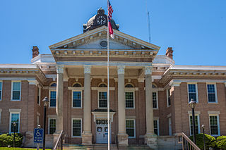
Courthouse
The oldest courthouse in continuous use, and one of two 18th century courthouses in Maryland, the Queen Anne's County Courthouse is located at 120 North Commerce Street. The location for the courthouse, and for the town of Centreville, was a piece of land on which Judge Joseph Hopper Nicholson lived on at the time.[19] In 1792 the Flemish-bond brick building was completed.[13] At the time it was composed of four rooms, two in the center and one on each side. The courthouse's use was increasing, so, in 1876 it was renovated and remodeled to add more space.[20] An iron balcony was also added to the second story.[13]
A unique feature of the courthouse is a gold eagle on the main building's rooftop. The eagle is thought to be symbolic of America's freedom from England and relays the idea of independence.[19] In Judge John W. Sause, Jr.'s essay, "Why the Eagle", he connects the idea of freedom and the importance of the United States’ seal to the courthouse's eagle. Here, he writes, "Executed by an unknown hand, undoubtedly that of an artisan rather than an artist...our eagle looked down upon the comings and going of the courtyard, the tears and smiles of its citizens and the successes and failures of the political system which it was designed to represent".[21]
A statue of Queen Anne of England, the county's namesake, sits in front of the courthouse. Princess Anne, daughter of Queen Elizabeth II, attended the dedication (1977).[20]
Today, the courthouse remains an important figure in Centreville, Queen Anne's County, and the state of Maryland. Keeping true to its original form, the building's exterior is true to its original look.[19]
Related Research Articles
Oakland is a town in and the county seat of Garrett County, Maryland, United States. The population was 1,851 at the 2020 census. It is situated only miles from the source of the Potomac River, which flows directly into Chesapeake Bay. It is also near the Wisp Resort at Deep Creek Lake. Oakland is part of the Pittsburgh media market.
Caroline County is a rural county located in the U.S. state of Maryland on its Eastern Shore. As of the 2020 census, the population was 33,293. Its county seat is Denton.
Queen Anne's County is located on the Eastern Shore of the U.S. state of Maryland. As of the 2020 census, the population was 49,874. Its county seat and most populous municipality is Centreville. The census-designated place of Stevensville is the county's most populous place with population of 7,442 as of 2020. The county is named for Queen Anne of Great Britain, who reigned when the county was established in 1706 during the colonial period.
Talbot County is located in the heart of the Eastern Shore of Maryland in the U.S. state of Maryland. As of the 2020 census, the population was 37,526. Its county seat is Easton. The county was named for Lady Grace Talbot, the wife of Sir Robert Talbot, an Anglo-Irish statesman, and the sister of Lord Baltimore.
Carroll is a city in, and the county seat of, Carroll County, Iowa, United States, along the Middle Raccoon River. The population was 10,321 in the 2020 census.
Cottonwood Falls is the largest city and county seat of Chase County, Kansas, United States. As of the 2020 census, the population of the city was 851. It is located south of Strong City along the south side of the Cottonwood River.
Prince Frederick is an unincorporated community and census-designated place (CDP) in Calvert County, Maryland, United States. As of the 2020 census, the population of Prince Frederick was 3,226, up from 2,538 in 2010. It is the county seat of Calvert County.
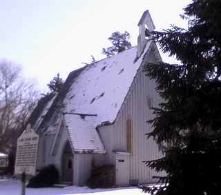
Hillsboro is a town in Caroline County, Maryland, United States. The population was 161 at the 2010 United States Census. Daffin House and St. Paul's Episcopal Church were listed on the National Register of Historic Places in 1975.
Preston is a town in Caroline County, Maryland, United States. The population was 719 at the 2010 census.
Eagle Harbor is an incorporated town in the far southeast corner of Prince George's County, Maryland, United States, and near the rural community of Aquasco that is known as a historic African American community founded in 1925. Per the 2020 census, the population was 67. The Chalk Point Generating Station, owned by NRG Energy, which was sold to Mirant by the Potomac Electric Power Company (PEPCO) in 2000, is located adjacent to the town.
Queenstown is a town in Queen Anne's County, Maryland, United States. The population was 664 at the 2010 census.
Stevensville is a census-designated place (CDP) in Queen Anne's County, Maryland, United States, and is the county's most populous place among both CDPs and municipalities. The community is the eastern terminus of the Chesapeake Bay Bridge. The Stevensville Historic District is one of two registered historic districts in the county, the other being the Centreville Historic District.
Leonardtown is a town in and the county seat of St. Mary's County, Maryland, United States. The population was 4,563 at the 2020 census.
Centreville is a village in the U.S. state of Michigan and the county seat of St. Joseph County. The population was 1,425 at the 2010 census.
Halifax is a town in Halifax County, North Carolina, United States. The population was 234 at the 2010 census. It is the county seat of Halifax County. It is known as "The Birthplace of Freedom" for being the location for the April 12, 1776, adoption of the Halifax Resolves, which was the first official action by a colony calling for independence. Halifax is also home to the Halifax Historic District, a historic site operated by the North Carolina Department of Cultural Resources. Halifax is part of the Roanoke Rapids, North Carolina Micropolitan Statistical Area.
Franklin is a town in and the county seat of Pendleton County, West Virginia, United States. The population was 486 at the 2020 census. Franklin was established in 1794 and named for Francis Evick, an early settler.
Parsons is the largest city in and county seat of Tucker County, West Virginia, United States. The population was 1,322 at the 2020 census. Parsons is located at the confluence of the Shavers Fork and the Black Fork, forming the head of the Cheat River.
Templeville is a town in Caroline and Queen Anne's counties, Maryland, United States. Templeville is located near the Maryland-Delaware line. The population was 138 at the 2010 census. It was known as Bullock Town until the name was changed in 1847. The name Templeville derives from the Temple family, whose most famous member was Governor William Temple of Delaware.
Millington is a town in Kent and Queen Anne's counties in the U.S. state of Maryland. The population was 642 at the 2010 census. Millington is the head of navigation for the Chester River.
Queen Anne is a town in Queen Anne's and Talbot counties in the U.S. state of Maryland. The population was 222 at the 2010 census.
1 2 3 4 5 Arnett, Earl, Brugger, Robert J., and Edward C. Papenfuse. Maryland: A New Guide to the Old Line State (2nd ed.) The Johns Hopkins University Press, Baltimore 1999 p. 153-154
This page is based on this Wikipedia article Text is available under the CC BY-SA 4.0 license; additional terms may apply. Images, videos and audio are available under their respective licenses.