Leonardtown, Maryland

Last updated

Leonardtown, Maryland
Leonardtown, Maryland - 8146395020.jpg
Central Leonardtown
Flag of Leonardtown, Maryland.png
Leonardtown, Maryland (town seal).gif
St. Mary's County Maryland Incorporated and Unincorporated areas Leonardtown Highlighted.svg
Coordinates: 38°17′43″N76°38′17″W / 38.29528°N 76.63806°W / 38.29528; -76.63806
Country Flag of the United States.svg United States
State Flag of Maryland.svg  Maryland
County St. Mary's
Founded 1660 as Seymour Town
Incorporation1858
Named for Benedict Leonard Calvert
Government
  Type Incorporated town
Area
[1]
  Total3.88 sq mi (10.04 km2)
  Land3.81 sq mi (9.87 km2)
  Water0.07 sq mi (0.18 km2)
Elevation
85 ft (26 m)
Population
 (2020)
  Total4,563
  Density1,197.64/sq mi (462.38/km2)
Time zone UTC-5 (Eastern (EST))
  Summer (DST) UTC-4 (EDT)
ZIP code
20650
Area code(s) 301, 240
FIPS code 24-46475
GNIS feature ID0594790
Website http://leonardtown.somd.com

Leonardtown is a town in and the county seat of St. Mary's County, Maryland, United States. [2] The population was 4,563 at the 2020 census.

Contents

Historic Leonardtown includes both a large public high school and a public middle school Leonardtown Middle School as well as a Catholic high school and an elementary school Leonardtown Elementary School, offices of the county government, and St. Mary's Hospital which serves the healthcare needs of the county. The College of Southern Maryland maintains a growing satellite campus within city limits, including an aquatic center. An upscale home development located in the Breton Bay area is just outside town, notable for both its country club golf course and swimming pool.

Leonardtown's population has grown significantly since 1990 as a result of the town's proximity to Patuxent River Naval Air Station and the Washington metro area.

Geography

Leonardtown is located at 38°17′43″N76°38′17″W / 38.29528°N 76.63806°W / 38.29528; -76.63806 (38.295332, -76.637939). [3]

According to the United States Census Bureau, the town has a total area of 3.25 square miles (8.42 km2), of which 3.18 square miles (8.24 km2) is land and 0.07 square miles (0.18 km2) is water. [4]

MD 5 southbound at MD 243 in Leonardtown 2019-05-22 16 47 37 View south along Maryland State Route 5 (Point Lookout Road) just south of Maryland State Route 243 (Newtowne Neck Road) in Leonardtown, Saint Mary's County, Maryland.jpg
MD 5 southbound at MD 243 in Leonardtown

Transportation

The primary method of travel to and from Leonardtown is by road, and three state highways serve the town directly. The most prominent of these is Maryland Route 5, which follows Point Lookout Road through Leonardtown. Heading north, MD 5 provides connections to U.S. Route 301 in Waldorf and Interstate 95/Interstate 495 (the Capital Beltway) near Washington, D.C. Heading south, MD 5 eventually reaches Point Lookout. The other two state highways serving the town directly are Maryland Route 245, which connects Leonardtown to Maryland Route 235 in Hollywood, and Maryland Route 243, which passes Compton before ending at Newtowne Neck State Park. Although not directly serving Leonardtown, MD 5 also has junctions with Maryland Route 4 and Maryland Route 234 just outside the town limits.

History

Early history

Records indicate that by 1654, county court was conducted at the house of John Hammond in the area known as "Newtown" or "Newtowne Hundred". During the late 17th century, it appears that court was held at various homes throughout Newtown, and that it was only in 1708 that an official town with a designated courthouse was established. It was during this same year that Phillip Lynes, then Mayor of St. Mary's City, Maryland's colonial capital, designated fifty acres of land at the head of "Brittons Bay" to be divided into 100 lots. He further ordered that one lot be set aside for a county courthouse to be built at an expense not to exceed 12,000 pounds of tobacco. At this time, Newtown was promptly renamed Seymour Town in honor of Governor John Seymour. Nearly 20 years later, Seymour Town was renamed again to Leonard Town in honor of Benedict Leonard Calvert, who was Maryland's governor during this period. In the decades that followed, Leonard Town became the place where local residents conducted their official business with the colony. Farm products were regularly shipped through the port.

Maryland Historic Society's Leonardtown marker LeonardtownSign.jpg
Maryland Historic Society's Leonardtown marker

The 19th century

During the War of 1812, the British blockaded the Chesapeake Bay. 1,000 British Marines invaded the town. This crippled the Tidewater economy and subjected areas to repeated British plundering and destruction. By 1860, the town had approximately 35 dwellings within these corporate limits. It was home to the county's newspaper, two hotels and several stores. During the American Civil War, a Union Naval contingent occupied Leonardtown, searching all houses for weapons and supplies intended for shipment across the Potomac River to Virginia as Southern Maryland and the town's sympathies lay with the Confederacy. Leonardtown served as a busy port and steamboat landing. Until the passing of the steamboat era, steamboats carried goods and passengers all over the Chesapeake Bay area well into the 20th century, and a floating theater docked each year at the port, providing entertainment.

The 20th century to the present

Historic Leonardtown remains the only incorporated municipality in St. Mary's County with its own elected mayor and town council. The town is experiencing a renaissance of its downtown as witnessed by recent openings of several new restaurants and businesses, some of which are located in historic buildings. [5] An old order Mennonite farming community is located a few miles to the northwest, where community members sell furniture, crafts, produce, and other homemade/home grown products. A large, modern public library and seniors center opened in 2021. The Leonardtown Wharf waterfront park opened as a public attraction for both locals and tourists in May 2008. Facilities for boating, kayaking and canoeing are also planned. [6] The Naval Air Base located at Patuxent River has boosted the economy in Leonardtown significantly. Many families have relocated to Leonardtown as a result of the base.

Entrance to the Leonardtown Wharf LeonardtownWarf.jpg
Entrance to the Leonardtown Wharf

St. Andrew's Church and Tudor Hall were listed on the National Register of Historic Places in 1973. [7]

The United States National Oyster Festival, which hosts an annual oyster shucking competition, has been held annually in Leonardtown since 1967. [8] [9]

Demographics

Historical population
CensusPop.Note
1860 568
1870 485−14.6%
1880 465−4.1%
1890 52112.0%
1900 463−11.1%
1910 52613.6%
1920 5575.9%
1930 69725.1%
1940 668−4.2%
1950 1,01752.2%
1960 1,28126.0%
1970 1,4069.8%
1980 1,4483.0%
1990 1,4751.9%
2000 1,89628.5%
2010 2,93054.5%
2020 4,56355.7%
U.S. Decennial Census [10]

2010 census

As of the census [11] of 2010, there were 2,930 people, 1,067 households, and 614 families living in the town. The population density was 921.4 inhabitants per square mile (355.8/km2). There were 1,156 housing units at an average density of 363.5 per square mile (140.3/km2). The racial makeup of the town was 77.0% White, 14.9% African American, 0.9% Native American, 2.7% Asian, 1.2% from other races, and 3.4% from two or more races. Hispanic or Latino people of any race were 3.6% of the population.

There were 1,067 households, of which 32.1% had children under the age of 18 living with them, 42.6% were married couples living together, 12.1% had a female householder with no husband present, 2.8% had a male householder with no wife present, and 42.5% were non-families. 37.3% of all households were made up of individuals, and 22% had someone living alone who was 65 years of age or older. The average household size was 2.35 and the average family size was 3.15.

The median age in the town was 40.8 years. 23.2% of residents were under the age of 18; 8% were between the ages of 18 and 24; 25.1% were from 25 to 44; 24.2% were from 45 to 64; and 19.5% were 65 years of age or older. The gender makeup of the town was 48.7% male and 51.3% female.

2000 census

As of the census [12] of 2000, there were 1,896 people, 598 households, and 367 families living in the town. The population density was 611.0 inhabitants per square mile (235.9/km2). There were 646 housing units at an average density of 208.2 per square mile (80.4/km2). The racial makeup of the town was 70.78% White, 26.00% African American, 0.11% Native American, 1.48% Asian, 0.37% from other races, and 1.27% from two or more races. Hispanic or Latino people of any race were 0.84% of the population.

There were 598 households, out of which 26.3% had children under the age of 18 living with them, 40.8% were married couples living together, 16.7% had a female householder with no husband present, and 38.5% were non-families. 33.4% of all households were made up of individuals, and 16.6% had someone living alone who was 65 years of age or older. The average household size was 2.22 and the average family size was 2.80.

In the town, the population was spread out, with 15.9% under the age of 18, 7.0% from 18 to 24, 28.3% from 25 to 44, 18.3% from 45 to 64, and 30.5% who were 65 years of age or older. The median age was 44 years. For every 100 females, there were 83.0 males. For every 100 females age 18 and over, there were 78.9 males.

The median income for a household in the town was $35,563, and the median income for a family was $42,083. Males had a median income of $35,417 versus $25,125 for females. The per capita income for the town was $16,614. About 12.9% of families and 21.8% of the population were below the poverty line, including 23.9% of those under age 18 and 19.9% of those age 65 or over.

See also

Related Research Articles

<span class="mw-page-title-main">Calvert County, Maryland</span> County in Maryland, United States

Calvert County is a county located in the U.S. state of Maryland. As of the 2020 census, the population was 92,783. Its county seat is Prince Frederick. The county's name is derived from the family name of the Barons of Baltimore, the proprietors of the English Colony of Maryland. Calvert County is included in the Washington–Arlington–Alexandria, DC–VA–MD–WV Metropolitan Statistical Area. It occupies the Calvert Peninsula, which is bordered on the east by Chesapeake Bay and on the west by the Patuxent River. Calvert County is part of the Southern Maryland region. The county has one of the highest median household incomes in the United States. It is one of the older counties in Maryland, after St. Mary's, Kent County and Anne Arundel counties.

<span class="mw-page-title-main">St. Mary's County, Maryland</span> County in Maryland, United States

St. Mary's County, established in 1637, is a county located in the U.S. state of Maryland. As of the 2020 census, the population was 113,777. Its county seat is Leonardtown. The name is in honor of Mary, the mother of Jesus. St. Mary's County comprises the California-Lexington Park, Maryland Metropolitan Statistical Area, which also is included in the Washington-Baltimore-Arlington, DC-MD-VA-WV-PA Combined Statistical Area. It is part of the Southern Maryland region. The county was the home to the first Maryland Colony, and the first capital of the Colony of Maryland. Settled by English Catholics, it is considered to be the birthplace of religious freedom in North America, at a time when the British colonies were settled primarily by Protestants. The county is home to the Patuxent River Naval Air Station and St. Mary's College of Maryland. Traditionally, St. Mary's County has been known for its unique and historic culture of Chesapeake Bay tidewater farming, fishing, and crabbing communities. But with the advent of the military bases, growth of an extensive defense contractor presence, and the growth of St. Mary's College of Maryland, as well as increasing numbers of long-distance Washington, D.C. commuters, it has been undergoing a decades-long transformation which has seen the county's population double since 1970.

<span class="mw-page-title-main">Lusby, Maryland</span> Census-designated place in Maryland, United States

Lusby is an unincorporated community and census-designated place (CDP) in Calvert County, Maryland, United States. The population of the CDP was 1,835 at the 2010 census. Residents of the Chesapeake Ranch Estates and Drum Point communities also use the Lusby ZIP code designation.

<span class="mw-page-title-main">Owings, Maryland</span> Census-designated place in Maryland, United States

Owings is a town center and census-designated place (CDP) in northern Calvert County, Maryland, United States. The population was 2,149 at the 2010 census, up from 1,325 in 2000.

<span class="mw-page-title-main">Prince Frederick, Maryland</span> Census-designated place in Maryland, United States

Prince Frederick is an unincorporated community and census-designated place (CDP) in Calvert County, Maryland, United States. As of the 2020 census, the population of Prince Frederick was 3,226, up from 2,538 in 2010. It is the county seat of Calvert County.

<span class="mw-page-title-main">St. Leonard, Maryland</span> Census-designated place in Maryland

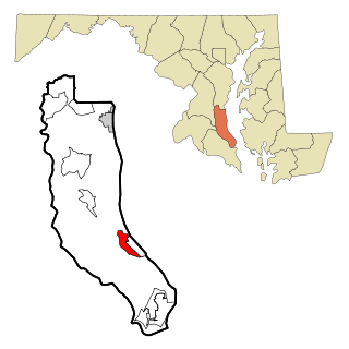
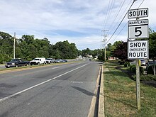
St. Leonard is a census-designated place (CDP) in Calvert County, Maryland, United States. The population was 742 at the 2010 census. Residents of the Calvert Beach and Long Beach communities also use the St. Leonard ZIP code designation.

<span class="mw-page-title-main">Chesapeake City, Maryland</span> Town in Maryland, United States

Chesapeake City is a town in Cecil County, Maryland, United States. The population was 736 at the 2020 census.

<span class="mw-page-title-main">North East, Maryland</span> Town in Maryland, United States

North East is a town in Cecil County, Maryland, United States. It is located between Philadelphia and Baltimore. The population was 3,572 at the 2010 census.

<span class="mw-page-title-main">La Plata, Maryland</span> Town in Maryland, United States

La Plata is a town in Charles County, Maryland, United States. The population was 10,159 at the 2020 census. It is the county seat of Charles County.

<span class="mw-page-title-main">St. Charles, Maryland</span> Former CDP in Maryland, United States

St. Charles is a planned community in Charles County, Maryland, United States. It is 22 miles (35 km) south-southeast of Washington, D.C., 24 miles (39 km) from northern Virginia and immediately south of Waldorf, which is the mailing address.. At the 2000 census, it was delineated as a census-designated place (CDP), with a population of 33,379. It was included in the Waldorf CDP for the 2010 census.

<span class="mw-page-title-main">Walkersville, Maryland</span> Town in Maryland

Walkersville is a town in Frederick County, Maryland, United States. The population was 5,800 at the 2010 census.

<span class="mw-page-title-main">Barnesville, Maryland</span> Town in Maryland, United States

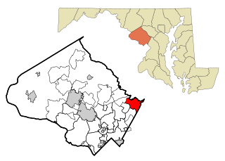
Barnesville is a town in Montgomery County, Maryland, United States. It was incorporated in 1888. The population was 144 at the 2020 census.

<span class="mw-page-title-main">Burtonsville, Maryland</span> Census-designated place in Maryland

Burtonsville is a census-designated place and an unincorporated area in Montgomery County, Maryland, United States. It is situated in the northeast corner of Montgomery County, right on the border of both Howard and Prince George's counties. It is considered a suburban town in the Washington D.C. Metro Area.

<span class="mw-page-title-main">Laytonsville, Maryland</span> Town in Maryland, United States

Laytonsville is a town in Montgomery County, Maryland, United States. The population was 572 at the 2020 census, up from 353 in 2010. Laytonsville was incorporated in 1892.

<span class="mw-page-title-main">Eagle Harbor, Maryland</span> Town in Maryland, United States

Eagle Harbor is an incorporated town in the far southeast corner of Prince George's County, Maryland, United States, and near the rural community of Aquasco that is known as a historic African American community founded in 1925. Per the 2020 census, the population was 67. The Chalk Point Generating Station, owned by NRG Energy, which was sold to Mirant by the Potomac Electric Power Company (PEPCO) in 2000, is located adjacent to the town.

<span class="mw-page-title-main">Upper Marlboro, Maryland</span> Town in Maryland, United States

Upper Marlboro, officially the Town of Upper Marlboro, is the seat of Prince George's County, Maryland. As of the 2020 census, the population within the town limits was 652, although Greater Upper Marlboro, which covers a large area outside the town limits, is many times larger.

<span class="mw-page-title-main">California, Maryland</span> CDP in Maryland, United States

California is a census-designated place and community in St. Mary's County, Maryland, United States. The population was 11,857 at the 2010 census, an increase of 27.4% from the 2000 census. California has been growing with the spread of population from the older adjacent community of Lexington Park and the growth in both technology-related and defense-related jobs at the Patuxent River Naval Air Station. There are department stores and numerous shopping centers situated along Maryland Highway 235. Maryland Route 4 crosses Highway 235 in California, providing access to the wide Governor Thomas Johnson Bridge and the popular weekend resort town of Solomons on its opposite side. Bridge-bound traffic is notorious for backing up during rush hour.

<span class="mw-page-title-main">Lexington Park, Maryland</span> CDP in Maryland, United States

Lexington Park is a census-designated place (CDP) in St. Mary's County, Maryland, United States, and the principal community of the Lexington Park, Maryland Micropolitan Statistical Area. The population was 11,626 at the 2010 census.

<span class="mw-page-title-main">Richland Township, Clarion County, Pennsylvania</span> Township in Pennsylvania, United States

Richland Township is a township in Clarion County, Pennsylvania, United States. The population was 473 at the 2020 census, a decrease from the figure of 494 tabulated in 2010.

<span class="mw-page-title-main">Colonial Beach, Virginia</span> Town in Virginia, United States

Colonial Beach, Virginia (CBVA) is a river and beach town located in the northwestern part of Westmoreland County on Virginia's Northern Neck peninsula. It is bounded by the Potomac River, Monroe Bay and Monroe Creek. It is located 65 mi (105 km) from Washington, D.C.; 70 mi (110 km) from the state capital of Richmond; and 35 nautical miles from the Chesapeake Bay.

References

  1. "2020 U.S. Gazetteer Files". United States Census Bureau. Retrieved April 26, 2022.
  2. "Find a County". National Association of Counties. Retrieved June 7, 2011.
  3. "US Gazetteer files: 2010, 2000, and 1990". United States Census Bureau. February 12, 2011. Retrieved April 23, 2011.
  4. "US Gazetteer files 2010". United States Census Bureau. Archived from the original on February 20, 2011. Retrieved January 25, 2013.
  5. http://www.gazette.net/stories/01012009/businew130156_32489.shtml. Gazette.Net. Retrieved on February 6, 2009.
  6. "Leonardtown, Maryland Historic Information". Southern Maryland Online. Archived from the original on June 30, 2013. Retrieved February 4, 2009.
  7. "National Register Information System". National Register of Historic Places . National Park Service. April 15, 2008.
  8. "Forty-second Annual Oyster Festival a Great Success". Southern Maryland Online. October 26, 2008. Retrieved March 7, 2024.
  9. Zou, Dan (October 19, 2016). "50th oyster festival draws record attendance in St. Mary's". SoMdNews.com. Retrieved March 7, 2024.
  10. "Census of Population and Housing". Census.gov. Retrieved June 4, 2015.
  11. "U.S. Census website". United States Census Bureau . Retrieved January 25, 2013.
  12. "U.S. Census website". United States Census Bureau . Retrieved January 31, 2008.