Pikesville, Maryland

Last updated

Pikesville, Maryland
Pikesville High School.JPG
The entrance to Pikesville High School, located at the intersection of Labyrinth Road and Smith Avenue.
Baltimore County Maryland Incorporated and Unincorporated areas Pikesville Highlighted.svg
Location of Pikesville, Maryland
Coordinates: 39°22′45″N76°42′18″W / 39.37917°N 76.70500°W / 39.37917; -76.70500
CountryFlag of the United States.svg United States
State Flag of Maryland.svg  Maryland
County Flag of Baltimore County, Maryland.svg Baltimore
Area
[1]
  Total12.38 sq mi (32.06 km2)
  Land12.35 sq mi (31.99 km2)
  Water0.03 sq mi (0.07 km2)
Elevation
509 ft (155 m)
Population
 (2020)
  Total34,168
  Density2,766.64/sq mi (1,068.21/km2)
Demonym Pikesvillian
Time zone UTC−5 (Eastern (EST))
  Summer (DST) UTC−4 (EDT)
ZIP codes
21208, 21282,21209,21215
Area code(s) 410, 443, and 667
FIPS code 24-61400
GNIS feature ID0586509

Pikesville is a census-designated place (CDP) in Baltimore County, Maryland, United States. Pikesville is just northwest of the Baltimore city limits. It is the northwestern suburb closest to Baltimore.

Contents

The population was 30,764 at the 2010 census. [2] The corridor along Interstate 795, which links Pikesville, Owings Mills and Reisterstown to the Baltimore Beltway (Interstate 695), contains one of the larger Jewish populations in Maryland.

Geography

Pikesville is located at 39°22′45″N76°42′18″W / 39.37917°N 76.70500°W / 39.37917; -76.70500 (39.379039, −76.705091). [3]

According to the United States Census Bureau, the CDP has a total area of 32.1 square kilometres (12.4 sq mi), of which 32.0 square kilometres (12.4 sq mi) is land and 0.07 square kilometres (0.027 sq mi), or 0.22%, is water. [4]

Demographics

Historical population
CensusPop.Note
1960 18,737
1970 24,15928.9%
1980 22,555−6.6%
1990 24,81510.0%
2000 29,12317.4%
2010 30,7645.6%
2020 34,16811.1%
[5]

As of the census [6] of 2010, there were 30,764 people and 13,642 households residing in the CDP. The population density was 2,490.8 people per square mile. There were 14,323 housing units. The racial makeup of the CDP was 77.0% White, 14.5% African American, 0.1% Native American, 6.0% Asian, 0.1% Pacific Islander, and 1.6% from two or more races. Hispanic or Latino of any race were 2.7% of the population.

As of the 2000 census, there were 12,747 households, out of which 24.1% had children under the age of 18 living with them, 54.9% were married couples living together, 7.0% had a female householder with no husband present, and 36.1% were non-families. 30.5% of all households were made up of individuals, and 14.9% had someone living alone who was 65 years of age or older. The average household size was 2.25 and the average family size was 2.81.

In the CDP, the population was spread out, with 19.7% under the age of 18, 5.3% from 18 to 24, 24.4% from 25 to 44, 27.0% from 45 to 64, and 23.6% who were 65 years of age or older. The median age was 45 years. For every 100 females, there were 86.0 males. For every 100 females age 18 and over, there were 81.0 males.

The median income for a household in the CDP was $58,598, and the median income for a family was $78,002 (these figures had risen to $73,846 and $100,237 respectively as of a 2007 estimate [7] ). Males had a median income of $52,079 versus $37,179 for females. The per capita income for the CDP was $41,035. About 5.0% of families and 6.9% of the population were below the poverty line, including 4.4% of those under age 18 and 11.5% of those age 65 or over.

In 2000, 19.3% of Pikesville residents identified as being of Russian heritage. Virtually all of them are Ashkenazi Jews whose ancestors immigrated from the Russian Empire. [8] In 2000, 3.7% of Pikesville residents identified as being of Ukrainian American heritage. This was the highest percentage of Ukrainian Americans of any place in Maryland. [9] 2% of the city were descended from Eastern European countries other than Russia and Ukraine. The majority of them are of Ashkenazi Jewish ancestry. 8% of Pikesville's residents were German, 7% Polish, 4% Irish, 3% English, and 2% Italian. [10]

Jewish community

In the 19th and early 20th centuries Jewish immigrants to the Baltimore area first formed enclaves in East Baltimore not far from Johns Hopkins Hospital in neighborhoods such as Broadway East, Jonestown, Middle East and Oliver. After World War II, the Jewish community started to move outside of Baltimore City into Pikesville which was a sleepy outpost on a major road that led to Western Maryland. During the Vietnam War, and exacerbated by riots in 1968, many Jewish businesses left northwestern Baltimore following this exodus.

Pikesville (and more recently its neighboring communities to the north, Owings Mills and Reisterstown) have been considered the center of the Baltimore area's Jewish community since the mid-1950s. Many of the region's largest and most established synagogues, Jewish schools, and kosher dining establishments are located in or near Pikesville.

History

Pikesville was named for the American soldier and explorer Zebulon Pike (1779–1813). While there are places named for Pike in many other states, Pikesville, Maryland, is the only contemporary place named "Pikesville" (compare Pikeville, Kentucky).

The (historic) town of Pikesville, incorporated August, 1818, in Barren County, Kentucky, was apparently named for Zebulon Pike, also. In 1858, the community adopted a new postal name, “Flippin, Kentucky,” to avoid confusion with Pikeville, Kentucky. “Pike[s]ville Branch” of Indian Creek is the only remaining physical landmark of historic Pikesville, in Kentucky, along with a colorful story of an almost forgotten past.

Education

Pikesville is served by several elementary, middle, and high schools and higher-education facilities:

Public

All public schools in Pikesville are part of the Baltimore County Public Schools system.

Independent

Higher education

Government

The Maryland State Police is headquartered at 1201 Reisterstown Road in the Pikesville CDP. [12] [13]

Transportation

Roads

Public transportation

The Baltimore Metro Subway runs through Pikesville, with two stops in the area, both named for the roads on which they are located: Milford Mill and Old Court.

Maryland Transit Administration bus routes serving Pikesville include nos. 83 and 89 on Reisterstown Road, 83 and 37 on Old Court Road, 85 on Milford Mill Road/Slade Avenue, and 34 and on Smith Avenue.

Notable residents

Pikesville in national/international news

Vernon Lee Evans was a key figure in the battle against lethal injection in Maryland and other states. Prior to Maryland's outlawing of capital punishment in 2013, he and Anthony Grandison were on death row for the murders of two clerks at the Warren House Motel (currently a Howard Johnson) in Pikesville in 1983. Governor Martin O'Malley commuted both men's sentences in 2014, along with those of the other two men who were, at the time, on Maryland's death row. [17]

Ziad Jarrah, a suspected terrorist involved in the 9/11 attacks, was pulled over two days earlier for speeding in Pikesville. [18]

On April 25th, 2024, Dazhon Darien, the Athletic Director at Pikesville High School, was arrested on terms of falsifying a audio recording of the Principal of making racist and antisemitic remarks using artificial intelligence. [19]

Related Research Articles

<span class="mw-page-title-main">Glen Burnie, Maryland</span> Census-designated place in Maryland, United States

Glen Burnie is an unincorporated town and census-designated place (CDP) in Anne Arundel County, Maryland, United States. It is a suburb of Baltimore. The population was 72,891 at the 2020 census.

<span class="mw-page-title-main">Pasadena, Maryland</span> Census-designated place in Maryland, United States

Pasadena is a census-designated place (CDP) in Anne Arundel County, Maryland, United States. The population was 24,287 at the 2010 census.

<span class="mw-page-title-main">Catonsville, Maryland</span> Census-designated place in Maryland, United States

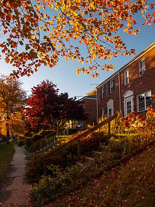
Catonsville is a census-designated place (CDP) in Baltimore County, Maryland. The population was 44,701 at the 2020 US Census. The community is a streetcar suburb of Baltimore along the city's western border. The town is known for its proximity to the Patapsco River and Patapsco Valley State Park, making it a regional mountain biking hub. The town is also notable as a local hotbed of music, earning it the official nickname of "Music City, Maryland." Catonsville contains the majority of the University of Maryland, Baltimore County (UMBC), a major public research university with close to 14,000 students.

<span class="mw-page-title-main">Lochearn, Maryland</span> Census-designated place in Maryland, United States

Lochearn is an unincorporated community and census-designated place in Baltimore County, Maryland, United States, located immediately to the west of the City of Baltimore. Per the 2020 census, the population was 25,511.

<span class="mw-page-title-main">Middle River, Maryland</span> Census-designated place in Maryland, United States

Middle River is an unincorporated community and census-designated place in Baltimore County, Maryland, United States. The population was 33,203 at the 2020 census. A Middle River Train Station first appeared on the 1877 G.M. Hopkins & Co Baltimore County Map and by 1898 had a designated Post Office and modest street grid. The town expanded during the 1930s and 1940s and established the "Aero Acres" housing community which borders the railroad tracks and Martin Blvd. to serve as housing for people working at the Martin Aerospace Company. For this development, the architecture firm of Skidmore, Owings & Merrill designed gable-roofed Cape Cod houses with dimensions of 24 feet by 28 feet, featuring large commercial-style windows in their principal rooms. In 1941 a total of 600 homes were built at Aero Acres using this design from Cemento .[2]

<span class="mw-page-title-main">Milford Mill, Maryland</span> Census-designated place in Maryland, United States

Milford Mill is an unincorporated community and census-designated place in Baltimore County, Maryland, United States. Per the 2020 census, the population was 30,622.

<span class="mw-page-title-main">Owings Mills, Maryland</span> Census-designated place in Maryland, United States

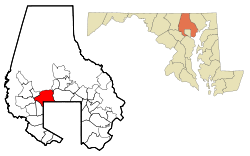
Owings Mills is an unincorporated community and census-designated place in Baltimore County, Maryland, United States. It is a suburb of Baltimore. Per the 2020 census, the population was 35,674. Owings Mills is home to the northern terminus of the Baltimore Metro Subway, and housed the Owings Mills Mall until its closure in 2015. It is also home to the Baltimore Ravens' headquarters facility, and the studios for Maryland Public Television. In 2008, CNNMoney.com named Owings Mills number 49 of the "100 Best Places to Live and Launch".

<span class="mw-page-title-main">Parkville, Maryland</span> Census-designated place in Maryland, United States

Parkville is an unincorporated community and census-designated place in Baltimore County, Maryland, United States. As of the 2010 census, the population was 30,734.

<span class="mw-page-title-main">Reisterstown, Maryland</span> Census-designated place in Maryland, United States

Reisterstown is an unincorporated community and census-designated place in Baltimore County, Maryland, United States. As of the 2010 census, it had a population of 25,968.

<span class="mw-page-title-main">Woodlawn, Baltimore County, Maryland</span> Place in Maryland, United States

Woodlawn is an unincorporated community and census-designated place in Baltimore County, Maryland. Per the 2020 census, the population was 39,986. It is home to the headquarters of the Social Security Administration (SSA) and the Centers for Medicare and Medicaid Services (CMS). It is bordered by Catonsville on the south, by the Patapsco River and Howard County on the west, by Randallstown and Lochearn to the north, and by the City of Baltimore to the east. Parts of Woodlawn are sometimes informally referred to as Security, Maryland, due to the importance of the SSA's headquarters as well as nearby Security Boulevard and Security Square Mall.

<span class="mw-page-title-main">Eldersburg, Maryland</span> Census-designated place in Maryland, United States

Eldersburg is an unincorporated community and census-designated place (CDP) in Carroll County, Maryland, United States. The population was 30,531 at the 2010 census.

<span class="mw-page-title-main">North Bethesda, Maryland</span> Census-designated place in Maryland, United States

North Bethesda is an unincorporated, census-designated place (CDP) in Montgomery County, Maryland, United States, located just north-west of the U.S. capital of Washington, D.C. It had a population of 50,094 as of the 2020 census. Among its neighborhoods, the centrally-located, urbanizing district of White Flint is the commercial and residential hub of North Bethesda. The Pike & Rose development and the Pike District is an initiative of Montgomery County to brand and market this region as "North Bethesda's Urban Core". The WMATA North Bethesda metro station and Grosvenor-Strathmore metro station serve the region.

<span class="mw-page-title-main">Potomac, Maryland</span> Census-designated place in Maryland, United States

Potomac is an unincorporated community and census-designated place in Montgomery County, Maryland, United States. As of the 2020 census, it had a population of 47,018. It is named after the nearby Potomac River. A part of the Washington metropolitan area, many Potomac residents work in nearby Washington, D.C., and Northern Virginia.

<span class="mw-page-title-main">Beltsville, Maryland</span> CDP in Maryland, United States

Beltsville is a census-designated place (CDP) in northern Prince George's County, Maryland, United States. The community was named for Truman Belt, a local landowner. The 2020 census counted 20,133 residents. Beltsville includes the unincorporated community of Vansville.

<span class="mw-page-title-main">Hampstead, Maryland</span> Town in Maryland, United States

Hampstead is a town in Carroll County in the U.S. state of Maryland. The population was 6,323 at the 2010 census.

<span class="mw-page-title-main">Calverton, Maryland</span> Census-designated place in Maryland, United States

Calverton is an unincorporated area and census-designated place located on the boundary between Montgomery and Prince George's counties, Maryland, in the United States. At the 2020 census, it had a population of 17,316.

<span class="mw-page-title-main">Lansdowne, Maryland</span> Census-designated place in Maryland, United States

Lansdowne is a census-designated place in southern Baltimore County, Maryland, United States, located just south of Baltimore. As of the 2010 census, it had a population of 8,409. At the 2000 census and earlier, the area was delineated as part of the Lansdowne-Baltimore Highlands CDP.

<span class="mw-page-title-main">Maryland Route 140</span> State highway in Maryland, US

Maryland Route 140 is a 49-mile (79 km) state highway in the U.S. state of Maryland. The route runs from U.S. Route 1 and US 40 Truck in Baltimore northwest to the Pennsylvania border, where the road continues into that state as Pennsylvania Route 16. MD 140 passes through the northern part of central Maryland, connecting Baltimore, Pikesville, Reisterstown, Westminster, Taneytown, and Emmitsburg.

<span class="mw-page-title-main">Milford Mill Road</span> Long road primarily situated in Baltimore County, Maryland

Milford Mill Road, Slade Avenue, and Smith Avenue are a long road mostly in Baltimore County, Maryland that runs through Milford Mill and Pikesville in the suburbs of Baltimore. The road starts out at the light rail stop in historic Mt. Washington Village in Baltimore city as Smith Avenue, and continues through Pikesville up to Seven Mile Lane before its name changes to Slade Avenue, and the road widens to four lanes. The road is known as Slade Avenue until Reisterstown Road, and from there, its name becomes Milford Mill Road until it dead-ends one block south of Rolling Road in an area known as Windsor Mill. It is one of the most heavily used routes in the northwest suburbs of Baltimore, as it is used for cross-county travel by motorists between the Pikesville and Randallstown areas.

<span class="mw-page-title-main">Glyndon, Maryland</span> Unincorporated community in Baltimore County, Maryland, US

Glyndon is an unincorporated community in Baltimore County, Maryland, United States. Founded in 1871 by Dr. Charles A. Leas, the village is located in the northwest section of Baltimore County and is primarily a residential suburb of metropolitan Baltimore City. Glyndon is listed on the National Register of Historic Places (1973) and on the Maryland Inventory of Historic Properties (1973); the Glyndon Historic District was also designated as the first historic district in Baltimore County (1981).

References

  1. "2020 U.S. Gazetteer Files". United States Census Bureau. Retrieved April 26, 2022.
  2. "Profile of General Population and Housing Characteristics: 2010 Demographic Profile Data (DP-1): Pikesville CDP, Maryland". United States Census Bureau . Retrieved March 1, 2012.
  3. "US Gazetteer files: 2010, 2000, and 1990". United States Census Bureau. February 12, 2011. Retrieved April 23, 2011.
  4. "Geographic Identifiers: 2010 Demographic Profile Data (G001): Pikesville CDP, Maryland". United States Census Bureau . Retrieved March 1, 2012.
  5. As a Census Designated Place, the boundaries may have changed arbitrarily in each decennial census.
  6. "U.S. Census website". United States Census Bureau . Retrieved January 31, 2008.
  7. Bureau, U. S. Census. "U.S. Census website". United States Census Bureau . Retrieved April 6, 2019.
  8. Vicino, Thomas J. (2008). Transforming Race and Class in Suburbia: Decline in Metropolitan Baltimore. New York City: Palgrave Macmillan. p. 77. ISBN   978-0-230-60545-9 . Retrieved October 15, 2012.
  9. "Ancestry Map of Ukrainian Communities". Epodunk.com. Archived from the original on May 23, 2013. Retrieved April 16, 2015.
  10. "Pikesville, MD, Ancestry & Family History". Epodunk.com. Retrieved April 16, 2015.
  11. "WITS/MAALOT | Women's Institute of Torah Seminary". maalotbaltimore.org.
  12. Home page. Maryland State Police . Retrieved on March 23, 2009.
  13. "Pikesville CDP, Maryland [ permanent dead link ]." U.S. Census Bureau . Retrieved on March 23, 2009.
  14. Kaltenbach, Chris (November 15, 2014). "Remembrance: Michael Shamberg, from Baltimore to New Order and beyond". Baltimore Sun . Retrieved November 29, 2014.
  15. Colford, Paul (1997). "Howard Stern: King of All Media (2nd ed.)".
  16. "#SweaterGame: Maryland man goes viral for knitting travel memories into wearable art". WTTE. January 18, 2017.
  17. "ndpteachers.org". ww11.ndpteachers.org.
  18. "Another hijacker was stopped for traffic violation". CNN. January 9, 2002. Retrieved May 22, 2010.
  19. "Teacher arrested, accused of using AI to falsely paint boss as racist and antisemitic". NBC News. April 26, 2024. Retrieved April 26, 2024.