
A ZIP Code is a system of postal codes used by the United States Postal Service (USPS). Introduced on July 1, 1963, the basic format consisted of five digits. In 1983, an extended ZIP+4 code was introduced; it included the five digits of the ZIP Code, followed by a hyphen and four digits that designated a more specific location.
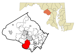
Potomac is an unincorporated community and census-designated place (CDP) in Montgomery County, Maryland. As of the 2020 census, it had a population of 47,018. It is named after the nearby Potomac River.
Fayette is a town in Seneca County, New York, United States. The population was 3,617 at the 2020 census. The town is in the north-central part of the county and is southeast of Geneva, New York.

McLean is an unincorporated community and census-designated place (CDP) in Fairfax County in Northern Virginia. McLean is home to many diplomats, military, members of Congress, and high-ranking government officials partially due to its proximity to Washington, D.C., the Pentagon and the Central Intelligence Agency. It is the location of Hickory Hill, the former home of Ethel Kennedy, the widow of Robert F. Kennedy. It is also the location of Salona, the former home of Light-Horse Harry Lee, the Revolutionary War hero.

Tornado, also called Upper Falls, is a census-designated place (CDP) in Kanawha County, West Virginia, United States.

Sterling, Virginia, refers most specifically to a census-designated place (CDP) in Loudoun County, Virginia, United States. The population of the CDP as of the 2010 United States Census was 27,822. The CDP boundaries are confined to a relatively small area between Virginia State Route 28 on the west and Virginia State Route 7 on the northeast, excluding areas near SR 606 and the Dulles Town Center.

Woodbine is an unincorporated rural community in Howard and Carroll counties, Maryland, United States. It is part of the Baltimorean metropolitan area. It is located southeast of Frederick, west of Baltimore, north of Washington, D.C., and east of Mount Airy. The community was named for the woodbine plant, which grew in the community in fields and along riverbanks.

Mount Washington is an area of northwest Baltimore, Maryland. It is a designated city historic district and divided into two sections: South Road/Sulgrave to the southeast and Dixon's Hill to the north. The Mount Washington Historic District was listed on the National Register of Historic Places in 1990 with a boundary increase in 2001, with five contributing buildings and four contributing structures.
Scaggsville is an unincorporated community and census-designated place in Howard County, Maryland, United States. It is situated near the southeastern tip of Howard County, between Laurel and Fulton. As of the 2010 census it had a population of 24,333. The town mainly consists of residences, with some commercial establishments. Scaggsville generally falls within ZIP code 20723, assigned to Laurel, though the town formerly had its own post office.
Dayton is an unincorporated community located in Howard County, Maryland, United States.
Krumville is a hamlet in the southeastern corner of the town of Olive in Ulster County, New York, United States. It takes its name from one of the most prominent of the early Dutch families who settled the area. Krumville is bordered on the northwest by the Olive hamlet of Samsonville, on the north by the hamlet of Olivebridge, on the southeast by the town of Marbletown and on the southwest by the town of Rochester. It lies at an elevation of 774 feet above sea level.
The Little Magothy River runs 2.5 miles (4.0 km) through Anne Arundel County in the U.S. state of Maryland. It is located southeast of the Magothy River, just outside its mouth and north of the Severn River.

Forest Hill is an unincorporated community in Harford County, Maryland, United States, located north of the county seat of Bel Air. The main part of town is located at the intersection of Maryland Route 24 and Jarrettsville Road. Until 1958, this community was served by the Maryland and Pennsylvania Railroad at milepost 30.3.

Beallsville is an unincorporated community in Montgomery County, Maryland, United States. It is a small community located north of Poolesville. The ZIP Code for Beallsville is 20839.

Ingleside is an unincorporated community in Queen Anne's County, Maryland, United States. Ingleside is located on Maryland Route 19, 6.5 miles (10.5 km) southeast of Church Hill. Ingleside has a post office with ZIP code 21644.

Price is an unincorporated community in Queen Anne's County, Maryland, United States. Price is located at the junction of U.S. Route 301 and Maryland Route 405, 3.5 miles (5.6 km) south-southeast of Church Hill. Price has a post office with ZIP code 21656.
Ericsburg is an unincorporated community in Koochiching County, Minnesota, United States.

Little York is an unincorporated community located along the border of Alexandria and Holland townships in Hunterdon County, in the U.S. state of New Jersey. Little York is located on County Route 614 3.1 miles (5.0 km) north-northeast of Milford. Little York has a post office with ZIP Code 08834.
Hoes Heights is an area of North Baltimore, Maryland in zip code 21211, between West Cold Spring Lane and West 41st Street (north-south) and Evans Chapel Road and Falls Road (east-west).
St. Margaret's is a suburb of Annapolis in Anne Arundel County, Maryland, United States on the scenic Broadneck Peninsula. The ZIP code is 21409.


