Essex, Maryland

Last updated

Essex, Maryland
EssexMonolith.jpg
Essex Monolith, Essex, Maryland
Baltimore County Maryland Incorporated and Unincorporated areas Essex Highlighted.svg
Location of Essex, Maryland
Coordinates: 39°18′28″N76°27′6″W / 39.30778°N 76.45167°W / 39.30778; -76.45167
CountryFlag of the United States.svg United States
State Flag of Maryland.svg  Maryland
County Flag of Baltimore County, Maryland.svg Baltimore
Area
[1]
  Total12.04 sq mi (31.19 km2)
  Land9.26 sq mi (23.98 km2)
  Water2.78 sq mi (7.20 km2)
Elevation
39 ft (12 m)
Population
 (2020)
  Total40,505
  Density4,374.19/sq mi (1,688.96/km2)
Time zone UTC−5 (Eastern (EST))
  Summer (DST) UTC−4 (EDT)
ZIP code
21221
Area code(s) 410, 443, 667
FIPS code 24-26600
GNIS feature ID0590171

Essex is an unincorporated community and census-designated place in Baltimore County, Maryland, United States. Essex history dates back to 1909. The population was 40,505 in the 2020 census, up from 39,262 in the 2010 census.

Contents

History

Essex is located on a peninsula bodied by the middle river to the east and the back river to the west. Essex was originally ten blocks, running from Mace Avenue to Marlyn Avenue. It began in 1909 by the Taylor Land Company for the residents in Baltimore who wanted a place outside the city limits to perhaps grow a garden or to pursue some other rural activity. Land was cheap, and sales were enhanced by a promotional pamphlet.

Henry Guttenberger built the first general store in Essex in 1910 on the corner of Eastern Boulevard and Mace Avenue. Between 1911 and 1912, the Taylor Land Company donated the lots for Essex Methodist and St. John's Lutheran churches. They also donated the land where the volunteer fire department built their station. The permanent fire station opened in 1921.

With the ever-growing population came the need to build schools. The elementary school opened in 1925 with 400 students. Essex Community College, now CCBC-Essex, was founded in 1957. Classes were first held at Kenwood High School, with fifty part-time and nine full-time students. In 1961, the college moved to Dorsey Avenue, and in 1968 moved to its present location, in Rossville. This site was owned by the Mace family, and the family burial plot is maintained and protected by the college.

A fire in August 1957 destroyed an entire block of businesses on Eastern Boulevard, and the town's business district never fully recovered from that catastrophe. The ten-alarm blaze caused a half million dollars in damages, in the time it took to repair the buildings new shopping centers were built changing the buying habits of consumers.

The Glenn L. Martin Company was the single biggest reason for the rapid growth of the area. Employment at the company peaked at more than 53,000 workers during World War II. In the years following, industry in the area dwindled, and much of the original Glenn L. Martin facility became the property of the State, including Martin State Airport. The remaining aerospace business followed a progression of corporate mergers and today is owned and operated by Lockheed Martin.

Another important company was Eastern Rolling Mill, which opened in 1919. The plant, at the head of the Back River, produced carbon sheet steel. In 1944, Eastern merged with Industrial Stainless Steel, Inc. to form Easco. The plant then merged with the British company Avesta-Sheffield in the early 1990s, finally shutting down operations in the late 1990s.

Today, there is interest in revitalizing Essex by including it in government-sponsored empowerment zones. Many neighborhoods have begun a "clean-up" of their areas, hoping to transform Essex into a place that will be ready to move into the twenty-first century. Improvements include removal of run-down, low-income housing, including the Tall Trees Community, Edgewater apartments, and the Riverdale Community; new medians and pavement on Eastern boulevard; a new Essex monolith replaced the old Essex cube, and new developments being built around the town.

Ballestone Mansion built in 1800 was listed on the National Register of Historic Places in 1975. [2]

The town has a strip of shops known as the business district on Eastern boulevard starting from Virginia avenue to Marlyn avenue. The business district originally started from Mace Avenue to Marlyn Avenue. Its largest shopping center, Middlesex, was built in 1955 which once had a department store Montgomery Ward and grocery store Food Fair as anchors of the shopping center. [3]

On August 2, 2009, the community of Essex celebrated its 100th birthday with a party at Cox's Point Park on Riverside Drive.

Sources: Baltimore County Public Library

Essex district court Essex district court.png
Essex district court

Geography

Essex is located at 39°18′28″N76°27′6″W / 39.30778°N 76.45167°W / 39.30778; -76.45167 (39.307737, 76.451710). [4]

According to the United States Census Bureau, the CDP has a total area of 11.9 square miles (30.8 km2), of which 9.3 square miles (24.0 km2) is land and 2.6 square miles (6.8 km2), or 22.16%, is water. [5]

The town is on mostly flat to gently rolling terrain, transitioning to marshland at the tip of the peninsula close to the Chesapeake Bay. Essex has a small island on the Chesapeake Bay named Hart Miller Island. The island is only accessible by boat, and the closest boat launch is located in Rocky Point. The island boasts an observation tower, beaches, and hiking trails. A made made landfill linking two Chesapeake islands consisting of Hart and Miller island.

Demographics

Historical population
CensusPop.Note
1960 35,205
1970 38,1938.5%
1980 39,6143.7%
1990 40,8723.2%
2000 39,078−4.4%
2010 39,2620.5%
2020 40,5053.2%
U.S. Decennial Census [6]

As of the census [7] of 2000, there were 39,078 people, 15,952 households, and 10,336 families residing in the CDP. The population density was 4,104.1 inhabitants per square mile (1,584.6/km2). There were 16,997 housing units at an average density of 1,785.1 per square mile (689.2/km2). The racial makeup of the CDP was 74.56% White, 20.98% African American, 0.55% Native American, 1.17% Asian, 0.05% Pacific Islander, 0.82% from other races, and 1.87% from two or more races. Hispanic or Latino of any race were 2.26% of the population.

There were 15,952 households, out of which 31.8% had children under the age of 18 living with them, 40.8% were married couples living together, 18.2% had a female householder with no husband present, and 35.2% were non-families. 29.3% of all households were made up of individuals, and 10.4% had someone living alone who was 65 years of age or older. The average household size was 2.45 and the average family size was 3.00.

In the CDP, the population was spread out, with 26.1% under the age of 18, 8.9% from 18 to 24, 30.5% from 25 to 44, 21.7% from 45 to 64, and 12.8% who were 65 years of age or older. The median age was 36 years. For every 100 females, there were 93.1 males. For every 100 females age 18 and over, there were 88.3 males.

The median income for a household in the CDP was $34,978, and the median income for a family was $42,177. Males had a median income of $34,105 versus $26,215 for females. The per capita income for the CDP was $17,550. About 10.0% of families and 12.2% of the population were below the poverty line, including 16.2% of those under age 18 and 11.0% of those age 65 or over.

Schools in Essex, Maryland

Notable person

Related Research Articles

<span class="mw-page-title-main">Glen Burnie, Maryland</span> Census-designated place in Maryland, United States

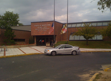
Glen Burnie is an unincorporated town and census-designated place (CDP) in Anne Arundel County, Maryland, United States. It is a suburb of Baltimore. The population was 72,891 at the 2020 census.

<span class="mw-page-title-main">Lake Shore, Maryland</span> Census-designated place in Maryland, United States

Lake Shore is a census-designated place and unincorporated community in Anne Arundel County, Maryland, United States, located east of Pasadena. The population of Lake Shore was 19,477 at the 2010 census.

<span class="mw-page-title-main">Parole, Maryland</span> Census-designated place in Maryland, United States

Parole, a suburb of Annapolis, is a census-designated place (CDP) in Anne Arundel County, Maryland, United States. The population was 15,922 at the 2010 census. It has several major roads intersect at the western edge of the state capital, Annapolis, and it contains the Annapolis Mall, a number of other large shopping centers, and the Anne Arundel Medical Center. It is generally considered to be part of Annapolis, rather than a separate town. The neighborhood was named because it was a parole camp, where Union and Confederate prisoners of war were brought for mutual exchange and eventual return to their respective homes.

<span class="mw-page-title-main">Pasadena, Maryland</span> Census-designated place in Maryland, United States

Pasadena is a census-designated place (CDP) in Anne Arundel County, Maryland, United States. The population was 24,287 at the 2010 census.

<span class="mw-page-title-main">Severna Park, Maryland</span> Census-designated place in Maryland, United States

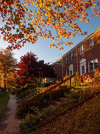
Severna Park is a census-designated place (CDP) in Anne Arundel County, Maryland, United States. Severna Park is part of the Baltimore-Washington Metropolitan Area, and is located approximately 8 miles (13 km) north of Annapolis, 17 miles (27 km) south of Baltimore and 39 miles (63 km) east of Washington, D.C. Severna Park's population was 39,933 at the 2020 census.

<span class="mw-page-title-main">Lochearn, Maryland</span> Census-designated place in Maryland, United States

Lochearn is an unincorporated community and census-designated place in Baltimore County, Maryland, United States, located immediately to the west of the City of Baltimore. Per the 2020 census, the population was 25,511.

<span class="mw-page-title-main">Middle River, Maryland</span> Census-designated place in Maryland, United States

Middle River is an unincorporated community and census-designated place in Baltimore County, Maryland, United States. The population was 33,203 at the 2020 census. A Middle River Train Station first appeared on the 1877 G.M. Hopkins & Co Baltimore County Map and by 1898 had a designated Post Office and modest street grid. The town expanded during the 1930s and 1940s and established the "Aero Acres" housing community which borders the railroad tracks and Martin Blvd. to serve as housing for people working at the Martin Aerospace Company. For this development, the architecture firm of Skidmore, Owings & Merrill designed gable-roofed Cape Cod houses with dimensions of 24 feet by 28 feet, featuring large commercial-style windows in their principal rooms. In 1941 a total of 600 homes were built at Aero Acres using this design from Cemento .[2]

<span class="mw-page-title-main">Owings Mills, Maryland</span> Census-designated place in Maryland, United States

Owings Mills is an unincorporated community and census-designated place in Baltimore County, Maryland, United States. It is a suburb of Baltimore. Per the 2020 census, the population was 35,674. Owings Mills is home to the northern terminus of the Baltimore Metro Subway, and housed the Owings Mills Mall until its closure in 2015. It is also home to the Baltimore Ravens' headquarters facility, and the studios for Maryland Public Television. In 2008, CNNMoney.com named Owings Mills number 49 of the "100 Best Places to Live and Launch".

<span class="mw-page-title-main">Parkville, Maryland</span> Census-designated place in Maryland, United States

Parkville is an unincorporated community and census-designated place in Baltimore County, Maryland, United States. As of the 2010 census, the population was 30,734.

<span class="mw-page-title-main">Rosedale, Maryland</span> Census-designated place in Maryland, United States

Rosedale is an unincorporated community and census-designated place in Baltimore County, Maryland, United States. The population was 19,257 at the 2010 United States Census.

<span class="mw-page-title-main">Lusby, Maryland</span> Census-designated place in Maryland, United States

Lusby is an unincorporated community and census-designated place (CDP) in Calvert County, Maryland, United States. The population of the CDP was 1,835 at the 2010 census. Residents of the Chesapeake Ranch Estates and Drum Point communities also use the Lusby ZIP code designation.

<span class="mw-page-title-main">Owings, Maryland</span> Census-designated place in Maryland, United States

Owings is a town center and census-designated place (CDP) in northern Calvert County, Maryland, United States. The population was 2,149 at the 2010 census, up from 1,325 in 2000.

<span class="mw-page-title-main">Prince Frederick, Maryland</span> Census-designated place in Maryland, United States

Prince Frederick is an unincorporated community and census-designated place (CDP) in Calvert County, Maryland, United States. As of the 2020 census, the population of Prince Frederick was 3,226, up from 2,538 in 2010. It is the county seat of Calvert County.

<span class="mw-page-title-main">Edgewood, Maryland</span> Census-designated place in Maryland, United States

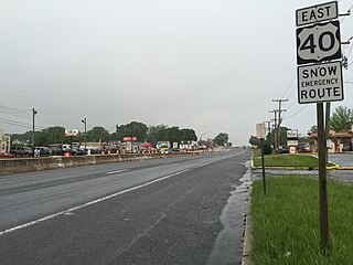
Edgewood is an unincorporated community and census-designated place (CDP) in Harford County, Maryland, United States. The population was 25,562 at the 2010 census, up from 23,378 in 2000.

<span class="mw-page-title-main">Betterton, Maryland</span> Historic district in Maryland, United States

Betterton is a town in Kent County, Maryland, United States. The population was 345 at the 2010 census.

<span class="mw-page-title-main">Lake Arbor, Maryland</span> Census-designated place in Maryland, United States

Lake Arbor is an unincorporated area and census-designated place (CDP) in Prince George's County, Maryland, United States. The population was 14,541 at the 2020 census. It is one of the nation's most affluent African-American communities. The ZIP Codes encompassing the CDP area are 20721 and 20774.

<span class="mw-page-title-main">Seat Pleasant, Maryland</span> City in Maryland

Seat Pleasant is an incorporated city in Prince George's County, Maryland, United States, located immediately east of Washington D.C.. Per the 2020 census, the population was 4,522. Two state highways pass through the community — Maryland routes 704 and 214. The Washington Metro's Blue and Silver Lines are nearby. The Washington Commanders' stadium is east of Seat Pleasant, near the Capital Beltway (I-95/495).

<span class="mw-page-title-main">Holbrook, New York</span> Hamlet and census-designated place in New York, United States

Holbrook is a hamlet and census-designated place (CDP) in Suffolk County, New York, United States. The population was 27,195 at the 2010 census. The community borders the eastern side of Long Island MacArthur Airport.

<span class="mw-page-title-main">Sound Beach, New York</span> Hamlet and census-designated place in New York, United States

Sound Beach, established in 1929, is a hamlet and census-designated place (CDP) in the north part of the Town of Brookhaven in Suffolk County, New York, United States. The population of the CDP was 7,612 at the 2010 census.

<span class="mw-page-title-main">Alum Creek, West Virginia</span> Census-designated place in West Virginia, United States

Alum Creek is a census-designated place (CDP) in Kanawha and Lincoln counties along the Coal River in the U.S. state of West Virginia. It includes the unincorporated communities of Alum Creek, Forks of Coal, and Priestley. The CDP had a population of 1,749 at the 2010 census, down from 1,839 at the 2000 census.

References

  1. "2020 U.S. Gazetteer Files". United States Census Bureau. Retrieved April 26, 2022.
  2. "National Register Information System". National Register of Historic Places . National Park Service. April 15, 2008.
  3. "Profile of General Population and Housing Characteristics: 2010 Demographic Profile Data (DP-1): Essex CDP, Maryland". United States Census Bureau . Retrieved February 23, 2012.
  4. "US Gazetteer files: 2010, 2000, and 1990". United States Census Bureau. February 12, 2011. Retrieved April 23, 2011.
  5. "Geographic Identifiers: 2010 Demographic Profile Data (G001): Essex CDP, Maryland". United States Census Bureau . Retrieved February 23, 2012.
  6. "Census of Population and Housing". Census.gov. Retrieved June 4, 2016.
  7. "U.S. Census website". United States Census Bureau . Retrieved January 31, 2008.