Camp Springs, Maryland

Last updated

Camp Springs, Maryland
Prince George's County Maryland Incorporated and Unincorporated areas Camp Springs Highlighted.svg
Location of Camp Springs, Maryland
Coordinates: 38°48′27″N76°55′5″W / 38.80750°N 76.91806°W / 38.80750; -76.91806
CountryFlag of the United States (23px).png  United States
State Flag of Maryland.svg  Maryland
County Flag of Prince George's County, Maryland (1963-present).svg Prince George's
Area
[1]
  Total7.69 sq mi (19.93 km2)
  Land7.68 sq mi (19.89 km2)
  Water0.01 sq mi (0.04 km2)
Elevation
266 ft (81 m)
Population
 (2020)
  Total22,734
  Density2,960.16/sq mi (1,142.95/km2)
Time zone UTC−5 (Eastern (EST))
  Summer (DST) UTC−4 (EDT)
ZIP codes
20746, 20748
Area code(s) 301, 240
FIPS code 24-12600
GNIS feature ID0597172
Website www.campsprings.net

Camp Springs is an unincorporated area and census-designated place (CDP) in Prince George's County, Maryland, United States. [2] The population was 22,734 at the 2020 census. [3] Camp Springs is not an official post office designation; the area is divided among the surrounding mailing addresses of Temple Hills, Fort Washington, Clinton, and Suitland.

Contents

History

The community of Camp Springs was settled in the mid-19th century at the crossroads of present-day Branch Avenue and Allentown Road. By 1860, the settlement contained several stores, a blacksmith shop, a school, Methodist church, and several residences. Early maps record the name of this settlement as Allentown, after the Allen family. The Allens were large landholders in the area, and the town, adjacent road, and Allenwood Elementary School were named in recognition of them. The town's popular name, and subsequently the name of its post office, was Camp Springs. According to local history, the community was called Camp Springs since soldiers en route to Fort Meade from the District of Columbia found the area to be a comfortable place to camp due to the abundant springs.

Throughout the late- 19th and early 20th centuries, the Camp Springs area did not experience significant growth. However, the opening of Andrews AFB on an adjacent tract of land, the proximity of the area to the District of Columbia, and a housing shortage after World War II made the Camp Springs area an ideal location for residential development. [4] [5]

Most of the development in the Camp Springs area occurred north of the Camp Springs crossroads in the 1940s and 1950s. The lack of water and sewer lines in most locations until the late 1950s and early 1960s kept the pace of development slow. The largest development in the 1940s was the subdivision of the Middleton farm north of Camp Springs. This farm was platted into Glenn Hills, Middleton Farm, and Middleton Valley. Guy Trueman built one of his many subdivisions in the mid-1940s by platting Trueman Heights on over 100 acres (0.40 km2) in the northwest quadrant of the Camp Springs crossroads. Modest single-family houses were constructed along a fragmented grid of streets. Residential development during the 1950s primarily took the form of infill construction within subdivisions platted in the 1940s. One of the exceptions is the large Westchester Estates development located in the southwest quadrant of the Camp Springs crossroads. The over 400 houses were constructed along a curvilinear network of streets. Commercial development, consisting of shopping centers, restaurants, and hotels, extends along Allentown Road east of Branch Avenue. The largest boom of construction occurred in the 1960s and 1970s after the completion of water and sewer lines and the construction of the Capital Beltway. Pyles Lumber Company, a historic lumber business at the crossroads, was destroyed by fire on December 27, 2000. [6] The 19th century crossroads vanished during the 20th century with the reconstruction of Branch Avenue into a limited-access divided highway, and extensive commercial and residential development. [4]

Geography

Camp Springs is located at 38°48′27″N76°55′05″W / 38.807463°N 76.918028°W / 38.807463; -76.918028 . [7] According to the United States Census Bureau, the CDP has a total area of 7.7 square miles (20.0 km2), of which 0.02 square miles (0.04 km2), or 0.19%, is water. [8]

Joint Base Andrews, home base of the Air Force Systems Command and the official presidential airplane Air Force One , is adjacent to Camp Springs, and the base in particular, along with federal jobs in Washington, D.C., were major reasons for the community's original development. The Capital Beltway passes through the area, and the Washington Metro Branch Avenue station, southern terminus of the Green Line, is located nearby. The Maryland-National Capital Park and Planning Commission operates a year-round indoor and outdoor public swimming pool on Allentown Road. The Camp Springs Senior Activity Center [9] is housed in the former Camp Springs Elementary School. From the Heart Church Ministries has an average weekly attendance of 7,000 worshippers.

Climate

The climate in this area is characterized by hot, humid summers and generally mild to cool winters. According to the Köppen Climate Classification system, Camp Springs has a humid subtropical climate, abbreviated "Cfa" on climate maps. [10]

Demographics

Historical population
CensusPop.Note
1970 22,776
1980 16,118−29.2%
1990 16,3921.7%
2000 17,9689.6%
2010 19,0966.3%
2020 22,73419.1%
U.S. Decennial Census [11]
2010 [12] 2020 [13]

2020 census

Camp Springs CDP, Maryland – Racial and ethnic composition
Note: the US Census treats Hispanic/Latino as an ethnic category. This table excludes Latinos from the racial categories and assigns them to a separate category. Hispanics/Latinos may be of any race.
Race / Ethnicity (NH = Non-Hispanic)Pop 2010 [12] Pop 2020 [13] % 2010% 2020
White alone (NH)1,7391,3629.11%5.99%
Black or African American alone (NH)14,87616,84777.90%74.10%
Native American or Alaska Native alone (NH)45620.24%0.27%
Asian alone (NH)4414372.31%1.92%
Pacific Islander alone (NH)13160.07%0.07%
Some Other Race alone (NH)411770.21%0.78%
Mixed Race or Multi-Racial (NH)3687121.93%3.13%
Hispanic or Latino (any race)1,5733,1218.24%13.73%
Total19,09622,734100.00%100.00%

2000 Census

As of the census [14] of 2000, there were 17,968 people, 6,210 households, and 4,831 families residing in the CDP. The population density was 2,475.9 inhabitants per square mile (956.0/km2). There were 6,494 housing units at an average density of 894.8 per square mile (345.5/km2). The racial makeup of the CDP was 20.07% White, 74.28% African American, 0.40% Native American, 2.33% Asian, 0.07% Pacific Islander, 1.07% from other races, and 1.79% from two or more races. Hispanic or Latino of any race were 2.44% of the population, but may have increased in recent years.

There were 6,210 households, out of which 32.4% had children under the age of 18 living with them, 54.7% were married couples living together, 17.7% had a female householder with no husband present, and 22.2% were non-families. 18.0% of all households were made up of individuals, and 5.5% had someone living alone who was 65 years of age or older. The average household size was 2.89 and the average family size was 3.24.

In the CDP, the population was spread out, with 25.4% under the age of 18, 7.0% from 18 to 24, 27.3% from 25 to 44, 28.9% from 45 to 64, and 11.5% who were 65 years of age or older. The median age was 39 years. For every 100 females, there were 92.5 males. For every 100 females age 18 and over, there were 87.6 males.

The median income for a household in the CDP was $69,371, and the median income for a family was $76,495. Males had a median income of $43,135 versus $39,736 for females. The per capita income for the CDP was $27,474. About 2.0% of families and 3.3% of the population were below the poverty line, including 3.1% of those under age 18 and 3.2% of those age 65 or over.

Government

Prince George's County Police Department District 4 Station in Glassmanor CDP, with an Oxon Hill postal address, serves the community. [15]

Education

Crossland High School in the CDP Crossland High School.jpg
Crossland High School in the CDP

The CDP is served by the Prince George's County Public Schools district. [16]

Elementary schools serving sections of the CDP include Allenwood, Avalon, William Beanes, Hillcrest Heights, and Princeton. [17] Middle schools serving sections of the CDP include Thurgood Marshall, Isaac J. Gourdine, and Drew-Freeman. [18] Much of the CDP is zoned to Crossland High School, with some portions zoned to Dr. Henry A. Wise High School. [19]

Middleton Valley Elementary School previously served the Camp Springs CDP. [16] It closed in 2010. [20]

Skyline Elementary School was previously in the CDP, [16] [21] until its 2016 closure. [22] Students were to be sent to Beanes Elementary. Until its closing it had a program for autistic students. [23]

Related Research Articles

<span class="mw-page-title-main">Brandywine, Maryland</span> Census-designated place in Maryland

Brandywine is the name of an unincorporated area in Prince George's County, Maryland, United States, that refers both to a census-designated place (CDP) and a zip code area which is much larger (20613), whose areas overlap. The population of Brandywine at the 2020 U.S. Census was 10,550 for the CDP, and the population of ZIP code 20613 was 11,860 in 2010.

<span class="mw-page-title-main">Forest Heights, Maryland</span> Town in Maryland

Forest Heights is a town in Prince George's County, Maryland, United States, and is part of the larger postal designation of Oxon Hill. The town straddles both sides of dual-lane Maryland Route 210 and includes two elementary schools. Per the 2020 census, the population was 2,658.

<span class="mw-page-title-main">Forestville, Maryland</span> CDP in Maryland

Forestville is an unincorporated area and census-designated place (CDP) in Prince George's County, Maryland, United States. Per the 2020 census, the population was 12,831. The community is a mixture of garden apartments, single-family homes, and shopping centers built mostly from the 1930s through 1970s, adjacent to the communities of District Heights, Suitland, Morningside, Westphalia and Camp Springs.

<span class="mw-page-title-main">Fort Washington, Maryland</span> Census-designated place in Maryland

Fort Washington is an unincorporated area and census-designated place in Prince George's County, Maryland, United States. It borders the Potomac River, situated 20 miles south of downtown Washington, D.C. As of the 2020 census, it had a population of 24,261. The Fort Washington community is located west of Maryland Route 210, with some additional area to the east of the highway.

<span class="mw-page-title-main">Friendly, Maryland</span> Census-designated place in Maryland

Friendly is an unincorporated area and census-designated place (CDP) in Prince George's County, Maryland, United States, with an African-American majority population, located a few miles south of Washington, D.C. The population was 9,937 at the 2020 census.

<span class="mw-page-title-main">Glenn Dale, Maryland</span> CDP in Maryland

Glenn Dale is an unincorporated area and census-designated place (CDP) in Prince George's County, Maryland, United States. The population was 14,698 at the 2020 census. Glenn Dale is home to the Glenn Dale Hospital, an abandoned sanatorium, and the USDA Plant Introduction Station.

<span class="mw-page-title-main">Hillcrest Heights, Maryland</span> CDP in Maryland

Hillcrest Heights is an unincorporated area and census-designated place (CDP) in Prince George's County, Maryland, United States. The population was 15,793 at the 2020 census. For mailing address purposes, it is part of the smaller community of Temple Hills and is also near Suitland.

<span class="mw-page-title-main">Marlow Heights, Maryland</span> Census-designated place in Maryland, United States

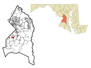
Marlow Heights is an unincorporated area and census-designated place (CDP) in Prince George's County, Maryland, United States. The population was 6,169 at the 2020 census. The Marlow Heights Shopping Center first opened in 1957, adjacent to the large community of Hillcrest Heights. It was joined ten years later, in 1967, by the two-level Iverson Mall, the Washington metropolitan area's first enclosed mall.

<span class="mw-page-title-main">Rosaryville, Maryland</span> Census-designated place in Maryland, US

Rosaryville is an unincorporated area and census-designated place (CDP) in Prince George's County, Maryland, United States, located south of Cinton and Upper Marlboro beside U.S. Route 301. Per the 2020 census, the population was 11,548. including housing developments and rural open space. It was named for a local Roman Catholic church. Close to Rosaryville are the Marlton housing development, Maryland Veterans Cemetery, the Southern Maryland Farmers Market, and Rosaryville State Park.

<span class="mw-page-title-main">Temple Hills, Maryland</span> Census-designated place in Maryland, United States

Temple Hills is an unincorporated area and census-designated place (CDP) in Prince George's County, Maryland, United States. Temple Hills borders the communities of Hillcrest Heights, Marlow Heights, Camp Springs and Oxon Hill. Per the 2020 census, the population was 8,350.

<span class="mw-page-title-main">Walker Mill, Maryland</span> Census-designated place in Maryland

Walker Mill is an unincorporated area and census-designated place (CDP) in Prince George's County, Maryland, United States. Per the 2020 census, the population was 12,187.

<span class="mw-page-title-main">Calverton, Maryland</span> Census-designated place in Maryland, United States

Calverton is an unincorporated area and census-designated place located on the boundary between Montgomery and Prince George's counties, Maryland, in the United States. At the 2020 census, it had a population of 17,316.

<span class="mw-page-title-main">Hillandale, Maryland</span> Census-designated place in Maryland, United States

Hillandale is an unincorporated area and census-designated place located in Montgomery and Prince George's counties, Maryland, United States. As of the 2020 census, it had a population of 5,774. Hillandale is contained between the Prince George's / Montgomery County line to the east, the Anacostia River to the west, McCeney Avenue to the north, and D.C.'s Capital Beltway to the south. It borders the communities of Adelphi, Avenel, White Oak and Beltsville.

Seabrook is an unincorporated community and census-designated place (CDP) in Prince George's County, Maryland, United States, located approximately 12 miles (19 km) east of Washington, D.C. Per the 2020 census, the population was 19,627. Prior to 2010, Seabrook was part of the Lanham-Seabrook census-designated place.

Peppermill Village is an unincorporated community near Maryland Route 214 in Prince George's County, Maryland, United States. Per the 2020 census, the population was 5,264. FedExField, Metrorail's Blue Line, and Hampton Mall shopping center are all located nearby. Because it is not formally incorporated, it has no official boundaries, but the United States Census Bureau has defined a census-designated place (CDP) consisting of Peppermill Village and the adjacent community of Carmody Hills, for statistical purposes.

<span class="mw-page-title-main">Oxon Hill, Maryland</span> Census-designated place in Maryland, United States

Oxon Hill is an unincorporated area and census-designated place (CDP) in southern Prince George's County, Maryland, United States. Oxon Hill is a suburb of Washington, located southeast of the downtown district and east of Alexandria, Virginia. Since 2008, it contains the 300-acre (120 ha) National Harbor development on the shore of the Potomac River.

Glassmanor is an unincorporated community and census-designated place in Prince George's County, Maryland, United States. As of the 2020 census, it had a population of 18,430. In the 1990 and 2000 censuses, the United States Census Bureau had placed Glassmanor and the adjacent community of Oxon Hill in the "Oxon Hill-Glassmanor" census-designated place for statistical purposes. Glassmanor was last delineated separately in 1980, when the CDP recorded a population of 7,751.

<span class="mw-page-title-main">Suitland, Maryland</span> Census-designated place in Maryland, United States

Suitland is a suburb of Prince George's County, Maryland, approximately one mile (1.6 km) southeast of Washington, D.C. Suitland is a census designated place (CDP), as of the 2020 census, its population was 25,839. Prior to 2010, it was part of the Suitland-Silver Hill census-designated place.

Marlboro Village is an unincorporated community and census-designated place (CDP) in Prince George's County, Maryland, United States. Per the 2020 census, the population was 9,221.

Queensland is a census-designated place south of Upper Marlboro in Prince George's County, Maryland, United States. The population of the CDP was 2,191 at the 2020 census. It was formerly known as Queenland until 2014 when its name was changed to Queensland and a small portion of its geography was transferred to Upper Marlboro.

References

  1. "2020 U.S. Gazetteer Files". United States Census Bureau. Retrieved April 26, 2022.
  2. U.S. Geological Survey Geographic Names Information System: Camp Springs, Maryland
  3. "Camp Springs CDP, Maryland". United States Census Bureau . Retrieved March 13, 2022.
  4. 1 2 "Community Summary Sheet, Prince George's County" (PDF). Camp Springs, Maryland. Maryland State Highway Administration, 1999. May 10, 2008.
  5. The Neighborhoods of Prince George's County. Upper Marlboro: Community Renewal Program, 1974.
  6. "3 Alarm Blaze-Pyles Lumber Company". chvfd.org. Retrieved February 28, 2018.
  7. "US Gazetteer files: 2010, 2000, and 1990". United States Census Bureau. February 12, 2011. Retrieved April 23, 2011.
  8. "Demographic Identifiers: 2010 Demographic Profile Data (G001): Camp Springs CDP, Maryland". United States Census Bureau . Retrieved December 16, 2011.
  9. "Camp Springs Senior Activity Center". Archived from the original on September 25, 2010. Retrieved August 27, 2010.
  10. "Camp Springs, Maryland Köppen Climate Classification (Weatherbase)". Weatherbase. Retrieved February 28, 2018.
  11. "Decennial Census of Population and Housing by Decades". US Census Bureau.
  12. 1 2 "P2 Hispanic or Latino, and Not Hispanic or Latino by Race – 2010: DEC Redistricting Data (PL 94-171) - Camp Springs CDP, Maryland". United States Census Bureau .
  13. 1 2 "P2 Hispanic or Latino, and Not Hispanic or Latino by Race – 2020: DEC Redistricting Data (PL 94-171) - Camp Springs CDP, Maryland". United States Census Bureau .
  14. "U.S. Census website". United States Census Bureau . Retrieved January 31, 2008.
  15. "District 4 Station - Oxon Hill." Prince George's County Police Department. Retrieved on September 9, 2018. " 5135 Indian Head Highway Oxon Hill, MD 20745". Beat map. See 2010 U.S. Census Map of Glassmanor CDP.
  16. 1 2 3 "2010 CENSUS - CENSUS BLOCK MAP (INDEX): Camp Springs CDP, MD." U.S. Census Bureau. Retrieved on August 29, 2018. p. 1 and 2.
  17. "NEIGHBORHOOD ELEMENTARY SCHOOLS AND BOUNDARIES SCHOOL YEAR 2018-2019." Prince George's County Public Schools. Retrieved on August 29, 2018.
  18. "NEIGHBORHOOD MIDDLE SCHOOLS AND BOUNDARIES SCHOOL YEAR 2018-2019." Prince George's County Public Schools. Retrieved on August 29, 2018.
  19. "NEIGHBORHOOD HIGH SCHOOLS AND BOUNDARIES SCHOOL YEAR 2018-2019." Prince George's County Public Schools. Retrieved on August 29, 2018.
  20. "Middleton Valley Elementary School (Closed 2010) Profile (2018-19) | Temple Hills, MD". Public School Review. Retrieved August 26, 2019.
  21. Home. Skyline Elementary School. Retrieved on April 29, 2018. "6311 Randolph Road Suitland, MD 20744"
  22. Evans, Brooke (April 12, 2016). "Prince George's County Parents Appeal Decision to Close Schools". NBC 4 Washington. Retrieved August 29, 2018.
  23. Uliano, Dick (February 23, 2016). "Prince George's Co. schools could close doors under funding pinch". WTOP . Retrieved August 29, 2018.