Palmer Park, Maryland

Last updated

Palmer Park, Maryland
USA Maryland location map.svg
Red pog.svg
Palmer Park
Location within the state of Maryland
Usa edcp location map.svg
Red pog.svg
Palmer Park
Palmer Park (the United States)
Coordinates: 38°55′15″N76°52′18″W / 38.92083°N 76.87167°W / 38.92083; -76.87167
CountryFlag of the United States.svg  United States
State Flag of Maryland.svg  Maryland
County Flag of Prince George's County, Maryland (1963-present).svg Prince George's
Time zone UTC−5 (Eastern (EST))
  Summer (DST) UTC−4 (EDT)
GNIS feature ID597865

Palmer Park is an unincorporated community in Prince George's County, Maryland, United States, within the census-designated place of Landover. [1] It was previously a CDP of its own until 2000.

Contents

History

Palmer Park was adjacent to Wilson Dairy Farm. FedEx Field is now located on what used to be the farm from the 1750s to the 1990s. Palmer Park was an enclave of post-World War II triplex housing units designed as starter homes for young low-income families (less than $13K). It is surrounded by three parks.

It was predominantly white (99%) until segregation ended and blockbusting began in the 1960s. Within approximately two years, the community went from predominantly white to predominantly black. A lawsuit was filed for blockbusting and was won by the former residents in the late 1960s. Despite its colorful history, it has been home to successful politicians, athletes, and artists. [2]

The former CDPs of Landover, Dodge Park, Kentland, and Palmer Park, defined as such by the U.S. Census Bureau in the 1990 U.S. Census, [3] were consolidated into the Greater Landover CDP as of the 2000 U.S. Census. [4] This amalgamated area was renamed the Landover CDP as of the 2010 U.S. Census. [5]

Government and infrastructure

Palmer Park is home to the Palmer Park Senior Housing.[ citation needed ]

It is also home to Prince George's County Police Headquarters, which also serves as the District III station. [3] [6] [7]

It is located right across from Prince George's Sports and Learning Complex and FedExField, home of the three-time Super Bowl champion Washington Commanders.

Right at the heart of Palmer Park are small stores that include a mini mart, gas station, hair salon, Boys and Girls Club offices, and a doctor's office. In addition to the stores, Palmer Park Community Center is located right across the street.

Education

Prince George's County Public Schools operates area public schools. [3]

William Paca and Highland Park elementary schools serve sections of the former 1990 CDP. [8] Kenmoor and G. James Gholson middle schools serve sections of the former 1990 CDP. [9] The neighborhood high schools serving sections of the CDP are DuVal, Flowers, and Fairmont Heights. [10]

Transportation

Palmer Park is served by the Washington Metro Landover station (orange line), which is northwest of Palmer Park across Landover Road.

Notable people

Comedian Martin Lawrence once lived in Palmer Park while attending Eleanor Roosevelt High School in nearby Greenbelt. Palmer Park was the hometown of 1976 Olympics gold medal winning boxer Sugar Ray Leonard. Rapper Rico Nasty lived in Palmer Park as a child.

Parks and recreation

The Prince George's County Department of Parks and Recreation operates the Palmer Park Community Center. [11]

The community is home to the Palmer Park Tigers, and holds an annual Palmer Park day in order to promote community spirit.

Historical population
CensusPop.Note
1970 8,172
1980 7,986−2.3%
1990 7,019−12.1%
source: [12] [13]

See also

Related Research Articles

<span class="mw-page-title-main">Brandywine, Maryland</span> Census-designated place in Maryland

Brandywine is the name of an unincorporated area in Prince George's County, Maryland, United States, that refers both to a census-designated place (CDP) and a zip code area which is much larger (20613), whose areas overlap. The population of Brandywine at the 2020 U.S. Census was 10,550 for the CDP, and the population of ZIP code 20613 was 11,860 in 2010.

<span class="mw-page-title-main">Cheverly, Maryland</span> Town in Prince Georges County, Maryland, US

Cheverly is a town in Prince George's County, Maryland, United States, located very close to Washington, D.C., though not bordering it directly. The town was founded in 1918 and incorporated in 1931. Per the 2020 census, the population was 6,170. Cheverly borders the communities of Tuxedo, Chapel Oaks, Landover, Landover Hills, Villa Heights, and Bladensburg.

<span class="mw-page-title-main">Chillum, Maryland</span> Census-designated place in Maryland

Chillum is an unincorporated area and census-designated place in Prince George's County, Maryland, United States, bordering Washington, D.C., and Montgomery County.

<span class="mw-page-title-main">Fairmount Heights, Maryland</span> Historic district in Maryland, United States

Fairmount Heights is a town in Prince George's County, Maryland, United States. Per the 2020 census, the population was 1,528. The town was formally incorporated in 1935, making the town the second oldest African-American-majority municipality in Prince George's County. The town is composed of six subdivisions: Fairmount Heights (1900), Waterford (1907), Mount Weissner (1909), North Fairmount Heights (1910), West Fairmount Heights (1911) and Sylvan Vista (1923).

<span class="mw-page-title-main">Forestville, Maryland</span> CDP in Maryland

Forestville is an unincorporated area and census-designated place (CDP) in Prince George's County, Maryland, United States. Per the 2020 census, the population was 12,831. The community is a mixture of garden apartments, single-family homes, and shopping centers built mostly from the 1930s through 1970s, adjacent to the communities of District Heights, Suitland, Morningside, Westphalia and Camp Springs.

<span class="mw-page-title-main">Glenarden, Maryland</span> City in Maryland

Glenarden is a city in Prince George's County, Maryland, United States. Per the 2020 census, the population was 6,402.

<span class="mw-page-title-main">Greater Landover, Maryland</span> Former census-designated place in Maryland

Greater Landover was a census-designated place (CDP) in Prince George's County, Maryland, United States, during the 2000 census. The population was 22,900 at that time. As of 2007, the rough estimate given by the census was at 22,665. For the 2010 U.S. Census, the area was designated the Landover CDP.

<span class="mw-page-title-main">Woodmore, Maryland</span> Census-designated place in Maryland

Woodmore is an unincorporated area and census-designated place in Prince George's County, Maryland, United States. Per the 2020 census, the population was 4,513. The CDP is located within the boundaries of Route 193 to the west, Church Road to the east, Route 214 to the south and Route 50 to the north. Woodmore Road runs east and west through the center. It contains a large gated community and country club, developments of Woodmore Meadows, and Woodmore South on the south side, as well as various other custom built homes and farmland.

Seabrook is an unincorporated community and census-designated place (CDP) in Prince George's County, Maryland, United States, located approximately 12 miles (19 km) east of Washington, D.C. Per the 2020 census, the population was 19,627. Prior to 2010, Seabrook was part of the Lanham-Seabrook census-designated place.

Landover is an unincorporated community and census-designated place in Prince George's County, Maryland, United States. As of the 2020 census, it had a population of 25,998.

Lanham is an unincorporated community and census-designated place in Prince George's County, Maryland. As of the 2020 United States Census it had a population of 11,282. The New Carrollton station as well as an Amtrak station are across the Capital Beltway in New Carrollton, Maryland. Doctors Community Hospital is located in Lanham.

<span class="mw-page-title-main">Suitland, Maryland</span> Census-designated place in Maryland, United States

Suitland is a suburb of Prince George's County, Maryland, approximately one mile (1.6 km) southeast of Washington, D.C. Rich in history and culture, Suitland offers plenty for residents and visitors to explore. Additionally, Suitland is a census designated place (CDP), as of the 2020 census, its population was 25,839. Prior to 2010, it was part of the Suitland-Silver Hill census-designated place.

<span class="mw-page-title-main">Kentland, Maryland</span> Unincorporated community in Maryland

Kentland is an unincorporated community and former census-designated place in Prince George's County, Maryland, United States, located within the Landover census area. Kentland is served by the Landover Metro Station, which is located just north of the community, across Landover Road.

<span class="mw-page-title-main">Aquasco, Maryland</span> Census-designated place in Maryland

Aquasco is an unincorporated area and census-designated place in southeastern Prince George's County, Maryland, United States, surrounding the town of Eagle Harbor and bordering Charles County. As of the 2020 census, the CDP had a population of 913. Aquasco was home to the Aquasco Speedway.

<span class="mw-page-title-main">Charles Herbert Flowers High School</span> Public high school in Springdale, Maryland, United States

Charles Herbert Flowers High School is a comprehensive science and technology magnet school located in unincorporated Prince George's County, Maryland, United States, adjacent to the Springdale census-designated place and with a Springdale postal address. It is part of the Prince George's County School System. Its principal is Dr. Gorman Brown.

<span class="mw-page-title-main">Fairmont Heights High School</span> Public comprehensive secondary school in Landover, Maryland , United States

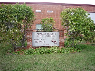
Fairmont Heights High School (est.1950) is an American public comprehensive secondary school located in Landover, Maryland, just outside Washington D.C. It is part of the Prince George's County Public Schools system. Two middle schools feed into Fairmont Heights. It is part of the School Board District 3.

<span class="mw-page-title-main">DuVal High School</span> Public high school in the United States

DuVal High School (DHS) is a comprehensive science and technology public magnet high school in the Seabrook census-designated place in unincorporated Prince George's County, Maryland, United States, with a Lanham postal address. Prior to 2010 the U.S. Census Bureau defined the area containing DuVal High as being within the Goddard CDP.

Queensland is a census-designated place south of Upper Marlboro in Prince George's County, Maryland, United States. The population of the CDP was 2,191 at the 2020 census. It was formerly known as Queenland until 2014 when its name was changed to Queensland and a small portion of its geography was transferred to Upper Marlboro.

Summerfield is a census-designated place near Landover in Prince George's County, Maryland. As of the 2020 census, the population was 14,758. It is a suburb of Washington, D.C.

Dodge Park is an unincorporated area and former census-designated place (CDP) in Prince George's County, Maryland, United States; it is currently within the Landover CDP.

References

  1. U.S. Geological Survey Geographic Names Information System: Palmer Park, Maryland
  2. "Landover, MD Household Income, Population & Demographics | Point2".
  3. 1 2 3 "1990 COUNTY BLOCK MAP" (index map) Prince George's County. U.S. Census Bureau. Retrieved on September 9, 2018. The CDPs of Landover, Dodge Park, Kentland, and Palmer Park are shown on pages 13, 14, 17, and 18.
  4. "CENSUS 2000 BLOCK MAP: GREATER LANDOVER CDP." U.S. Census Bureau. Retrieved on September 9, 2018.
  5. "2010 CENSUS - CENSUS BLOCK MAP: Landover CDP, MD." U.S. Census Bureau. Retrieved on September 1, 2018.
  6. "Winter/Spring PAL Basketball Clinic." Government of Prince George's County. Retrieved on September 20, 2018. "Location: Police Headquarters Address: 7600 Barlowe Road Landover, MD 20785 "
  7. "District 3 Station - Landover." Prince George's County Police Department. Retrieved on September 9, 2018. " 7600 Barlowe Road Landover, MD 20785 ". Beat map
  8. "NEIGHBORHOOD ELEMENTARY SCHOOLS AND BOUNDARIES SCHOOL YEAR 2018-2019." Prince George's County Public Schools. Retrieved on September 1, 2018.
  9. "NEIGHBORHOOD MIDDLE SCHOOLS AND BOUNDARIES SCHOOL YEAR 2018-2019." Prince George's County Public Schools. Retrieved on September 1, 2018.
  10. "NEIGHBORHOOD HIGH SCHOOLS AND BOUNDARIES SCHOOL YEAR 2018-2019." Prince George's County Public Schools. Retrieved on September 1, 2018.
  11. "Palmer Park Community Center." Prince George's County Department of Parks and Recreation. Retrieved on September 20, 2018. "Palmer Park Community Center 7720 Barlowe Road Landover, MD 20785"
  12. "Census of Population and Housing (1790–2000)". U.S. Census Bureau . Retrieved July 17, 2010.
  13. Not enumerated separately in 2000. Merged with Dodge Park, Landover and Kentland to form Greater Landover, renamed Landover for 2010 census.