Friendly, Maryland

Last updated

Friendly, Maryland
Prince George's County Maryland Incorporated and Unincorporated areas Friendly Highlighted.svg
Location of Friendly, Maryland
Coordinates: 38°45′0″N76°58′27″W / 38.75000°N 76.97417°W / 38.75000; -76.97417
CountryFlag of the United States.svg  United States
State Flag of Maryland.svg  Maryland
County Flag of Prince George's County, Maryland (1963-present).svg Prince George's
Area
[1]
  Total4.88 sq mi (12.64 km2)
  Land4.88 sq mi (12.63 km2)
  Water0.01 sq mi (0.01 km2)
Elevation
236 ft (72 m)
Population
 (2020)
  Total9,937
  Density2,037.94/sq mi (786.81/km2)
Time zone UTC−5 (Eastern (EST))
  Summer (DST) UTC−4 (EDT)
FIPS code 24-30575
GNIS feature ID0597435

Friendly is an unincorporated area and census-designated place (CDP) in Prince George's County, Maryland, United States, with an African-American majority population, located a few miles south of Washington, D.C. [2] The population was 9,937 at the 2020 census. [3]

Contents

Friendly had its own rural post office in the early 20th century, and is now under the mailing address Fort Washington. The name "Friendly" is most associated with Friendly High School, which serves most of the greater Fort Washington area. The Friendly area was largely rural until about 1960 and has steadily grown with single-family housing developments. At least five new residential neighborhoods are currently under construction in the area.[ citation needed ] Allentown Road connects Friendly with Andrews Air Force Base.

Geography

Friendly is located at 38°45′0″N76°58′27″W / 38.75000°N 76.97417°W / 38.75000; -76.97417 (38.750064, 76.974267). [4]

According to the United States Census Bureau, the CDP has a total area of 4.9 square miles (12.6 km2), all land. [5]

Demographics

Historical population
CensusPop.Note
2010 9,250
2020 9,9377.4%
U.S. Decennial Census [6]
2010 [7] 2020 [8]

2020 census

Friendly CDP, Maryland – Racial and ethnic composition
Note: the US Census treats Hispanic/Latino as an ethnic category. This table excludes Latinos from the racial categories and assigns them to a separate category. Hispanics/Latinos may be of any race.
Race / Ethnicity (NH = Non-Hispanic)Pop 2010 [7] Pop 2020 [8] % 2010% 2020
White alone (NH)5895386.37%5.41%
Black or African American alone (NH)7,2966,69778.88%67.39%
Native American or Alaska Native alone (NH)24110.26%0.11%
Asian alone (NH)4265124.61%5.15%
Pacific Islander alone (NH)450.04%0.05%
Some Other Race alone (NH)22990.24%1.00%
Mixed Race or Multi-Racial (NH)1863132.01%3.15%
Hispanic or Latino (any race)7031,7627.60%17.73%
Total9,2509,937100.00%100.00%

2000 Census

As of the census [9] of 2000, there were 10,938 people, 3,506 households, and 2,962 families residing in the CDP. The population density was 1,610.3 inhabitants per square mile (621.7/km2). There were 3,636 housing units at an average density of 535.3 per square mile (206.7/km2). The racial makeup of the CDP was 77.67% African American, 13.39% White, 0.36% Native American, 5.66% Asian, 0.07% Pacific Islander, 0.98% from other races, and 1.87% from two or more races. Hispanic or Latino of any race were 2.19% of the population.

There were 3,506 households, out of which 38.4% had children under the age of 18 living with them, 65.6% were married couples living together, 13.9% had a female householder with no husband present, and 15.5% were non-families. 12.2% of all households were made up of individuals, and 2.5% had someone living alone who was 65 years of age or older. The average household size was 3.12 and the average family size was 3.36.

In the CDP, the population was spread out, with 27.4% under the age of 18, 7.5% from 18 to 24, 27.8% from 25 to 44, 30.3% from 45 to 64, and 7.0% who were 65 years of age or older. The median age was 38 years. For every 100 females, there were 93.0 males. For every 100 females age 18 and over, there were 90.5 males.

The median income for a household in the CDP was $80,214, and the median income for a family was $82,827. Males had a median income of $43,281 versus $42,086 for females. The per capita income for the CDP was $28,545. About 0.2% of families and 0.4% of the population were below the poverty line, including 0.2% of those under age 18 and 0.5% of those age 65 or over. By the end of 2020, the CDP ranks # 8 among top 10 richest black communities in US, with an average family income of $82,827. [10]

Transportation

Potomac Airfield is in Friendly CDP, with a Fort Washington address. [11] [12]

Education

Friendly is served by the Prince George's County School District. [11]

Zoned elementary schools serving the CDP are Rose Valley Elementary School and Tayac Elementary School. [13] Isaac J. Gourdine Middle School and Friendly High School serve all of the current CDP. [14] [15]

Fort Washington Elementary School and Accokeek Middle School serve areas that were in the Friendly CDP (now in Fort Washington CDP) until 2010. [13] [14] [16]

Related Research Articles

<span class="mw-page-title-main">Brandywine, Maryland</span> Census-designated place in Maryland

Brandywine is the name of an unincorporated area in Prince George's County, Maryland, United States, that refers both to a census-designated place (CDP) and a zip code area which is much larger (20613), whose areas overlap. The population of Brandywine at the 2020 U.S. Census was 10,550 for the CDP, and the population of ZIP code 20613 was 11,860 in 2010.

<span class="mw-page-title-main">Camp Springs, Maryland</span> Census-designated place in Maryland

Camp Springs is an unincorporated area and census-designated place (CDP) in Prince George's County, Maryland, United States. The population was 22,734 at the 2020 census. Camp Springs is not an official post office designation; the area is divided among the surrounding mailing addresses of Temple Hills, Fort Washington, Clinton, and Suitland.

<span class="mw-page-title-main">Clinton, Maryland</span> Census-designated place in Maryland, United States

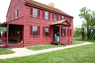
Clinton is an unincorporated census-designated place (CDP) in Prince George's County, Maryland, United States. Clinton was formerly known as Surrattsville until after the time of the Civil War. The population of Clinton was 38,760 at the 2020 census. Clinton is historically known for its role in the American Civil War concerning the Abraham Lincoln assassination. Clinton is adjacent to Camp Springs, Rosaryville, Melwood, and Andrews Air Force Base.

<span class="mw-page-title-main">Coral Hills, Maryland</span> Census-designated place in Maryland

Coral Hills is an unincorporated area and census-designated place (CDP) in Prince George's County, Maryland, United States. As of the 2020 census, the population was 9,997.

<span class="mw-page-title-main">Forestville, Maryland</span> CDP in Maryland

Forestville is an unincorporated area and census-designated place (CDP) in Prince George's County, Maryland, United States. Per the 2020 census, the population was 12,831. The community is a mixture of garden apartments, single-family homes, and shopping centers built mostly from the 1930s through 1970s, adjacent to the communities of District Heights, Suitland, Morningside, Westphalia and Camp Springs.

<span class="mw-page-title-main">Fort Washington, Maryland</span> Census-designated place in Maryland

Fort Washington is an unincorporated area and census-designated place in Prince George's County, Maryland, United States. It borders the Potomac River, situated 20 miles south of downtown Washington, D.C. As of the 2020 census, it had a population of 24,261. The Fort Washington community is located west of Maryland Route 210, with some additional area to the east of the highway.

<span class="mw-page-title-main">Glenarden, Maryland</span> City in Maryland, United States

Glenarden is a city in Prince George's County, Maryland, United States. Per the 2020 census, the population was 6,402.

<span class="mw-page-title-main">Kettering, Maryland</span> Census-designated place in Maryland, United States

Kettering is an unincorporated area and census-designated place in Prince George's County, Maryland, United States. At the 2020 United States Census, the population was 14,424,. Kettering is adjacent to Prince George's Community College, the upscale gated community of Woodmore, Six Flags America, Evangel Temple megachurch, and the community of Largo at the end of the Washington Metro Blue Line. Watkins Regional Park in Kettering offers a large playground, a colorful carousel, miniature golf, a miniature train ride, and various animals.

<span class="mw-page-title-main">Lake Arbor, Maryland</span> Census-designated place in Maryland, United States

Lake Arbor is an unincorporated area and census-designated place (CDP) in Prince George's County, Maryland, United States. The population was 14,541 at the 2020 census. It is one of the nation's most affluent African-American communities. The ZIP Codes encompassing the CDP area are 20721 and 20774.

<span class="mw-page-title-main">Largo, Maryland</span> Census-designated place in Maryland, United States

Largo, located within Greater Upper Marlboro, Maryland, is an unincorporated area and census-designated place in Prince George's County, Maryland, United States. The population was 11,605 at the 2020 census.

<span class="mw-page-title-main">Marlow Heights, Maryland</span> Census-designated place in Maryland, United States

Marlow Heights is an unincorporated area and census-designated place (CDP) in Prince George's County, Maryland, United States. The population was 6,169 at the 2020 census. The Marlow Heights Shopping Center first opened in 1957, adjacent to the large community of Hillcrest Heights. It was joined ten years later, in 1967, by the two-level Iverson Mall, the Washington metropolitan area's first enclosed mall.

<span class="mw-page-title-main">Marlton, Maryland</span> Census-designated place in Maryland

Marlton is an unincorporated area and census-designated place (CDP) in Prince George's County, Maryland, United States. The population was 9,802 at the 2020 census. The Marlton housing development, at first briefly called "Brandywine Country", grew up along U.S. Route 301 in the 1970s, and is part of the greater Upper Marlboro community. Originally made up of only single-family homes, more recently townhouses have been added.

<span class="mw-page-title-main">New Carrollton, Maryland</span> City in Maryland, United States

New Carrollton is a city located in central Prince George's County, Maryland, United States. As of the 2020 census, the population was 13,715. New Carrollton is located 10 miles (16 km) east of central Washington, D.C.

<span class="mw-page-title-main">Rosaryville, Maryland</span> Census-designated place in Maryland, US

Rosaryville is an unincorporated area and census-designated place (CDP) in Prince George's County, Maryland, United States, located south of Cinton and Upper Marlboro beside U.S. Route 301. Per the 2020 census, the population was 11,548. including housing developments and rural open space. It was named for a local Roman Catholic church. Close to Rosaryville are the Marlton housing development, Maryland Veterans Cemetery, the Southern Maryland Farmers Market, and Rosaryville State Park.

<span class="mw-page-title-main">South Laurel, Maryland</span> Census-designated place in Maryland

South Laurel is an unincorporated area and census-designated place (CDP) in Prince George's County, Maryland, United States. Per the 2020 census, the population was 29,602.

<span class="mw-page-title-main">Springdale, Maryland</span> Census-designated place in Maryland

Springdale is an unincorporated area and census-designated place (CDP) in Prince George's County, Maryland, United States. Per the 2020 census, the population was 5,301.

<span class="mw-page-title-main">Walker Mill, Maryland</span> Census-designated place in Maryland

Walker Mill is an unincorporated area and census-designated place (CDP) in Prince George's County, Maryland, United States. Per the 2020 census, the population was 12,187.

<span class="mw-page-title-main">West Laurel, Maryland</span> Census-designated place in Maryland

West Laurel is an unincorporated area and census-designated place (CDP) in Prince George's County, Maryland, United States. Per the 2020 census, the population was 4,428.

<span class="mw-page-title-main">Woodmore, Maryland</span> Census-designated place in Maryland

Woodmore is an unincorporated area and census-designated place in Prince George's County, Maryland, United States. Per the 2020 census, the population was 4,513. The CDP is located within the boundaries of Route 193 to the west, Church Road to the east, Route 214 to the south and Route 50 to the north. Woodmore Road runs east and west through the center. It contains a large gated community and country club, developments of Woodmore Meadows, and Woodmore South on the south side, as well as various other custom built homes and farmland.

<span class="mw-page-title-main">Calverton, Maryland</span> Census-designated place in Maryland, United States

Calverton is an unincorporated area and census-designated place located on the boundary between Montgomery and Prince George's counties, Maryland, in the United States. At the 2020 census, it had a population of 17,316.

References

  1. "2020 U.S. Gazetteer Files". United States Census Bureau. Retrieved April 26, 2022.
  2. U.S. Geological Survey Geographic Names Information System: Friendly, Maryland
  3. "Friendly CDP, Maryland". United States Census Bureau . Retrieved April 15, 2022.
  4. "US Gazetteer files: 2010, 2000, and 1990". United States Census Bureau. February 12, 2011. Retrieved April 23, 2011.
  5. "Geographic Identifiers: 2010 Demographic Profile Data (G001): Friendly CDP, Maryland". United States Census Bureau . Retrieved December 19, 2011.
  6. "Decennial Census of Population and Housing by Decades". US Census Bureau.
  7. 1 2 "P2 Hispanic or Latino, and Not Hispanic or Latino by Race – 2010: DEC Redistricting Data (PL 94-171) – Friendly CDP, Maryland". United States Census Bureau .
  8. 1 2 "P2 Hispanic or Latino, and Not Hispanic or Latino by Race – 2020: DEC Redistricting Data (PL 94-171) – Friendly CDP, Maryland". United States Census Bureau .
  9. "U.S. Census website". United States Census Bureau . Retrieved January 31, 2008.
  10. "10 Richest Black Communities in America" . Retrieved November 12, 2020.
  11. 1 2 "2010 CENSUS - CENSUS BLOCK MAP: Friendly CDP, MD." U.S. Census Bureau. Retrieved on September 2, 2018. Previously Friendly had a different shape: "CENSUS 2000 BLOCK MAP: FRIENDLY CDP." In the 1990 U.S. Census Bureau maps of Prince George's County, Maryland (index map) Friendly CDP is on pages 27, 28, and 33.
  12. "3rd%20class%20medical%20-%20final%20-%20PUBLIC.pdf." Potomac Airfield. Retrieved on September 2, 2018. "10300 Glen Way * Fort Washington * MD "
  13. 1 2 "NEIGHBORHOOD ELEMENTARY SCHOOLS AND BOUNDARIES SCHOOL YEAR 2018-2019." Prince George's County Public Schools. Retrieved on September 2, 2018.
  14. 1 2 "NEIGHBORHOOD MIDDLE SCHOOLS AND BOUNDARIES SCHOOL YEAR 2018-2019." Prince George's County Public Schools. Retrieved on September 2, 2018.
  15. "NEIGHBORHOOD HIGH SCHOOLS AND BOUNDARIES SCHOOL YEAR 2018-2019." Prince George's County Public Schools. Retrieved on September 2, 2018.
  16. "2010 CENSUS - CENSUS BLOCK MAP (INDEX): Fort Washington CDP, MD." U.S. Census Bureau. Retrieved on September 2, 2018. Note that the CDP previously covered a different set of territory: "CENSUS 2000 BLOCK MAP: FORT WASHINGTON CDP" with pages 1 and 2. In the 1990 U.S. Census Bureau maps of Prince George's County, Maryland (index map) Fort Washington CDP is on pages 26, 27, 32, and 33.