Coral Hills, Maryland

Last updated

Coral Hills, Maryland
Prince George's County Maryland Incorporated and Unincorporated areas Coral Hills Highlighted.svg
Location of Coral Hills, Maryland
Coordinates: 38°52′20″N76°55′41″W / 38.87222°N 76.92806°W / 38.87222; -76.92806
CountryFlag of the United States.svg  United States
State Flag of Maryland.svg  Maryland
County Flag of Prince George's County, Maryland (1963-present).svg Prince George's
Area
[1]
  Total1.64 sq mi (4.24 km2)
  Land1.63 sq mi (4.23 km2)
  Water0.00 sq mi (0.01 km2)
Elevation
292 ft (89 m)
Population
 (2020)
  Total9,997
  Density6,121.86/sq mi (2,363.92/km2)
Time zone UTC−5 (Eastern (EST))
  Summer (DST) UTC−4 (EDT)
FIPS code 24-19825
GNIS feature ID0597280

Coral Hills is an unincorporated area and census-designated place (CDP) in Prince George's County, Maryland, United States. [2] As of the 2020 census, the population was 9,997. [3]

Contents

Geography

Coral Hills is located at 38°52′20″N76°55′41″W / 38.87222°N 76.92806°W / 38.87222; -76.92806 (38.872312, 76.928010). [4]

According to the United States Census Bureau, the CDP has a total area of 1.5 square miles (3.9 km2), all land.

Demographics

Historical population
CensusPop.Note
2000 10,720
2010 9,895−7.7%
2020 9,9971.0%
U.S. Decennial Census [5]
2010 [6] 2020 [7]

2020 census

Coral Hills CDP, Maryland – Racial and ethnic composition
Note: the US Census treats Hispanic/Latino as an ethnic category. This table excludes Latinos from the racial categories and assigns them to a separate category. Hispanics/Latinos may be of any race.
Race / Ethnicity (NH = Non-Hispanic)Pop 2010 [6] Pop 2020 [7] % 2010% 2020
White alone (NH)2251402.27%1.40%
Black or African American alone (NH)8,8308,06289.24%80.64%
Native American or Alaska Native alone (NH)29230.29%0.23%
Asian alone (NH)27600.27%0.60%
Pacific Islander alone (NH)130.01%0.03%
Some Other Race alone (NH)13520.13%0.52%
Mixed Race or Multi-Racial (NH)1692531.71%2.53%
Hispanic or Latino (any race)6011,4046.07%14.04%
Total9,8959,997100.00%100.00%

2000 Census

As of the census [8] of 2000, there were 10,720 people, 3,833 households, and 2,694 families residing in the CDP. The population density was 7,046.6 inhabitants per square mile (2,720.7/km2). There were 4,177 housing units at an average density of 2,745.7 per square mile (1,060.1/km2). The racial makeup of the CDP was 3.59% White, 93.56% African American, 0.49% Native American, 0.51% Asian, 0.05% Pacific Islander, 0.45% from other races, and 1.34% from two or more races. Hispanic or Latino of any race were 1.25% of the population.

There were 3,833 households, out of which 35.2% had children under the age of 18 living with them, 31.3% were married couples living together, 30.9% had a female householder with no husband present, and 29.7% were non-families. 23.9% of all households were made up of individuals, and 3.3% had someone living alone who was 65 years of age or older. The average household size was 2.80 and the average family size was 3.31.

In the CDP, the population was spread out, with 30.7% under the age of 18, 9.8% from 18 to 24, 31.1% from 25 to 44, 21.9% from 45 to 64, and 6.5% who were 65 years of age or older. The median age was 32 years. For every 100 females, there were 88.2 males. For every 100 females age 18 and over, there were 84.0 males.

The median income for a household in the CDP was $41,122, and the median income for a family was $45,288. Males had a median income of $30,799 versus $30,466 for females. The per capita income for the CDP was $17,876. About 9.2% of families and 12.1% of the population were below the poverty line, including 13.3% of those under age 18 and 11.8% of those age 65 or over.

Education

Coral Hills is a part of the Prince George's County Public Schools system. [9]

Zoned elementary schools for the CDP are Bradbury Heights, Doswell Brooks, Concord, and William Hall. [10] Zoned middle schools for the CDP are Drew-Freeman, William Hall, and Walker Mill. [11] All residents are zoned to Suitland High School. [12] William Hall was previously an elementary school but was scheduled to convert into being a K-8 in 2009. [13]

John Edgar Howard Elementary was previously in Coral Hills CDP. [14] It was scheduled to close in 2009. [15] The facility is now used as the John E. Howard Community Center. [16]

Parks and recreation

The Prince George's County Department of Parks and Recreation operates the John E. Howard Community Center, [16] the former John E. Howard Elementary School. [14] It includes an athletic field, a game room, a gymnasium, a playground, and a tennis court. It also has a kitchen, a multipurpose area, and a picnic facility with tables. [16]

Related Research Articles

<span class="mw-page-title-main">Camp Springs, Maryland</span> Census-designated place in Maryland

Camp Springs is an unincorporated area and census-designated place (CDP) in Prince George's County, Maryland, United States. The population was 22,734 at the 2020 census. Camp Springs is not an official post office designation; the area is divided among the surrounding mailing addresses of Temple Hills, Fort Washington, Clinton, and Suitland.

<span class="mw-page-title-main">Capitol Heights, Maryland</span> Town in Maryland

Capitol Heights is a town in Prince George's County, Maryland, United States, located on the border of both the Northeast & Southeast quadrants of Washington. Per the 2020 census, the population was 4,050. The town of Capitol Heights is officially bounded between Southern Avenue NE/SE to the north, Yost Place, and Eastern Avenue NE to the east, the Watts Branch Stream, Brooke Road, and Capitol Heights Boulevard to the south, and Marlboro Pike to the west. The zip code of Capitol Heights is 20743.

<span class="mw-page-title-main">Chillum, Maryland</span> Census-designated place in Maryland

Chillum is an unincorporated area and census-designated place in Prince George's County, Maryland, United States, bordering Washington, D.C., and Montgomery County.

<span class="mw-page-title-main">East Riverdale, Maryland</span> Census-designated place in Maryland, United States

East Riverdale is an unincorporated area and census-designated place (CDP) in Prince George's County, Maryland, United States. The population was 18,459 at the 2020 census.

<span class="mw-page-title-main">Fort Washington, Maryland</span> Census-designated place in Maryland

Fort Washington is an unincorporated area and census-designated place in Prince George's County, Maryland, United States. It borders the Potomac River, situated 20 miles south of downtown Washington, D.C. As of the 2020 census, it had a population of 24,261. The Fort Washington community is located west of Maryland Route 210, with some additional area to the east of the highway.

<span class="mw-page-title-main">Friendly, Maryland</span> Census-designated place in Maryland

Friendly is an unincorporated area and census-designated place (CDP) in Prince George's County, Maryland, United States, with an African-American majority population, located a few miles south of Washington, D.C. The population was 9,937 at the 2020 census.

<span class="mw-page-title-main">Hillcrest Heights, Maryland</span> CDP in Maryland

Hillcrest Heights is an unincorporated area and census-designated place (CDP) in Prince George's County, Maryland, United States. The population was 15,793 at the 2020 census. For mailing address purposes, it is part of the smaller community of Temple Hills and is also near Suitland.

<span class="mw-page-title-main">Kettering, Maryland</span> Census-designated place in Maryland, United States

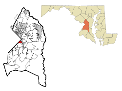
Kettering is an unincorporated area and census-designated place in Prince George's County, Maryland, United States. At the 2020 United States Census, the population was 14,424,. Kettering is adjacent to Prince George's Community College, the upscale gated community of Woodmore, Six Flags America, Evangel Temple megachurch, and the community of Largo at the end of the Washington Metro Blue Line. Watkins Regional Park in Kettering offers a large playground, a colorful carousel, miniature golf, a miniature train ride, and various animals.

<span class="mw-page-title-main">Marlow Heights, Maryland</span> Census-designated place in Maryland, United States

Marlow Heights is an unincorporated area and census-designated place (CDP) in Prince George's County, Maryland, United States. The population was 6,169 at the 2020 census. The Marlow Heights Shopping Center first opened in 1957, adjacent to the large community of Hillcrest Heights. It was joined ten years later, in 1967, by the two-level Iverson Mall, the Washington metropolitan area's first enclosed mall.

<span class="mw-page-title-main">Marlton, Maryland</span> Census-designated place in Maryland

Marlton is an unincorporated area and census-designated place (CDP) in Prince George's County, Maryland, United States. The population was 9,802 at the 2020 census. The Marlton housing development, at first briefly called "Brandywine Country", grew up along U.S. Route 301 in the 1970s, and is part of the greater Upper Marlboro community. Originally made up of only single-family homes, more recently townhouses have been added.

<span class="mw-page-title-main">Mitchellville, Maryland</span> Census-designated place in Maryland

Mitchellville is an upper-class majority African-American unincorporated area and census-designated place (CDP) in Prince George's County, Maryland, United States. Per the 2020 census, the population was 11,136.

<span class="mw-page-title-main">Morningside, Maryland</span> Town in Maryland

Morningside is an incorporated town in Prince George's County, Maryland, United States. Per the 2020 census, the population was 1,240. The town developed with the establishment of nearby Andrews Air Force Base and the federal Census Bureau. The government of the town is led by a mayor and town council. Morningside Elementary School and Benjamin Foulois Junior High School/Elementary/Creative and Performing Arts Academy (current) as well as Michael J Polley Neighborhood Park are located within the town limits. Morningside has one of the largest VFW posts (chapters) in the entire country. Morningside is also the city of license of one of Washington's most prominent radio stations, from the 1960s to the present, WJFK and WPGC-FM. Additionally, Morningside is home to one of the busiest volunteer fire departments in Prince George's County, Morningside VFD Station 827. In 2015, station 827 ran over 8,000 calls for service with 150 working fires in Morningside and the adjacent communities, and has garnered national recognition for their service to the community.

<span class="mw-page-title-main">Rosaryville, Maryland</span> Census-designated place in Maryland, US

Rosaryville is an unincorporated area and census-designated place (CDP) in Prince George's County, Maryland, United States, located south of Cinton and Upper Marlboro beside U.S. Route 301. Per the 2020 census, the population was 11,548. including housing developments and rural open space. It was named for a local Roman Catholic church. Close to Rosaryville are the Marlton housing development, Maryland Veterans Cemetery, the Southern Maryland Farmers Market, and Rosaryville State Park.

<span class="mw-page-title-main">Springdale, Maryland</span> Census-designated place in Maryland

Springdale is an unincorporated area and census-designated place (CDP) in Prince George's County, Maryland, United States. Per the 2020 census, the population was 5,301.

<span class="mw-page-title-main">Temple Hills, Maryland</span> Census-designated place in Maryland, United States

Temple Hills is an unincorporated area and census-designated place (CDP) in Prince George's County, Maryland, United States. Temple Hills borders the communities of Hillcrest Heights, Marlow Heights, Camp Springs and Oxon Hill. Per the 2020 census, the population was 8,350.

<span class="mw-page-title-main">Walker Mill, Maryland</span> Census-designated place in Maryland

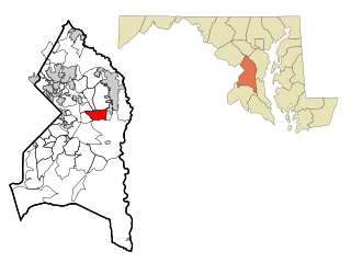
Walker Mill is an unincorporated area and census-designated place (CDP) in Prince George's County, Maryland, United States. Per the 2020 census, the population was 12,187.

<span class="mw-page-title-main">West Laurel, Maryland</span> Census-designated place in Maryland

West Laurel is an unincorporated area and census-designated place (CDP) in Prince George's County, Maryland, United States. Per the 2020 census, the population was 4,428.

<span class="mw-page-title-main">Woodlawn, Prince George's County, Maryland</span> Census-designated place in Maryland

Woodlawn is an unincorporated area and census-designated place (CDP) in Prince George's County, Maryland, United States. As of the 2020 census it had a population of 7,541.

<span class="mw-page-title-main">Calverton, Maryland</span> Census-designated place in Maryland, United States

Calverton is an unincorporated area and census-designated place located on the boundary between Montgomery and Prince George's counties, Maryland, in the United States. At the 2020 census, it had a population of 17,316.

<span class="mw-page-title-main">Hillandale, Maryland</span> Census-designated place in Maryland, United States

Hillandale is an unincorporated area and census-designated place located in Montgomery and Prince George's counties, Maryland, United States. As of the 2020 census, it had a population of 5,774. Hillandale is contained between the Prince George's / Montgomery County line to the east, the Anacostia River to the west, McCeney Avenue to the north, and D.C.'s Capital Beltway to the south. It borders the communities of Adelphi, Avenel, White Oak and Beltsville.

References

  1. "2020 U.S. Gazetteer Files". United States Census Bureau. Retrieved April 26, 2022.
  2. U.S. Geological Survey Geographic Names Information System: Coral Hills, Maryland
  3. "Coral Hills CDP, Maryland". United States Census Bureau . Retrieved March 13, 2022.
  4. "US Gazetteer files: 2010, 2000, and 1990". United States Census Bureau. February 12, 2011. Retrieved April 23, 2011.
  5. "Decennial Census of Population and Housing by Decades". US Census Bureau.
  6. 1 2 "P2 Hispanic or Latino, and Not Hispanic or Latino by Race – 2010: DEC Redistricting Data (PL 94-171) - Coral Hills CDP, Maryland". United States Census Bureau .
  7. 1 2 "P2 Hispanic or Latino, and Not Hispanic or Latino by Race – 2020: DEC Redistricting Data (PL 94-171) - Coral Hills CDP, Maryland". United States Census Bureau .
  8. "U.S. Census website". United States Census Bureau . Retrieved January 31, 2008.
  9. "2010 CENSUS - CENSUS BLOCK MAP: Coral Hills CDP, MD." U.S. Census Bureau. Retrieved on August 31, 2018.
  10. "NEIGHBORHOOD ELEMENTARY SCHOOLS AND BOUNDARIES SCHOOL YEAR 2018-2019." Prince George's County Public Schools. Retrieved on August 31, 2018. The Concord zone is highlighted at the "Boundary" tab at Schooldigger.
  11. "NEIGHBORHOOD MIDDLE SCHOOLS AND BOUNDARIES SCHOOL YEAR 2018-2019." Prince George's County Public Schools. Retrieved on August 31, 2018.
  12. "NEIGHBORHOOD HIGH SCHOOLS AND BOUNDARIES SCHOOL YEAR 2018-2019." Prince George's County Public Schools. Retrieved on August 31, 2018.
  13. Preliminary Subregion 4 Master Plan and Proposed Sectional Map Amendment. Maryland-National Capital Park and Planning Commission. Chapter 9, Public Facilities. p. 268 (PDF p. 10/28). Retrieved on September 7, 2018.
  14. 1 2 Home. John Edgar Howard Elementary School. February 19, 1999. Retrieved on September 7, 2018. "John Edgar Howard Elmentary[ sic ] School 4400 Shell Street Capitol Heights, MD 20743"
  15. Preliminary Subregion 4 Master Plan and Proposed Sectional Map Amendment. Maryland-National Capital Park and Planning Commission. Chapter 9, Public Facilities. p. 261 (PDF p. 3/28). Retrieved on September 7, 2018.
  16. 1 2 3 "John E Howard Community Center". Prince George's County Department of Parks and Recreation. Retrieved September 7, 2018. John E Howard Community Center 4400 Shell Street Capitol Heights, MD 20743