Walker Mill, Maryland

Last updated

Walker Mill, Maryland
Prince George's County Maryland Incorporated and Unincorporated areas Walker Mill Highlighted.svg
Location of Walker Mill, Maryland
Coordinates: 38°52′15″N76°53′29″W / 38.87083°N 76.89139°W / 38.87083; -76.89139
CountryFlag of the United States.svg  United States
State Flag of Maryland.svg  Maryland
County Flag of Prince George's County, Maryland (1963-present).svg Prince George's
Area
[1]
  Total3.02 sq mi (7.81 km2)
  Land3.02 sq mi (7.81 km2)
  Water0.00 sq mi (0.00 km2)
Elevation
203 ft (62 m)
Population
 (2020)
  Total12,187
  Density4,039.44/sq mi (1,559.89/km2)
Time zone UTC−5 (Eastern (EST))
  Summer (DST) UTC−4 (EDT)
FIPS code 24-81250
GNIS feature ID1867304

Walker Mill is an unincorporated area and census-designated place (CDP) in Prince George's County, Maryland, United States. [2] Per the 2020 census, the population was 12,187. [3]

Contents

Geography

Walker Mill is located at 38°52′15″N76°53′29″W / 38.870962°N 76.891403°W / 38.870962; -76.891403 . [4]

According to the United States Census Bureau, the CDP has a total area of 3.2 square miles (8.3 km2), all land.

Demographics

Historical population
CensusPop.Note
1970 6,322
1980 10,65168.5%
1990 10,9202.5%
2000 11,1041.7%
2010 11,3021.8%
2020 12,1877.8%
U.S. Decennial Census [5]
2010 [6] 2020 [7]

2020 census

Walker Mill CDP, Maryland – Racial and ethnic composition
Note: the US Census treats Hispanic/Latino as an ethnic category. This table excludes Latinos from the racial categories and assigns them to a separate category. Hispanics/Latinos may be of any race.
Race / Ethnicity (NH = Non-Hispanic)Pop 2010 [6] Pop 2020 [7] % 2010% 2020
White alone (NH)1292371.14%1.94%
Black or African American alone (NH)10,62610,73794.02%88.10%
Native American or Alaska Native alone (NH)46350.41%0.29%
Asian alone (NH)42570.37%0.47%
Pacific Islander alone (NH)260.02%0.05%
Some Other Race alone (NH)5460.04%0.38%
Mixed Race or Multi-Racial (NH)1683261.49%2.67%
Hispanic or Latino (any race)2847432.51%6.10%
Total11,30212,187100.00%100.00%

2000 Census

As of the census [8] of 2000, there were 11,104 people, 3,976 households, and 2,985 families residing in the CDP. The population density was 3,523.2 inhabitants per square mile (1,360.3/km2). There were 4,219 housing units at an average density of 1,338.7 per square mile (516.9/km2). The racial makeup of the CDP was 2.47% White, 94.99% African American, 0.37% Native American, 0.26% Asian, 0.01% Pacific Islander, 0.23% from other races, and 1.68% from two or more races. Hispanic or Latino of any race were 0.90% of the population.

There were 3,976 households, out of which 37.9% had children under the age of 18 living with them, 34.4% were married couples living together, 34.7% had a female householder with no husband present, and 24.9% were non-families. 20.7% of all households were made up of individuals, and 3.4% had someone living alone who was 65 years of age or older. The average household size was 2.78 and the average family size was 3.18.

In the CDP, the population was spread out, with 30.9% under the age of 18, 9.0% from 18 to 24, 29.6% from 25 to 44, 23.2% from 45 to 64, and 7.3% who were 65 years of age or older. The median age was 32 years. For every 100 females, there were 80.3 males. For every 100 females aged 18 and over, there were 70.5 males.

The median income for a household in the CDP was $49,276, and the median income for a family was $51,052. Males had a median income of $35,473 versus $31,281 for females. The per capita income for the CDP was $19,340. About 8.8% of families and 11.5% of the population were below the poverty line, including 16.7% of those under age 18 and 8.3% of those age 65 or over.

Education

Central High School Central High School .jpg
Central High School

Walker Mill is a part of the Prince George's County Public Schools system. [9]

Zoned elementary schools for the CDP are John Bayne, Doswell Brooks, Concord, and District Heights. [10] Walker Mill Middle School serves most of Walker Mill CDP while Drew-Freeman Middle serves a section. [11] Much of the CDP is zoned to Central High School while a portion is zoned to Suitland High School. [12]

Thomas Claggett Elementary School was previously in Walker Mill CDP. [13] Its official capacity was 464. [14] In 2005 it had 236 students, filling 49% of the official capacity; this was the lowest percentage of any PGCPS school. [15] At one point the capacity percentage was 38%. [16] In 2010 it had 290 students, but after that year the student count declined: it had 216, [15] and later 223 in the 2013–2014 school year, [14] and the projected 2014-2015 enrollment was 187. [15] In addition, in state tests circa 2014, about 56% of the students were proficient in reading while 36.7% were proficient in mathematics. [14] In May 2014 PGCPS applied for a grant from the state of Maryland that would permit it to close Claggett. [15]

Related Research Articles

<span class="mw-page-title-main">Adelphi, Maryland</span> Census-designated place in Maryland

Adelphi is an unincorporated area and census-designated place in Prince George's County, Maryland, United States. Per the 2020 Census, the population was 16,823. Adelphi includes the following subdivisions; Adelphi, Adelphi Park, Adelphi Hills, Adelphi Terrace, Adelphi Village, Buck Lodge, Chatham, Cool Spring Terrace, Hillandale Forest, Holly Hill Manor, Knollwood, Lewisdale, and White Oak Manor.

<span class="mw-page-title-main">Brandywine, Maryland</span> Census-designated place in Maryland

Brandywine is the name of an unincorporated area in Prince George's County, Maryland, United States, that refers both to a census-designated place (CDP) and a zip code area which is much larger (20613), whose areas overlap. The population of Brandywine at the 2020 U.S. Census was 10,550 for the CDP, and the population of ZIP code 20613 was 11,860 in 2010.

<span class="mw-page-title-main">Coral Hills, Maryland</span> Census-designated place in Maryland

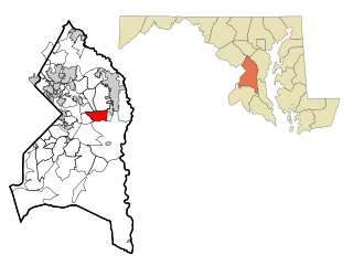
Coral Hills is an unincorporated area and census-designated place (CDP) in Prince George's County, Maryland, United States. As of the 2020 census, the population was 9,997.

<span class="mw-page-title-main">District Heights, Maryland</span> City in Maryland

District Heights is an incorporated municipality in Prince George's County, Maryland, United States, located near Maryland Route 4. Per the 2020 census, the population was 5,959. For more information, see the separate articles on Forestville and Suitland.

<span class="mw-page-title-main">East Riverdale, Maryland</span> Census-designated place in Maryland, United States

East Riverdale is an unincorporated area and census-designated place (CDP) in Prince George's County, Maryland, United States. The population was 18,459 at the 2020 census.

<span class="mw-page-title-main">Forestville, Maryland</span> CDP in Maryland

Forestville is an unincorporated area and census-designated place (CDP) in Prince George's County, Maryland, United States. Per the 2020 census, the population was 12,831. The community is a mixture of garden apartments, single-family homes, and shopping centers built mostly from the 1930s through 1970s, adjacent to the communities of District Heights, Suitland, Morningside, Westphalia and Camp Springs.

<span class="mw-page-title-main">Friendly, Maryland</span> Census-designated place in Maryland

Friendly is an unincorporated area and census-designated place (CDP) in Prince George's County, Maryland, United States, with an African-American majority population, located a few miles south of Washington, D.C. The population was 9,937 at the 2020 census.

<span class="mw-page-title-main">Glenn Dale, Maryland</span> CDP in Maryland

Glenn Dale is an unincorporated area and census-designated place (CDP) in Prince George's County, Maryland, United States. The population was 14,698 at the 2020 census. Glenn Dale is home to the Glenn Dale Hospital, an abandoned sanatorium, and the USDA Plant Introduction Station.

<span class="mw-page-title-main">Kettering, Maryland</span> Census-designated place in Maryland, United States

Kettering is an unincorporated area and census-designated place in Prince George's County, Maryland, United States. At the 2020 United States Census, the population was 14,424,. Kettering is adjacent to Prince George's Community College, the upscale gated community of Woodmore, Six Flags America, Evangel Temple megachurch, and the community of Largo at the end of the Washington Metro Blue Line. Watkins Regional Park in Kettering offers a large playground, a colorful carousel, miniature golf, a miniature train ride, and various animals.

<span class="mw-page-title-main">Marlow Heights, Maryland</span> Census-designated place in Maryland, United States

Marlow Heights is an unincorporated area and census-designated place (CDP) in Prince George's County, Maryland, United States. The population was 6,169 at the 2020 census. The Marlow Heights Shopping Center first opened in 1957, adjacent to the large community of Hillcrest Heights. It was joined ten years later, in 1967, by the two-level Iverson Mall, the Washington metropolitan area's first enclosed mall.

<span class="mw-page-title-main">Marlton, Maryland</span> Census-designated place in Maryland

Marlton is an unincorporated area and census-designated place (CDP) in Prince George's County, Maryland, United States. The population was 9,802 at the 2020 census. The Marlton housing development, at first briefly called "Brandywine Country", grew up along U.S. Route 301 in the 1970s, and is part of the greater Upper Marlboro community. Originally made up of only single-family homes, more recently townhouses have been added.

<span class="mw-page-title-main">Mitchellville, Maryland</span> Census-designated place in Maryland

Mitchellville is an upper-class majority African-American unincorporated area and census-designated place (CDP) in Prince George's County, Maryland, United States. Per the 2020 census, the population was 11,136.

<span class="mw-page-title-main">Morningside, Maryland</span> Town in Maryland

Morningside is an incorporated town in Prince George's County, Maryland, United States. Per the 2020 census, the population was 1,240. The town developed with the establishment of nearby Andrews Air Force Base and the federal Census Bureau. The government of the town is led by a mayor and town council. Morningside Elementary School and Benjamin Foulois Junior High School/Elementary/Creative and Performing Arts Academy (current) as well as Michael J Polley Neighborhood Park are located within the town limits. Morningside has one of the largest VFW posts (chapters) in the entire country. Morningside is also the city of license of one of Washington's most prominent radio stations, from the 1960s to the present, WJFK and WPGC-FM. Additionally, Morningside is home to one of the busiest volunteer fire departments in Prince George's County, Morningside VFD Station 827. In 2015, station 827 ran over 8,000 calls for service with 150 working fires in Morningside and the adjacent communities, and has garnered national recognition for their service to the community.

<span class="mw-page-title-main">Rosaryville, Maryland</span> Census-designated place in Maryland, US

Rosaryville is an unincorporated area and census-designated place (CDP) in Prince George's County, Maryland, United States, located south of Cinton and Upper Marlboro beside U.S. Route 301. Per the 2020 census, the population was 11,548. including housing developments and rural open space. It was named for a local Roman Catholic church. Close to Rosaryville are the Marlton housing development, Maryland Veterans Cemetery, the Southern Maryland Farmers Market, and Rosaryville State Park.

<span class="mw-page-title-main">Springdale, Maryland</span> Census-designated place in Maryland

Springdale is an unincorporated area and census-designated place (CDP) in Prince George's County, Maryland, United States. Per the 2020 census, the population was 5,301.

<span class="mw-page-title-main">West Laurel, Maryland</span> Census-designated place in Maryland

West Laurel is an unincorporated area and census-designated place (CDP) in Prince George's County, Maryland, United States. Per the 2020 census, the population was 4,428.

<span class="mw-page-title-main">Woodlawn, Prince George's County, Maryland</span> Census-designated place in Maryland

Woodlawn is an unincorporated area and census-designated place (CDP) in Prince George's County, Maryland, United States. As of the 2020 census it had a population of 7,541.

<span class="mw-page-title-main">Woodmore, Maryland</span> Census-designated place in Maryland

Woodmore is an unincorporated area and census-designated place in Prince George's County, Maryland, United States. Per the 2020 census, the population was 4,513. The CDP is located within the boundaries of Route 193 to the west, Church Road to the east, Route 214 to the south and Route 50 to the north. Woodmore Road runs east and west through the center. It contains a large gated community and country club, developments of Woodmore Meadows, and Woodmore South on the south side, as well as various other custom built homes and farmland.

<span class="mw-page-title-main">Calverton, Maryland</span> Census-designated place in Maryland, United States

Calverton is an unincorporated area and census-designated place located on the boundary between Montgomery and Prince George's counties, Maryland, in the United States. At the 2020 census, it had a population of 17,316.

<span class="mw-page-title-main">Hillandale, Maryland</span> Census-designated place in Maryland, United States

Hillandale is an unincorporated area and census-designated place located in Montgomery and Prince George's counties, Maryland, United States. As of the 2020 census, it had a population of 5,774. Hillandale is contained between the Prince George's / Montgomery County line to the east, the Anacostia River to the west, McCeney Avenue to the north, and D.C.'s Capital Beltway to the south. It borders the communities of Adelphi, Avenel, White Oak and Beltsville.

References

  1. "2020 U.S. Gazetteer Files". United States Census Bureau. Retrieved April 26, 2022.
  2. U.S. Geological Survey Geographic Names Information System: Walker Mill, Maryland
  3. "Walker Mill CDP, Maryland". United States Census Bureau . Retrieved April 15, 2022.
  4. "US Gazetteer files: 2010, 2000, and 1990". United States Census Bureau. February 12, 2011. Retrieved April 23, 2011.
  5. "Decennial Census of Population and Housing by Decades". US Census Bureau.
  6. 1 2 "P2 Hispanic or Latino, and Not Hispanic or Latino by Race – 2010: DEC Redistricting Data (PL 94-171) – Walker Mill CDP, Maryland". United States Census Bureau .
  7. 1 2 "P2 Hispanic or Latino, and Not Hispanic or Latino by Race –– 2020: DEC Redistricting Data (PL 94-171) – Walker Mill CDP, Maryland". United States Census Bureau .
  8. "U.S. Census website". United States Census Bureau . Retrieved January 31, 2008.
  9. "2010 CENSUS - CENSUS BLOCK MAP (INDEX): Walker Mill CDP, MD." U.S. Census Bureau. Retrieved on August 31, 2018. Pages: 1, 2, and 3.
  10. "NEIGHBORHOOD ELEMENTARY SCHOOLS AND BOUNDARIES SCHOOL YEAR 2018-2019." Prince George's County Public Schools. Retrieved on August 31, 2018. The Concord zone is highlighted at the "Boundary" tab at Schooldigger.
  11. "NEIGHBORHOOD MIDDLE SCHOOLS AND BOUNDARIES SCHOOL YEAR 2018-2019." Prince George's County Public Schools. Retrieved on August 31, 2018.
  12. "NEIGHBORHOOD HIGH SCHOOLS AND BOUNDARIES SCHOOL YEAR 2018-2019." Prince George's County Public Schools. Retrieved on August 31, 2018.
  13. Home. Thomas Claggett Elementary School. May 19, 2001. Retrieved on September 7, 2018. "2001 Addison Road, South District Heights, MD 20747"
  14. 1 2 3 Anfenson-Comeau, Jamie (May 23, 2014). "District Heights school may close after next school year". The Gazette . Retrieved September 7, 2018.
  15. 1 2 3 4 Wiggins, Ovetta (May 20, 2014). "Claggett Elementary in Prince George's may close; low enrollment, poor performance cited". Washington Post . Retrieved September 7, 2018. (Archive at Archive.is)
  16. Preliminary Subregion 4 Master Plan and Proposed Sectional Map Amendment. Maryland-National Capital Park and Planning Commission. Chapter 9, Public Facilities. p. 261 (PDF p. 3/28). Retrieved on September 7, 2018.