Croom, Maryland

Last updated

Croom
2016-09-11 09 17 19 View south down the Patuxent River from the Maryland State Route 4 (Stephanie Roper Highway) bridge connecting Croom, Prince Georges County, Maryland with Waysons Corner, Anne Arundel County, Maryland.jpg
The Patuxent River forms the eastern boundary of Croom
USA Maryland location map.svg
Red pog.svg
Croom
Location within the state of Maryland
Usa edcp location map.svg
Red pog.svg
Croom
Croom (the United States)
Coordinates: 38°45′9″N76°45′50″W / 38.75250°N 76.76389°W / 38.75250; -76.76389
CountryFlag of the United States.svg  United States
State Flag of Maryland.svg  Maryland
County Flag of Prince George's County, Maryland (1963-present).svg Prince George's
Area
[1]
  Total35.41 sq mi (91.70 km2)
  Land34.19 sq mi (88.56 km2)
  Water1.21 sq mi (3.14 km2)
Population
 (2020)
  Total2,720
  Density79.55/sq mi (30.71/km2)
Time zone UTC−5 (Eastern (EST))
  Summer (DST) UTC−4 (EDT)
FIPS code 24-20925
GNIS feature ID597296

Croom is an unincorporated community and census-designated place in Southern Prince George's County, Maryland, United States. [2] As of the 2020 census it had a population of 2,720. [3] Croom largely consists of former tobacco farms and forests converted to Washington bedroom subdivisions such as nearby Marlton. The main (Jug Bay Natural Area) part of Patuxent River Park is in Croom.

Contents

History

The community was patented in 1671 as Croome by Christopher Rousby; it was named for the manor of Croom, near Sledmere in the East Riding of Yorkshire. [4] In August 1814, British forces marched through Croom on their way to the Burning of Washington in the War of 1812. [4]

St. Thomas' Episcopal Church dates to colonial times and was listed on the NRHP in 2000. Other buildings on the National Register of Historic Places located at Croom are the John W. Coffren House and Store, Bellefields, Brookefield of the Berrys, Mattaponi (John Bowie Jr. House), St. Thomas' Episcopal Parish Historic District, and Waverly. [5] [6]

The Columbia Air Center was located in Croom from 1941-1956. [7] It was among the first African-American owned airports in the United States.

Geography

According to the United States Census Bureau, Croom has a total area of 35.4 square miles (91.7 km2), of which 34.2 square miles (88.6 km2) is land and 1.2 square miles (3.1 km2), or 3.43%, is water. [8]

Demographics

Historical population
CensusPop.Note
2010 2,631
2020 2,7203.4%
U.S. Decennial Census [9]
2010 [10] 2020 [11]

2020 census

Croom CDP, Maryland – Racial and ethnic composition
Note: the US Census treats Hispanic/Latino as an ethnic category. This table excludes Latinos from the racial categories and assigns them to a separate category. Hispanics/Latinos may be of any race.
Race / Ethnicity (NH = Non-Hispanic)Pop 2010 [10] Pop 2020 [11] % 2010% 2020
White alone (NH)1,3211,08950.21%40.04%
Black or African American alone (NH)1,0681,12640.59%41.40%
Native American or Alaska Native alone (NH)16110.61%0.40%
Asian alone (NH)35301.33%1.10%
Pacific Islander alone (NH)110.04%0.04%
Some Other Race alone (NH)16290.61%1.07%
Mixed Race or Multi-Racial (NH)641602.43%5.88%
Hispanic or Latino (any race)1102744.18%10.07%
Total2,6312,720100.00%100.00%

Government

Prince George's County Police Department District 5 Station in Clinton CDP serves the community. [12]

Education

Prince George's County Public Schools operates public schools serving the census-designated place. [13]

Elementary schools serving sections of Croom are Baden, Brandywine, Marlton, Mattaponi, and Patuxent. [14] Most areas are zoned to Gwynn Park Middle School, with some zoned to James Madison Middle School and Kettering Middle School. [15] Most areas are zoned to Frederick Douglass High School in Croom, with some areas to the north zoned to Dr. Henry A Wise, Jr. High School and some to the south zoned to Gwynn Park High School. [16]

Notable people

Related Research Articles

<span class="mw-page-title-main">Brandywine, Maryland</span> Census-designated place in Maryland

Brandywine is the name of an unincorporated area in Prince George's County, Maryland, United States, that refers both to a census-designated place (CDP) and a zip code area which is much larger (20613), whose areas overlap. The population of Brandywine at the 2020 U.S. Census was 10,550 for the CDP, and the population of ZIP code 20613 was 11,860 in 2010.

<span class="mw-page-title-main">Eagle Harbor, Maryland</span> Town in Maryland, United States

Eagle Harbor is an incorporated town in the far southeast corner of Prince George's County, Maryland, United States, and near the rural community of Aquasco that is known as a historic African American community founded in 1925. Per the 2020 census, the population was 67. The Chalk Point Generating Station, owned by NRG Energy, which was sold to Mirant by the Potomac Electric Power Company (PEPCO) in 2000, is located adjacent to the town.

<span class="mw-page-title-main">Glenn Dale, Maryland</span> CDP in Maryland

Glenn Dale is an unincorporated area and census-designated place (CDP) in Prince George's County, Maryland, United States. The population was 14,698 at the 2020 census. Glenn Dale is home to the Glenn Dale Hospital, an abandoned sanatorium, and the USDA Plant Introduction Station.

<span class="mw-page-title-main">Greater Upper Marlboro, Maryland</span> Unincorporated area in Maryland

Greater Upper Marlboro is an area of Prince George's County, Maryland, United States, that completely surrounds Upper Marlboro, the county seat. It was formerly a census-designated place (CDP), with a population of 18,720 at the 2000 census. However, the 2010 census divided the area into several smaller CDPs, including portions of Marlboro Meadows, Brock Hall, Marlboro Village, Queenland, and Croom.

<span class="mw-page-title-main">Kettering, Maryland</span> Census-designated place in Maryland, United States

Kettering is an unincorporated area and census-designated place in Prince George's County, Maryland, United States. At the 2020 United States Census, the population was 14,424,. Kettering is adjacent to Prince George's Community College, the upscale gated community of Woodmore, Six Flags America, Evangel Temple megachurch, and the community of Largo at the end of the Washington Metro Blue Line. Watkins Regional Park in Kettering offers a large playground, a colorful carousel, miniature golf, a miniature train ride, and various animals.

<span class="mw-page-title-main">Marlton, Maryland</span> Census-designated place in Maryland

Marlton is an unincorporated area and census-designated place (CDP) in Prince George's County, Maryland, United States. The population was 9,802 at the 2020 census. The Marlton housing development, at first briefly called "Brandywine Country", grew up along U.S. Route 301 in the 1970s, and is part of the greater Upper Marlboro community. Originally made up of only single-family homes, more recently townhouses have been added.

<span class="mw-page-title-main">Mitchellville, Maryland</span> Census-designated place in Maryland

Mitchellville is an upper-class majority African-American unincorporated area and census-designated place (CDP) in Prince George's County, Maryland, United States. Per the 2020 census, the population was 11,136.

<span class="mw-page-title-main">Rosaryville, Maryland</span> Census-designated place in Maryland, US

Rosaryville is an unincorporated area and census-designated place (CDP) in Prince George's County, Maryland, United States, located south of Cinton and Upper Marlboro beside U.S. Route 301. Per the 2020 census, the population was 11,548. including housing developments and rural open space. It was named for a local Roman Catholic church. Close to Rosaryville are the Marlton housing development, Maryland Veterans Cemetery, the Southern Maryland Farmers Market, and Rosaryville State Park.

<span class="mw-page-title-main">Springdale, Maryland</span> Census-designated place in Maryland

Springdale is an unincorporated area and census-designated place (CDP) in Prince George's County, Maryland, United States. Per the 2020 census, the population was 5,301.

<span class="mw-page-title-main">Upper Marlboro, Maryland</span> Town in Maryland, United States

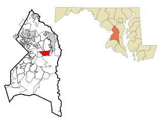
Upper Marlboro, officially the Town of Upper Marlboro, is the seat of Prince George's County, Maryland. As of the 2020 census, the population within the town limits was 652, although Greater Upper Marlboro, which covers a large area outside the town limits, is many times larger.

<span class="mw-page-title-main">Woodmore, Maryland</span> Census-designated place in Maryland

Woodmore is an unincorporated area and census-designated place in Prince George's County, Maryland, United States. Per the 2020 census, the population was 4,513. The CDP is located within the boundaries of Route 193 to the west, Church Road to the east, Route 214 to the south and Route 50 to the north. Woodmore Road runs east and west through the center. It contains a large gated community and country club, developments of Woodmore Meadows, and Woodmore South on the south side, as well as various other custom built homes and farmland.

Lanham is an unincorporated community and census-designated place in Prince George's County, Maryland. As of the 2020 United States Census it had a population of 11,282. The New Carrollton station as well as an Amtrak station are across the Capital Beltway in New Carrollton, Maryland. Doctors Community Hospital is located in Lanham.

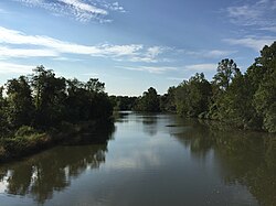
Queen Anne in Prince George's County, Maryland, United States, is a former port on the Patuxent River. It was delineated as a CDP for the 2010 census, at which time it had a population of 1,280. Per the 2020 census, the population was 1,405.

<span class="mw-page-title-main">Aquasco, Maryland</span> Census-designated place in Maryland

Aquasco is an unincorporated area and census-designated place in southeastern Prince George's County, Maryland, United States, surrounding the town of Eagle Harbor and bordering Charles County. As of the 2020 census, the CDP had a population of 913. Aquasco was home to the Aquasco Speedway.

<span class="mw-page-title-main">Baden, Maryland</span> Census-designated place in Maryland, United States

Baden is an unincorporated area and census-designated place in southeastern Prince George's County, Maryland, United States. As of the 2020 census, the CDP had a population of 2,114.

<span class="mw-page-title-main">Brock Hall, Maryland</span> Census-designated place in Maryland

Brock Hall is an unincorporated area and census-designated place in eastern Prince George's County, Maryland, United States, located south of Largo and Bowie, and north of Upper Marlboro. As of the 2020 census, the CDP had a population of 13,181.

Cedarville is an unincorporated community and census-designated place in southern Prince George's County, Maryland, United States. As of the 2020 census the population was 639.

<span class="mw-page-title-main">Marlboro Meadows, Maryland</span> Census-designated place in Maryland

Marlboro Meadows is an unincorporated community and census-designated place (CDP) in Prince George's County, Maryland, United States. Per the 2020 census, the population was 3,655. It was newly delineated for the 2010 census prior to which the area was part of the Greater Upper Marlboro census-designated place.

Queensland is a census-designated place south of Upper Marlboro in Prince George's County, Maryland, United States. The population of the CDP was 2,191 at the 2020 census. It was formerly known as Queenland until 2014 when its name was changed to Queensland and a small portion of its geography was transferred to Upper Marlboro.

Brown Station is an census designated place in Prince George's County, Maryland, United States. Per the 2020 Census, the population was 3,298.

References

  1. "2020 U.S. Gazetteer Files". United States Census Bureau. Retrieved April 26, 2022.
  2. U.S. Geological Survey Geographic Names Information System: Croom, Maryland
  3. "Croom CDP, Maryland". United States Census Bureau . Retrieved March 13, 2022.
  4. 1 2 "Croom". Historical Marker Project. 3RiverDev. Retrieved May 27, 2019. Christopher Rousby patented Croome in 1671. Home of Thomas John Claggett (1743-1816). First Episcopal Bishop of Maryland (1792), First Protestant Bishop consecrated in the United States, And first Chaplain of the US Senate. In August 1814 British forces marched through before burning Washington. Croom Post Office established in 1855. By 1873 a stop on the Pope's Creek branch of the Baltimore & Potomac Railroad.
  5. "National Register Information System". National Register of Historic Places . National Park Service. July 9, 2010.
  6. "National Register of Historic Places Listings". Weekly List of Actions Taken on Properties: 12/27/11 through 12/30/11. National Park Service. January 6, 2012. Archived from the original on October 5, 2015.
  7. Maryland-National Capital Park and Planning Commission (June 2010). "Approved Historic Sites and District Plan" (PDF): 153. Retrieved August 15, 2012.{{cite journal}}: Cite journal requires |journal= (help)
  8. "Geographic Identifiers: 2010 Demographic Profile Data (DP-1): Croom CDP, Maryland". United States Census Bureau . Retrieved December 19, 2011.
  9. "Decennial Census of Population and Housing by Decades". US Census Bureau.
  10. 1 2 "P2 Hispanic or Latino, and Not Hispanic or Latino by Race – 2010: DEC Redistricting Data (PL 94-171) - Croom CDP, Maryland". United States Census Bureau .
  11. 1 2 "P2 Hispanic or Latino, and Not Hispanic or Latino by Race – 2020: DEC Redistricting Data (PL 94-171) - Croom CDP, Maryland". United States Census Bureau .
  12. "District 5 Station - Clinton Archived September 9, 2018, at the Wayback Machine ." Prince George's County Police Department. Retrieved on September 9, 2018. " 6707 Groveton Drive Clinton, MD 20735". Beat map Archived September 9, 2018, at the Wayback Machine . See 2010 U.S. Census index map of Clinton CDP: area with police station is on the edge of page 6 with surroundings on page 5.
  13. "2010 CENSUS - CENSUS BLOCK MAP (INDEX): Croom CDP, MD." U.S. Census Bureau. Retrieved on August 28, 2018. Pages: 1, 2, 3, and 4.
  14. "NEIGHBORHOOD ELEMENTARY SCHOOLS AND BOUNDARIES SCHOOL YEAR 2018-2019." Prince George's County Public Schools. Retrieved on August 26, 2018.
  15. "NEIGHBORHOOD MIDDLE SCHOOLS AND BOUNDARIES SCHOOL YEAR 2018-2019." Prince George's County Public Schools. Retrieved on August 26, 2018.
  16. "NEIGHBORHOOD HIGH SCHOOLS AND BOUNDARIES SCHOOL YEAR 2018-2019." Prince George's County Public Schools. Retrieved on August 26, 2018.
  17. Spencer, Richard Henry (1919). Genealogical and Memorial Encyclopedia of the State of Maryland. New York: American Historical Society. pp.  392. ISBN   0-8328-5943-5. general thomas f bowie.