Rogers Heights, Maryland

Last updated
Rogers Heights
USA Maryland location map.svg
Red pog.svg
Rogers Heights
Location within the state of Maryland
Usa edcp location map.svg
Red pog.svg
Rogers Heights
Rogers Heights (the United States)
Coordinates: 38°56′55″N76°55′19″W / 38.94861°N 76.92194°W / 38.94861; -76.92194 Coordinates: 38°56′55″N76°55′19″W / 38.94861°N 76.92194°W / 38.94861; -76.92194
Country Flag of the United States.svg  United States of America
State Flag of Maryland.svg  Maryland
County Flag of Prince George's County, Maryland (1963-present).svg Prince George's
Time zone UTC-5 (Eastern (EST))
  Summer (DST) UTC-4 (EDT)
GNIS feature ID597980

Rogers Heights is an unincorporated community in Prince George's County, Maryland, United States. [1]

Unincorporated area Region of land not governed by own local government

In law, an unincorporated area is a region of land that is not governed by a local municipal corporation; similarly an unincorporated community is a settlement that is not governed by its own local municipal corporation, but rather is administered as part of larger administrative divisions, such as a township, parish, borough, county, city, canton, state, province or country. Occasionally, municipalities dissolve or disincorporate, which may happen if they become fiscally insolvent, and services become the responsibility of a higher administration. Widespread unincorporated communities and areas are a distinguishing feature of the United States and Canada. In most other countries of the world, there are either no unincorporated areas at all, or these are very rare; typically remote, outlying, sparsely populated or uninhabited areas.

Prince Georges County, Maryland County in Maryland

Prince George's County is located in the U.S. state of Maryland, bordering the eastern portion of Washington, D.C. As of the 2010 U.S. Census, the population was 863,420, making it the second-most populous county in Maryland, behind Montgomery County. Its county seat is Upper Marlboro. It is one of the richest African American-majority counties in the United States, with five of its communities identified in a 2015 top ten list.

Maryland State in the United States

Maryland is a state in the Mid-Atlantic region of the United States, bordering Virginia, West Virginia, and the District of Columbia to its south and west; Pennsylvania to its north; and Delaware to its east. The state's largest city is Baltimore, and its capital is Annapolis. Among its occasional nicknames are Old Line State, the Free State, and the Chesapeake Bay State. It is named after the English queen Henrietta Maria, known in England as Queen Mary, who was the wife of King Charles I.

History

The Rogers Heights subdivision is bounded on the north by 1950s-era subdivisions, on the south and east by Bladensburg, and on the west by Edmonston. Named after one of the former owners of the land tract, Rogers Heights was developed between 1938 and 1952. Two factors contributed largely to the selection of this tract for development; roadways and sewers. The subdivision was located along or close to major roadways. Rogers Heights is located along Edmonston Avenue, a north-south route later rebuilt as Kenilworth Avenue. This road gave residents access to Bladensburg and the Bladensburg Road into the District of Columbia. Residents could also travel west on Decatur Street to the growing center of Hyattsville and access U.S. Route 1. The second factor in the settlement of Rogers Heights was the availability of public sewer lines from Bladensburg. [2] [3]

Bladensburg, Maryland Town in Maryland

Bladensburg is a town in Prince George's County, Maryland, United States. The population was 9,148 at the 2010 census. Areas in Bladensburg have the ZIP code 20710. Bladensburg is 8.6 miles (13.8 km) from central Washington, D.C.

Edmonston, Maryland Town in Maryland

Edmonston is a town in Prince George's County, Maryland, in the United States. As of the 2010 census, the town population was 1,445.

Maryland Route 201 state highway in Prince Georges County, Maryland, United States

Maryland Route 201 is a state highway in the U.S. state of Maryland. Known for most of its length as Kenilworth Avenue, the highway runs 9.40 miles (15.13 km) from the District of Columbia boundary near Cheverly, where the highway continues south as District of Columbia Route 295, north to MD 212 in Beltsville. MD 201 is a four to six-lane divided highway that connects Washington with the northern Prince George's County municipalities of Cheverly, Bladensburg, Edmonston, Riverdale Park, College Park, Berwyn Heights, and Greenbelt. The highway also provides part of the connections from Interstate 95 and I-495 to a pair of Washington Metro stations. MD 201 was built as two separate highways in the late 1920s: MD 201 from Washington to Bladensburg and MD 205 from Bladensburg to Greenbelt. These highways, some of which became MD 769, were replaced with a relocated Kenilworth Avenue in the mid 1950s, including the Kenilworth Interchange with U.S. Route 50 and the Baltimore–Washington Parkway in Cheverly. MD 201 was extended north to Beltsville in the early 1960s. The Maryland State Highway Administration (MDSHA) plans to extend MD 201 north toward Laurel.

By 1942, the Rogers Heights subdivision contained ten residential blocks and approximately 200 residences. The streets were laid out in a grid pattern with three roads extending east from Edmonston Avenue intersected by five north-south streets. Roads constructed between 1942 and 1957 to the east of the earlier blocks were slightly more curvilinear. The common building type constructed was the modest brick and frame ranch. Scattered commercial properties are located along Edmonston and Kenilworth Avenues. However, most of the retail facilities are clustered around the Riverdale Plaza, in nearby Riverdale Park. [2]

Riverdale Park, Maryland Town in Maryland

Riverdale Park, formerly known and often referred to as Riverdale, Maryland is a semi-urban town in Prince George's County, Maryland, United States, a suburb in the Washington D.C. metropolitan area. The population was 6,956 as of 2010. The population as of 2018 is approximately 7,225, according to the US Census Bureau and other entities.

The area is served by Rogers Heights elementary school and Bladensburg High School; Elizabeth Seton High School (Catholic, girls-only) and the Bladensburg Community Center Park are also located in Bladensburg, immediately adjacent to Rogers Heights.

Bladensburg High School Public secondary school in Bladensburg, Maryland, U.S.

Bladensburg High School is a public high school located in Bladensburg, Maryland. The school, which serves grades 9 through 12, is a part of the Prince George's County Public Schools district.

Elizabeth Seton High School is a private, all-girls Roman Catholic high school in Bladensburg, Maryland, United States. It is located in the Roman Catholic Archdiocese of Washington. Elizabeth Seton High School was established on March 15, 1957, and opened with an enrollment of 138 freshmen and a faculty of six Daughters of Charity in September 1959. As early as 1965, the Maryland State Department of Education issued a Certificate of Approval to the school and in 1968 the Middle States Association of Colleges and Secondary Schools accredited Elizabeth Seton High School.

Related Research Articles

College Park, Maryland City in Maryland, United States

The City of College Park is in Prince George's County, Maryland, United States, and is about 4 miles (6.4 km) from the northeast border of Washington, D.C. The population was 30,413 at the 2010 United States Census. It is best known as the home of the University of Maryland, College Park, and since 1994 the city has also been home to the National Archives at College Park, a facility of the U.S. National Archives, as well as to the National Oceanic and Atmospheric Administration (NOAA) Center for Weather and Climate Prediction (NCWCP).

Camp Springs, Maryland Census-designated place in Maryland

Camp Springs is an unincorporated area and census-designated place (CDP) in Prince George's County, Maryland, United States. The population was 19,096 at the 2010 census. Camp Springs is not an official post office designation; the area is divided between the surrounding mailing addresses of Temple Hills, Fort Washington, Clinton, and Suitland. It includes the unincorporated area of Andrews Manor, Maryland.

Cheverly, Maryland Town in Maryland

Cheverly is a town in Prince George's County, Maryland, United States, located within very close proximity to Washington, D.C., though not bordering it directly. The town was founded in 1918, and it was incorporated in 1931. Cheverly had 6,173 residents as of the 2010 Census. Cheverly borders the adjacent communities of Tuxedo, Chapel Oaks, Landover, Landover Hills, Villa Heights, and Bladensburg.

Cottage City, Maryland Town in Maryland

Cottage City, officially the Town of Cottage City, is a town in Prince George's County, Maryland, United States. The population was 1,305 at the 2010 census. Cottage City is a small, quiet community lying between Eastern Avenue, Brentwood, Colmar Manor, and the Anacostia River. Cottage City was developed beginning in 1870 under the name of "The Highlands". The area was incorporated in 1924 as Cottage City.

East Riverdale, Maryland Census-designated place in Maryland

East Riverdale is an unincorporated area and census-designated place (CDP) in Prince George's County, Maryland, United States. The population was 15,509 at the 2010 census.

Landover, Maryland Census-designated place in Maryland, United States

Landover is an unincorporated community and census-designated place in Prince George's County, Maryland, United States. Landover is located within very close proximity to Washington D.C. although it does not directly border Washington D.C. unlike its neighboring communities, Chapel Oaks and Fairmount Heights, which directly border Washington D.C. and go all the way up to/ touch the Maryland/ D.C. line. As of the 2010 census it had a population of 23,078.

Anacostia River tributary of the Potomac River in Maryland and Washington, D.C.

The Anacostia River is a river in the Mid Atlantic region of the United States. It flows from Prince George's County in Maryland into Washington, D.C., where it joins with the Washington Channel to empty into the Potomac River at Buzzard Point. It is approximately 8.7 miles (14.0 km) long. The name "Anacostia" derives from the area's early history as Nacotchtank, a settlement of Necostan or Anacostan Native Americans on the banks of the Anacostia River.

Maryland Route 450 highway in Maryland

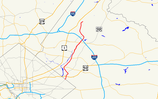
Maryland Route 450 is a state highway in the U.S. state of Maryland. The state highway runs 30.19 miles (48.59 km) from U.S. Route 1 Alternate in Bladensburg east to US 50, US 301, and MD 2 near Arnold. MD 450 forms a local complement to US 50 from near Washington through Annapolis. In Prince George's County, the highway is a four- to six-lane divided highway that serves Bladensburg, Landover Hills, New Carrollton, Lanham, and Bowie. In Anne Arundel County, MD 450 connects Crofton with Parole and Annapolis with the portion of the county east of the Severn River. The highway serves as one of the main streets of Annapolis, including the state capital's historic core, and is the primary vehicular access to the U.S. Naval Academy.

Maryland Route 410 state highway in the U.S. state of Maryland, known for most of its length as East–West Highway.

Maryland Route 410 (MD 410) is a state highway in the U.S. state of Maryland and known for most of its length as East–West Highway. The highway runs east to west for 13.92 miles (22.40 km)–from Pennsy Drive in Landover Hills to MD 355 in Bethesda.

U.S. Route 1 (US 1) is the easternmost and longest of the major north–south routes of the older 1920s era United States Numbered Highway System, running from Key West, Florida to Fort Kent, Maine. In the U.S. state of Maryland, an 80.86-mile (130.13 km) segment of the route runs through central Maryland between Mount Rainier and Rising Sun.

Maryland Route 769 highway in Maryland

Maryland Route 769 is a collection of unsigned state highways in the U.S. state of Maryland. These three highways are sections of old alignment of MD 201 and the former MD 205 in Bladensburg. MD 769D and MD 769C form the old alignment of MD 201 between a dead end next to the Baltimore–Washington Parkway and MD 450. MD 769B forms part of the old alignment of MD 205 in Bladensburg and Edmonston. The portions of MD 201 and MD 205 that are now part of MD 769 were constructed in the mid- to late 1920s and widened in the early 1940s. Modern MD 201 was constructed in the early to mid-1950s; many of the bypassed sections later became portions of MD 769.

Avondale, Maryland Unincorporated community in Maryland

Avondale is an unincorporated community in Prince George's County Maryland, United States. It is contained between Eastern Avenue NE to the south, Queens Chapel Road (MD-500) to the east, and the Northwest Branch Anacostia River to the north and west.

The Anacostia Tributary Trail System (ATTS) is a unified and signed system of stream valley trails joining trails along the Anacostia tributaries of Northwest Branch, Northeast Branch, Indian Creek and Paint Branch with a trail along the Anacostia River, set aside and maintained by the Maryland-National Capital Park and Planning Commission (M-NCPPC) in the Maryland suburbs of Washington, D.C.

Northeast Branch Anacostia River tributary of the Anacostia River in Prince George’s County, Maryland, United States

Northeast Branch Anacostia River is a 3.2-mile-long (5.1 km) free-flowing stream in Prince George's County, Maryland. It is a tributary of the Anacostia River, which flows to the Potomac River and the Chesapeake Bay.

Andrews Manor, Maryland Unincorporated community in Maryland

Andrews Manor is an unincorporated community in Prince George's County, Maryland, United States. For statistical purposes, it is part of the Camp Springs census-designated place (CDP).

References

  1. U.S. Geological Survey Geographic Names Information System: Rogers Heights, Maryland
  2. 1 2 "Community Summary Sheet, Prince George's County" (PDF). Rogers Heights, Maryland. Maryland State Highway Administration, 1999. 2008-05-10.
  3. The Neighborhoods of Prince George's County. Upper Marlboro: Community Renewal Program, 1974.