Fort Washington, Maryland

Last updated

Fort Washington, Maryland
Fort Washington Park 2004-10-17.jpg
Fort Washington Park's main gate in October 2004
Prince George's County Maryland Incorporated and Unincorporated areas Fort Washington Highlighted.svg
Location of Fort Washington in Maryland
Coordinates: 38°44′37″N77°0′37″W / 38.74361°N 77.01028°W / 38.74361; -77.01028
CountryFlag of the United States.svg United States
State Flag of Maryland.svg  Maryland
County Flag of Prince George's County, Maryland (1963-present).svg Prince George's
Area
[1]
  Total16.57 sq mi (42.92 km2)
  Land13.79 sq mi (35.73 km2)
  Water2.78 sq mi (7.19 km2)
Elevation
105 ft (32 m)
Population
 (2020)
  Total24,261
  Density1,758.81/sq mi (679.08/km2)
Time zone UTC−5 (Eastern (EST))
  Summer (DST) UTC−4 (EDT)
ZIP Codes
20744, 20749
Area code(s) 301, 240
FIPS code 24-29525
GNIS feature ID0598313
Fort Washington Fort Washington 1812.jpg
Fort Washington

Fort Washington is an unincorporated area and census-designated place in Prince George's County, Maryland, United States. It borders the Potomac River, situated 20 miles south of downtown Washington, D.C. [3] [ discuss ] As of the 2020 census, it had a population of 24,261. [4] The Fort Washington community is located west of Maryland Route 210, with some additional area to the east of the highway.

Contents

History

The Fort

A group of historical reenactors at Fort Washington in April 2008 Soliders-at-fort-washington-park.JPG
A group of historical reenactors at Fort Washington in April 2008

The community is named for Fort Washington. The first Fort Washington was completed in 1809, and it was the only defensive fort protecting Washington, D.C. until the American Civil War. [5] It consisted of a small earthwork near the shore of the Potomac River. The failure of that fort to stop a British fleet from invading the national capital during the War of 1812 led to the construction of the current, larger, stone fortification. In 1844, a cannon exploded on the USS Princeton as it was passing Fort Washington. [6] During World War II, the US Army's Adjutant General's School was located at the fort, and had billeting for 362 officers and 2,526 enlisted persons. [7]

The site is now part of a park with views of the Potomac River and hiking paths.

War of 1812

During the War of 1812 Fort Washington, built to protect the capital from enemy advances on the Potomac River, was captured by the British under the command of Admiral Gordon, three days after the burning of the capital. [8]

Civil War

Upon the outbreak of the American Civil War, fearing for the safety of Washington in case of attack, Secretary of the Navy Isaac Toucey ordered a detachment of US Marines to garrison the fort.

In May 1865 Secretary of the Navy Gideon Welles ordered the Potomac Flotilla reduced to half strength due to cessation of hostilities. This included the removal of the Marines from Fort Washington. [9]

Twentieth century to present

Near the fort are many riverfront homes, two marinas, two community pools, and National Golf Club. The area was rural until about 1960, when suburban growth began.[ citation needed ] Until the founding of the Oxon Hill post office about 1960, the Fort Washington area generally used the mailing address Washington, D.C., except for the few years that Friendly had a post office. In 1980, the postal service split the Fort Washington area from Oxon Hill, defining it as a separate town name. At that time, to make mail sorting easier, they drew the boundary between the two communities to conform to already existing zip code boundaries. The end result sometimes confuses people, since the northern end of the Fort Washington postal area (near the Beltway) identifies more with the communities of Oxon Hill or Temple Hills / Camp Springs but still uses a Fort Washington mailing address.

Geography

According to the United States Census Bureau, the CDP has a total area of 16.57 square miles (42.9 km2), of which 13.79 square miles (35.7 km2) is land and 2.78 square miles (7.2 km2), or 16.8%, is water. [10]

First-time visitors are often confused by the several "Livingston Roads", which repeatedly cross Route 210, as well as by the two separate "Old Fort Roads", causing them to make wrong turns off of Maryland Route 210. Eventually, all roads intersecting Route 210 in the Fort Washington area (from the Beltway as far south as the Highway 210 curve at Piscataway Creek) will be upgraded to controlled-access interchanges (eliminating all traffic signals) gradually during the 2020s.

The fort's land originally included 347 acres, which was last surveyed in June 1944. [7]

Community institutions

The Maryland-National Capital Park and Planning Commission (M-NCPPC) maintains the Harmony Hall Regional Center , including the John Addison Concert Hall, site of community theater ("Tantallon Community Players"), art shows, frequent concerts, and a variety of classes for all ages. A YMCA fitness center operated from 2005 until 2016, and a community center facility opened in 2013 in Fort Washington Forest.

The 12,000-member Ebenezer A.M.E. Church is a large nursery/landscaping business and a popular motorcycle shop. There is a small 50-bed hospital (Fort Washington Hospital).

Government

Prince George's County Police Department District 7 Station in Fort Washington CDP serves the community. [11] [12]

The U.S. Postal Service operates the Fort Washington Post Office in Fort Washington CDP. [13]

The Interagency Training Center, a training center for the National Security Agency, is based in Fort Washington CDP.

Demographics

Historical population
CensusPop.Note
1990 24,032
2000 23,845−0.8%
2010 23,717−0.5%
2020 24,2612.3%
U.S. Decennial Census [14]
2010 [15] 2020 [16]

2020 census

Fort Washington CDP, Maryland – Racial and ethnic composition
Note: the US Census treats Hispanic/Latino as an ethnic category. This table excludes Latinos from the racial categories and assigns them to a separate category. Hispanics/Latinos may be of any race.
Race / Ethnicity (NH = Non-Hispanic)Pop 2010 [15] Pop 2020 [16] % 2010% 2020
White alone (NH)2,6902,17011.34%8.94%
Black or African American alone (NH)16,57615,33469.89%63.20%
Native American or Alaska Native alone (NH)51320.22%0.13%
Asian alone (NH)2,1542,2279.08%9.18%
Pacific Islander alone (NH)8170.03%0.07%
Some Other Race alone (NH)561790.24%0.74%
Mixed Race or Multi-Racial (NH)6178282.60%3.41%
Hispanic or Latino (any race)1,5653,4746.60%14.32%
Total23,71724,261100.00%100.00%

Per the 2020 census, the population was 24,261. [4]

2000 census

As of the census of 2010, [17] there were 23,717 people, 8,135 households, and 6,319 families residing in the CDP. The population density was 1,719.8 inhabitants per square mile (664.0/km2). There were 8,681 housing units at an average density of 523.0 per square mile (201.9/km2). The racial makeup of the CDP was 70.6% African American, 13.40% White, 9.2% Asian (mostly Filipino), 0.2% Native American, 0.00% Pacific Islander, 3.3% from other races, and 2.38% from two or more races. Hispanic or Latino of any race were 6.6% of the population.

There were 8,135 households, out of which 26.5% had children under the age of 18 living with them, 57.9% were married couples living together, 14.7% had a female householder with no husband present, and 22.3% were non-families. 18.3% of all households were made up of individuals, and 7.1% had someone living alone who was 65 years of age or older. The average household size was 2.89 and the average family size was 3.24.

In the CDP, the population was spread out, with 21.7% under the age of 18, 5.2% from 20 to 24, 21.9% from 25 to 44, 32.9% from 45 to 64, and 16.1% who were 65 years of age or older. The median age was 44.3 years. For every 100 females, there were 91.6 males. For every 100 females age 18 and over, there were 89.3 males.

According to a 2007 estimate, the median income for a household in the CDP was $105,475, and the median income for a family was $111,227. [18] In 2000, males had a median income of $46,656 versus $42,450 for females. The per capita income for the CDP was $30,871. About 2.8% of families and 3.7% of the population were below the poverty line, including 5.0% of those under age 18 and 4.5% of those age 65 or over. By the end of 2020, the CDP ranks # 5 among top 10 richest black communities in US, with an average family income of $114,234. [19] [ better source needed ]

Transportation

Potomac Airfield is in Friendly CDP, with a Fort Washington address. [20] [21] Several Metrobus routes serve the area.

Education

Fort Washington is under the Prince George's County Public Schools district. [12]

Zoned elementary schools serving the CDP are: [22]

Zoned middle schools serving the CDP are: [23]

Zoned high schools serving the CDP are: [24]

The following private schools are located in Fort Washington

Notable people

Related Research Articles

<span class="mw-page-title-main">Accokeek, Maryland</span> Census-designated place in Maryland, United States

Accokeek, "at the edge of the hill" in Algonquin, is a census-designated place (CDP) located in Prince George's County, Maryland, United States. The CDP is located on the Potomac River, borders Charles County and is approximately 17 miles from Washington. It is a part of the Washington metropolitan area. The population of the CDP, as of the 2020 United States Census was 13,927.

<span class="mw-page-title-main">Brandywine, Maryland</span> Census-designated place in Maryland

Brandywine is the name of an unincorporated area in Prince George's County, Maryland, United States, that refers both to a census-designated place (CDP) and a zip code area which is much larger (20613), whose areas overlap. The population of Brandywine at the 2020 U.S. Census was 10,550 for the CDP, and the population of ZIP code 20613 was 11,860 in 2010.

<span class="mw-page-title-main">Camp Springs, Maryland</span> Census-designated place in Maryland

Camp Springs is an unincorporated area and census-designated place (CDP) in Prince George's County, Maryland, United States. The population was 22,734 at the 2020 census. Camp Springs is not an official post office designation; the area is divided among the surrounding mailing addresses of Temple Hills, Fort Washington, Clinton, and Suitland.

<span class="mw-page-title-main">Chillum, Maryland</span> Census-designated place in Maryland

Chillum is an unincorporated area and census-designated place in Prince George's County, Maryland, United States, bordering Washington, D.C., and Montgomery County.

<span class="mw-page-title-main">Forest Heights, Maryland</span> Town in Maryland

Forest Heights is a town in Prince George's County, Maryland, United States, and is part of the larger postal designation of Oxon Hill. The town straddles both sides of dual-lane Maryland Route 210 and includes two elementary schools. Per the 2020 census, the population was 2,658.

<span class="mw-page-title-main">Friendly, Maryland</span> Census-designated place in Maryland

Friendly is an unincorporated area and census-designated place (CDP) in Prince George's County, Maryland, United States, with an African-American majority population, located a few miles south of Washington, D.C. The population was 9,937 at the 2020 census.

<span class="mw-page-title-main">Hillcrest Heights, Maryland</span> CDP in Maryland

Hillcrest Heights is an unincorporated area and census-designated place (CDP) in Prince George's County, Maryland, United States. The population was 15,793 at the 2020 census. For mailing address purposes, it is part of the smaller community of Temple Hills and is also near Suitland.

<span class="mw-page-title-main">Largo, Maryland</span> Census-designated place in Maryland, United States

Largo, located within Greater Upper Marlboro, Maryland, is an unincorporated area and census-designated place in Prince George's County, Maryland, United States. The population was 11,605 at the 2020 census.

<span class="mw-page-title-main">Marlow Heights, Maryland</span> Census-designated place in Maryland, United States

Marlow Heights is an unincorporated area and census-designated place (CDP) in Prince George's County, Maryland, United States. The population was 6,169 at the 2020 census. The Marlow Heights Shopping Center first opened in 1957, adjacent to the large community of Hillcrest Heights. It was joined ten years later, in 1967, by the two-level Iverson Mall, the Washington metropolitan area's first enclosed mall.

<span class="mw-page-title-main">Temple Hills, Maryland</span> Census-designated place in Maryland, United States

Temple Hills is an unincorporated area and census-designated place (CDP) in Prince George's County, Maryland, United States. Temple Hills borders the communities of Hillcrest Heights, Marlow Heights, Camp Springs and Oxon Hill. Per the 2020 census, the population was 8,350.

Seabrook is an unincorporated community and census-designated place (CDP) in Prince George's County, Maryland, United States, located approximately 12 miles (19 km) east of Washington, D.C. Per the 2020 census, the population was 19,627. Prior to 2010, Seabrook was part of the Lanham-Seabrook census-designated place.

Landover is an unincorporated community and census-designated place in Prince George's County, Maryland, United States. As of the 2020 census, it had a population of 25,998.

Lanham is an unincorporated community and census-designated place in Prince George's County, Maryland. As of the 2020 United States Census it had a population of 11,282. The New Carrollton station as well as an Amtrak station are across the Capital Beltway in New Carrollton, Maryland. Doctors Community Hospital is located in Lanham.

<span class="mw-page-title-main">Oxon Hill, Maryland</span> Census-designated place in Maryland, United States

Oxon Hill is an unincorporated area and census-designated place (CDP) in southern Prince George's County, Maryland, United States. Oxon Hill is a suburb of Washington, located southeast of the downtown district and east of Alexandria, Virginia. Since 2008, it contains the 300-acre (120 ha) National Harbor development on the shore of the Potomac River.

Glassmanor is an unincorporated community and census-designated place in Prince George's County, Maryland, United States. As of the 2020 census, it had a population of 18,430. In the 1990 and 2000 censuses, the United States Census Bureau had placed Glassmanor and the adjacent community of Oxon Hill in the "Oxon Hill-Glassmanor" census-designated place for statistical purposes. Glassmanor was last delineated separately in 1980, when the CDP recorded a population of 7,751.

<span class="mw-page-title-main">Suitland, Maryland</span> Census-designated place in Maryland, United States

Suitland is a suburb of Prince George's County, Maryland, approximately one mile (1.6 km) southeast of Washington, D.C. Suitland is a census designated place (CDP), as of the 2020 census, its population was 25,839. Prior to 2010, it was part of the Suitland-Silver Hill census-designated place.

<span class="mw-page-title-main">Oxon Hill High School</span> Public magnet high school in the United States

Oxon Hill High School (OHHS) is a public senior high school, located in Oxon Hill, an unincorporated area in Prince George's County, Maryland, and a suburb of Washington, D.C. in the United States. The school, which serves grades 9 through 12, is a part of the Prince George's County Public Schools system.

Silver Hill is an unincorporated community and census-designated place (CDP) in Prince George's County, Maryland, United States, approximately 1 mile (1.6 km) southeast of Washington, D.C. Per the 2020 census, the population was 6,381. Prior to 2010, Silver Hill was part of the Suitland-Silver Hill census-designated place.

<span class="mw-page-title-main">National Harbor, Maryland</span> Census-designated place in Maryland, United States

National Harbor is a census-designated place (CDP) in Prince George's County, Maryland, United States, located along the Potomac River near the Woodrow Wilson Bridge and just south of Washington, D.C. It originated as a 300-acre (1.2 km2) multi-use waterfront development. Per the 2020 census, the population was 5,509.

<span class="mw-page-title-main">Croom, Maryland</span> Census-designated place in Maryland

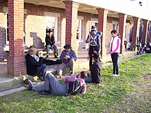
Croom is an unincorporated community and census-designated place in Southern Prince George's County, Maryland, United States. As of the 2020 census it had a population of 2,720. Croom largely consists of former tobacco farms and forests converted to Washington bedroom subdivisions such as nearby Marlton. The main part of Patuxent River Park is in Croom.

References

  1. "2020 U.S. Gazetteer Files". United States Census Bureau. Retrieved April 26, 2022.
  2. Lossing, Benson (1868). The Pictorial Field-Book of the War of 1812. Harper & Brothers, Publishers. p. 939.
  3. U.S. Geological Survey Geographic Names Information System: Fort Washington, Maryland
  4. 1 2 "Fort Washington CDP, Maryland". United States Census Bureau . Retrieved April 15, 2022.
  5. "History & Culture". National Park Service . Retrieved January 2, 2024.
  6. "Fort Washington Park Mammoth Guns". National Park Service. Retrieved February 10, 2009.
  7. 1 2 Stanton, Shelby L. (1984). Order Of Battle: US Army; World War II . 31 Pamaron Way; Novato, California: Presidio Press. pp.  621. ISBN   0-89141-195-X.{{cite book}}: CS1 maint: location (link)
  8. Roosevelt, 'The naval war of 1812:', p.319
  9. Toomey, Daniel Carroll (2004). The Civil War In Maryland; 11th Edition. P.O. Box 122; Linthicum, Maryland: Toomey Press. pp. 183 w/index. ISBN   0-9612670-0-3.{{cite book}}: CS1 maint: location (link)
  10. "Population, Housing Units, Area, and Density: 2010 - State -- Place and (in selected states) County Subdivision 2010 Census Summary File 1". U.S. Census Bureau . Retrieved October 6, 2010.
  11. "District 7- Fort Washington [ sic ]." Prince George's County Police Department. Retrieved on September 9, 2018. "11108 Fort Washington Road Fort Washington, MD 20744". Beat map.
  12. 1 2 "2010 CENSUS - CENSUS BLOCK MAP (INDEX): Fort Washington CDP, MD." U.S. Census Bureau. Retrieved on September 2, 2018. Note that the CDP previously covered a different set of territory: "CENSUS 2000 BLOCK MAP: FORT WASHINGTON CDP" with pages 1 and 2. In the 1990 U.S. Census Bureau maps of Prince George's County, Maryland (index map) Fort Washington CDP is on pages 26, 27, 32, and 33.
  13. "FORT WASHINGTON." U.S. Postal Service. Retrieved on September 11, 2018. "11550 LIVINGSTON RD FORT WASHINGTON, MD"
  14. "Decennial Census of Population and Housing by Decades". US Census Bureau.
  15. 1 2 "P2 Hispanic or Latino, and Not Hispanic or Latino by Race – 2010: DEC Redistricting Data (PL 94-171) – Fort Washington CDP, Maryland". United States Census Bureau .
  16. 1 2 "P2 Hispanic or Latino, and Not Hispanic or Latino by Race – 2020: DEC Redistricting Data (PL 94-171) – Fort Washington CDP, Maryland". United States Census Bureau .
  17. "U.S. Census website". United States Census Bureau . Retrieved January 31, 2008.
  18. "American FactFinder". Archived from the original on February 11, 2020. Retrieved January 31, 2009.
  19. "10 Richest Black Communities in America" . Retrieved November 12, 2020.
  20. "2010 CENSUS - CENSUS BLOCK MAP: Friendly CDP, MD." U.S. Census Bureau. Retrieved on September 2, 2018. Previously Friendly had a different shape: "CENSUS 2000 BLOCK MAP: FRIENDLY CDP." In the 1990 U.S. Census Bureau maps of Prince George's County, Maryland (index map) Friendly CDP is on pages 27, 28, and 33.
  21. "3rd%20class%20medical%20-%20final%20-%20PUBLIC.pdf." Potomac Airfield. Retrieved on September 2, 2018. "10300 Glen Way * Fort Washington * MD "
  22. "NEIGHBORHOOD ELEMENTARY SCHOOLS AND BOUNDARIES SCHOOL YEAR 2018-2019." Prince George's County Public Schools. Retrieved on September 2, 2018.
  23. "NEIGHBORHOOD MIDDLE SCHOOLS AND BOUNDARIES SCHOOL YEAR 2018-2019." Prince George's County Public Schools. Retrieved on September 2, 2018.
  24. "NEIGHBORHOOD HIGH SCHOOLS AND BOUNDARIES SCHOOL YEAR 2018-2019." Prince George's County Public Schools. Retrieved on September 2, 2018.
  25. Home. The Beddow Schools. Retrieved on September 8, 2018. "Fort Washington Montessori School 8600 Loughran Road Fort Washington, MD 20744"
  26. Maese, Rick (July 5, 2010). "Boxer Riddick Bowe's Life Since His Boxing Peak". Washington Post .
  27. Wilbur, Del Quentin (August 10, 2011). "Charles L. Gittens, first black Secret Service agent, dies at 82". Washington Post . Retrieved August 18, 2011.
  28. Sheridan, Mary Beth (February 27, 2007). "For Hoyer, a Life Of Quiet Victories, Redefined Purpose". The Washington Post . Retrieved January 1, 2024.
  29. "'Diary of a Wimpy Kid' Author visits Potomac Landing Elementary School". Prince George's County Public Schools . Retrieved January 1, 2024.