Greater Landover, Maryland

Last updated
Greater Landover, Maryland
Prince George's County Maryland Incorporated and Unincorporated areas Greater Landover Highlighted.svg
Coordinates: 38°55′28″N76°53′14″W / 38.92444°N 76.88722°W / 38.92444; -76.88722
Country Flag of the United States.svg United States
State Flag of Maryland.svg  Maryland
County Flag of Prince George's County, Maryland (1963-present).svg Prince George's
Area
  Total4.1 sq mi (10.7 km2)
  Land4.1 sq mi (10.7 km2)
  Water0.0 sq mi (0.0 km2)
Population
 (2000)
  Total22,900
  Density5,560.9/sq mi (2,147.1/km2)
Time zone UTC−5 (Eastern (EST))
  Summer (DST) UTC−4 (EDT)
ZIP Code
20784-85
FIPS code 24-34711

Greater Landover was a census-designated place (CDP) in Prince George's County, Maryland, during the 2000 United States Census. The population was 22,900 at that time. As of 2007, the rough estimate given by the census was at 22,665. [1] For the 2010 U.S. Census, the area was designated the Landover CDP.

Contents

Description

The former CDPs of Landover, Dodge Park, Kentland, and Palmer Park, defined as such by the U.S. Census Bureau in the 1990 U.S. Census, [2] were consolidated into the Greater Landover CDP as of the 2000 U.S. Census. [3] This amalgamated area was renamed the Landover CDP as of the 2010 U.S. Census. [4]

Geography

Greater Landover was located at 38°55′28″N76°53′14″W / 38.92444°N 76.88722°W / 38.92444; -76.88722 (38.924311, 76.887248). [5]

According to the United States Census Bureau, the place had a total area of 4.1 square miles (11 km2), all of it land.

Demographics

As of the census [6] of 2000, there were 22,900 people, 7,696 households, and 5,656 families residing in the area. The population density was 5,560.9 inhabitants per square mile (2,147.1/km2). There were 8,600 housing units at an average density of 2,088.4 per square mile (806.3/km2). The racial makeup of the area was 4.14% White, 92.03% African American, 0.20% Native American, 0.52% Asian, 0.04% Pacific Islander, 1.35% from other races, and 1.72% from two or more races. Hispanic or Latino of any race were 2.90% of the population.

There were 7,696 households, out of which 40.9% had children under the age of 18 living with them, 32.0% were married couples living together, 34.0% had a female householder with no husband present, and 26.5% were non-families. 20.4% of all households were made up of individuals, and 2.8% had someone living alone who was 65 years of age or older. The average household size was 2.97 and the average family size was 3.40.

In the area the population was spread out, with 33.3% under the age of 18, 9.9% from 18 to 24, 31.7% from 25 to 44, 20.0% from 45 to 64, and 5.2% who were 65 years of age or older. The median age was 30 years. For every 100 females, there were 85.8 males. For every 100 females age 18 and over, there were 78.4 males.

The median income for a household in the area was $37,730, and the median income for a family was $38,315. Males had a median income of $30,474 versus $30,083 for females. The per capita income for the area was $15,191. About 13.8% of families and 17.0% of the population were below the poverty line, including 22.4% of those under age 18 and 16.0% of those age 65 or over.

Related Research Articles

<span class="mw-page-title-main">East Whittier, California</span> Unincorporated community in California, United States

East Whittier is an unincorporated community in Los Angeles County, California, United States. The population was 9,757 at the 2010 census, up from 9,538 at the 2000 census. For statistical purposes, the United States Census Bureau has defined this community as a census-designated place (CDP). The name was changed from East La Mirada in 2012, likely due to its precise location in relation to the city of Whittier. The previous delineation of East Whittier CDP occurred during the 1960 census, when the area recorded a population of 19,884.

<span class="mw-page-title-main">Vincent, California</span> Census-designated place in California, United States

Vincent is a census-designated place (CDP) in the central San Gabriel Valley, in Los Angeles County, California, United States. The city name and zipcode for addresses south of Arrow Highway is Covina and 91722, respectively, and Azusa and 91702 for addresses north of Arrow Highway. The population was 15,922 at the 2010 census, up from 15,097 at the 2000 census. Vincent is named after Vincent Avenue, which passes through the community.

<span class="mw-page-title-main">Kalaheo, Hawaii</span> Census-designated place in Hawaii, United States

Kalāheo is an unincorporated community and census-designated place (CDP) in Kauaʻi County, island of Kauaʻi, Hawaiʻi, United States. The population was 4,996 at the 2020 census, up from 3,913 at the 2000 census.

<span class="mw-page-title-main">Dulac, Louisiana</span> CDP in Louisiana, United States

Dulac is a census-designated place (CDP) in Terrebonne Parish, Louisiana, United States. The population was 1,241 in 2020. It is part of the Houma–Bayou Cane–Thibodaux metropolitan statistical area.

<span class="mw-page-title-main">Parole, Maryland</span> Census-designated place in Maryland, United States

Parole, a suburb of Annapolis, is a census-designated place (CDP) in Anne Arundel County, Maryland, United States. The population was 15,922 at the 2010 census. It has several major roads intersect at the western edge of the state capital, Annapolis, and it contains the Annapolis Mall, a number of other large shopping centers, and the Anne Arundel Medical Center. It is generally considered to be part of Annapolis, rather than a separate town. The neighborhood was named because it was a parole camp, where Union and Confederate prisoners of war were brought for mutual exchange and eventual return to their respective homes.

<span class="mw-page-title-main">Algonquin, Maryland</span> Census-designated place in Maryland, United States

Algonquin is a census-designated place (CDP) in Dorchester County, Maryland, United States. The population was 1,241 at the 2010 census. The community was named for the Algonquin people, one of the Native American tribes in the East.

<span class="mw-page-title-main">Forestville, Maryland</span> CDP in Maryland

Forestville is an unincorporated area and census-designated place (CDP) in Prince George's County, Maryland, United States. Per the 2020 census, the population was 12,831. The community is a mixture of garden apartments, single-family homes, and shopping centers built mostly from the 1930s through 1970s, adjacent to the communities of District Heights, Suitland, Morningside, Westphalia and Camp Springs.

<span class="mw-page-title-main">Friendly, Maryland</span> Census-designated place in Maryland

Friendly is an unincorporated area and census-designated place (CDP) in Prince George's County, Maryland, United States, with an African-American majority population, located a few miles south of Washington, D.C. The population was 9,937 at the 2020 census.

<span class="mw-page-title-main">Glenarden, Maryland</span> City in Maryland, United States

Glenarden is a city in Prince George's County, Maryland, United States. Per the 2020 census, the population was 6,402.

<span class="mw-page-title-main">Marlton, Maryland</span> Census-designated place in Maryland

Marlton is an unincorporated area and census-designated place (CDP) in Prince George's County, Maryland, United States. The population was 9,802 at the 2020 census. The Marlton housing development, at first briefly called "Brandywine Country", grew up along U.S. Route 301 in the 1970s, and is part of the greater Upper Marlboro community. Originally made up of only single-family homes, more recently townhouses have been added.

<span class="mw-page-title-main">South Woodbridge, California</span> Unincorporated community in California, United States

South Woodbridge was a former census-designated place (CDP) in San Joaquin County, California, United States. The population was 2,825 at the 2000 census. For the 2010 census, the CDP's of South Woodbridge and North Woodbridge were merged into Woodbridge.

<span class="mw-page-title-main">Mifflinville, Pennsylvania</span> Census-designated place in Pennsylvania, United States

Mifflinville is an unincorporated community and census-designated place (CDP) in Columbia County, Pennsylvania, United States. It is part of Northeastern Pennsylvania. The population was 1,233 at the 2020 census. It is part of the Bloomsburg-Berwick micropolitan area.

Forestville is a census-designated place (CDP) in Schuylkill County, Pennsylvania, United States. The population was 431 at the 2000 census.

<span class="mw-page-title-main">Laguna Seca, Texas</span> Census-designated place in Texas

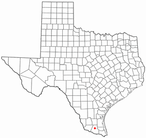
Laguna Seca is a census-designated place (CDP) in Hidalgo County, Texas, United States. The population was 266 at the 2010 United States Census. It is part of the McAllen–Edinburg–Mission Metropolitan Statistical Area.

<span class="mw-page-title-main">La Paloma-Lost Creek, Texas</span> CDP in Texas, United States

La Paloma-Lost Creek is a census-designated place (CDP) in Nueces County, Texas, United States. The population was 408 at the 2010 census, up from 323 at the 2000 census.

<span class="mw-page-title-main">Neilton, Washington</span> Census-designated place in Washington, United States

Neilton is an unincorporated community and census-designated place (CDP) in Grays Harbor County, Washington, United States. The population was 315 at the 2010 census.

Landover is an unincorporated community and census-designated place in Prince George's County, Maryland, United States. As of the 2020 census, it had a population of 25,998.

<span class="mw-page-title-main">Kentland, Maryland</span> Unincorporated community in Maryland

Kentland is an unincorporated community and former census-designated place in Prince George's County, Maryland, United States, located within the Landover census area. Kentland is served by the Landover Metro Station, which is located just north of the community, across Landover Road.

Palmer Park is an unincorporated community in Prince George's County, Maryland, United States, within the census-designated place of Landover. It was previously a CDP of its own until 2000.

Dodge Park is an unincorporated area and former census-designated place (CDP) in Prince George's County, Maryland, United States; it is currently within the Landover CDP.

References

  1. "Greater Landover CDP, Maryland - ACS Demographic and Housing. [[United States Census Bureau|U.S. Census Bureau]]. Retrieved 2010-07-17". Archived from the original on 2011-07-19. Retrieved 2010-07-17.
  2. "1990 COUNTY BLOCK MAP" (index map) Prince George's County. U.S. Census Bureau. Retrieved on September 9, 2018. The CDPs of Landover, Dodge Park, Kentland, and Palmer Park are shown on pages 13, 14, 17, and 18.
  3. "CENSUS 2000 BLOCK MAP: GREATER LANDOVER CDP." U.S. Census Bureau. Retrieved on September 9, 2018.
  4. "2010 CENSUS - CENSUS BLOCK MAP: Landover CDP, MD." U.S. Census Bureau. Retrieved on September 1, 2018.
  5. "US Gazetteer files: 2010, 2000, and 1990". United States Census Bureau. 2011-02-12. Retrieved 2011-04-23.
  6. "U.S. Census website". United States Census Bureau . Retrieved 2008-01-31.