Frederick County, Maryland

Last updated

Frederick County
Frederick city.jpg
Downtown Frederick with the Blue Ridge Mountains in the distance in June 2014
2023 flag of Frederick County, Maryland.svg
Seal of Frederick County, Maryland.png
Nicknames: 
"Frederick", "FredCo"
Map of Maryland highlighting Frederick County.svg
Location of Frederick County in Maryland
Coordinates: 39°28′N77°24′W / 39.47°N 77.40°W / 39.47; -77.40
CountryUnited States
State Maryland
FoundedJune 10, 1748
County seat Frederick
Government
  County ExecutiveJessica Fitzwater
  County CouncilRenee Knapp (D)
Brad Young (D)
Jerry Donald (D)
Steven McKay (R)
M. C. Keegan-Ayer (D)
Kavonte Duckett (D)
Mason Carter (R) [1]
Area
  Total667 sq mi (1,730 km2)
  Land660 sq mi (1,700 km2)
  Water7.2 sq mi (19 km2)
Population
 (2020)
  Total271,717
  Density410/sq mi (160/km2)
Time zone Eastern (EST)
  Summer (DST) EDT
ZIP Codes
21701, 21702, 21703, 21704, 21705, 21709
Area codes 301, 240
Congressional districts 6th
Website http://www.FrederickCountyMD.gov/

Frederick County is located in Maryland, United States. As of the 2020 U.S. census, the population was 271,717. [2] The county seat is Frederick. [3]

Contents

Frederick County is part of the Washington-Arlington-Alexandria, DC-VA-MD-WV Metropolitan Statistical Area. Like other outlying sections of the Washington metropolitan area, Frederick County has experienced a rapid population increase in recent[ when? ] years. [4] It borders the southern border of Pennsylvania and the northeastern border of Virginia.

Catoctin Mountain Park in the county is the location of Camp David, a U.S. presidential retreat, and Fort Detrick, a U.S. Army base.

Etymology

The namesake of Frederick County and its county seat is unknown, but it was probably either Frederick, Prince of Wales, or Frederick Calvert, 6th Baron Baltimore. [5]

History

Frederick County was created in 1748 by the Province of Maryland from parts of Prince George's County and Baltimore County.

In 1776, following US independence, Frederick County was divided into three parts. The westernmost portion became Washington County, named after George Washington, the southernmost portion became Montgomery County, named after another Revolutionary War general, Richard Montgomery. The northern portion remained Frederick County.

In 1837, a part of Frederick County was combined with a part of Baltimore County to form Carroll County which is east of current day Frederick County.

The county has a number of properties on the National Register of Historic Places. [6]

Geography

According to the U.S. Census Bureau, the county has a total area of 667 square miles (1,730 km2), of which 660 square miles (1,700 km2) is land and 7.2 square miles (19 km2) (1.1%) is water. [8] It is the largest county in Maryland in terms of land area. [9]

Frederick County straddles the boundary between the Piedmont Plateau Region and the Appalachian Mountains. The county's two prominent ridges, Catoctin Mountain and South Mountain, form an extension of the Blue Ridge. The Middletown Valley lies between them.

Attractions in the Frederick area include the Clustered Spires, a monument to Francis Scott Key, the National Museum of Civil War Medicine, Monocacy National Battlefield and South Mountain battlefields, and the Schifferstadt Architectural Museum.

Adjacent counties

National protected areas

Major highways

I-70 and US 40 in Frederick County 2019-07-24 11 33 44 View east along Interstate 70 and U.S. Route 40 (Baltimore National Pike) from the overpass for Mussetter Road in Linganore, Frederick County, Maryland.jpg
I-70 and US 40 in Frederick County

Demographics

Historical population
CensusPop.Note
1790 30,791
1800 31,5232.4%
1810 34,4379.2%
1820 40,45917.5%
1830 45,78913.2%
1840 36,405−20.5%
1850 40,98712.6%
1860 46,59113.7%
1870 47,5722.1%
1880 50,4826.1%
1890 49,512−1.9%
1900 51,9204.9%
1910 52,6731.5%
1920 52,541−0.3%
1930 54,4403.6%
1940 57,3125.3%
1950 62,2878.7%
1960 71,93015.5%
1970 84,92718.1%
1980 114,79235.2%
1990 150,20830.9%
2000 195,27730.0%
2010 233,38519.5%
2020 271,71716.4%
2023 (est.)293,391 [10] 8.0%
U.S. Decennial Census [11]
1790-1960 [12] 1900-1990 [13]
1990-2000 [14] 2010 [15] 2020 [16]

Frederick County has experienced a rapid increase in population in recent[ when? ] years, including that of minority groups. [4]

2020 census

Frederick County, Maryland – Racial and ethnic composition
Note: the US Census treats Hispanic/Latino as an ethnic category. This table excludes Latinos from the racial categories and assigns them to a separate category. Hispanics/Latinos may be of any race.
Race / Ethnicity (NH = Non-Hispanic)Pop 2010 [15] Pop 2020 [16] % 2010% 2020
White alone (NH)181,645183,63677.83%67.58%
Black or African American alone (NH)19,61127,0078.40%9.94%
Native American or Alaska Native alone (NH)5124010.22%0.15%
Asian alone (NH)8,87613,4273.80%4.94%
Pacific Islander alone (NH)921540.04%0.06%
Some Other Race alone (NH)4051,4450.17%0.53%
Mixed Race or Multi-Racial (NH)5,10913,5282.19%4.98%
Hispanic or Latino (any race)17,13532,1197.34%11.82%
Total233,385271,717100.00%100.00%

2010 census

At the 2010 United States Census, there were 233,385 people, 84,800 households and 61,198 families residing in the county. [17] The population density was 353.5 per square mile (136.5/km2). There were 90,136 housing units at an average density of 136.5 per square mile (52.7/km2). [18] The racial make-up of the county was 81.5% white, 8.6% black or African American, 3.8% Asian, 0.3% American Indian, 2.9% from other races and 2.8% from two or more races. The total (all races) of those self-identifying as Hispanic or Latino origin made up 7.3%, and those persons who were white alone made up 77.8% of the population. [17] 26.3% of the population cited German ancestry, 17.4% Irish, 12.1% English, 7.2% Italian, and 6.3% American. [19]

Of the 84,800 households, 37.6% had children under the age of 18 living with them, 57.8% were married couples living together, 10.0% had a female householder with no husband present, 27.8% were non-families, and 22.0% of all households were made up of individuals. The average household size was 2.70 and the average family size was 3.17. The median age was 38.6 years. [17]

The median household income was $81,686 and the median family income was $95,036. Males had a median income of $62,494 and females $46,720. The per capita income was $35,172. About 3.2% of families and 4.8% of the population were below the poverty line, including 5.8% of those under age 18 and 5.6% of those age 65 or over.<ref"> "DP03 SELECTED ECONOMIC CHARACTERISTICS – 2006-2010 American Community Survey 5-Year Estimates". United States Census Bureau. Archived from the original on February 13, 2020. Retrieved January 22, 2016.</ref>

Law, government, and politics

Charter government

On December 1, 2014, Frederick County changed to a "charter home rule government". [20]

Voters approved this governmental change at the November 6, 2012, election with 62,469 voting for the transition and 37,368 against. Previously, Frederick County had been governed by a five-member county commission that could only legislate in local matters with the prior consent of the Maryland General Assembly. Even that authority was limited to areas authorized by the General Assembly, enabling legislation, or public local laws. As a charter county, Frederick County is now governed by a seven-member county council, with five elected from districts and two elected at-large. A popularly elected county executive is responsible for providing direction, supervision, and administrative oversight of all executive departments, agencies, and offices. The council has broad power to act on most local matters. [21]

Jan H. Gardner was elected the first Frederick County executive in 2014 [22] and was re-elected in 2018. [23]

County Executive
 NameAffiliationTerm
 Jan Gardner Democrat 2014–2022
 Jessica Fitzwater Democrat 2022–present

The members of the third Frederick County Council for the term beginning 2022 are: [24]

County Council
 NameAffiliationDistrictRegionFirst elected
 Renee Knapp Democrat At-largeAt-large2022
 Brad W. Young Democrat At-largeAt-large2022
 Jerry Donald [25] Democrat 1 Braddock Heights, Middletown, Brunswick 2014
 Steve McKay Republican 2 Monrovia, Urbana, New Market, Mount Airy 2018
 M.C. Keegan-Ayer Democrat 3 Frederick, Clover Hill 2014
 Kavonte Duckett Democrat 4 Frederick, Ballenger Creek, Linganore 2022
 Mason Carter Republican 5 Myersville, Emmitsburg, Thurmont 2022

The Frederick County state's attorney, first elected November 2, 2010, and re-elected in 2018 and 2022, is Charlie Smith, a Republican. [24]

The sheriff of Frederick County is Republican Chuck Jenkins. [24]

The executive director for the Frederick County Office of Economic Development is Helen Propheter. The Office of Economic Development is located at 118 North Market Street, Suite 300, Frederick, MD 21701.

Frederick County's fire and rescue service is handled by a combination career and volunteer service delivery system. The county employs over 450 career firefighters. Volunteers of the 26 volunteer fire and rescue corporations number approximately 300 active operational members. Fire, rescue and emergency medical services, including advanced life support, are handled by career staffing supplemented by volunteers. The county has a Maryland State Police Medevac located at the Frederick Municipal Airport and is designated "Trooper 3". Trooper 3 handles calls throughout the state, but provides immediate assistance to local police, fire and rescue services.

Politics

Like the rest of German-influenced Western Maryland, Frederick County was once staunchly Republican, with Lyndon B. Johnson in 1964 being the last Democrat to carry it in a presidential election until Joe Biden carried the county in 2020. The growth of the county with migration from Washington D.C. had begun to narrow the margins starting from 2008, with John McCain only edging out Barack Obama by only 1,157 votes out of over one hundred thousand cast in the 2008 election.

Democratic strength is mostly concentrated in the City of Frederick, while the suburban and rural areas of the county lean more Republican.

Voter registration and party enrollment as of March 2024 [26]
Democratic 77,554
Republican 67,917
Unaffiliated52,948
Libertarian 1,245
Other parties 1,750
Total201,414
United States presidential election results for Frederick County, Maryland [27]
Year Republican Democratic Third party
No.%No.%No.%
2020 63,68243.73%77,67553.34%4,2582.92%
2016 59,52247.36%56,52244.97%9,6337.66%
2012 58,79850.21%55,14647.09%3,1712.71%
2008 55,17049.62%54,01348.58%2,0031.80%
2004 59,93459.58%39,50339.27%1,1571.15%
2000 45,35057.65%30,72539.06%2,5863.29%
1996 34,49452.82%25,08138.41%5,7288.77%
1992 31,29048.37%21,84833.77%11,55317.86%
1988 32,57565.32%17,06134.21%2310.46%
1984 29,60668.67%13,41131.11%960.22%
1980 22,03356.31%13,62934.83%3,4688.86%
1976 17,94155.23%14,54244.77%00.00%
1972 19,90769.48%8,23528.74%5091.78%
1968 13,64951.87%8,31631.60%4,34816.52%
1964 9,26438.90%14,54861.10%00.00%
1960 13,40857.50%9,91042.50%10.00%
1956 14,38765.38%7,61934.62%00.00%
1952 14,56264.86%7,85134.97%380.17%
1948 9,93457.77%7,14241.53%1210.70%
1944 11,36757.13%8,52842.87%00.00%
1940 10,48548.02%11,25551.55%930.43%
1936 9,50046.83%10,72252.85%640.32%
1932 7,14439.64%10,68659.29%1941.08%
1928 12,56962.57%7,40636.87%1140.57%
1924 8,44149.35%7,74045.25%9255.41%
1920 9,55954.57%7,74744.22%2121.21%
1916 5,72547.61%6,09450.67%2071.72%
1912 2,81324.76%5,54548.81%3,00226.43%
1908 5,96652.72%5,15845.58%1921.70%
1904 5,78852.83%5,00445.67%1641.50%
1900 6,39151.30%5,82046.72%2461.97%
1896 6,35253.20%5,21443.67%3743.13%
1892 5,50248.12%5,64349.35%2892.53%
1888 5,82250.89%5,38547.07%2332.04%
1884 5,49750.59%5,20447.89%1651.52%
1880 5,76452.13%5,27847.73%160.14%
1876 5,26051.42%4,97048.58%00.00%
1872 5,18656.06%4,06543.94%00.00%
1868 3,86950.36%3,81349.64%00.00%
1864 3,55360.68%2,30239.32%00.00%
1860 1031.40%4456.07%6,78392.52%
1856 210.30%3,30446.87%3,72452.83%
1852 3,20448.85%3,34250.95%130.20%
1848 3,15851.26%2,98348.42%200.32%
1844 3,19051.58%2,99448.42%00.00%
1840 2,95853.00%2,62347.00%00.00%
1836 3,13050.94%3,01549.06%00.00%

In state-level elections, Republicans in Frederick rebounded to more historical levels in the 2010 Maryland gubernatorial and senatorial elections, giving the Republican EhrlichKane ticket 55% to Democrat O'MalleyBrown's 45. Frederick voters also supported Republican Senate challenger Eric Wargotz over incumbent Democratic Senator Barbara Mikulski by a margin of 51–46, even as Mikulski was winning statewide by a landslide 61–37. Despite its conservative reputation, Frederick County voted in favor of Maryland Question 6, which legalized same-sex marriage in Maryland. In the 2014 gubernatorial race, Republican Larry Hogan won Frederick County strongly with 63 percent of the vote compared to Democrat Anthony Brown's 35 percent. [28] In the 2018 elections, despite increased support for Hogan, the Democrats experienced significant gains, securing a majority on the County Council and winning District 3B in the House of Delegates. [29] [30] The Senate election also saw incumbent U.S. Senator Ben Cardin win Frederick County with 51.7% of the vote. [31] After Biden's win in 2020, the trend towards Democrats continued in 2022, as Democrats increased their majority on the County Council by one seat and gubernatorial candidate Wes Moore won the county with over 53% of the vote compared to 43% for Republican and Emmitsburg resident Dan Cox, the first time Frederick County voted for a Democratic gubernatorial candidate since William Donald Schaefer's landslide victory in 1986. [32] In the Senate election also held in 2022, incumbent Democratic Senator Chris Van Hollen won the county 55.3% to 44.6% over Republican Chris Chaffee. [33]

Gubernatorial elections results
Gubernatorial elections results [34]
Year Republican Democratic Third parties
2022 43.19% 46,04053.46%56,9923.34% 3,576
2018 67.67%72,56031.11% 33,3551.22% 1,304
2014 63.34%50,71534.57% 27,6822.09% 1,675
2010 54.74%41,41042.59% 32,2222.67% 2,021
2006 59.57%43,53639.19% 28,6441.24% 908
2002 65.98%43,64633.12% 21,9130.9% 596

Public safety

The Frederick County Sheriff's Office provides court protection, jail management and morgue operation for the entire county. It provides police patrol and detective services within the unincorporated areas of Frederick County. The entire county entails a population of 222,938 within 662.88 square miles (1,716.9 km2). Frederick City, Brunswick, Mount Airy, Emmitsburg and Thurmont have municipal police departments. Middletown contracts with the Sheriff's Office for its policing. [35]

Crime

The following table includes the number of incidents reported for each type of offense from 2012 to 2019. [36]

YearHomicideForcible sex offenseAssaultRobberyBurglaryTheftMotor vehicle theftFraudArson
201207145915319854111
2013Increase Negative.svg4Decrease Positive.svg50Decrease Positive.svg36Increase Negative.svg23Decrease Positive.svg139Decrease Positive.svg85Increase Negative.svg10Increase Negative.svg46Increase Negative.svg17
2014Decrease Positive.svg0Increase Negative.svg61Decrease Positive.svg30Steady2.svg23Increase Negative.svg169Increase Negative.svg161Decrease Positive.svg3Decrease Positive.svg42Decrease Positive.svg9
2015Increase Negative.svg4Decrease Positive.svg56Increase Negative.svg32Steady2.svg23Decrease Positive.svg150Decrease Positive.svg124Increase Negative.svg4Increase Negative.svg47Increase Negative.svg10
2016Decrease Positive.svg1Decrease Positive.svg53Decrease Positive.svg31Increase Negative.svg26Decrease Positive.svg134Increase Negative.svg142Increase Negative.svg12Increase Negative.svg62Decrease Positive.svg4
2017Increase Negative.svg3Increase Negative.svg64Increase Negative.svg35Decrease Positive.svg24Steady2.svg134Increase Negative.svg145Increase Negative.svg18Decrease Positive.svg57Increase Negative.svg8
2018Decrease Positive.svg1Decrease Positive.svg52Decrease Positive.svg33Decrease Positive.svg16Decrease Positive.svg103Increase Negative.svg158Decrease Positive.svg7Increase Negative.svg85Decrease Positive.svg4
2019Steady2.svg1Increase Negative.svg56Increase Negative.svg45Increase Negative.svg17Decrease Positive.svg97Decrease Positive.svg147Increase Negative.svg18Decrease Positive.svg77Increase Negative.svg9

Economy

The U.S. Census Bureau reported the following data for Frederick County, June 6, 2011. [37]

MetricFrederick CountyMaryland
Per capita money income in past 12 months (2013 dollars), 2009-2013$36,917$36,354
Median household income, 2009-2013$84,570$73,538
Persons below poverty level, percent, 2009-20136.1%9.8%
Private nonfarm establishments, 20135,955135,4211
Private nonfarm employment, 201383,7992,182,2601
Private nonfarm employment, percent change, 2012-20131.1%1.4%
Nonemployer establishments, 201216,843442,314
Total number of firms, 200721,430528,112
Black-owned firms, percent5.9%19.3%
Asian-owned firms, percent3.3%6.8%
Hispanic-owned firms, percent, 20073.6%4.9%
Women-owned firms31.1%32.6%
Manufacturers shipments, 2007 ($1000)3,003,69641,456,097
Merchant wholesaler sales, 2007 ($1000)1,252,14251,276,797
Retail sales, 2007 ($1000)3,066,28175,664,186
Retail sales per capita, 2007$13,629$13,429
Accommodation and food services sales, 2007 ($1000)356,48210,758,428
Building permits, 20131,22017,918

According to the Maryland Department of Business and Economic Development, the following are the principal employers in Frederick County. This list excludes U.S. post offices and state and local governments, but includes public institutions of higher education. [38]

EmployerEmployees
(Nov. 2014) [38]
Fort Detrick
(including Frederick National Laboratory
for Cancer Research)
4,600
Frederick Memorial Healthcare System2,696
Wells Fargo Home Mortgage 1,881
Leidos Biomedical Research 1,836
Bechtel 1,578
Frederick Community College 1,055
State Farm Insurance 900
Walmart/Sam's Club 700
AstraZeneca 595
Lonza Walkersville520
Hood College 519
Mount St. Mary's University 511
UnitedHealthcare 500
McDonald's 499
Giant Food 490
Way Station480
Costco Wholesale 452
Life Technologies 450
NVR 450
Wegmans Food Markets 445
Home Depot 444
Plamondon Companies400
Stulz Air Technology Systems375
Weis Markets 363
RR Donnelley 359
YMCA of Frederick County350
Canam Steel333
Giant Eagle 330
Homewood Retirement Centers300
Toys "R" Us 260
Trans-Tech260

Frederick County leads Maryland in milk production; the county's dairy herds account for one-third of the state's total. [39] However, the dairy market is unstable, and the county, like the state more broadly, has lost dairy farms. [40]

Communities

Map of Frederick County's urban areas Fred ua.png
Map of Frederick County's urban areas
Brunswick Downtown Brunswick 009.jpg
Brunswick
Burkittsville Burkittsville street.JPG
Burkittsville
Emmitsburg Emmitsburg Pano.jpg
Emmitsburg
Frederick, the county seat and largest community in Frederick County 2008 03 28 - Frederick - City Hall 2.jpg
Frederick, the county seat and largest community in Frederick County
Middletown Middletown, Maryland Main Street.jpg
Middletown

Cities

Towns

Village

Census-designated places

The Census Bureau recognizes the following census-designated places in the county:

Unincorporated communities

Education

The school district for the county is Frederick County Public Schools. [41]

A statewide school for the deaf, Maryland School for the Deaf, is in Frederick.

Notable people

Notable people from Frederick County include:

See also

Related Research Articles

<span class="mw-page-title-main">Baltimore County, Maryland</span> County in Maryland, United States

Baltimore County is the third-most populous county in the U.S. state of Maryland. It is part of the Baltimore metropolitan area.

<span class="mw-page-title-main">Caroline County, Maryland</span> County in Maryland, United States

Caroline County is a rural county located in the U.S. state of Maryland on its Eastern Shore. As of the 2020 census, the population was 33,293. Its county seat is Denton.

<span class="mw-page-title-main">Carroll County, Maryland</span> County in Maryland, United States

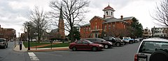
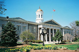
Carroll County is located in the U.S. state of Maryland. As of the 2020 census, the population was 172,891. Its county seat is Westminster.

<span class="mw-page-title-main">Kent County, Maryland</span> County in Maryland, United States

Kent County is a county located in the U.S. state of Maryland. As of the 2020 census, its population was 19,198, making it the least populous county in Maryland. Its county seat is Chestertown. The county was named for the county of Kent in England.

<span class="mw-page-title-main">Wicomico County, Maryland</span> County in Maryland, United States

Wicomico County is located in the southeastern part of the U.S. state of Maryland, on the Delmarva Peninsula. As of the 2020 census, the population was 103,588. The county seat is Salisbury. The county was named for the Wicomico River, which in turn derives its name from the Algonquian language words wicko mekee, meaning "a place where houses are built," apparently referring to a Native American town on the banks. The county is included in the Salisbury, MD-DE Metropolitan Statistical Area.

<span class="mw-page-title-main">King County, Texas</span> County in Texas, United States

King County is a county located in the U.S. state of Texas. The population was 265 at the 2020 census, making it the second-least populated county in Texas and the third-least populated county in the United States. King County has no incorporated communities. Its county seat is the census-designated place (CDP) of Guthrie. The county was created in 1876 and organized in 1891. It is named for William Philip King, who died at the Battle of the Alamo.

<span class="mw-page-title-main">Lebanon County, Pennsylvania</span> County in Pennsylvania, United States

LebanonCounty is a county in the Commonwealth of Pennsylvania, United States. As of the 2020 census, the population was 143,257. Its county seat is the city of Lebanon. It lies 72 miles northwest of Philadelphia, which is the nearest major city. The county is part of the South Central Pennsylvania region of the state.

<span class="mw-page-title-main">Oklahoma County, Oklahoma</span> County in Oklahoma, United States

Oklahoma County is located in the central part of the U.S. state of Oklahoma. As of the 2020 census, the population was 796,292, making it the most populous county in Oklahoma. The county seat is Oklahoma City, the state capital and largest city. Oklahoma County is at the heart of the Oklahoma City metropolitan statistical area.

<span class="mw-page-title-main">Silver Bow County, Montana</span> County in Montana, United States

Silver Bow County is a county in the U.S. state of Montana. As of the 2020 census, the population was 35,133. Its county seat is Butte. In 1977, the city and county governments consolidated to form the single entity of Butte-Silver Bow. Additionally, the town of Walkerville is a separate municipality from Butte and is within the county.

<span class="mw-page-title-main">Monroe County, Missouri</span> County in Missouri, United States

Monroe County is a county in northeast Missouri. As of the 2020 census, the population was 8,666. Its county seat is Paris. It is the birthplace of Mark Twain.

<span class="mw-page-title-main">Wilkinson County, Georgia</span> County in Georgia, United States

Wilkinson County is a county located in the central portion of the U.S. state of Georgia. As of the 2020 census, the population was 8,877. The county seat is Irwinton. The county was created on May 11, 1803, and named for General James Wilkinson (1757–1825).

<span class="mw-page-title-main">Montrose County, Colorado</span> County in Colorado, United States

Montrose County is a county located in the U.S. state of Colorado. As of the 2020 census, the population was 42,679. The county seat is Montrose, for which the county is named.

<span class="mw-page-title-main">Emmitsburg, Maryland</span> Town in Maryland, United States

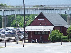
Emmitsburg is a town in Frederick County, Maryland, United States, 0.3 miles (0.5 km) south of the Mason-Dixon line separating Maryland from Pennsylvania.

<span class="mw-page-title-main">Thurmont, Maryland</span> Town in Maryland

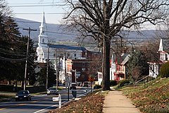
Thurmont is a town in Frederick County, Maryland, United States. The population was 6,935 at the 2020 census. The town is located in the northern part of Frederick County, approximately ten miles from the Pennsylvania border, along U.S. Highway 15. It is very close to Cunningham Falls State Park and Catoctin Mountain Park, the latter of which contains the presidential retreat of Camp David. Thurmont is also home to Catoctin Colorfest, an arts and crafts festival that draws in about 125,000 people each autumn.

Spring Ridge is census-designated place (CDP) and suburban housing community in Frederick County, in the U.S. state of Maryland, just outside the city of Frederick. As of the 2020 census it had a population of 6,005. Before 2010, it was part of the Linganore-Bartonsville, Maryland census-designated place, which was split into three for the 2010 census.

<span class="mw-page-title-main">Maryland House of Delegates District 29C</span> American legislative district

Maryland House of Delegates District 29C is one of the 67 districts that compose the Maryland House of Delegates. Along with subdistricts 29A and 29B, it makes up the 29th district of the Maryland Senate. District 29C includes parts of Calvert County and St. Mary's County, and is represented by one delegate.

<span class="mw-page-title-main">Maryland House of Delegates District 1B</span> American legislative district

Maryland House of Delegates District 1B is one of the 67 districts that compose the Maryland House of Delegates. Along with subdistricts 1A and 1C, it makes up the 1st district of the Maryland Senate. Near the state's western border, District 1B is located entirely within Allegany County. Since 2015, it has been represented by Jason C. Buckel, a Republican.

<span class="mw-page-title-main">Maryland House of Delegates District 3A</span> American legislative district

Maryland House of Delegates District 3A is one of the 67 districts that compose the Maryland House of Delegates. Along with subdistrict 3B, it makes up the 3rd district of the Maryland Senate. District 3A includes part of Frederick County and is represented by two delegates.

<span class="mw-page-title-main">Maryland House of Delegates District 3B</span> American legislative district

Maryland House of Delegates District 3B is one of the 67 districts that compose the Maryland House of Delegates. Along with subdistrict 3A, it makes up the 3rd district of the Maryland Senate. District 3B includes part of Frederick County and is represented by one delegate.

<span class="mw-page-title-main">2022 Maryland Senate election</span> Legislative election in Maryland

The 2022 Maryland Senate election were held on November 8, 2022, to elect senators in all 47 districts of the Maryland Senate. Members were elected in single-member constituencies to four-year terms. These elections were held concurrently with various federal and state elections, including for Governor of Maryland. The Democratic and Republican primaries were held on July 19, 2022.

References

  1. "2022 Frederick County Election Results". Frederick County. Retrieved December 5, 2022.
  2. "Frederick County, Maryland". United States Census Bureau . Retrieved January 30, 2022.
  3. "Find a County". National Association of Counties. Archived from the original on May 31, 2011. Retrieved June 7, 2011.
  4. 1 2 "Population Change in Suburban Maryland" (PDF). George Mason University. Retrieved February 16, 2014.
    "Metropolitan sprawl puts urban in suburban". 2012. Retrieved February 16, 2014.
  5. "Frederick County, Maryland – Government". March 5, 2008. Retrieved August 16, 2008 via Maryland State Archives.
  6. "National Register Information System". National Register of Historic Places . National Park Service. April 15, 2008.
  7. "Washington-Arlington-Alexandria, DC-VA-MD-WV". U.S. Census Bureau. U.S. Department of Commerce. Retrieved April 12, 2017.
  8. "2010 Census Gazetteer Files". United States Census Bureau. August 22, 2012. Archived from the original on September 13, 2014. Retrieved September 12, 2014.
  9. "Frederick News-Post Local Section". The Frederick News-Post. Archived from the original on March 16, 2007. Retrieved March 16, 2007.
  10. "Annual Estimates of the Resident Population for Counties: April 1, 2020 to July 1, 2023". United States Census Bureau. Retrieved April 3, 2024.
  11. "Census of Population and Housing from 1790-2000". US Census Bureau . Retrieved January 24, 2022.
  12. "Historical Census Browser". University of Virginia Library. Retrieved September 12, 2014.
  13. "Population of Counties by Decennial Census: 1900 to 1990". United States Census Bureau. Retrieved September 12, 2014.
  14. "Census 2000 PHC-T-4. Ranking Tables for Counties: 1990 and 2000" (PDF). United States Census Bureau. Retrieved September 12, 2014.
  15. 1 2 "P2 Hispanic or Latino, and Not Hispanic or Latino by Race – 2010: DEC Redistricting Data (PL 94-171) - Frederick County, Maryland". United States Census Bureau.
  16. 1 2 "P2 Hispanic or Latino, and Not Hispanic or Latino by Race – 2020: DEC Redistricting Data (PL 94-171) - Frederick County, Maryland". United States Census Bureau.
  17. 1 2 3 "DP-1 Profile of General Population and Housing Characteristics: 2010 Demographic Profile Data". United States Census Bureau. Archived from the original on February 13, 2020. Retrieved January 22, 2016.
  18. "Population, Housing Units, Area, and Density: 2010 - County". United States Census Bureau. Archived from the original on February 13, 2020. Retrieved January 22, 2016.
  19. "DP02 SELECTED SOCIAL CHARACTERISTICS IN THE UNITED STATES – 2006-2010 American Community Survey 5-Year Estimates". United States Census Bureau. Archived from the original on February 13, 2020. Retrieved January 22, 2016.
  20. "Charter Government Transition". Frederick County, MD Government. Archived from the original on March 7, 2014. Retrieved March 7, 2014.
  21. Depies, Lori (March 18, 2013). "Charter Government and Transition: What it means to you and to Frederick County" (PDF). Archived from the original (PDF) on March 7, 2014. Retrieved March 7, 2014.
  22. McManus, Kevin (November 5, 2014). "Gardner Elected Frederick County's First Executive". WFMD-AM. Frederick, Maryland: Aloha Station Trust, LLC. Archived from the original on November 8, 2014.
  23. "2018 county election results in Maryland". WTOP. November 7, 2018.
  24. 1 2 3 "Election Summary Report Gubernatorial General Election, Frederick County, Maryland, November 4, 2014: Summary For Jurisdiction Wide, All Counters, All Races, Unofficial Results, Early Voting, Polling Place, and Absentee 1 Canvass" (PDF). Frederick County Board of Elections. November 6, 2014. Archived from the original (PDF) on November 8, 2014.
    - "2014 Council Districts" (PDF). Frederick County Board of Elections. November 19, 2013. Archived from the original (PDF) on March 5, 2014.
  25. Rodgers, Bethany (November 15, 2014). "Donald takes County Council seat by 25 votes". Frederick News-Post. Retrieved November 15, 2014.
  26. "Maryland Board of Elections Voter Registration Activity Report March 2024" (PDF). Maryland Board of Elections. Retrieved April 9, 2024.
  27. Leip, David. "Dave Leip's Atlas of U.S. Presidential Elections". uselectionatlas.org. Retrieved June 11, 2018.
  28. "Election Summary Report". Archived from the original on January 29, 2015. Retrieved June 30, 2015.
  29. "2018 Maryland Election Results: Governor's race, statewide offices". WTOP. November 6, 2018. Retrieved August 28, 2019.
    - "2018 county election results in Maryland". WTOP. November 7, 2018. Retrieved August 28, 2019.
  30. "2018 Maryland House of Delegates Election Results". WTOP. November 6, 2018. Retrieved August 28, 2019.
  31. "Maryland Election Results 2018: Live Midterm Map by County & Analysis". Politico. Retrieved August 28, 2019.
  32. "Unofficial 2022 Gubernatorial General Election Results for Frederick County". Maryland Board of Elections. November 22, 2022. Retrieved November 22, 2022.
  33. "Maryland Senate Midterm Election Results and Maps 2022 | CNN Politics". CNN. Retrieved January 23, 2023.
  34. Leip, David. "Dave Leip's Atlas of U.S. Presidential Elections - State Data". uselectionatlas.org.
  35. Frederick County Sheriff office website
  36. "2019 Frederick County Sheriff's Office Annual Report". WTOP. November 6, 2018. Retrieved August 28, 2019.
  37. State & County QuickFacts, Frederick County Archived June 6, 2011, at the Wayback Machine , Maryland, United States Census Bureau.
  38. 1 2 Major Employers in Frederick County, Maryland, Maryland Department of Business and Economic Development.
  39. "Maryland at a Glance: Agriculture", Maryland Manual, April 2015.
  40. "Frederick County Dairy Farm Closes Its Doors". CBS News Baltimore. Associated Press. October 1, 2012.
  41. "2020 CENSUS - SCHOOL DISTRICT REFERENCE MAP: Frederick County, MD" (PDF). U.S. Census Bureau . Retrieved March 16, 2024. - Text list
  42. "TANNEHILL, Adamson". Biographical Directory of the United States Congress . Retrieved January 16, 2024.