Wolfsville, Maryland

Last updated

Wolfsville, Maryland
Wolfsville MD1.jpg
The center of Wolfsville
USA Maryland location map.svg
Red pog.svg
Wolfsville
Location in Maryland
Usa edcp location map.svg
Red pog.svg
Wolfsville
Wolfsville (the United States)
Coordinates: 39°34′27″N77°33′02″W / 39.57417°N 77.55056°W / 39.57417; -77.55056
Country Flag of the United States.svg  United States of America
State Flag of Maryland.svg  Maryland
County Flag of Frederick County, Maryland.svg Frederick
Elevation
[1]
315 m (1,034 ft)
GNIS feature ID588318 [1]

Wolfsville is an unincorporated community in Frederick County, Maryland, United States. [1] Situated in the upper Middletown Valley, the village developed as a regional center of commerce and industry in the mid-nineteenth century. The rural character of the community remains well preserved in its culture and architecture today.

Contents

History

Beginning in the second quarter of the 18th century, European settlers, mainly Germans and Swiss, began to populate the northern Middletown Valley. Their first permanent settlement was called Jerusalem, located west of the present-day town of Myersville. As settlers began to spread out in the valley, taking advantage of plentiful timber sources and fertile farm land, crossroad villages began to develop, including Wolfsville, named for the Wolf Family who were living within the present village by the 1830s. In 1848, the population had grown to an extant that the General Assembly established a new election district called Catoctin with Wolfsville at its center. [2] That same year, Wolfsville was affixed as a stop for the stage lines carrying U.S. mail throughout Frederick County. [3] In 1851, a local effort was launched to create a new county from several districts in north-western Frederick and north-eastern Washington Counties, but the Catoctin District voted unanimously against the proposal. [4]

Wolfsville in 1873 1873 Titus Atlas Map of Wolfsville.jpg
Wolfsville in 1873

Wolfsville continued to grow as a commercial center for area farmers. By 1858, the village was served by two general stores, a tannery, and a blacksmith shop. [5] Two decades later, the village had expanded with a total of three general stores, two blacksmith shops, and a post office. [6] Many of these buildings, designed to serve both as commercial spaces and dwellings, remain well-preserved in Wolfsville today. By the turn of the twentieth century, the construction of the Hagerstown and Frederick Railway bypassed Wolfsville several miles to the south, bringing growth to the town of Myersville. [7]

Today, Wolfsville retains much of its historic fabric with a high degree of integrity. Architectural styles range from early vernacular expressions of Greek Revival or Federal styles to late Victorian era examples of Queen Anne and Gothic Revival styles. Several buildings display their original dual use as dwellings and commercial spaces. One general store remains in operation today at the crossroads in the heart of Wolfsville, operated by the Harne Family since 1945. [7] The Hoover Farm, situated on the southeastern edge of the village, preserves an early 19th-century stone dwelling and barn, site of early religious meetings which later formalized into Wolfsville's churches. [7] In the mid-19th century, Wolfsville had three churches: Lutheran, German Reformed, and United Brethren. Two of these congregations remain active today: St. Mark's Lutheran Church and Salem United Brethren Church, both built in 1847 out of native stone, but significantly altered since. [7]

Furniture production

A sewing rocking chair made by Christopher Columbus Stottlemyer, displaying the characteristic scalloped back slats. Stottlemyer Sewing Rocking Chair.jpg
A sewing rocking chair made by Christopher Columbus Stottlemyer, displaying the characteristic scalloped back slats.
A sewing rocking chair made by Kelsey Alvey Gaver in Ellerton, Maryland, closely resembling the Stottlemyer style. Gaver Sewing Rocking Chair.jpg
A sewing rocking chair made by Kelsey Alvey Gaver in Ellerton, Maryland, closely resembling the Stottlemyer style.

For eighty years, Wolfsville was a regional center of chair making, primary through the business operated by the Stottlemyer Family. In the decade prior to the American Civil War, Frederick Stottlemyer (1830-1913) established a shop and began turning Shaker-styled ladderback straight and rocking chairs. Frederick's son, Christopher Columbus Stottlemyer (1857-1931) apprenticed with his father and gradually assumed the management of the family's business, modernizing the production through the introduction of a steam powered lathe and sawmill, increasing the shop's output in the last quarter of the nineteenth century. [8] Christopher Stottlemyer also developed many of the characteristic components for which Stottlemyer Chairs came to be recognized, including scalloped back slats and turned acorn-shaped finials on the back posts of the chairs. Stottlemyer chairs were mostly produced in three forms: straight chairs, sewing or nursing rockers (a rocking chair without arms), and armed rocking chairs. The shop also produced other furniture, including tables and cradles. [9]

Following the death of Christopher Stottlemyer in 1931, the family business was purchased by Kelsey Alvey Gaver of nearby Ellerton who moved production to his family's farm along Catoctin Creek and began producing his own chairs, bearing strong resemblance to those made by his predecessors. Gaver was only in production for a decade before he was killed in action serving in the Pacific during World War II in June 1943. [10]

Other furniture production in the Wolfsville area was carried on by the Marken and Gladhill families in the early and mid-nineteenth century.

Related Research Articles

<span class="mw-page-title-main">Frederick County, Maryland</span> County in Maryland, United States

Frederick County is located in Maryland, United States. As of the 2020 U.S. census, the population was 271,717. The county seat is Frederick.

<span class="mw-page-title-main">Frederick, Maryland</span> City in Maryland, United States

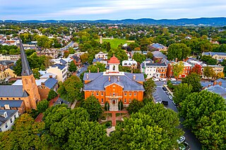
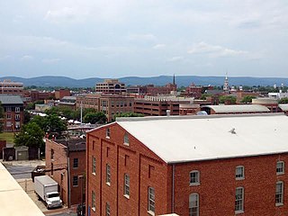
Frederick is a city in, and the county seat of, Frederick County, Maryland, United States. It is located at an important crossroads at the intersection of a major north–south Native American trail and east–west routes to the Chesapeake Bay, both at Baltimore and what became Washington, D.C., and across the Appalachian mountains to the Ohio River watershed. Frederick's population was 78,171 people as of the 2020 census, making it the second-largest incorporated city in Maryland behind Baltimore. It is a part of the Washington metropolitan area and the greater Washington–Baltimore combined statistical area.

<span class="mw-page-title-main">Braddock Heights, Maryland</span> Census-designated place in Maryland

Braddock Heights is an unincorporated community and census-designated place (CDP) in Frederick County, Maryland, United States. The population was 2,608 at the 2010 census. The local ZIP codes are 21714 and 21703.

<span class="mw-page-title-main">Burkittsville, Maryland</span> Town in Maryland, United States

Burkittsville is a historic village in Frederick County, Maryland, United States. The village lies in the southern Middletown Valley along the eastern base of South Mountain.

<span class="mw-page-title-main">Middletown, Maryland</span> Town in Maryland

Middletown is a town in Frederick County, Maryland, United States. The population was 4,136 as of the 2010 census. Located in the Middletown Valley that stretches between the Catoctin Mountains on the east and South Mountain on the west, the town reportedly gained its name from its location midway between those ranges.

<span class="mw-page-title-main">Myersville, Maryland</span> Town in the United States

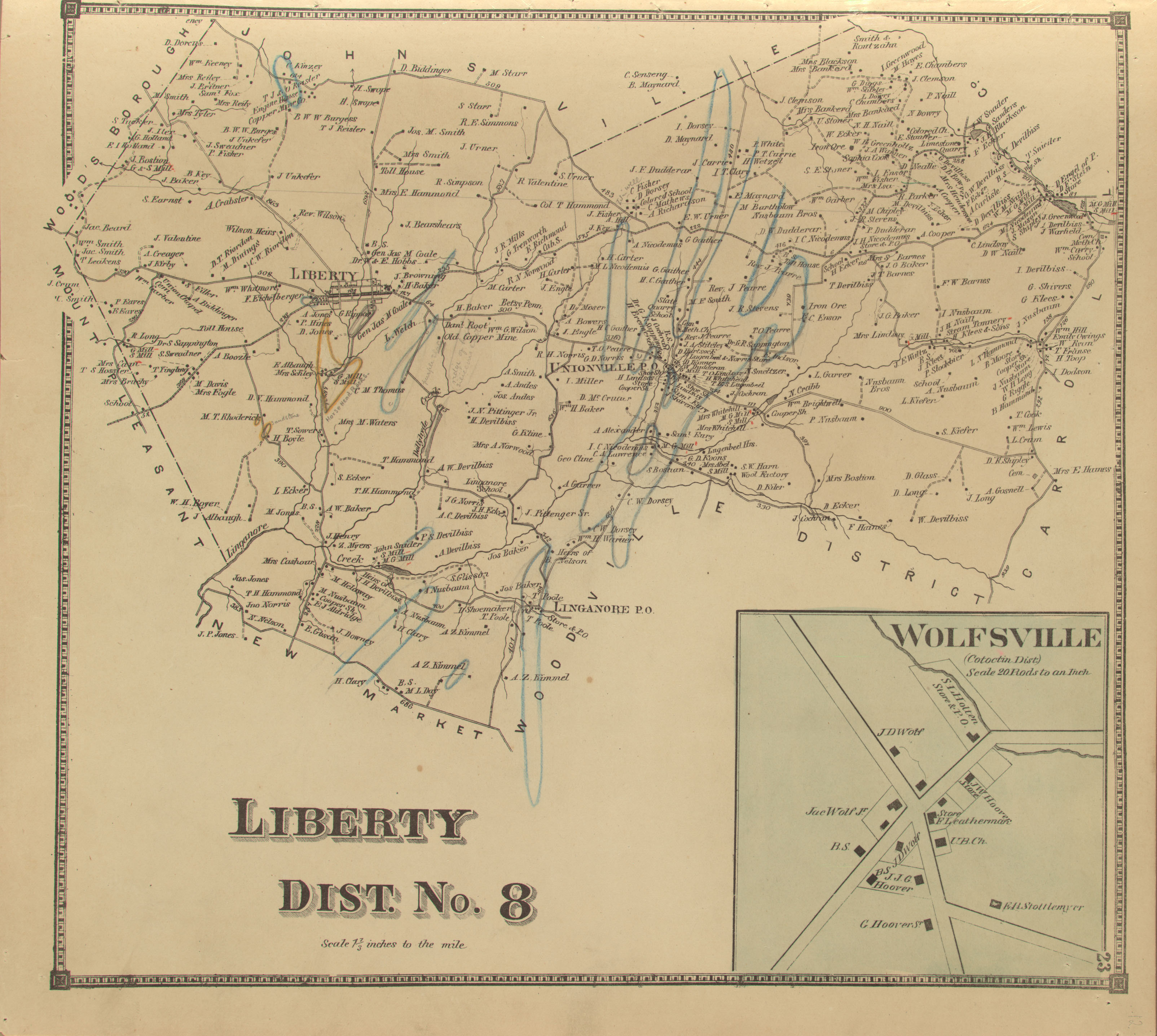
Myersville is a town in Frederick County, Maryland, United States. The population was 1,626 at the 2010 United States Census.

<span class="mw-page-title-main">Rohrersville, Maryland</span> CDP in Maryland, United States

Rohrersville is a census-designated place (CDP) in Washington County, Maryland, United States. The population was 175 at the 2010 census.

<span class="mw-page-title-main">Jefferson, Maryland</span> Census-designated place in Maryland, United States

Jefferson is an unincorporated community and census-designated place (CDP) in Frederick County, Maryland, United States. As of the 2020 census the town had a population of 2,235. Jefferson was established in 1774 and incorporated as a town in 1831. However, a year later, in 1832, the citizens of the town decided that municipal government was unnecessary, and dis-incorporated the town, which has been unincorporated since then.

<span class="mw-page-title-main">Maryland Route 17</span> State highway in Frederick County, Maryland, US

Maryland Route 17 is a state highway in the U.S. state of Maryland. The state highway begins at the Virginia state line at the Potomac River in Brunswick, where the highway continues south as Virginia State Route 287. MD 17 runs 29.49 miles (47.46 km) north from the Brunswick Bridge to the Frederick–Washington county line near Wolfsville. The state highway serves as the main north–south highway of the Middletown Valley of western Frederick County. MD 17 connects Brunswick and Wolfsville with Rosemont, Burkittsville, Middletown, and Myersville. The state highway also connects those communities with the valley's main east–west highways, which include U.S. Route 340, US 40 Alternate, Interstate 70 (I-70), and US 40.

The Hagerstown and Frederick Railway, now defunct, was an American railroad of central Maryland built in the 19th and 20th centuries.

<span class="mw-page-title-main">Maryland Route 77</span> State highway in Maryland, US

Maryland Route 77 is a state highway in the U.S. state of Maryland. The state highway runs 20.74 miles (33.38 km) from MD 64 in Smithsburg east to MD 194 in Keymar. MD 77 is the main east–west highway of northern Frederick County. The state highway connects Thurmont with eastern Washington County via Foxville, which lies between South Mountain and Catoctin Mountain near Catoctin Mountain Park and Cunningham Falls State Park. MD 77 links Thurmont with western Carroll County through the communities of Graceham, Rocky Ridge, and Detour in the Monocacy River valley. MD 77 was constructed from Thurmont east to Detour in the 1920s and early 1930s. A disjoint section of MD 77 was built between Cavetown and Foxville in the late 1930s. The portions of the modern highway between Foxville and Thurmont and from Detour to Keymar were county highways until they were designated part of MD 77 in 1956. MD 77's western terminus was moved east to MD 64 in Smithsburg in 1960.

<span class="mw-page-title-main">Frederick County Public Schools (Maryland)</span>

Frederick County Public Schools (FCPS) is a public school system serving the residents of Frederick County, Maryland. The system includes several schools to serve the educational needs of the youth in Frederick and the surrounding areas of Frederick County.

<span class="mw-page-title-main">Lambs Knoll</span> Mountain in Maryland, US

Lambs Knoll is a peak of South Mountain on the border of Washington County and Frederick County in the state of Maryland. The 1,758 feet (536 m) peak is the second tallest on South Mountain in Maryland behind Quirauk Mountain.

<span class="mw-page-title-main">Johnsville, Maryland</span> Unincorporated community in Maryland, U.S.

Johnsville is an unincorporated community in Frederick County, Maryland, United States. It is located approximately halfway between Libertytown and Union Bridge along Maryland Route 75. The Kitterman-Buckey Farm was listed on the National Register of Historic Places in 2005.

Eakles Mills is an unincorporated community and census-designated place in Washington County, Maryland, United States. Its population was 26 as of the 2020 census. Snively Farm was listed on the National Register of Historic Places in 1979.

<span class="mw-page-title-main">U.S. Route 40 Alternate (Hagerstown–Frederick, Maryland)</span> Highway in Washington and Frederick counties in Maryland

U.S. Route 40 Alternate (US 40 Alternate) is an alternate route of US 40 in the U.S. state of Maryland. The highway runs 22.97 miles (36.97 km) from Potomac Street in Hagerstown east to US 40 in Frederick. US 40 Alternate parallels US 40 and much of Interstate 70 (I-70) to the south through eastern Washington County and western Frederick County. The alternate route connects Hagerstown and Frederick with Funkstown, Boonsboro, Middletown, and Braddock Heights. US 40 Alternate crosses two major north–south components of the Blue Ridge Mountains that separate the Great Appalachian Valley and the Piedmont: South Mountain between Boonsboro and Middletown and Catoctin Mountain, which is locally known as Braddock Mountain, at Braddock Heights.

Petersville is an unincorporated community in Frederick County, Maryland, United States. Petersville is located at the junction of Maryland routes 79 and 180, 1.3 miles (2.1 km) northeast of Rosemont.

<span class="mw-page-title-main">Broad Run, Maryland</span> Unincorporated community in Maryland, United States

Broad Run is an unincorporated community in Frederick County, Maryland, United States. Broad Run is located on Maryland Route 383, 4.5 miles (7.2 km) southeast of Middletown.

<span class="mw-page-title-main">Foxville, Maryland</span> Unincorporated community in Maryland, United States

Foxville is an unincorporated community in Frederick County, Maryland, United States. Foxville is located on Maryland Route 77, 4.7 miles (7.6 km) west of Thurmont. Settled in the late 18th century, the historic village is situated between South Mountain to the west and Catoctin Mountain to the east. Catoctin Mountain Park, Cunningham Falls State Park, and the Appalachian Trail are all within a few miles of Foxville.

Garfield is an unincorporated community in Frederick County, Maryland, United States, situated within the District 6, Catoctin. It has an elevation of 1,453 feet (443 m).

References

  1. 1 2 3 U.S. Geological Survey Geographic Names Information System: Wolfsville, Maryland
  2. Scharf, J. Thomas (1882). History of Western Maryland. Philadelphia: L.H. Everts. p. 595.
  3. Extract from the Act of Congress. Baltimore. March 10, 1848. p. 1.{{cite book}}: |work= ignored (help)
  4. New County. Baltimore. February 13, 1851. p. 1.{{cite book}}: |work= ignored (help)CS1 maint: location missing publisher (link)
  5. "Isaac Bond Atlas of Frederick County". Legacy of Slavery in Maryland. Maryland State Archives.
  6. "Liberty District/Wolfsville Map 1873". Frederick Roots.
  7. 1 2 3 4 Davis, Janet L. "Wolfsville Survey District" (PDF). Maryland Historical Trust.
  8. Main Street. Hagerstown: The Daily Mail. August 18, 1971. p. 3.
  9. Shanley, Barbara. "Stottlemyer Rocking Chairs".{{cite journal}}: Cite journal requires |journal= (help)
  10. Public Sale. Frederick: The News. April 8, 1944. p. 7.