Rosemont, Maryland

Last updated

Rosemont, Maryland
Village of Rosemont
Rosemont MD1.jpg
Rosemont
Seal of Rosemont, Maryland.png
Frederick County Maryland Incorporated and Unincorporated areas Rosemont Highlighted.svg
Coordinates: 39°19′54″N77°37′27″W / 39.33167°N 77.62417°W / 39.33167; -77.62417
Country Flag of the United States.svg  United States of America
State Flag of Maryland.svg  Maryland
County 2023 flag of Frederick County, Maryland.svg Frederick
Incorporated 1953 [1]
Government
  Type Municipality
Area
[2]
  Total0.56 sq mi (1.44 km2)
  Land0.56 sq mi (1.44 km2)
  Water0.00 sq mi (0.00 km2)
Elevation
[3]
495 ft (151 m)
Population
 (2020)
  Total272
  Density489.21/sq mi (188.81/km2)
Time zone UTC-5 (Eastern (EST))
  Summer (DST) UTC-4 (EDT)
FIPS code 24-68600
GNIS feature ID2391099 [3]
Website sites.google.com/site/rosemontmd/

Rosemont is a village in Frederick County, Maryland, United States. The population was 272 at the 2020 census. Maryland state routes 79 and 871 pass through Rosemont. [4]

Contents

Geography

According to the United States Census Bureau, the village has a total area of 0.56 square miles (1.45 km2), all land. [5]

MD 17 southbound approaching its junction with MD 79 and MD 464 in Rosemont 2019-05-19 13 55 09 View south along Maryland State Route 17 (Burkittsville Road) just north of Maryland State Route 79 (Petersville Road) and Maryland State Route 464 (Souder Road) in Rosemont, Frederick County, Maryland.jpg
MD 17 southbound approaching its junction with MD 79 and MD 464 in Rosemont

Transportation

The primary means of travel to and from Rosemont is by road. Despite its small size, the village is served by four separate state highways. The most prominent of these is Maryland Route 17, which skims the southwest side of the village. MD 17 continues southward to Brunswick and onward across the Potomac River to Virginia, where it becomes Virginia State Route 287. To the north, MD 17 interchanges with U.S. Route 340, then continues on to Burkittsville, Middletown and Myersville, where it interchanges with Interstate 70. Other state highways serving Rosemont include Maryland Route 79, Maryland Route 464 and Maryland Route 871.

Demographics

Historical population
CensusPop.Note
1960 212
1970 25017.9%
1980 223−10.8%
1990 25614.8%
2000 2736.6%
2010 2947.7%
2020 272−7.5%
U.S. Decennial Census [6]

2010 census

As of the census [7] of 2010, there were 294 people, 114 households, and 84 families living in the village. The population density was 525.0 inhabitants per square mile (202.7/km2). There were 118 housing units at an average density of 210.7 per square mile (81.4/km2). The racial makeup of the village was 92.9% White, 1.4% African American, 0.3% Asian, 0.3% Pacific Islander, 0.7% from other races, and 4.4% from two or more races. Hispanic or Latino of any race were 1.4% of the population.

There were 114 households, of which 22.8% had children under the age of 18 living with them, 58.8% were married couples living together, 9.6% had a female householder with no husband present, 5.3% had a male householder with no wife present, and 26.3% were non-families. 18.4% of all households were made up of individuals, and 10.6% had someone living alone who was 65 years of age or older. The average household size was 2.58 and the average family size was 2.93.

The median age in the village was 49.6 years. 14.6% of residents were under the age of 18; 8.2% were between the ages of 18 and 24; 19% were from 25 to 44; 38.4% were from 45 to 64; and 19.7% were 65 years of age or older. The gender makeup of the village was 49.3% male and 50.7% female.

2000 census

As of the census [8] of 2000, there were 273 people, 104 households, and 76 families living in the village. The population density was 488.3 inhabitants per square mile (188.5/km2). There were 106 housing units at an average density of 189.6 per square mile (73.2/km2). The racial makeup of the village was 99.27% White, 0.37% African American and 0.37% Native American. Hispanic or Latino of any race were 0.37% of the population.

There were 104 households, out of which 26.0% had children under the age of 18 living with them, 63.5% were married couples living together, 8.7% had a female householder with no husband present, and 26.9% were non-families. 16.3% of all households were made up of individuals, and 10.6% had someone living alone who was 65 years of age or older. The average household size was 2.63 and the average family size was 3.04.

In the village, the population was spread out, with 19.8% under the age of 18, 5.9% from 18 to 24, 23.1% from 25 to 44, 31.9% from 45 to 64, and 19.4% who were 65 years of age or older. The median age was 46 years. For every 100 females, there were 88.3 males. For every 100 females age 18 and over, there were 87.2 males.

The median income for a household in the village was $59,750, and the median income for a family was $66,875. Males had a median income of $52,000 versus $31,806 for females. The per capita income for the village was $24,382. None of the families and 1.0% of the population were living below the poverty line, including none under eighteen and 4.2% of those over 64.

Related Research Articles

<span class="mw-page-title-main">Rosemont, California</span> Census-designated place in California, United States

Rosemont is a census-designated place (CDP) in Sacramento County, California, United States. It is part of the Sacramento–Arden-Arcade–Roseville metropolitan area. The population rose to 23,510 at the 2020 census. It was 22,681 at the 2010 census, down from 22,904 at the 2000 census.

<span class="mw-page-title-main">Midland, Maryland</span> Town in Maryland, United States

Midland is a town in Allegany County, Maryland, United States, along the Georges Creek Valley. It is part of the Cumberland, MD-WV Metropolitan Statistical Area. The population was 446 at the 2010 census. Midland was founded in 1850 as a coal-mining community, though today only some strip mining remains.

<span class="mw-page-title-main">Goldsboro, Maryland</span> Town in Maryland

Goldsboro is a town in Caroline County, Maryland, United States. William James Yeager is the current mayor. The population was 246 at the 2010 United States Census. The zip code is 21636. First known as Oldtown, it was renamed in 1870 for the prominent Goldsborough family who owned land in the area. Castle Hall was listed on the National Register of Historic Places in 1975.

<span class="mw-page-title-main">Greensboro, Maryland</span> Town in Maryland

Greensboro is a town located on the banks of the Choptank River in Caroline County, Maryland, United States. The population was 1,931 at the 2010 United States Census. The ZIP code is 21639. The primary phone exchange is 482 and the area code is 410. The town is served by Maryland Routes 480 and 313.

<span class="mw-page-title-main">Charlestown, Maryland</span> Town in Maryland, United States

Charlestown is a town in Cecil County, Maryland, United States. The population was 1,183 at the 2010 census.

<span class="mw-page-title-main">Friendsville, Maryland</span> Town in Maryland, United States

Friendsville is a town in Garrett County, Maryland, United States. The population was 438 at the 2020 census.

<span class="mw-page-title-main">Grantsville, Maryland</span> Town in Maryland, United States

Grantsville is a town in the northern part of Garrett County, Maryland, United States, near the Pennsylvania border. The population was 968 as of the 2020 census.

<span class="mw-page-title-main">Kitzmiller, Maryland</span> Town in Maryland, United States

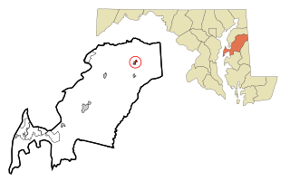
Kitzmiller is a town in Garrett County, Maryland, United States. The population was 321 at the 2010 census.

<span class="mw-page-title-main">Loch Lynn Heights, Maryland</span> Town in Maryland, United States

Loch Lynn Heights is a town in Garrett County, Maryland, United States. The population was 493 at the 2020 census.

<span class="mw-page-title-main">Chevy Chase Section Five, Maryland</span> Village in Maryland, United States

Chevy Chase Section Five is an incorporated village in Montgomery County, Maryland, United States. The population was 672 at the 2020 census.

<span class="mw-page-title-main">Chevy Chase Village, Maryland</span> Town in Maryland, United States

Chevy Chase Village is an incorporated municipality in Montgomery County, Maryland, United States, bordering Washington, D.C. The population was 2,049 as of the 2020 census. The town was the wealthiest in Maryland as of 2017, with a median income of over $250,000, the highest income bracket listed by the census bureau, and a median home value of $1,823,800.

<span class="mw-page-title-main">Laytonsville, Maryland</span> Town in Maryland, United States

Laytonsville is a town in Montgomery County, Maryland, United States. The population was 572 at the 2020 census, up from 353 in 2010. Laytonsville was incorporated in 1892.

<span class="mw-page-title-main">Martin's Additions, Maryland</span> Village in Maryland, United States

Martin's Additions is a village in Montgomery County, Maryland, United States. It was established as a Special Tax District in 1916 and incorporated as a village in 1985. The population was 946 at the 2020 Census.

<span class="mw-page-title-main">Sudlersville, Maryland</span> Town in Maryland, United States

Sudlersville is a town in the far northeastern corner of Queen Anne's County, Maryland, United States. The ZIP code is 21668 and the area code is 410. The population was 497 at the 2010 census. It is perhaps best known as the hometown of Baseball Hall Of Fame slugger Jimmie Foxx. Other famous residents include astronomer and mathematician Simon Newcomb.

<span class="mw-page-title-main">Bull Creek, Missouri</span> Village in Missouri, United States

Bull Creek is a village in northwest Taney County, Missouri, United States. The population was 426 at the 2020 census. It is part of the Branson, Missouri Micropolitan Statistical Area.

<span class="mw-page-title-main">Fredericktown, Ohio</span> Village in Ohio, United States

Fredericktown is a village in Knox County, Ohio, United States. The population was 2,648 at the 2020 census.

<span class="mw-page-title-main">Lakeview, Ohio</span> Village in Ohio, United States

Lakeview is a village in Logan County, Ohio, United States. The population was 1,184 at the 2020 census.

<span class="mw-page-title-main">Carpendale, West Virginia</span> Town in West Virginia, United States

Carpendale is a town in Mineral County, West Virginia, United States, and part of the Cumberland, MD-WV Metropolitan Statistical Area'. The population was 861 at the 2020 census. Carpendale was incorporated on January 2, 1990, by the Circuit Court. The town is a combination of three subdivisions of which its name reflects: Carpenters Addition, Millerdale I, and Millerdale II. There are no stores in Carpendale and there is only one road in and out of the town.

<span class="mw-page-title-main">Elk Garden, West Virginia</span> Town in West Virginia, United States

Elk Garden is a town in Mineral County, West Virginia, United States. It is part of the 'Cumberland, MD-WV Metropolitan Statistical Area'. The population was 211 at the 2020 census. Elk Garden High School was consolidated into Keyser High School in 1997. However the Primary School is still in session, offering classes from Pre-Kindergarten through the fifth grade. The school mascot is the Elk Garden Stags. Elk Garden was incorporated in 1890 by the Mineral County Circuit Court. It is named for an elk lick near the original town site.

<span class="mw-page-title-main">Hampstead, Maryland</span> Town in Maryland, United States

Hampstead is a town in Carroll County in the U.S. state of Maryland. The population was 6,323 at the 2010 census.

References

  1. "Rosemont". Maryland Manual. Retrieved June 26, 2017.
  2. "2020 U.S. Gazetteer Files". United States Census Bureau. Retrieved April 26, 2022.
  3. 1 2 U.S. Geological Survey Geographic Names Information System: Rosemont, Maryland
  4. "US Gazetteer files: 2010, 2000, and 1990". United States Census Bureau. February 12, 2011. Retrieved April 23, 2011.
  5. "US Gazetteer files 2010". United States Census Bureau. Archived from the original on January 25, 2012. Retrieved January 25, 2013.
  6. "Census of Population and Housing". Census.gov. Retrieved June 4, 2015.
  7. "U.S. Census website". United States Census Bureau . Retrieved January 25, 2013.
  8. "U.S. Census website". United States Census Bureau . Retrieved January 31, 2008.