Burkittsville, Maryland

Last updated

Burkittsville, Maryland
Burkittsville street.JPG
Main Street in Burkittsville
Flag of Burkittsville, Maryland.png
Seal of Burkittsville, Maryland.png
Frederick County Maryland Incorporated and Unincorporated areas Burkittsville Highlighted.svg
Location of Burkittsville, Maryland
Coordinates: 39°23′30″N77°37′33″W / 39.39167°N 77.62583°W / 39.39167; -77.62583
CountryUnited States
State Maryland
County Frederick
Incorporated 1894;130 years ago (1894) [1]
Area
[2]
  Total0.46 sq mi (1.19 km2)
  Land0.45 sq mi (1.18 km2)
  Water0.00 sq mi (0.01 km2)
Elevation
[3]
551 ft (168 m)
Population
 (2020)
  Total142
  Density312.78/sq mi (120.70/km2)
Time zone UTC−05:00 (Eastern (EST))
  Summer (DST) UTC−04:00 (EDT)
ZIP Code
21718
Area code(s) 301, 240
FIPS code 24-11400
GNIS feature ID2390762 [3]
Website Burkittsville-MD.gov

Burkittsville is a historic village in Frederick County, Maryland, United States. The village lies in the southern Middletown Valley along the eastern base of South Mountain.

Contents

Burkittsville is a residential area with an economy based in agriculture and tourism. The village was the scene of the Battle of Crampton's Gap, part of the Battle of South Mountain during the Maryland Campaign of the Civil War on September 14, 1862. Burkittsville was also made a subject of national attention when it was used as the setting of the 1999 horror film The Blair Witch Project . Nearby attractions include the Gathland State Park and the Appalachian Trail.

The population was 142 as of the 2020 census.

History

Harley/Arnold Farm David Arnold House, Burkittsville, MD.jpg
Harley/Arnold Farm

English settlement in this region began in the early 18th century. Land was being surveyed and patented in the south-western portion of the Middletown Valley beginning in the 1720s. The first land tract to be patented within the present boundaries of Burkittsville was "Dawson's Purchase," dated May 14, 1741. [4] The Harley/Arnold Farm, located on the western border of the village at the base of South Mountain, stands on the "Dawson's Purchase" tract.

Burkittsville was first founded by two property owners: Major Joshua Harley and Henry Burkitt. The western half was first founded as "Harley's Post Office" in 1824. After Harley's passing in 1828, Burkitt renamed it Burkittsville. Over the next thirty years it grew as a community with stores, shops, blacksmiths, a schoolhouse, and a tannery.

On September 13, 1862, Confederate cavalry under command of Colonel Thomas Munford (under General J.E.B. Stuart) occupied Burkittsville. On Sunday, September 14, the forces of the Union and Confederate armies engaged in the Battle of Crampton's Gap, a bloody prelude to the Battle of Antietam. The Reformed and Lutheran churches and adjacent schoolhouse were used as hospitals for the more than 300 wounded of both sides. These buildings still stand today.

Routinely characterized as the trigger to Antietam, victory at Crampton's Gap embodied Union Gen. George B. McClellan's strategic reaction to his acquiring the legendary “Lost Order” at Frederick which disclosed Confederate Gen. Robert E. Lee's campaign movements. It was McClellan's intention to “cut the enemy in two and beat him in detail”.

Union Cemetery in Burkittsville, established in 1831. Burkittsville Cemetery MD1.jpg
Union Cemetery in Burkittsville, established in 1831.

After seizing Crampton's Gap Gen. William B. Franklin failed to relieve the besieged Union garrison at Harpers Ferry, and more importantly to prevent Confederate generals James Longstreet and “Stonewall” Jackson from reuniting at Sharpsburg. There Lee hastily stood his ground in the mammoth battle of Antietam, the war's bloodiest day. President Abraham Lincoln then used the marginal Union victory at Antietam as a springboard to his Emancipation Proclamation which changed war aims. Without the fall of Crampton's Gap there would have been no Antietam.

Nearly all of Burkittsville is a historic district, listed on the National Register of Historic Places on November 20, 1975. The 300 acres (120 ha) district includes about 70 contributing structures. [5] The Burkittsville Historic District is itself part of the larger Crampton's Gap Historic District, which comprises the southern portion of the lands involved in the Battle of South Mountain, extending from the western side of Crampton's Gap, over South Mountain and about a mile to the east of Burkittsville. [6]

Blair Witch

Burkittsville gained popularity with the 1999 film The Blair Witch Project and the franchise.

Geography

According to the United States Census Bureau, the town has a total area of 0.45 square miles (1.17 km2), all land. [7]

Transportation

MD 17 southbound leaving central Burkittsville 2019-05-19 13 41 57 View south along Maryland State Route 17 (Potomac Street) between Main Street and Lake Side Drive in Burkittsville, Frederick County, Maryland.jpg
MD 17 southbound leaving central Burkittsville

The main method of travel to and from Burkittsville is by road. The only significant highway serving the town is Maryland Route 17, which follows Potomac Street within the town limits. To the north, MD 17 connects to Middletown and eventually reaches Interstate 70 in Myersville. Heading south, MD 17 interchanges with U.S. Route 340 just before reaching Brunswick.

Demographics

Historical population
CensusPop.Note
1870 293
1880 280−4.4%
1890 273−2.5%
1900 229−16.1%
1910 228−0.4%
1920 200−12.3%
1930 173−13.5%
1940 1772.3%
1950 1907.3%
1960 2089.5%
1970 2216.3%
1980 202−8.6%
1990 194−4.0%
2000 171−11.9%
2010 151−11.7%
2020 142−6.0%
U.S. Decennial Census [8]

2010 census

As of the 2010 census [9] there were 151 people, 69 households, and 42 families residing in the town. The population density was 335.6 inhabitants per square mile (129.6/km2). There were 74 housing units at an average density of 164.4 per square mile (63.5/km2). The racial makeup of the town was 99.3% White and 0.7% Asian. Hispanic or Latino of any race were 1.3% of the population.

There were 69 households, of which 20.3% had children under the age of 18 living with them, 50.7% were married couples living together, 4.3% had a female householder with no husband present, 5.8% had a male householder with no wife present, and 39.1% were non-families. 34.8% of all households were made up of individuals, and 10.1% had someone living alone who was 65 years of age or older. The average household size was 2.19 and the average family size was 2.79.

The median age in the town was 50.5 years. 15.9% of residents were under the age of 18; 3.9% were between the ages of 18 and 24; 21.9% were from 25 to 44; 43.1% were from 45 to 64; and 15.2% were 65 years of age or older. The gender makeup of the town was 50.3% male and 49.7% female.

2000 census

Resurrection Reformed Church Burkittsville MD4.jpg
Resurrection Reformed Church

As of the census [10] of 2000, there were 171 people, 72 households, and 49 families residing in the town. The population density was 415.8 inhabitants per square mile (160.5/km2). There were 76 housing units at an average density of 184.8 per square mile (71.4/km2). The racial makeup of the town was 94.74% White, 1.17% African American and 4.09% Asian. 1.8 percent of the population is Hispanic or Latino of any race.

There were 72 households out of which 30.6% had children under the age of 18 living with them, 61.1% were married couples living together, 5.6% had a female householder with no husband present, and 31.9% were non-families. 26.4% of all households were made up of individuals, and 5.6% had someone living alone who was 65 years of age or older. The average household size was 2.38 and the average family size was 2.92.

In the town, the population was spread out, with 22.8% under the age of 18, 2.3% from 18 to 24, 38.6% from 25 to 44, 28.1% from 45 to 64, and 8.2% who were 65 years of age or older. The median age was 40 years. For every 100 females, there were 85.9 males. For every 100 females age 18 and over, there were 88.6 males.

The median income for a household in the town was $50,313, and the median income for a family was $53,125. Males had a median income of $45,833 versus $30,417 for females. The per capita income for the town was $24,919. About 4.1% of families and 4.4% of the population were below the poverty line, including none of those under the age of eighteen and 5.6% of those 65 or over.

Points of interest

Related Research Articles

<span class="mw-page-title-main">Washington County, Maryland</span> County in Maryland, United States

Washington County is located in the western part of the U.S. state of Maryland. As of the 2020 census, the population was 154,705. It is the most populous county in the Western Maryland region and its county seat is Hagerstown.

<span class="mw-page-title-main">Cecilton, Maryland</span> Town in Maryland, United States

Cecilton is a town in Cecil County, Maryland, United States. The population was 663 at the 2010 census.

<span class="mw-page-title-main">Emmitsburg, Maryland</span> Town in Maryland, United States

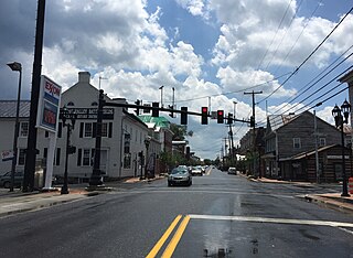
Emmitsburg is a town in Frederick County, Maryland, United States, 0.3 miles (0.5 km) south of the Mason-Dixon line separating Maryland from Pennsylvania.

<span class="mw-page-title-main">Middletown, Maryland</span> Town in Maryland

Middletown is a town in Frederick County, Maryland, United States. The population was 4,136 as of the 2010 census. Located in the Middletown Valley that stretches between the Catoctin Mountains on the east and South Mountain on the west, the town reportedly gained its name from its location midway between those ranges.

<span class="mw-page-title-main">Rosemont, Maryland</span> Village in Maryland

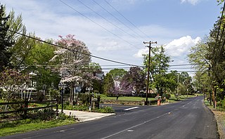
Rosemont is a village in Frederick County, Maryland, United States. The population was 272 at the 2020 census. Maryland state routes 79 and 871 pass through Rosemont.

<span class="mw-page-title-main">Walkersville, Maryland</span> Town in Maryland

Walkersville is a town in Frederick County, Maryland, United States. The population was 5,800 at the 2010 census.

<span class="mw-page-title-main">Mountain Lake Park, Maryland</span> Town in Maryland, United States

Mountain Lake Park is a town in Garrett County, Maryland, United States. The population was 2,147 as of the 2020 census.

<span class="mw-page-title-main">Somerset, Maryland</span> Town in Maryland, United States

Somerset is an incorporated town in Montgomery County, Maryland, United States, located near the border with Washington, D.C. The population was 1,187 at the 2020 census.

<span class="mw-page-title-main">Boonsboro, Maryland</span> Town in Maryland, United States

Boonsboro is a town in Washington County, Maryland, United States, located at the foot of South Mountain. It nearly borders Frederick County and is proximate to the Antietam National Battlefield. The population was 3,779 at the 2020 census.

<span class="mw-page-title-main">Funkstown, Maryland</span> Town in Maryland, United States

Funkstown is a town in Washington County, Maryland, United States. The population was 904 at the 2010 census.

<span class="mw-page-title-main">Keedysville, Maryland</span> Town in Maryland, United States

Keedysville is a town in Washington County, Maryland, United States. The population was 1,152 at the 2010 census.

<span class="mw-page-title-main">Sharpsburg, Maryland</span> Town in Maryland, United States

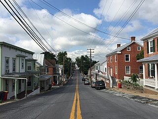
Sharpsburg is a town in Washington County, Maryland. The town is approximately 13 miles (21 km) south of Hagerstown. Its population was 560 at the 2020 census.

<span class="mw-page-title-main">Smithsburg, Maryland</span> Town in Maryland, United States

Smithsburg is a town in Washington County, Maryland, United States. The population was 2,975 at the 2010 census. Smithsburg is close to the former Fort Ritchie army base and just west of the presidential retreat Camp David.

<span class="mw-page-title-main">Middletown, Dauphin County, Pennsylvania</span> Borough in Pennsylvania, United States

Middletown is a borough in Dauphin County, Pennsylvania, on the Susquehanna River, 10 miles (16 km) southeast of Harrisburg. As of the 2020 census, it had a population of 9,550. It is part of the Harrisburg–Carlisle Metropolitan Statistical Area.

<span class="mw-page-title-main">Waynesboro, Pennsylvania</span> Borough in Pennsylvania, United States

Waynesboro is a borough in Franklin County, Pennsylvania, United States. Located on the southern border of the state, Waynesboro is in the Cumberland Valley between Hagerstown, Maryland, and Chambersburg, Pennsylvania. It is part of Chambersburg, PA Micropolitan Statistical Area, which is part of the Washington–Baltimore metropolitan area. It is two miles north of the Mason–Dixon line and close to Camp David and the Raven Rock Mountain Complex.

<span class="mw-page-title-main">Middletown, Virginia</span> Town in Virginia, United States

Middletown is a town in Frederick County, Virginia, United States, in the northern Shenandoah Valley. The population was 1,265 at the 2010 census, up from 1,015 at the 2000 census.

<span class="mw-page-title-main">Mount Jackson, Virginia</span> Town in Virginia, United States

Mount Jackson is a town in Shenandoah County, Virginia, United States. The population was 1,994 at the 2010 census.

<span class="mw-page-title-main">New Market, Virginia</span> Town in Virginia, United States

New Market is a town in Shenandoah County, Virginia, United States. Founded as a small crossroads trading town in the Shenandoah Valley, it has a population of 2,155 as of the most recent 2020 U.S. census. The north–south U.S. 11 and the east–west U.S. 211 pass near it and cross Massanutten Mountain at the town's titular gap.

<span class="mw-page-title-main">Belington, West Virginia</span> City in West Virginia

Belington is a town in Barbour County, West Virginia, United States, situated along the Tygart Valley River. The population was 1,804 as of the 2020 census.

The Battle of Crampton's Gap, or Battle of Burkittsville, was fought between forces under Confederate Brig. Gen. Howell Cobb and Union Maj. Gen. William B. Franklin as part of the Battle of South Mountain on September 14, 1862, at Crampton's Gap in Western Maryland, during the Maryland Campaign of the American Civil War.

References

  1. Burkittsville, Municipalities, Frederick County, Maryland . Retrieved January 28, 2019.{{cite book}}: |work= ignored (help)
  2. "2020 U.S. Gazetteer Files". United States Census Bureau. Retrieved April 26, 2022.
  3. 1 2 U.S. Geological Survey Geographic Names Information System: Burkittsville, Maryland
  4. Tracey, Grace; Dern, John (1987). Pioneers of Old Monocacy: The Early Settlement of Frederick County, Maryland 1721-1743. Baltimore, MD: Genealogical Publishing Co., Inc. p. 363. ISBN   0-8063-1183-5.
  5. Way, Lawrence A.; Cooper, H. Austin; Stowell, Walton D.; Winslow, Barbara; Winslow, Mary K. (May 1975). "National Register of Historic Places Inventory - Nomination Form: Town of Burkittsville". National Park Service. Archived from the original on July 19, 2011. Retrieved March 31, 2011.
  6. Phifer, Paige; Wallace, Edie; Reed, Paula (March 14, 2008). "National Register of Historic Places Registration Form: Crampton's Gap Historic District" (PDF). National Park Service. Archived from the original (PDF) on April 19, 2011. Retrieved March 30, 2011.
  7. "US Gazetteer files 2010". United States Census Bureau. Archived from the original on January 25, 2012. Retrieved January 25, 2013.
  8. "Census of Population and Housing". Census.gov. Retrieved June 4, 2015.
  9. "U.S. Census website". United States Census Bureau . Retrieved January 25, 2013.
  10. "U.S. Census website". United States Census Bureau . Retrieved January 31, 2008.
  11. "Spook Hill Cider and Wine 4 Mile Run". Spook Hill Cider and Wine 4 Mile Run. Retrieved January 6, 2022.