Maryland Route 144

Last updated

MD Route 144.svg

Maryland Route 144

Maryland Route 144
Route information
Maintained by MDSHA and Baltimore DOT
Existed1952–present
Tourist
routes
MUTCD D6-4.svg Historic National Road
MD scenic byway.svg Chesapeake and Ohio Canal Scenic Byway
MD scenic byway.svg Antietam Campaign Scenic Byway
Location
Country United States
State Maryland
Counties Allegany, Washington, Frederick, Carroll, Howard, Baltimore, Baltimore City
Highway system
MD Route 140.svg MD 140 MD Route 145.svg MD 145

Maryland Route 144 (MD 144) is a collection of state highways in the U.S. state of Maryland. These highways are sections of old alignment of U.S. Route 40 (US 40) between Cumberland and Baltimore. Along with US 40 Scenic, US 40 Alternate, and a few sections of county-maintained highway, MD 144 is assigned to what was once the main highway between the two cities, connecting those endpoints with Hancock, Hagerstown, Frederick, New Market, Mount Airy, Ellicott City, and Catonsville. MD 144 has seven disjoint sections of mainline highway that pass through the Appalachian Mountains in Allegany and Washington counties and the rolling Piedmont of Frederick, Carroll, Howard, and Baltimore counties.

Contents

Route description

There are seven mainline sections of MD 144:

MD 144 is a part of the National Highway System as a principal arterial in two sections. The first section runs from the western terminus of MD 144FA at Jefferson Street east to I-70 and US 40 within Frederick. [1] [3] The second section runs from North Rolling Road in Catonsville to the highway's eastern terminus at US 1 in Baltimore. [1] [4]

CumberlandFlintstone

MD Route 144.svg

Maryland Route 144

Location Cumberland Flintstone
Length17.55 mi [1]  (28.24 km)
Tourist
routes
MUTCD D6-4.svg Historic National Road
View west along MD 144 from I-68/US 40 in Pleasant Grove, east of Cumberland 2020-05-28 16 31 48 View west along Maryland State Route 144 (National Pike) from the overpass for Interstate 68 and U.S. Route 40 (National Freeway) in Pleasant Grove, Allegany County, Maryland.jpg
View west along MD 144 from I-68/US 40 in Pleasant Grove, east of Cumberland

MD 144 begins at an intersection with MD 807 (Bedford Road) a short distance north of the Cumberland city limits. The state highway heads east as two-lane undivided Naves Cross Road, passing through a pair of ridges before meeting a pair of ramps to and from westbound I-68 (National Freeway) and heading north of a park and ride lot. Naves Cross Road continues east as MD 807A, while MD 144 turns south onto Christie Road to pass under I-68. Christie Road continues south while MD 144 turns east onto Ali Ghan Road, passing to the south of a park and ride lot. The state highway crosses Evitts Creek before receiving an exit ramp from eastbound I-68 and joins US 220 in a short concurrency. US 220 turns north onto its bypass of Bedford Road while MD 144 continues east, meeting I-68 at Exit 47, a diamond interchange. [1] [5]

Within the interchange, MD 144 becomes National Pike and expands to a four-lane divided highway that follows the valley of Elk Lick Run. The state highway passes under I-68 and reduces to a two-lane undivided highway at Hinkle Road. At Rocky Gap Road, MD 144 begins to closely parallel the eastbound lanes of I-68. The state highway leaves the valley of Elk Lick Run and ascends Martin Mountain. On the climb, MD 144 intersects Pleasant Valley Road, which meets I-68 at Exit 50 and leads to Rocky Gap State Park. At the top of Martin Mountain, the state highway crosses over I-68 and intersects Sunset Orchard Road, which leads to a ramp to westbound I-68. On the descent, MD 144 crosses I-68 again and receives a ramp from the eastbound direction of the freeway and the highways part ways around a quarry. [1] [5]

MD 144 curves around the quarry and rejoins the side of I-68 as the highway passes West Wilson Road and crosses a tributary of Flintstone Creek. The state highway leaves the freeway and passes through the unincorporated village of Flintstone, where the state highway intersects the Exit 56 ramps to and from eastbound I-68 and Black Valley Road, which leads to ramps for westbound I-68. MD 144 joins I-68 and Flintstone Creek in passing through a gap in Warrior Mountain. Gilpin Road, an older alignment of US 40 that is designated MD 144AE, begins to parallel the eastbound side of the state highway at Town Creek Road. The two surface highways cross Town Creek and begin to climb Polish Mountain, with MD 144 following a gentle curve while Gilpin Road follows a winding alignment. MD 144 intersects Gilpin Road as the highway begins the descent from the mountain. MD 144 and I-68 follow Pratt Hollow east between several ridges. The state highway crosses the freeway and over Pine Lick Hollow and closely parallels the westbound direction of I-68 before reaching its eastern terminus at US 40 Scenic (Old National Pike) just north of I-68 Exit 62, just west of Fifteen Mile Creek, and on the edge of Green Ridge State Forest. [1] [5]

Hancock

MD Route 144.svg

Maryland Route 144WB

Location Hancock
Length5.91 mi [1]  (9.51 km)
Tourist
routes
MUTCD D6-4.svg Historic National Road
MD scenic byway.svg Chesapeake and Ohio Canal Scenic Byway
MD 144 in Hancock 1540 - Hancock - MD144.JPG
MD 144 in Hancock

MD 144 begins at Exit 77 of I-68 (National Freeway) north of Woodmont and west of Hancock. The state highway heads south through the diamond interchange to an intersection with US 40 Scenic (National Pike), at which MD 144 turns east as two-lane undivided Western Pike. The state highway intersects Woodmont Road and crosses Little Tonoloway Creek before ascending Tonoloway Ridge. East of the ridge, MD 144 passes through multiple curves through a mixture of farms and forest, intersecting Locher Road, which leads south to Fort Tonoloway State Park, before passing north of Hancock Middle-Senior High School at the town limits of Hancock. The state highway passes through a residential area before issuing a ramp to southbound US 522. MD 144 passes under US 522 itself, crosses Little Tonoloway Creek, and intersects Limestone Road, which is the old alignment of US 522 and unsigned MD 894. [1] [6]

MD 144 continues east as Main Street through downtown Hancock. Access to northbound US 522 as well as both I-70 and I-68 is provided by Virginia Avenue. MD 144 parallels both the Western Maryland Rail Trail and Chesapeake and Ohio Canal National Historical Park one block to the north through the downtown area. The state highway leaves the town limits and passes the C&O Canal's Hancock visitor center and a park and ride lot before crossing Tonoloway Creek. MD 144 reaches its eastern terminus at a partial interchange with I-70 (Eisenhower Memorial Highway). There is no direct access from MD 144 to westbound I-70 at Exit 3; that movement can be completed by turning around at Exit 5. [1] [6]

Hagerstown

MD Route 144.svg

Maryland Route 144WA

Location Hagerstown
Length1.47 mi [1]  (2.37 km)

MD 144 begins at an intersection with US 40 (National Pike) between Huyett and Hagerstown. The state highway heads east as two-lane undivided Washington Street past farmland, residential subdivisions, and a cemetery. After crossing over I-81 (Maryland Veterans Memorial Highway) with no access, MD 144 enters an industrial area and reaches its eastern terminus at a roundabout with Western Maryland Parkway. Western Maryland Parkway, which is unsigned MD 910C heading north, is used to access US 40 and I-81. Washington Street continues east into the city of Hagerstown, where it meets US 40 again in the downtown area. [1] [7]

FrederickBartonsville

MD Route 144.svg

Maryland Route 144FA

Location Frederick Bartonsville
Length5.57 mi [1]  (8.96 km)
Tourist
routes
MUTCD D6-4.svg Historic National Road
MD scenic byway.svg Antietam Campaign Scenic Byway
MD 144 eastbound in downtown Frederick 2008 03 28 - Frederick - MD 144-355 (South St) at Ice St - Broadway St 2.JPG
MD 144 eastbound in downtown Frederick

The old alignment of US 40 through Frederick begins at a partial cloverleaf interchange with the Frederick Freeway, which heads north from the interchange as US 15 and south as a concurrency of US 15 and US 40. Patrick Street heads east from the interchange as a four-lane undivided highway that splits into a one-way pair just beyond West College Terrace/Catoctin Avenue. The eastbound direction, which is signed as eastbound MD 144 at the split, follows municipally-maintained South Street. MD 144 in Frederick officially begins at the intersection of Patrick Street, which is one-way westbound, and Jefferson Street, which was formerly US 340. Both streets pass through the Frederick Historic District: Patrick Street crosses Carroll Creek into the commercial district, while South Street has a more residential flavor. Both streets intersect Market Street, the main northsouth thoroughfare of the downtown area that was formerly MD 355. The eastbound direction of MD 144 turns north onto East Street, passing by the Frederick station serving the Frederick Branch of MARC's Brunswick Line and traversing Carroll Creek before meeting Patrick Street. [1] [8]

MD 144 heads east from downtown Frederick on two-lane undivided Patrick Street. The state highway crosses Carroll Creek and passes between a residential area to the south and the Frederick Fairgrounds to the north. MD 144 expands to a four-lane undivided street and continues east through an industrial area where the highway intersects Monocacy Boulevard, which is used to access westbound I-70 and Frederick Municipal Airport. Just before reaching I-70, the street's alignment continues straight as an unnamed road, unsigned MD 870G, that receives the westbound Exit 56 ramp from I-70 and is used to access Bowmans Farm Road. MD 144 reduces to two lanes and veers to the southeast to cross I-70 (Baltimore National Pike), then curves back to the original alignment ahead of ramps to and from eastbound I-70 at the intersection with Quinn Orchard Road. [1] [8]

MD 144 continues east as Old National Pike, a two-lane undivided road that is paralleled by an unused carriageway immediately to the north that serves as a park and ride and the original alignment further north, which is lined with scattered residences. The two southern carriageways cross the Monocacy River on bridges while the northernmost road dead ends at the site of the removed Jug Bridge. East of Bartonsville Road, MD 144 expands to a four-lane divided highway, with the westbound direction making use of what to the west was an unused carriageway. The original alignment, Baltimore Road, now parallels the highway to the south, while Long Branch parallels the highway to the north. MD 144 crosses Long Branch before approaching its eastern terminus. Westbound MD 144 receives a loop ramp from Exit 59 of westbound I-70. The old alignment, Old National Pike, heads north from the divided highway, passes under I-70, and turns east toward New Market as a county highway. MD 144 continues east to its terminus at Ijamsville Road, where the divided highway ends, with the eastbound direction becoming an entrance ramp to eastbound I-70. [1] [8]

New Market

MD Route 144.svg

Maryland Route 144FB

Location New Market
Length0.31 mi [1]  (500 m)
Tourist
routes
MUTCD D6-4.svg Historic National Road

Old National Pike parallels I-70 as a county highway for about 3 miles (4.8 km) to the western town limits of New Market. The road heads east through New Market as Main Street, which is a municipal street that passes through the New Market Historic District, within which it intersects MD 874 (Prospect Street). MD 144 begins again at the east town limit of New Market, where it heads east as Old National Pike. The original alignment continues straight to a dead end while the state highway turns north and then east to its eastern terminus at MD 75 (Green Valley Road), which is used to access I-70. Old National Pike continues east as a county highway for about 6 miles (9.7 km) to Mount Airy on the FrederickCarroll county line. [1] [9]

Mount Airy Ellicott City

MD Route 144.svg

Maryland Route 144A

Location Mount Airy Ellicott City
Length17.20 mi [1]  (27.68 km)
Tourist
routes
MUTCD D6-4.svg Historic National Road
MD 144 eastbound past MD 27 in Mount Airy 2020-06-08 14 29 23 View east along Maryland State Route 144 (Frederick Road) just east of Maryland State Route 27 (Ridge Road) just south of Mount Airy in Carroll County, Maryland.jpg
MD 144 eastbound past MD 27 in Mount Airy

MD 144 begins at an intersection with MD 27 (Ridge Road) just south of MD 27's interchange with I-70 south of Mount Airy. The state highway, known as Frederick Road, immediately turns north and after 0.07 miles (0.11 km) crosses the FrederickCarroll County line. [1] MD 144 passes Parr's Spring, the source of the Patapsco River, before curving to the east through residential subdivisions and closely paralleling the eastbound lanes of I-70. [1] Shortly after crossing the Patapsco River and entering Howard County, the state highway veers away from the freeway and passes through a mix of farmland and scattered residences. MD 144 intersects Long Corner Road and Watersville Road before reaching Lisbon, where the highway meets MD 94 (Woodbine Road) at a roundabout. The state highway continues past Daisy Road and Morgan Station Road to Cooksville, where the highway passes the historic Roberts Inn and intersects MD 97 (Roxbury Mills Road). A park and ride lot is located at the northeast corner of this intersection. MD 144 continues east to West Friendship, where the highway crosses the Middle Patuxent River and Terrapin Branch, passes the Howard County Fairgrounds, and intersects MD 32 (Sykesville Road). The state highway leaves the farmland behind and passes through a mixture of forest and residential subdivisions, passing Marriottsville Road and Folly Quarter Road. On the western edge of Ellicott City, MD 144 reaches its eastern terminus at US 40 (Baltimore National Pike). [1] [10]

Ellicott City Baltimore

MD Route 144.svg

Maryland Route 144

Location Ellicott City Baltimore
Length8.62 mi [1] [2]  (13.87 km)
Tourist
routes
MUTCD D6-4.svg Historic National Road

Frederick Road splits off from US 40 as a county highway about 1 mile (1.6 km) east of the eastern end of the Mount Airy Ellicott City portion of MD 144. This county highway parallels US 40 to the south as it passes through residential subdivisions, crossing the Little Patuxent River, intersecting Centennial Lane and St. John's Lane, and passing the historic home MacAlpine. Frederick Road passes under US 29 (Columbia Pike) before intersecting Toll House Road. The county highway intersects Rogers Avenue and descends into downtown Ellicott City as Main Street. Within the Ellicott City Historic District and nearby are the Howard County offices and the Howard County Circuit Courthouse, the remains of the Patapsco Female Institute, and the Ellicott City Station, which preserves the oldest remaining passenger train station in the U.S. as a railroad museum. The highway passes under the Oliver Viaduct, which carries CSX's Old Main Line Subdivision railroad line, before crossing the Patapsco River into Baltimore County. [11]

View east along MD 144 at MD 166 in Catonsville 2020-08-07 18 34 35 View east along Maryland State Route 144 (Frederick Road) at Maryland State Route 166 (Rolling Road) in Catonsville, Baltimore County, Maryland.jpg
View east along MD 144 at MD 166 in Catonsville

MD 144 begins at the county line as two-lane undivided Frederick Road, where the state highway passes through the Ellicott's Mills Historic District. The state highway parallels the Patapsco River east to River Road, where the highway gains an eastbound climbing lane and leaves the steep river valley. MD 144 passes several loops of old alignment on the ascent, which concludes shortly after passing Old Frederick Road. MD 144 continues east through a densely populated residential area, intersecting North Rolling Road and entering Catonsville, where the highway intersects MD 166 (South Rolling Road), which heads south toward the University of Maryland Baltimore County and Baltimore/Washington International Thurgood Marshall Airport (via I-195). The state highway passes close to the historic home Summit and passes between the Old Catonsville Historic District and Central Catonsville and Summit Park Historic District as it enters downtown Catonsville, which contains Old Catonsville High School. At the eastern end of the central business district, MD 144 passes Wade Avenue, which heads south to Spring Grove Hospital Center, before meeting I-695 (Baltimore Beltway) at a diamond interchange. [1] [11]

View west along Lombard Street (MD 144) at Monroe Street (US 1) in Baltimore 2020-07-29 12 49 37 View west along Maryland State Route 144 (West Lombard Street) at U.S. Route 1 southbound (South Monroe Street) in Baltimore, Maryland.jpg
View west along Lombard Street (MD 144) at Monroe Street (US 1) in Baltimore

Shortly after the interchange with I-695, MD 144 enters the city of Baltimore, where it continues as Frederick Avenue. The state highway passes Baltimore National Cemetery, Mount Saint Joseph College high school, the Schwartze Mansion, and Loudon Park National Cemetery in an affluent residential area. MD 144 expands to a four-lane undivided highway at Beechfield Avenue before reaching Hilton Street and Caton Avenue, where the highway crosses over Amtrak's Northeast Corridor railroad line. The state highway continues east through a less affluent series of neighborhoods where it crosses over Gwynns Falls and CSX's Hanover Subdivision railroad line. East of Bentalou Street, MD 144 splits into a one-way pair, with the eastbound lanes following Pratt Street and the westbound lanes following Frederick Avenue and then Lombard Street. The state highway intersects US 1 at its own one-way pair, Monroe Street southbound and Fulton Avenue northbound. Both directions of MD 144 have their eastern terminus at Fulton Avenue, although Frederick Avenue itself continues two more blocks to its own terminus at Baltimore and Gilmor Streets. Both Pratt Street and Lombard Street continue east toward downtown Baltimore, passing through the Union Square neighborhood and by the Mount Clare Shops and the B&O Railroad Museum. [2] [11]

History

The section of MD 144FB within New Market was transferred to the town in an agreement dated December 14, 2011. [12] In 2014, the group Preservation Howard County placed the road on its top 10 most endangered list, followed by Preservation Maryland in 2015. [13] In 2015, a roundabout was constructed at the eastern terminus of the Hagerstown section of MD 144 at MD 910C. [14]

MD 144WB

MD 144 follows what was constructed as the Baltimore and Cumberland Turnpike through Hancock in the 19th century. [15] This highway was reconstructed as one of the original state roads by the Maryland State Roads Commission. The highway was paved from Little Tonoloway Creek to the western edge of Hancock in 1913, and from there east through the town to east of Tonoloway Creek in 1915. [16] The highway through Hancock followed the same alignment as modern MD 144 except for a circuitous alignment on both sides of Tonoloway Creek that followed what is now Old Route 40, Tollgate Ridge Road, and Ford Drive. The present bridge and alignment were constructed in 1940. [17] Construction on I-70 from the Pennsylvania state line to east of Tonoloway Creek began in 1963. [18] By 1964, a US 40 bypass of Hancock, following what is now I-68 from Exit 77 to I-70, was under construction. [19] I-70 and the US 40 bypass were completed in 1966. [20] MD 144 was marked along the old alignment of US 40 through Hancock by 1967. [21]


Junction lists

MD 144 Allegany

The entire route is in Allegany County.

Locationmi [1] kmDestinationsNotes
Cumberland 0.000.00MD Route 807.svg MD 807 (Bedford Road)Western terminus; MD 807 is unsigned
0.460.74West plate blue.svg
I-68.svg
West plate.svg
US 40.svg
South plate.svg
US 220.svg
I-68 west / US 40 west / US 220 south (National Freeway) Cumberland
I-68 Exit 46 (westbound)
0.570.92Naves Cross Road eastMD 144 turns south onto Christie Road; Naves Cross Road is unsigned MD 807A
0.691.11Christie Road southMD 144 turns east onto Ali Ghan Road
1.262.03North plate.svg
US 220.svg
US 220 north Bedford
1.422.29West plate blue.svg
I-68.svg
West plate.svg
US 40.svg
South plate.svg
US 220.svg
I-68 west / US 40 west (National Freeway) / US 220 south Hancock, Cumberland
I-68 Exit 47 (westbound)
4.306.92Rocky Gap Road northUnsigned MD 948AE
5.599.00Pleasant Valley Road north Rocky Gap State Park Unsigned MD 948AD
6.9711.22To plate blue.svg
West plate blue.svg
I-68.svg
To plate.svg
West plate.svg
US 40.svg
Sunset Orchard Road north to I-68 west / US 40 west
Unsigned MD 948C
9.1414.71West Wilson Road westUnsigned MD 948M
Flintstone 10.7717.33East plate blue.svg
I-68.svg
East plate.svg
US 40.svg
I-68 east / US 40 east (National Freeway) Hancock
I-68 Exit 56
10.9717.65To plate blue.svg
West plate blue.svg
I-68.svg
To plate.svg
West plate.svg
US 40.svg
Black Valley Road north to I-68 west / US 40 west Cumberland
Unsigned MD 948AO
11.5618.60Town Creek Road south Green Ridge State Forest
13.7222.08Gilpin Road westUnsigned MD 144AE
17.5528.24Scenic plate.svg
US 40.svg
To plate blue.svg
I-68.svg
To plate.svg
US 40.svg
US 40 Scenic (National Pike) to I-68  / US 40
Eastern terminus
1.000 mi = 1.609 km; 1.000 km = 0.621 mi

MD 144WB

The entire route is in Washington County.

Locationmi [1] kmDestinationsNotes
Woodmont 0.000.00I-68.svgUS 40.svg I-68  / US 40 (National Freeway) Cumberland, Hancock Western terminus; I-68 Exit 77
0.120.19West plate.svg
Scenic plate.svg
US 40.svg
US 40 Scenic west (National Pike)
US 40 Scenic is county-maintained but signed
0.250.40Woodmont Road southFormer MD 453
Hancock 3.525.66South plate.svg
US 522.svg
US 522 south Berkeley Springs, WV
Ramp is unsigned US 522B
3.675.91Limestone Road northUnsigned MD 894; old alignment of US 522
3.756.04To plate.svg
North plate.svg
US 522.svg
To plate blue.svg
I-68.svg
To plate blue.svg
I-70.svg
Virginia Avenue to US 522 north / I-68  / I-70
Unsigned US 522C
5.919.51East plate blue.svg
I-70.svg
East plate.svg
US 40.svg
I-70 east / US 40 east (Eisenhower Memorial Highway) Hagerstown, Frederick
Eastern terminus; I-70 Exit 3; no direct access from MD 144 to I-70 west; use Exit 5 to access I-70 and I-68 west
1.000 mi = 1.609 km; 1.000 km = 0.621 mi

MD 144WA

The entire route is in Washington County.

Locationmi [1] kmDestinationsNotes
Huyett 0.000.00US 40.svg US 40 (National Pike) Clear Spring Western terminus
Hagerstown 1.472.37To plate.svg
US 40.svg
To plate blue.svg
I-81.svg
Western Maryland Parkway to US 40  / I-81  / Washington Street east
Roundabout; eastern terminus; Western Maryland Parkway north is unsigned MD 910C
1.000 mi = 1.609 km; 1.000 km = 0.621 mi

MD 144FA

The entire route is in Frederick County.

Locationmi [1] kmDestinationsNotes
Frederick 0.000.00To plate.svg
US 40.svg
Patrick Street west to US 40  / Jefferson Street
Western terminus; Patrick Street is one-way westbound; Jefferson Street is former US 340
0.560.90Market StreetFormer MD 355
0.861.38East StreetPatrick Street becomes two-way
1.913.07To plate blue.svg
West plate blue.svg
I-70.svg
To plate.svg
West plate.svg
US 40.svg
Monocacy Boulevard to I-70 west / US 40 west
1.913.07To Bowmans Farm RoadUnsigned MD 870G
2.233.59East plate blue.svg
I-70.svg
East plate.svg
US 40.svg
I-70 east / US 40 east (Baltimore National Pike) Baltimore
I-70 Exit 56; no direct access from MD 144 to I-70 west
Bartonsville 5.458.77Old National Pike east New Market
5.578.96I-70.svgUS 40.svg I-70  / US 40 (Baltimore National Pike) / Ijamsville Road south Frederick, Baltimore Eastern terminus; I-70 Exit 59; no entrance from eastbound I-70 [22]
1.000 mi = 1.609 km; 1.000 km = 0.621 mi

MD 144FB

The entire route is in New Market, Frederick County.

mi [1] kmDestinationsNotes
0.000.00Main Street west New Market Western terminus; New Market town limit
0.310.50MD Route 75.svgTo plate blue.svg
I-70.svg
To plate.svg
US 40.svg
MD 75 (Green Valley Road) to I-70  / US 40  Libertytown, Hyattstown
Old National Pike east Mount Airy
Eastern terminus
1.000 mi = 1.609 km; 1.000 km = 0.621 mi

MD 144A

CountyLocationmi [1] kmDestinationsNotes
Frederick Mount Airy 0.000.00MD Route 27.svgTo plate blue.svg
I-70.svg
To plate.svg
US 40.svg
MD 27 (Ridge Road) to I-70  / US 40  Damascus, Westminster
Western terminus
Carroll
No major junctions
Howard 2.443.93Long Corner Road south / Twin Arch Road northTwin Arch Road is unsigned MD 144HC
4.447.15Watersville Road northFormer MD 532
Lisbon 5.749.24MD Route 94.svg MD 94 (Woodbine Road) Woodbine, Florence Roundabout
6.5210.49Daisy Road southFormer MD 96
7.1011.43Morgan Station Road southFormer MD 476
Cooksville 8.8814.29MD Route 97.svg MD 97 (Roxbury Mills Road) Olney, Westminster
West Friendship 12.6920.42MD Route 32.svg MD 32 (Sykesville Road) Sykesville, Clarksville
15.5224.98To plate blue.svg
I-70.svg
To plate.svg
US 40.svg
Marriottsville Road north to I-70  / US 40  Marriottsville
16.0525.83Folly Quarter Road southFormer MD 98
Ellicott City 17.2027.68US 40.svg US 40 (Baltimore National Pike) Catonsville, Frederick Eastern terminus
1.000 mi = 1.609 km; 1.000 km = 0.621 mi

MD 144 Baltimore

CountyLocationmi [1] [2] kmDestinationsNotes
Howard Ellicott City 0.000.00Main Street west Ellicott City Historic District Western terminus; HowardBaltimore county line at Patapsco River
Baltimore Catonsville 2.854.59South plate.svg
MD Route 166.svg
To plate blue.svg
I-195.svg
MD 166 south (Rolling Road) to I-195  University of Maryland Baltimore County, BWI Airport
4.076.55I-695.svg I-695 (Baltimore Beltway) Glen Burnie, Towson I-695 Exit 13
Baltimore City 7.0111.28Hilton Street north / Caton Avenue south
7.6912.38Pratt Street eastMD 144 splits into one way pair following Pratt Street (eastbound) and Lombard Street/Frederick Avenue (westbound)
8.5213.71North plate.svg
US 1.svg
US 1 north (Monroe Street)
8.6213.87South plate.svg
US 1.svg
US 1 south (Fulton Avenue) / Pratt Street east Baltimore Inner Harbor
Eastern terminus
1.000 mi = 1.609 km; 1.000 km = 0.621 mi

Auxiliary routes

MD 144 has four auxiliary routes, two in Allegany County and two in Howard County.

See also

Related Research Articles

<span class="mw-page-title-main">U.S. Route 522</span> Highway in the United States

U.S. Route 522 is a spur route of US 22 in the states of Virginia, West Virginia, Maryland, and Pennsylvania. The U.S. Highway travels in a north-south direction, and runs 308.59 miles (496.63 km) from US 60 near Powhatan, Virginia, to its northern terminus at US 11 and US 15 near Selinsgrove, Pennsylvania. US 522 serves many small cities and towns in the Piedmont, Blue Ridge Mountains, and northern Shenandoah Valley of Virginia. The highway serves the Virginia communities of Goochland, Mineral, Culpeper, the town of Washington, and Front Royal and the independent city of Winchester. US 522 then follows the Ridge-and-Valley Appalachians north and then east through the Eastern Panhandle of West Virginia, a 2-mile-wide (3.2 km) stretch of Western Maryland, and South Central Pennsylvania to its terminus in the Susquehanna Valley. The highway serves Berkeley Springs, West Virginia; Hancock, Maryland; and the Pennsylvania communities of McConnellsburg, Mount Union, Lewistown, and Middleburg.

<span class="mw-page-title-main">Maryland Route 2</span> State highway in Maryland, US

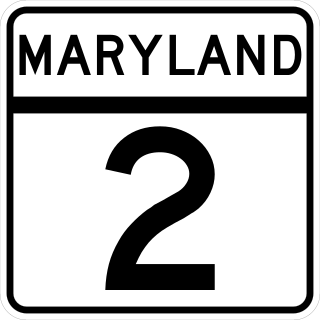
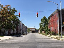
Maryland Route 2 is the longest state highway in the U.S. state of Maryland. The 79.24-mile (127.52 km) route runs from Solomons Island in Calvert County north to an intersection with U.S. Route 1 /US 40 Truck in Baltimore. The route runs concurrent with MD 4 through much of Calvert County along a four-lane divided highway known as Solomons Island Road, passing through rural areas as well as the communities of Lusby, Port Republic, Prince Frederick, and Huntingtown. In Sunderland, MD 2 splits from MD 4 and continues north as two-lane undivided Solomons Island Road into Anne Arundel County, still passing through rural areas. Upon reaching Annapolis, the route runs concurrent with US 50/US 301 to the north of the city. Between Annapolis and Baltimore, MD 2 runs along the Governor Ritchie Highway, a multilane divided highway that heads through suburban areas, passing through Arnold, Severna Park, Pasadena, Glen Burnie, and Brooklyn Park. In Baltimore, the route heads north on city streets and passes through the downtown area of the city.

<span class="mw-page-title-main">Maryland Route 7</span> State highway in Maryland, US

Maryland Route 7 (MD 7) is a collection of state highways in the U.S. state of Maryland. Known for much of their length as Philadelphia Road, there are five disjoint mainline sections of the highway totaling 40.23 miles (64.74 km) that parallel U.S. Route 40 (US 40) in Baltimore, Harford, and Cecil counties in northeastern Maryland. The longest section of MD 7 begins at US 40 just east of the city of Baltimore in Rosedale and extends through eastern Baltimore County and southern Harford County to US 40 in Aberdeen. The next segment of the state highway is a C-shaped route through Havre de Grace on the west bank of the Susquehanna River. The third mainline section of MD 7 begins in Perryville on the east bank of the Susquehanna River and ends at US 40 a short distance west of the start of the fourth section, which passes through Charlestown and North East before ending at US 40, just west of Elkton. The fifth segment of the highway begins at South Street and passes through the eastern part of Elkton before reconnecting with US 40 east of Elkton and west of the Delaware state line.

<span class="mw-page-title-main">Maryland Route 355</span> State highway in Montgomery and Frederick Counties, Maryland, United States

Maryland Route 355 (MD 355) is a 36.75-mile (59.14 km) north–south road in western central Maryland in the United States. The southern terminus of the route, Wisconsin Avenue, is located in Bethesda in Montgomery County, at the county's border with Washington, D.C. It continues south into Washington, D.C. as Wisconsin Avenue NW. The northern terminus is just north of a bridge over Interstate 70 (I-70)/U.S. Route 40 (US 40) in the city of Frederick in Frederick County, where the road continues north as Market Street through Frederick towards MD 26.

<span class="mw-page-title-main">Maryland Route 99</span> State highway in Howard County, Maryland, US, known as Old Frederick Rd

Maryland Route 99 is a state highway in the U.S. state of Maryland. Known as Old Frederick Road, the state highway runs 7.57 miles (12.18 km) from MD 32 near West Friendship east to U.S. Route 29 in Ellicott City. MD 99 parallels the north side of Interstate 70 (I-70) through a rural and suburban area in northeastern Howard County. MD 99, which follows the original 18th-century road west from Baltimore, was constructed as part of three state highways: MD 99, the original MD 100, and MD 105. All three highways were constructed between the early 1920s and early 1930s. MD 99 originally turned south along St. Johns Lane to US 40 and MD 144; in 1956, the state highway was rerouted along part of MD 100 and all of MD 105 to downtown Ellicott City. MD 99's eastern terminus was rolled back to US 29 in two steps in the late 1970s and late 1980s.

<span class="mw-page-title-main">Maryland Route 140</span> State highway in Maryland, US

Maryland Route 140 is a 49-mile (79 km) state highway in the U.S. state of Maryland. The route runs from U.S. Route 1 and US 40 Truck in Baltimore northwest to the Pennsylvania border, where the road continues into that state as Pennsylvania Route 16. MD 140 passes through the northern part of central Maryland, connecting Baltimore, Pikesville, Reisterstown, Westminster, Taneytown, and Emmitsburg.

<span class="mw-page-title-main">Maryland Route 85</span> State highway in Frederick County, Maryland, US, known as Buckeystown Pike

Maryland Route 85 is a state highway in the U.S. state of Maryland. Known as Buckeystown Pike, the state highway runs 10.80 miles (17.38 km) from MD 28 in Tuscarora north to the Frederick city limit north of Interstate 70 (I-70), where the highway continues north as East Street. MD 85 connects Tuscarora and Buckeystown in southern Frederick County with the county seat of Frederick. The state highway also links the suburban area between Buckeystown and Frederick with I-70 and I-270. MD 85 is the old alignment of U.S. Route 15, which was originally constructed between Tuscarora and Frederick in the late 1910s and early 1920s. MD 85 was assigned to the highway in 1970 when US 15 was moved to a new highway heading north from its Potomac River crossing at Point of Rocks. The state highway was extended north to the city of Frederick as part of a project to overhaul MD 355's interchange with I-70 in the first decade of the 21st century.

<span class="mw-page-title-main">Maryland Route 180</span> State highway in Frederick County, Maryland

Maryland Route 180 is a state highway in the U.S. state of Maryland. Known for most of its length as Jefferson Pike, the state highway runs 14.95 miles (24.06 km) from U.S. Route 340 in Knoxville east to Ballenger Creek Pike and Interstate 70 (I-70) in Frederick. MD 180 is the old alignment of US 340 through Knoxville, Petersville, and Jefferson in the Middletown Valley of western Frederick County. The state highway was originally constructed in the early 1910s and designated US 340 in 1927. MD 180 was assigned to the highway bypassed by the US 340 freeway between Sandy Hook in far southern Washington County and Jefferson in the mid-1960s. The state highway was extended east to Frederick and south along Ballenger Creek Pike after the US 340 freeway was completed in the late 1960s. MD 180 was rolled back to Frederick and removed from Washington County in 1989.

<span class="mw-page-title-main">Interstate 70 in Maryland</span> Section of Interstate Highway in Maryland

Interstate 70 (I-70) is a part of the Interstate Highway System that runs from Cove Fort, Utah, to Baltimore, Maryland. In Maryland, the Interstate Highway runs 93.62 miles (150.67 km) from the Pennsylvania state line in Hancock east to the Interstate's eastern terminus near its junction with I-695 at a park and ride in Baltimore. I-70 is the primary east–west Interstate in Maryland; the Interstate Highway connects Baltimore—and Washington, D.C., via I-270—with Western Maryland. The Interstate serves Frederick and Hagerstown directly and provides access to Cumberland via its junction with I-68 at Hancock. I-70 runs concurrently with its predecessor highway, U.S. Route 40 (US 40), from Hancock to Indian Springs in Washington County and from Frederick to West Friendship in Howard County.

<span class="mw-page-title-main">U.S. Route 40 in Maryland</span> Section of U.S. Highway in Maryland, United States

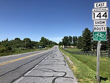
U.S. Route 40 in the U.S. state of Maryland runs from Garrett County in Western Maryland to Cecil County in the state's northeastern corner. With a total length of 221 miles (356 km), it is the longest numbered highway in Maryland. Almost half of the road overlaps or parallels with Interstate 68 (I-68) or I-70, while the old alignment is generally known as US 40 Alternate, US 40 Scenic, or Maryland Route 144. West of Baltimore, in the Piedmont and Appalachian Mountains / Blue Ridge region of the Western Maryland panhandle of the small state, the portions where it does not overlap an Interstate highway are mostly two-lane roads. The portion northeast of Baltimore going toward Wilmington in northern Delaware and Philadelphia in southeastern Pennsylvania is a four-lane divided highway, known as the Pulaski Highway. This section crosses the Susquehanna River at the north end of the Chesapeake Bay on the Thomas J. Hatem Memorial Bridge.

<span class="mw-page-title-main">Maryland Route 56</span> State highway in Washington County, Maryland, US, known as Big Pool Rd

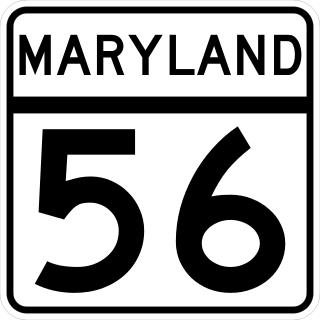
Maryland Route 56 is a state highway in the U.S. state of Maryland. Known as Big Pool Road, the state highway runs 8.08 miles (13.00 km) from Interstate 70 (I-70) in Big Pool east to MD 68 near Pinesburg in western Washington County. MD 56, which features a pair of one-lane bridges, provides access to Fort Frederick State Park and the eastern trailhead of the Western Maryland Rail Trail. The state highway was first constructed in the mid 1910s from what is now U.S. Route 40 south to Big Pool. The highway was extended east toward the village of Big Spring in the early 1930s and to MD 68 in the late 1950s. MD 56 was truncated at I-70 in the mid-1990s.

<span class="mw-page-title-main">Maryland Route 166</span> State highway in Baltimore County, Maryland, United States

Maryland Route 166 is a state highway in the U.S. state of Maryland. The state highway runs 2.71 miles (4.36 km) from Interstate 195 (I-195) in Arbutus north to MD 144 in Catonsville. MD 166 consists of two sections: a short freeway section that serves as a northern continuation of I-195 and provides access to the University of Maryland, Baltimore County (UMBC), and a segment of Rolling Road, a major north–south highway in western Baltimore County. Rolling Road dates to the colonial era as a highway used to transport tobacco from plantations to river ports. North Rolling Road, which connects Catonsville with Woodlawn and Milford Mill, has always been a county highway. South Rolling Road was constructed as a state highway by the early 1920s between what were to become U.S. Route 1 and US 40. Parts of South Rolling Road were transferred to county maintenance after they were severed by the construction of I-95 and a freeway relocation of the southern end of MD 166 in the early 1970s.

<span class="mw-page-title-main">Maryland Route 75</span> State highway in Maryland, US

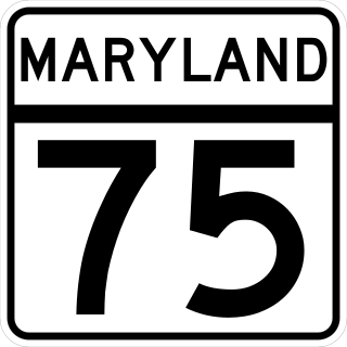
Maryland Route 75 is a state highway in the U.S. state of Maryland. Known for most of its length as Green Valley Road, the state highway runs 28.40 miles (45.71 km) from MD 355 near Hyattstown north to MD 31 in New Windsor. MD 75 serves as the main north–south highway of eastern Frederick County, where it connects Hyattstown with New Market, Libertytown, Johnsville, and the Carroll County town of Union Bridge. The first sections of MD 75 were constructed around New Windsor and between Green Valley and New London in the early 1910s. The latter highway was extended south to Green Valley in the late 1910s. In the early 1920s, MD 75 was constructed between New Windsor and Union Bridge and from Libertytown to Johnsville. The remainder of the state highway was constructed in the late 1920s and early 1930s. MD 75 was relocated between Union Bridge and New Windsor in the early 1960s, around its interchange with Interstate 70 (I-70)/U.S. Route 40 in New Market in the early 1970s, and at its northern terminus in New Windsor in 2007.

<span class="mw-page-title-main">Maryland Route 615</span> Highway in Maryland

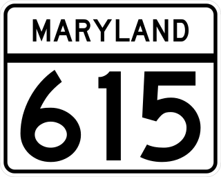
Maryland Route 615 (MD 615) is a state highway in the U.S. state of Maryland. The state highway runs 4.35 miles (7.00 km) from Interstate 70 (I-70) and U.S. Route 40 (US 40) east of Hancock north to the Pennsylvania state line, where the highway continues as State Route 2001 (SR 2001) in Fulton County. MD 615 has two sections, an east–west section that closely parallels I-70 and US 40 and a north–south highway that follows Heavenly Acres Ridge. The ridge road was constructed as MD 615 in the mid-1930s. The east–west segment is part of the original alignment of US 40 constructed in the mid-1910s. After I-70 was constructed east of Hancock in the early 1960s, MD 615 was extended to its current length parallel to the new freeway.

<span class="mw-page-title-main">U.S. Route 220 in Maryland</span> Highway in Maryland

U.S. Route 220 is a part of the U.S. Highway System that runs from Rockingham, North Carolina, to South Waverly, Pennsylvania. In Maryland, the federal highway runs 27.30 miles (43.94 km) from the West Virginia state line at the North Branch Potomac River in McCoole north to the Pennsylvania state line in Dickens. Known as McMullen Highway for much of its length in Maryland, US 220 is the primary north–south route in central Allegany County, connecting Cumberland with its southern suburbs and Keyser, West Virginia, to the south and Bedford, Pennsylvania, to the north. The federal highway is part of the National Highway System between the West Virginia state line and Maryland Route 53 in Cresaptown and between Interstate 68 (I-68), with which it is concurrent through Cumberland, and the Pennsylvania state line.

<span class="mw-page-title-main">Maryland Route 132</span> State highway in Harford County, Maryland, US

Maryland Route 132 is a collection of state highways in the U.S. state of Maryland. These four highways are sections of old alignment of and connecting roads with MD 22 in Aberdeen, Harford County. MD 132 connects Aberdeen neighborhoods east and west of U.S. Route 40 with MD 22 and Interstate 95 (I-95). MD 132B serves the area east of US 40 and north of MD 22 between Aberdeen and Havre de Grace. MD 132A and MD 132C are connectors between MD 132 and MD 22. The highways that are now part of MD 132 were originally built in the early 1910s and marked as part of MD 22 and US 40 in 1927. MD 22 was extended east and north along the US 40 portion when the U.S. highway was relocated in the 1930s. MD 132 was assigned to the highway when MD 22 was relocated in the late 1960s. MD 132 became a split route following the construction of a railroad grade separation in the 1980s.

<span class="mw-page-title-main">Maryland Route 155</span> State highway in Harford County, Maryland, known as Level Rd

Maryland Route 155 is a state highway in the U.S. state of Maryland. Known for most of its length as Level Road, the state highway runs 9.06 miles (14.58 km) from MD 22 in Churchville east to U.S. Route 40 and MD 7 in Havre de Grace. In conjunction with MD 22, MD 155 serves as the main highway linking Bel Air and Havre de Grace in eastern Harford County. The state highway also connects Havre de Grace with Interstate 95 (I-95) and Susquehanna State Park. The first portion of MD 155 near Havre de Grace was built by 1910; the remainder of the highway east of Hopewell Village was completed in the mid-1920s. The Churchville–Hopewell Village portion of the state highway, originally designated MD 156, was built in the mid-1930s. MD 155 received its present designation over its western half in 1952 when MD 155 and MD 156 swapped paths.

<span class="mw-page-title-main">U.S. Route 40 Scenic</span> Highway in Maryland

U.S. Route 40 Scenic (US 40 Scenic) is a scenic route of US 40 in the U.S. state of Maryland. US 40 Scenic, which is known for most of its route as National Pike, is the old alignment of US 40 over Town Hill in eastern Allegany County and Sideling Hill in far western Washington County. The highway was originally constructed as part of a turnpike connecting Baltimore with the eastern end of the National Road at Cumberland in the early 19th century. The highway was paved as a modern road in the mid-1910s and designated US 40 in the late 1920s. US 40 was relocated over Sideling Hill in the early 1950s and over Town Hill in the mid-1960s. The US 40 Scenic designation was first applied to the old highway over Town Hill in 1965. Following the completion of Interstate 68 (I-68) at Sideling Hill, US 40 Scenic was extended east along old US 40's crossing of the mountain in the late 1980s. US 40 Scenic is the only scenic route in the U.S. Highway System; formerly, there was a second, US 412 Scenic in Oklahoma, but this has since been redesignated to a more conventional "Alternate" route.

<span class="mw-page-title-main">U.S. Route 40 Alternate (Hagerstown–Frederick, Maryland)</span> Highway in Washington and Frederick counties in Maryland

U.S. Route 40 Alternate (US 40 Alternate) is an alternate route of US 40 in the U.S. state of Maryland. The highway runs 22.97 miles (36.97 km) from Potomac Street in Hagerstown east to US 40 in Frederick. US 40 Alternate parallels US 40 and much of Interstate 70 (I-70) to the south through eastern Washington County and western Frederick County. The alternate route connects Hagerstown and Frederick with Funkstown, Boonsboro, Middletown, and Braddock Heights. US 40 Alternate crosses two major north–south components of the Blue Ridge Mountains that separate the Great Appalachian Valley and the Piedmont: South Mountain between Boonsboro and Middletown and Catoctin Mountain, which is locally known as Braddock Mountain, at Braddock Heights.

References

  1. 1 2 3 4 5 6 7 8 9 10 11 12 13 14 15 16 17 18 19 20 21 22 23 24 25 26 27 28 29 30 31 32 33 34 35 36 37 38 39 40 41 Highway Information Services Division (December 31, 2013). Highway Location Reference. Maryland State Highway Administration. Retrieved 2012-02-21.
  2. 1 2 3 4 Highway Information Services Division (December 31, 2005). Highway Location Reference. Maryland State Highway Administration. Retrieved 2012-02-21.
  3. Federal Highway Administration (October 1, 2012). National Highway System: Frederick, MD (PDF) (Map). Scale not given. Washington, DC: Federal Highway Administration. Retrieved 2015-01-10.
  4. Federal Highway Administration (October 1, 2012). National Highway System: Baltimore, MD (PDF) (Map). Scale not given. Washington, DC: Federal Highway Administration. Retrieved 2015-01-10.
  5. 1 2 3 Google (November 9, 2010). "Maryland Route 144: Allegany County" (Map). Google Maps . Google. Retrieved 2010-11-09.
  6. 1 2 Google (November 9, 2010). "Maryland Route 144WB" (Map). Google Maps. Google. Retrieved 2010-11-09.
  7. Google (November 9, 2010). "Maryland Route 144WA" (Map). Google Maps. Google. Retrieved 2010-11-09.
  8. 1 2 3 Google (November 9, 2010). "Maryland Route 144FA" (Map). Google Maps. Google. Retrieved 2010-11-09.
  9. Google (November 9, 2010). "Maryland Route 144FB" (Map). Google Maps. Google. Retrieved 2010-11-09.
  10. Google (November 9, 2010). "Maryland Route 144A" (Map). Google Maps. Google. Retrieved 2010-11-09.
  11. 1 2 3 Google (November 9, 2010). "Maryland Route 144: Baltimore County and City" (Map). Google Maps. Google. Retrieved 2010-11-09.
  12. Highway Information Services Division (December 31, 2018). Highway Location Reference. Maryland State Highway Administration. Retrieved 2020-03-21.
  13. Yeager, Amanda (May 26, 2015). "Former School Tops Howard County's Endangered Sites List". The Baltimore Sun.
  14. Highway Information Services Division (December 31, 2015). Highway Location Reference. Maryland State Highway Administration. Retrieved 2016-08-10.
  15. United States Geological Survey (1901). Hancock, WV quadrangle (Topographic map). 1:48,000. 15 Minute Series. Reston, Virginia: United States Geological Survey. Retrieved 2010-11-29.
  16. Maryland State Roads Commission (May 1915). Report of the State Roads Commission of Maryland (1912–1915 ed.). Baltimore: Maryland State Roads Commission. p. 114. Retrieved 2010-11-29.
  17. Maryland State Roads Commission (March 15, 1941). Report of the State Roads Commission of Maryland (1939–1940 ed.). Baltimore: Maryland State Roads Commission. p. 25. Retrieved 2010-11-29.
  18. Maryland State Roads Commission (1963). Maryland: Official Highway Map (Map). Baltimore: Maryland State Roads Commission.
  19. Maryland State Roads Commission (1964). Maryland: Official Highway Map (Map). Baltimore: Maryland State Roads Commission.
  20. Maryland State Roads Commission (1966). Maryland: Official Highway Map (Map). Baltimore: Maryland State Roads Commission.
  21. Maryland State Roads Commission (1967). Maryland: Official Highway Map (Map). Baltimore: Maryland State Roads Commission.
  22. Marshall, Ryan (October 1, 2019). "I-70 Ramp Opens at Meadow Road". The Frederick News-Post . Retrieved 2020-03-19.
  23. Google (November 9, 2010). "Maryland Route 144AE" (Map). Google Maps. Google. Retrieved 2010-11-09.
  24. Google (November 9, 2010). "Maryland Route 144AL" (Map). Google Maps. Google. Retrieved 2010-11-09.
  25. Google (November 9, 2010). "Maryland Route 144HB" (Map). Google Maps. Google. Retrieved 2010-11-09.
Template:Attached KML/Maryland Route 144
KML is from Wikidata