
Lochearn is an unincorporated community and census-designated place in Baltimore County, Maryland, United States, located immediately to the west of the City of Baltimore. Per the 2020 census, the population was 25,511.

Milford Mill is an unincorporated community and census-designated place in Baltimore County, Maryland, United States. Per the 2020 census, the population was 30,622.

Owings Mills is an unincorporated community and census-designated place in Baltimore County, Maryland, United States. It is a suburb of Baltimore. Per the 2020 census, the population was 35,674. Owings Mills is home to the northern terminus of the Baltimore Metro Subway, and housed the Owings Mills Mall until its closure in 2015. It is also home to the Baltimore Ravens' headquarters facility, and the studios for Maryland Public Television. In 2008, CNNMoney.com named Owings Mills number 49 of the "100 Best Places to Live and Launch".

Woodlawn is an unincorporated community and census-designated place in Baltimore County, Maryland. Per the 2020 census, the population was 39,986. It is home to the headquarters of the Social Security Administration (SSA) and the Centers for Medicare and Medicaid Services (CMS). It is bordered by Catonsville on the south, by the Patapsco River and Howard County on the west, by Randallstown and Lochearn to the north, and by the City of Baltimore to the east. Parts of Woodlawn are sometimes informally referred to as Security, Maryland, due to the importance of the SSA's headquarters as well as nearby Security Boulevard and Security Square Mall.

Brandywine is the name of an unincorporated area in Prince George's County, Maryland, United States, that refers both to a census-designated place (CDP) and a zip code area which is much larger (20613), whose areas overlap. The population of Brandywine at the 2020 U.S. Census was 10,550 for the CDP, and the population of ZIP code 20613 was 11,860 in 2010.

Jessup is an unincorporated community and census-designated place in Howard and Anne Arundel counties, about 15 miles (24 km) southwest of Baltimore, Maryland, United States. Per the 2020 census, the population was 10,535.

Calverton is an unincorporated area and census-designated place located on the boundary between Montgomery and Prince George's counties, Maryland, in the United States. At the 2020 census, it had a population of 17,316.
Seabrook is an unincorporated community and census-designated place (CDP) in Prince George's County, Maryland, United States, located approximately 12 miles (19 km) east of Washington. Per the 2020 census, the population was 19,627. Prior to 2010, Seabrook was part of the Lanham-Seabrook census-designated place.
Peppermill Village is an unincorporated community near Maryland Route 214 in Prince George's County, Maryland, United States. Per the 2020 census, the population was 5,264. FedExField, Metrorail's Blue Line, and Hampton Mall shopping center are all located nearby. Because it is not formally incorporated, it has no official boundaries, but the United States Census Bureau has defined a census-designated place (CDP) consisting of Peppermill Village and the adjacent community of Carmody Hills, for statistical purposes.
Glassmanor is an unincorporated community and census-designated place in Prince George's County, Maryland, United States. As of the 2020 census, it had a population of 18,430. In the 1990 and 2000 censuses, the United States Census Bureau had placed Glassmanor and the adjacent community of Oxon Hill in the "Oxon Hill-Glassmanor" census-designated place for statistical purposes. Glassmanor was last delineated separately in 1980, when the CDP recorded a population of 7,751.
Silver Hill is an unincorporated community and census-designated place (CDP) in Prince George's County, Maryland, United States, approximately 1 mile (1.6 km) southeast of Washington, D.C. Per the 2020 census, the population was 6,381. Prior to 2010, Silver Hill was part of the Suitland-Silver Hill census-designated place.
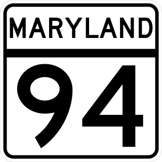
Maryland Route 94 is a state highway in the U.S. state of Maryland. Known as Woodbine Road, the state highway runs 6.25 miles (10.06 km) from the Montgomery–Howard county line at the Patuxent River north to Old Frederick Road near Lisbon. MD 94 originally extended into southern Carroll County in addition to connecting the western Howard County communities of Lisbon and Florence. The state highway was constructed from Lisbon to Woodbine in the late 1910s. MD 94 was constructed from Lisbon south through Florence and from Woodbine north to the village of Daniel south of MD 26 in the late 1920s and early 1930s. The state highway was extended south and removed from the state highway system north of Lisbon in 1956. MD 94 was relocated when its interchange with Interstate 70 (I-70) and U.S. Route 40 was built in the mid-1970s. The state highway has two roundabouts, one of which was the first modern roundabout in Maryland.
Cedar Heights is an census designated place in Prince George's County, Maryland, United States. Per the 2020 Census, the population was 1,597.

Brock Hall is an unincorporated area and census-designated place in eastern Prince George's County, Maryland, United States, located south of Largo and Bowie, and north of Upper Marlboro. As of the 2020 census, the CDP had a population of 13,181.
Cedarville is an unincorporated community and census-designated place in southern Prince George's County, Maryland, United States. As of the 2020 census the population was 639.
Queensland is a census-designated place south of Upper Marlboro in Prince George's County, Maryland, United States. The population of the CDP was 2,191 at the 2020 census. It was formerly known as Queenland until 2014 when its name was changed to Queensland and a small portion of its geography was transferred to Upper Marlboro.
Summerfield is a census-designated place near Landover in Prince George's County, Maryland, United States. Per the 2020 census, the population was 14,758. It is a suburb of Washington, D.C.
The Carr's Mill Landfill is a controversial landfill in Howard County, Maryland in the United States. Its official address is 15900 Carrs Mill Road in Lisbon, Maryland.
Ten Mile Creek is a census designated place in Montgomery County, Maryland, United States. It first appeared as a CDP prior to the 2020 Census with a population was 1,012.
Honeygo is a census designated place in Baltimore County, Maryland, United States. It first appeared as a CDP in the 2020 Census with a population of 12,927.


