Clarksville is an unincorporated community in Howard County; the second wealthiest county in the United States according to the U.S. Census Bureau. The community is named for William Clark, a farmer who owned much of the land on which the community now lies and served as a postal stop that opened on the 4th of July 1851.

River Hill is the last and westernmost village to be developed in the town of Columbia, Maryland, though some residents have addresses in Clarksville. The village is home to 6,520 residents in 2,096 housing units in 2014. The area was used as a game preserve by James Rouse to entertain clients and personal hunting during the buildout of the Columbia project. In 1976, County Executive Edward L. Cochran selected the 784-acre parcel owned by Howard Research and Development for an alternate location for a county landfill; a task force selected Alpha Ridge Landfill instead. Residential construction started in 1990. It is bounded by Maryland Route 108 and Maryland Route 32, and is centered on Trotter Road. The village is divided into two neighborhoods: Pheasant Ridge and Pointers Run, with about 6,500 residents.
Oakland Mills is one of the 10 villages in Columbia, Maryland. It is located immediately east of Town Center, across US Route 29.
Hickory Ridge is one of the 10 villages in Columbia, Maryland, located to the west of the Town Center with a 2014 population of 13,000 in 4,659 housing units. The village overlays the former postal community of Elioak, Maryland. It was first occupied in 1974. Neighborhoods in the village are Hawthorn, Clary's Forest, and Clemens Crossing. The name Hickory Ridge comes from the 1753 land grant patented by Greenberry Ridgley and Richard Davis named "Hickory Ridge" and the 1749 slave plantation "Hickory Ridge" in nearby Highland, Maryland that resides on the tract.

Blandair, also known as Blandair Farm, Blandair Park, and Blandair Regional Park, is 300 acres of former slave plantation located in Columbia, Maryland. The Blandair Foundation estate of Mrs. Smith was purchased by Howard County, Maryland in the late 1990s and is in the process of being developed as a regional park.
Long Reach, one of ten villages composing Columbia, Maryland, is found in the northeast part of Columbia along Maryland Route 108. Started in 1971, it is one of the oldest villages, and comprises four neighborhoods: Jeffers Hill, Kendall Ridge, Locust Park, and Phelps Luck. The village, with an approximate population of 17,000, is governed by five elected village board members through "Long Reach Community Association, Inc." The Village Office is located in Stonehouse, the community center, which opened in 1974.

Highland is an unincorporated community and census-designated place in Howard County, Maryland, United States. As of the 2010 census it had a population of 1,034. It uses the 20777 zip code.
Ilchester is an unincorporated community and census-designated place in Howard County, Maryland, United States. The population was 23,476 at the 2010 census. It was named after the village of Ilchester in the English county of Somerset.
Dorsey's Search is a parcel of land patented by John Dorsey of Hockley-in-the-hole (1645–1714) in Baltimore County. The 479-acre (194 ha) property adjacent to the north branch of the Patuxent river was surveyed by Richard Beard in December 1684, and granted to Dorsey in March 1696. The property lying between "Long Reach" and "Elk Ridge" was resurveyed in March 1723 to include 750 acres (300 ha). After several generations of inheritance, a series of legal disputes were held over the land by Rezin Hammond and Richard Ridgley in 1820. In 1827 the property exchanged hands to Robert Oliver, builder of Oakland Mill, who combined it with multiple properties totaling 2,300 acres (930 ha). George Gaither acquired the property in 1838. John Dorsey's grandson, "Patuxent" John Dorsey of "Dorsey's Search" built Dorsey Hall at the site.
Owen Brown is one of the ten villages in Columbia, Maryland, USA, incorporated in 1972. Neighborhoods in the village include Dasher Green, Elkhorn and Hopewell. Owen Brown lies south and east of the Town Center.

Paternal Gift Farm is an historic farm converted to an unincorporated community located in Howard County, Maryland in the Highland, Maryland ZIP code 20777. The Paternal Gift Farm, Inc is its homeowners' association, and all homeowners are members.
Fort Howard is an unincorporated community and census-designated place in Baltimore County, Maryland, United States. The population was 303 at the 2010 census. The median age is 47.9. 52.86% are female and 47.14% are male. 58.9% are married and 41.1% are single. The average household size is 2.64.

Daniels is a ghost town straddling the Patapsco River east of Woodstock and north of Old Ellicott City in Baltimore County and Howard County, Maryland, United States. It is the location of the Daniels Mill, a site listed on the National Register of Historic Places. It is the home town of former Howard County Executive and State Senator James N. Robey. A postal office operated in the community from 1 March 1943 to 31 August 1971.

Town Center is one of the ten villages in Columbia, Maryland, United States, first occupied in 1974. It is a non-contiguous, diverse area, and the most urban-like, ranging from multi-level high density apartments homes and office buildings, to single family homes.
Simpsonville is an unincorporated community in Howard County, Maryland, United States.
Hopewell is an unincorporated community in St. Mary's County, Maryland, United States. It lies at an elevation of 7 feet.
Hopewell Village is an unincorporated community in Harford County, Maryland, United States. It lies at an elevation of 449 feet.
Atholton is an unincorporated community in Howard County, Maryland, United States. A postal office operated from May 26, 1897 to November 1900 and again from 1903 to July 1917.
Elioak is an unincorporated community in Howard County, Maryland, United States. It was the home of the "Pushpin Farm", a 200-acre slave plantation purchased in 1724 in the Howard District of Anne Arundel County by Col. Edward Dorsey and site of many prominent Dorsey family graves. The postal community was named after the Elioak plantation built by Owen Dorsey, Judge of the Baltimore Orphans' Court. A postal office operated in the community from 12 June 1893 to 15 September 1922. Local farm orchards were known for prize winning apples and pears. Local families such as the Kahler, Miller, and Worthington claimed Elioak as home while they served in World War I. After the war, the name fell out of use.

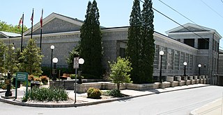
Howard County Library System (HCLS), established in 1940, is a award-winning public library system located in central Maryland. HCLS delivers equal opportunity in education to students of all ages in Howard County, Maryland.