Clear Spring, Maryland

Last updated

Clear Spring, Maryland
Clear Spring, Maryland on Cumberland Street.jpg
Cumberland Street looking west in Clear Spring in 2023
Seal of Clear Spring, Maryland.png
Washington County Maryland Incorporated and Unincorporated areas Clear Spring Highlighted.svg
Location of Clear Spring, Maryland
Coordinates: 39°39′22″N77°55′49″W / 39.65611°N 77.93028°W / 39.65611; -77.93028
Country United States
State Maryland
County Washington
Incorporated 1836 [1]
Area
[2]
  Total0.12 sq mi (0.30 km2)
  Land0.12 sq mi (0.30 km2)
  Water0.00 sq mi (0.00 km2)
Elevation
[3]
545 ft (166 m)
Population
 (2020)
  Total372
  Density3,234.78/sq mi (1,250.41/km2)
Time zone UTC-5 (Eastern (EST))
  Summer (DST) UTC-4 (EDT)
ZIP code
21722
Area code(s) 301, 240
FIPS code 24-17600
GNIS feature ID2390800 [3]
Website www.clearspringmd.gov

Clear Spring is a town in Washington County, Maryland, United States. The population was 358 at the 2010 census.

Contents

History

The Joseph Fiery House, Wilson School, Rufus Wilson Complex, and Plumb Grove are listed on the National Register of Historic Places. [4] [5]

Geography

According to the United States Census Bureau, the town has a total area of 0.11 square miles (0.28 km2), all land. [6]

The town is situated at the eastern base of Fairview Mountain. The area is underlain by Conococheague limestone. The spring after which the town is named is the only local source of ground water, from which the local run, Tom's Run, receives its volume.

US 40 westbound through central Clear Spring 2019-05-18 14 15 19 View west along U.S. Route 40 (Cumberland Street) at Maryland State Route 68 (Mill Street) in Clear Spring, Washington County, Maryland.jpg
US 40 westbound through central Clear Spring

Transportation

The primary means of travel to and from Clear Spring are by road. U.S. Route 40 is the main highway directly serving the town, serving as the town's main street. US 40 continues westward towards Hancock and eastward to Hagerstown. Maryland Route 68 is the other state highway serving the town. MD 68 reaches its western terminus at US 40 in Clear Spring, and heads eastward towards Williamsport. MD 68 also has an interchange with Interstate 70, the primary long-distance highway serving the region around Clear Spring, just south of the town limits. I-70 heads east to Baltimore and west to the southern suburbs of Pittsburgh.

Demographics

Historical population
CensusPop.Note
1870 702
1880 7212.7%
1900 474
1910 5219.9%
1920 5383.3%
1930 5390.2%
1940 500−7.2%
1950 55811.6%
1960 488−12.5%
1970 4992.3%
1980 477−4.4%
1990 415−13.0%
2000 4559.6%
2010 358−21.3%
2020 3723.9%
U.S. Decennial Census [7]

2010 census

As of the census [8] of 2010, there were 358 people, 157 households, and 88 families living in the town. The population density was 3,254.5 inhabitants per square mile (1,256.6/km2). There were 189 housing units at an average density of 1,718.2 per square mile (663.4/km2). The racial makeup of the town was 98.3% White, 0.3% African American, 0.3% Native American, 0.3% Asian, and 0.8% from two or more races. Hispanic or Latino of any race were 0.6% of the population.

There were 157 households, of which 30.6% had children under the age of 18 living with them, 34.4% were married couples living together, 16.6% had a female householder with no husband present, 5.1% had a male householder with no wife present, and 43.9% were non-families. 37.6% of all households were made up of individuals, and 13.3% had someone living alone who was 65 years of age or older. The average household size was 2.28 and the average family size was 3.02.

The median age in the town was 42.3 years. 19.8% of residents were under the age of 18; 10.1% were between the ages of 18 and 24; 26.9% were from 25 to 44; 27.9% were from 45 to 64; and 15.4% were 65 years of age or older. The gender makeup of the town was 48.0% male and 52.0% female.

2000 census

As of the census [9] of 2000, there were 455 people, 195 households, and 124 families living in the town. The population density was 4,214.2 inhabitants per square mile (1,627.1/km2). There were 210 housing units at an average density of 1,945.0 per square mile (751.0/km2). The racial makeup of the town was 98.02% White, 0.88% Asian, and 1.10% from two or more races.

There were 195 households, out of which 32.3% had children under the age of 18 living with them, 44.6% were married couples living together, 14.4% had a female householder with no husband present, and 36.4% were non-families. 28.2% of all households were made up of individuals, and 12.8% had someone living alone who was 65 years of age or older. The average household size was 2.33 and the average family size was 2.85.

In the town, the population was spread out, with 25.7% under the age of 18, 9.0% from 18 to 24, 32.3% from 25 to 44, 18.7% from 45 to 64, and 14.3% who were 65 years of age or older. The median age was 33 years. For every 100 females, there were 97.0 males. For every 100 females age 18 and over, there were 91.0 males.

The median income for a household in the town was $38,056, and the median income for a family was $38,750. Males had a median income of $32,411 versus $24,688 for females. The per capita income for the town was $17,774. About 9.1% of families and 12.6% of the population were below the poverty line, including 23.4% of those under age 18 and 1.4% of those age 65 or over.

Education

Clear Spring is the home of Clear Spring High School with a student population of 415, which hosts the home field of the Blazers. Clear Spring High School houses Washington County Public Schools' Academy of Agricultural and Environmental Science, a program available to any student enrolled in Washington County Public Schools regardless of their home district.

Related Research Articles

<span class="mw-page-title-main">Clear Lake, Indiana</span> Town in Indiana, United States

Clear Lake is a town located in the northeast corner of Steuben County, Indiana, in Clear Lake Township. As such, is the northeasternmost community in the State of Indiana. The population was 339 at the 2010 census.

<span class="mw-page-title-main">Brookview, Maryland</span> Town in Maryland, United States

Brookview is a town in Dorchester County, Maryland, United States. The population was 48 at the 2020 census. Brookview was incorporated in 1953. Brookview is governed by a three-person town council. Each member of the town council is elected by voters to a three-year term in office. The now deceased Richard E. Sullivan had previously served as mayor of the town since 1996 and was recognized at the 2017 Annual Maryland Municipal League Summer Conference as a long-serving mayor of over 25 years. The 2018 council consisted of Mayor J.D. Hurley, Commissioner Clint Falduto, Commissioner Shelly Hurley. The present 2021 council consists of Mayor Clint Falduto, Commissioner Mary Falduto, Commissioner Shelly Hurley.

<span class="mw-page-title-main">Galestown, Maryland</span> Town in Maryland, United States

Galestown is a town in Dorchester County, Maryland, United States. The population was 138 at the 2010 census.

<span class="mw-page-title-main">Myersville, Maryland</span> Town in the United States

Myersville is a town in Frederick County, Maryland, United States. The population was 1,626 at the 2010 United States Census.

<span class="mw-page-title-main">Friendsville, Maryland</span> Town in Maryland, United States

Friendsville is a town in Garrett County, Maryland, United States. The population was 438 at the 2020 census.

<span class="mw-page-title-main">Grantsville, Maryland</span> Town in Maryland, United States

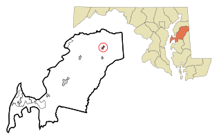
Grantsville is a town in the northern part of Garrett County, Maryland, United States, near the Pennsylvania border. The population was 968 as of the 2020 census.

<span class="mw-page-title-main">Kitzmiller, Maryland</span> Town in Maryland, United States

Kitzmiller is a town in Garrett County, Maryland, United States. The population was 321 at the 2010 census.

<span class="mw-page-title-main">Ashton-Sandy Spring, Maryland</span> Census-designated place in Maryland, United States

Ashton-Sandy Spring is a census-designated place (CDP) in Montgomery County, Maryland, United States. The CDP is designated to include the two unincorporated communities of Ashton and Sandy Spring, as well as the smaller community of Brinklow. It had a population of 5,746 as of the 2020 census.

<span class="mw-page-title-main">Queenstown, Maryland</span> Town in Maryland, United States

Queenstown is a town in Queen Anne's County, Maryland, United States. The population was 664 at the 2010 census.

<span class="mw-page-title-main">Sudlersville, Maryland</span> Town in Maryland, United States

Sudlersville is a town in the far northeastern corner of Queen Anne's County, Maryland, United States. The ZIP code is 21668 and the area code is 410. The population was 497 at the 2010 census. It is perhaps best known as the hometown of Baseball Hall Of Fame slugger Jimmie Foxx. Other famous residents include astronomer and mathematician Simon Newcomb.

<span class="mw-page-title-main">Hebron, Maryland</span> Town in Maryland, United States

Hebron is a town in Wicomico County, Maryland, United States. The population was 1,084 at the 2010 census. It is included in the Salisbury, Maryland-Delaware Metropolitan Statistical Area. It is the hometown of pro-wrestler Mark Hildreth and politician Scott Taylor.

<span class="mw-page-title-main">Mardela Springs, Maryland</span> Town in Maryland, United States

Mardela Springs is a town in Wicomico County, Maryland, United States. The population was 357 at the 2010 census. It is included in the Salisbury, Maryland-Delaware Metropolitan Statistical Area.

<span class="mw-page-title-main">Pittsville, Maryland</span> Town in Maryland, United States

Pittsville is a town in Wicomico County, Maryland, United States. The population was 1,417 at the 2010 census. It is included in the Salisbury, Maryland-Delaware Metropolitan Statistical Area.

<span class="mw-page-title-main">Sharptown, Maryland</span> Town in Maryland, United States

Sharptown is a town in Wicomico County, Maryland, United States. The population was 651 at the 2010 census. It is included in the Salisbury, Maryland-Delaware Metropolitan Statistical Area.

<span class="mw-page-title-main">Willards, Maryland</span> Town in Maryland, United States

Willards is a town in Wicomico County, Maryland, United States. The population was 958 at the 2010 census. It is included in the Salisbury, Maryland-Delaware Metropolitan Statistical Area.

<span class="mw-page-title-main">Heidelberg Township, York County, Pennsylvania</span> Township in Pennsylvania, United States

Heidelberg Township is a township in York County, Pennsylvania, United States. The township was erected in 1750 and encompassed the land grant known as Digges' Choice, a warrant granted to John Digges in 1727 by the colonial-era Province of Maryland, prior to the time the Mason-Dixon line fixed the final boundary between Maryland and Pennsylvania. The population of Heidelberg Township was 3,027 at the 2020 census.

<span class="mw-page-title-main">Clear Lake, South Dakota</span> City in South Dakota, United States

Clear Lake is a city in and the county seat of Deuel County, South Dakota, United States. The population was 1,218 at the 2020 census.

<span class="mw-page-title-main">Hampstead, Maryland</span> Town in Maryland, United States

Hampstead is a town in Carroll County in the U.S. state of Maryland. The population was 6,323 at the 2010 census.

<span class="mw-page-title-main">Templeville, Maryland</span> Town in Maryland, United States

Templeville is a town in Caroline and Queen Anne's counties, Maryland, United States. Templeville is located near the Maryland-Delaware line. The population was 138 at the 2010 census. It was known as Bullock Town until the name was changed in 1847. The name Templeville derives from the Temple family, whose most famous member was Governor William Temple of Delaware.

Clear Lake is a town in Polk County, Wisconsin, United States. The population was 800 at the 2000 census. The Village of Clear Lake is located within the town.

References

  1. "Clear Spring". Maryland Manual. Retrieved June 27, 2017.
  2. "2020 U.S. Gazetteer Files". United States Census Bureau. Retrieved April 26, 2022.
  3. 1 2 U.S. Geological Survey Geographic Names Information System: Clear Spring, Maryland
  4. "National Register Information System". National Register of Historic Places . National Park Service. July 9, 2010.
  5. "National Register of Historic Places Listings". Weekly List of Actions Taken on Properties: 12/05/11 through 12/09/11. National Park Service. December 16, 2011.
  6. "US Gazetteer files 2010". United States Census Bureau. Archived from the original on July 2, 2012. Retrieved January 25, 2013.
  7. "Census of Population and Housing". Census.gov. Retrieved June 4, 2015.
  8. "U.S. Census website". United States Census Bureau . Retrieved January 25, 2013.
  9. "U.S. Census website". United States Census Bureau . Retrieved January 31, 2008.