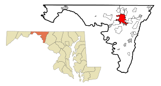
Washington County is located in the western part of the U.S. state of Maryland. As of the 2020 census, the population was 154,705. It is the most populous county in the Western Maryland region and its county seat is Hagerstown.

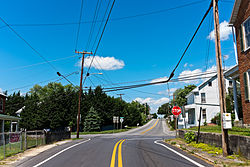
Robinwood is a census-designated place (CDP) in Washington County, Maryland, United States. The population was 4,731 at the 2000 census. It is a part of the Hagerstown Metropolitan Area. Robinwood is home to Hagerstown Community College.

Downsville is a village in Lincoln and Union parishes in the U.S. state of Louisiana. The population as of the 2010 census was 143, an increase from 118 in the 2000 census.

Jefferson is an unincorporated community and census-designated place (CDP) in Frederick County, Maryland, United States. As of the 2020 census the town had a population of 2,235. Jefferson was established in 1774 and incorporated as a town in 1831. However, a year later, in 1832, the citizens of the town decided that municipal government was unnecessary, and dis-incorporated the town, which has been unincorporated since then.
Ellerslie is an unincorporated community and census-designated place (CDP) in Allegany County, Maryland, United States. As of the 2010 census it had a population of 572. Ellerslie is part of the Cumberland, MD-WV Metropolitan Statistical Area.
Pylesville is an unincorporated community and census-designated place (CDP) in Harford County, Maryland, United States. The population was 693 at the 2010 census. It is part of the Baltimore metropolitan area.The town was named after Brandon Pyles. Until 1958, this community was served by the Maryland and Pennsylvania Railroad at milepost 40.3.

Fairplay is an unincorporated community and census-designated place (CDP) in Washington County, Maryland, United States. Its population was 580 as of the 2010 census. It is sometimes recognized, along with neighboring Tilghmanton, as Fairplay-Tilghmanton; the two communities share a post office as well as a fire company. Fairplay is located between Hagerstown and Sharpsburg, along Maryland Route 65 and is part of the Hagerstown Metropolitan Area. Marsh Mills was listed on the National Register of Historic Places in 1996.

Big Pool is an unincorporated community and census-designated place in western Washington County, Maryland, United States. Its population was 82 as of the 2010 census. It is between Clear Spring, Maryland and Hancock, Maryland along Interstate 70 and is officially a part of the Hagerstown Metropolitan Area.
Cearfoss is an unincorporated community and census-designated place in northwestern Washington County, Maryland, United States. Its population was 178 as of the 2010 census. Cearfoss is located northwest of Hagerstown and Maugansville, near the Pennsylvania border. Many highways intersect in Cearfoss in a roundabout, including Maryland routes 58, 63 and 494. Cearfoss is officially included in the Hagerstown Metropolitan Area.

Beaver Creek is an unincorporated community in eastern Washington County, Maryland, United States. Its population was 251 as of the 2010 census. It is located southeast of Hagerstown and north of Boonsboro near U.S. Route 40 and Maryland Route 66. The community is officially included in the Hagerstown Metropolitan Area. This town was founded in 1766.
Bishopville is an unincorporated community and census-designated place 10 miles (16 km) north of Berlin in Worcester County, Maryland, United States. The community is just south of the Delaware state line. It is part of the Salisbury, Maryland-Delaware Metropolitan Statistical Area. As of the 2010 census, Bishopville had a population of 531.
Indian Springs is an unincorporated community in western Washington County, Maryland, United States. Its population was 64 as of the 2010 census.
The Hagerstown–Martinsburg metropolitan area, officially designated by the United States Office of Management and Budget (OMB) as Hagerstown–Martinsburg, Maryland–West Virginia Metropolitan Statistical Area (MSA), constitutes the primary cities of Hagerstown, Maryland; Martinsburg, West Virginia; and surrounding areas in three counties: Washington County, Maryland; Berkeley County, West Virginia; and Morgan County, West Virginia. The metro area lies mainly within the rich, fertile Cumberland and Shenandoah valleys, and is approximately a 60–90 minute drive from Washington, D.C.; Baltimore, Maryland; and Harrisburg, Pennsylvania; Hagerstown is approximately 75 miles (121 km) driving distance from all three cities. The population of the metropolitan area as of 2008 is 263,753.
Hagerstown is a city in and the county seat of Washington County, Maryland, United States. The population was 43,527 at the 2020 census. Hagerstown ranks as Maryland's sixth-most populous incorporated city and is the most populous city in the Maryland Panhandle.

Sabillasville is an unincorporated community and census-designated place in Frederick County, Maryland, United States. As of the 2010 census it had a population of 354.
Eakles Mills is an unincorporated community in Washington County, Maryland, United States. Its population was 26 as of the 2020 census. Snively Farm was listed on the National Register of Historic Places in 1979.

Mapleville is an unincorporated community and census-designated place in eastern Washington County, Maryland, United States. Its population was 243 as of the 2020 census. It is officially a part of the Hagerstown Metropolitan Area.
Gilmore is an unincorporated community and census-designated place (CDP) in Allegany County, Maryland, United States. As of the 2010 census it had a population of 127. It is part of the Cumberland, MD-WV Metropolitan Statistical Area.
Big Spring is an unincorporated community and census-designated place in Washington County, Maryland, United States. Its population was 84 as of the 2010 census. Maryland Route 56 passes through the community.
Breathedsville is an unincorporated community and census-designated place in Washington County, Maryland, United States. Its population was 254 as of the 2010 census. Maryland Route 68 passes through the community.