Washington County is located in the western part of the U.S. state of Maryland. As of the 2020 census, the population was 154,705. It is the most populous county in the Western Maryland region and its county seat is Hagerstown.

Boonsboro is a town in Washington County, Maryland, United States, located at the foot of South Mountain. It nearly borders Frederick County and is proximate to the Antietam National Battlefield. The population was 3,779 at the 2020 census.

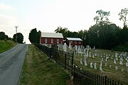
Funkstown is a town in Washington County, Maryland, United States. The population was 904 at the 2010 census.
Keedysville is a town in Washington County, Maryland, United States. The population was 1,152 at the 2010 census.

Antrim Township is a township in Franklin County, Pennsylvania, United States. The population was 15,778 at the 2020 census, an increase over the figure of 12,504 tabulated in 2000. It was named after County Antrim in Northern Ireland.
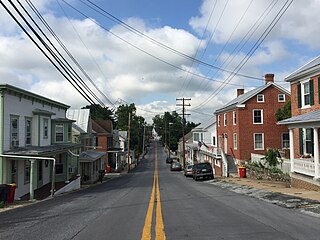
Waynesboro is a borough in Franklin County, Pennsylvania, United States. Located on the southern border of the state, Waynesboro is in the Cumberland Valley between Hagerstown, Maryland, and Chambersburg, Pennsylvania. It is part of Chambersburg, PA Micropolitan Statistical Area, which is part of the Washington–Baltimore metropolitan area. It is two miles north of the Mason–Dixon line and close to Camp David and the Raven Rock Mountain Complex.

Jefferson is an unincorporated community and census-designated place (CDP) in Frederick County, Maryland, United States. As of the 2020 census the town had a population of 2,235. Jefferson was established in 1774 and incorporated as a town in 1831. However, a year later, in 1832, the citizens of the town decided that municipal government was unnecessary, and dis-incorporated the town, which has been unincorporated since then.
Ellerslie is an unincorporated community and census-designated place (CDP) in Allegany County, Maryland, United States. As of the 2010 census it had a population of 572. Ellerslie is part of the Cumberland, MD-WV Metropolitan Statistical Area.

Refton is an unincorporated community and census-designated place (CDP) in Strasburg Township, Lancaster County, Pennsylvania, United States, with a ZIP code of 17560. The community is located along U.S. Route 222. As of the 2010 census, the population was 298.

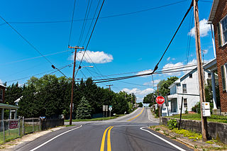
Fairplay is an unincorporated community and census-designated place (CDP) in Washington County, Maryland, United States. Its population was 580 as of the 2010 census. It is sometimes recognized, along with neighboring Tilghmanton, as Fairplay-Tilghmanton; the two communities share a post office as well as a fire company. Fairplay is located between Hagerstown and Sharpsburg, along Maryland Route 65 and is part of the Hagerstown Metropolitan Area. Marsh Mills was listed on the National Register of Historic Places in 1996.

Big Pool is an unincorporated community and census-designated place in western Washington County, Maryland, United States. Its population was 82 as of the 2010 census. It is between Clear Spring, Maryland and Hancock, Maryland along Interstate 70 and is officially a part of the Hagerstown Metropolitan Area.
Downsville is an unincorporated community and census-designated place (CDP) in southwestern Washington County, Maryland, United States. Its population was 355 as of the 2010 census. It is located southeast of Williamsport on Maryland Route 63 and on Maryland Route 632, southwest of Hagerstown. It is officially included in the Hagerstown Metropolitan Area.
Cearfoss is an unincorporated community and census-designated place in northwestern Washington County, Maryland, United States. Its population was 178 as of the 2010 census. Cearfoss is located northwest of Hagerstown and Maugansville, near the Pennsylvania border. Many highways intersect in Cearfoss in a roundabout, including Maryland routes 58, 63 and 494. Cearfoss is officially included in the Hagerstown Metropolitan Area.
Bishopville is an unincorporated community and census-designated place 10 miles (16 km) north of Berlin in Worcester County, Maryland, United States. The community is just south of the Delaware state line. It is part of the Salisbury, Maryland-Delaware Metropolitan Statistical Area. As of the 2010 census, Bishopville had a population of 531.
Indian Springs is an unincorporated community in western Washington County, Maryland, United States. Its population was 64 as of the 2010 census.
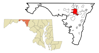
Hagerstown is a city in and the county seat of Washington County, Maryland, United States. The population was 43,527 at the 2020 census. Hagerstown ranks as Maryland's sixth-most populous incorporated city and is the most populous city in the Maryland Panhandle.
Eakles Mills is an unincorporated community in Washington County, Maryland, United States. Its population was 26 as of the 2020 census. Snively Farm was listed on the National Register of Historic Places in 1979.

Mapleville is an unincorporated community and census-designated place in eastern Washington County, Maryland, United States. Its population was 243 as of the 2020 census. It is officially a part of the Hagerstown Metropolitan Area.
Garretts Mill is an unincorporated community and census-designated place in Washington County, Maryland, United States. Its population was 234 as of the 2010 census.

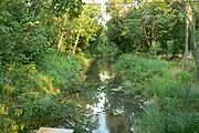
Kemps Mill is an unincorporated community and census-designated place in Washington County, Maryland, United States. Its population was 126 as of the 2010 census. It is named after a 1739 built mill structure which still stands in 2020 and has operated under a variety of names through almost three centuries. The mill dam creates a slackwater which is popular for fishing and other recreational water activities. The mill is several miles above the mouth of the Conococheague Creek which flows to the Potomac River at a location where Native American trading posts existed for many centuries prior to European settlement in the area.