Mount Aetna, Maryland

Last updated

Mount Aetna, Maryland
CDP
Washington County Maryland Incorporated and Unincorporated areas Mount Aetna Highlighted.svg
Location of Mount Aetna, Maryland
Coordinates: 39°36′10″N77°36′49″W / 39.60278°N 77.61361°W / 39.60278; -77.61361
CountryUnited States
State Maryland
County Washington
Area
[1]
  Total1.41 sq mi (3.66 km2)
  Land1.41 sq mi (3.66 km2)
  Water0.00 sq mi (0.00 km2)
Elevation
535 ft (163 m)
Population
 (2020)
  Total580
  Density410.47/sq mi (158.51/km2)
Time zone UTC−5 (Eastern (EST))
  Summer (DST) UTC−4 (EDT)
FIPS code 24-53750
GNIS feature ID0590831

Mount Aetna is a census-designated place (CDP) in Washington County, Maryland, United States. The population was 838 at the 2000 census.

Contents

Geography

Mount Aetna is located at 39°36′10″N77°36′49″W / 39.60278°N 77.61361°W / 39.60278; -77.61361 (39.602673, 77.613496). [2]

According to the United States Census Bureau, the CDP has a total area of 3.9 square miles (10 km2), all land.

The community is situated at the western base of South Mountain at elevations between 500 and 700 feet; the landscape here is principally underlain by the Tomstown Dolomite, and the neighboring area is home to at least four known solutional caves, one of which—Mount Aetna Cave—was open briefly for commercial tours in the 1930s. [3] This region is drained by Mount Aetna Creek, which has at least three headwaters in the neighboring mountain, and is a tributary of Beaver Creek. [4]

Demographics

Historical population
CensusPop.Note
1990 3,608
2000 838−76.8%
2020 580
source: [5] [6]

As of the census [7] of 2000, there were 838 people, 286 households, and 233 families residing in the CDP. The population density was 215.5 inhabitants per square mile (83.2/km2). There were 292 housing units at an average density of 75.1 per square mile (29.0/km2). The racial makeup of the CDP was 95.94% White, 1.07% African American, 0.36% Native American, 1.55% Asian, 0.84% from other races, and 0.24% from two or more races. Hispanic or Latino of any race were 2.39% of the population.

There were 286 households, out of which 35.3% had children under the age of 18 living with them, 73.4% were married couples living together, 4.5% had a female householder with no husband present, and 18.5% were non-families. 12.2% of all households were made up of individuals, and 4.5% had someone living alone who was 65 years of age or older. The average household size was 2.88 and the average family size was 3.13.

In the CDP, the population was spread out, with 27.7% under the age of 18, 6.4% from 18 to 24, 30.0% from 25 to 44, 27.7% from 45 to 64, and 8.2% who were 65 years of age or older. The median age was 38 years. For every 100 females, there were 102.4 males. For every 100 females age 18 and over, there were 95.5 males.

The median income for a household in the CDP was $48,523, and the median income for a family was $52,344. Males had a median income of $40,750 versus $31,250 for females. The per capita income for the CDP was $21,435. About 3.0% of families and 4.0% of the population were below the poverty line, including none of those under the age of eighteen or sixty-five or over.

Community

The area is traditionally defined as lying along the road of the same name, between MD Route 66 and Crystal Falls Road. Mount Aetna is home to a Seventh-day Adventist community; a Seventh-day Adventist private elementary/middle school, Mt. Aetna Adventist School; as well as the Seventh-day Adventist private high school, Highland View Academy, founded in 1949. There is also a volunteer fire company, as well as the SDA-run Mt. Aetna Retreat Center. There was once a small convenience market, but now the only food store in the community is located on the academy grounds. This store sells books, vegetarian meat substitutes, and Big Texas rolls, which are loved by the chunky students. [8]

Related Research Articles

<span class="mw-page-title-main">Rosedale, Maryland</span> Census-designated place in Maryland, United States

Rosedale is an unincorporated community and census-designated place in Baltimore County, Maryland, United States. The population was 19,257 at the 2010 United States Census.

<span class="mw-page-title-main">Bennsville, Maryland</span> Census-designated place in Maryland, United States

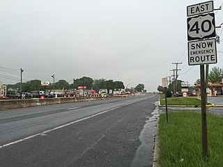
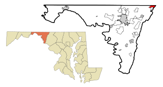
Bennsville is a census-designated place (CDP) in Charles County, Maryland, United States. Per the 2020 census, the population was 15,288. The area is not an official postal designation, but is part of the Waldorf or Pomfret postal area. The Bennsville area is growing with new residential development, encouraged by the extension in the 1990s of Maryland Route 228 which provides quick access to Maryland Route 210. Bennsville has experienced the 2006 opening of North Point High School and the straightening of Middletown Road in 2008.

<span class="mw-page-title-main">Ballenger Creek, Maryland</span> Census-designated place in Maryland

Ballenger Creek is an unincorporated community and census-designated place (CDP) in Frederick County, Maryland, United States. It is a part of the Frederick, Maryland urban area and is adjacent to Frederick's southern city limits. The CDP had a 2010 census population of 18,274.

<span class="mw-page-title-main">Clover Hill, Maryland</span> Unincorporated community in Maryland

Clover Hill is an unincorporated community and former census-designated place (CDP) in Frederick County, Maryland, United States. The population was 3,260 at the 2000 census. The area was not listed as a CDP for the 2010 census, and no population total was published.

<span class="mw-page-title-main">Green Valley, Maryland</span> Census-designated place in Maryland

Green Valley is an unincorporated area and census-designated place (CDP) in southern Frederick County, Maryland, United States. The population was 12,643 at the 2020 census. The area was listed as a census-designated place in 2000 but not listed as part of any CDP at the 2010 census. It was re-designated a census-designated place for the 2020 census.

<span class="mw-page-title-main">Cavetown, Maryland</span> CDP in Maryland, United States

Cavetown is a census-designated place (CDP) in Washington County, Maryland, United States. The population was 1,486 at the 2000 census.

<span class="mw-page-title-main">Chewsville, Maryland</span> CDP in Maryland, United States

Chewsville is a census-designated place (CDP) in Washington County, Maryland, United States. The population was 293 at the 2000 census.

<span class="mw-page-title-main">Fountainhead-Orchard Hills, Maryland</span> CDP in Maryland, United States

Fountainhead-Orchard Hills is a census-designated place (CDP) in Washington County, Maryland, United States. The population was 3,861 at the 2000 census.

<span class="mw-page-title-main">Halfway, Maryland</span> CDP in Maryland, United States

Halfway is a census-designated place (CDP) in Washington County, Maryland, United States. The population was 11,896 at the 2020 census. It is named due to its location, which is halfway between Hagerstown and Williamsport. As a major suburb of Hagerstown, Halfway is part of the Hagerstown-Martinsburg, MD-WV, Metropolitan Statistical Area.

<span class="mw-page-title-main">Highfield-Cascade, Maryland</span> CDP in Maryland, United States

Highfield-Cascade is a census-designated place (CDP) in Washington County, Maryland, United States. The CDP encompasses two closely-spaced unincorporated communities, Highfield and Cascade, which are usually referred to separately. The population of the combined CDP was 1,141 at the 2000 census.

<span class="mw-page-title-main">Leitersburg, Maryland</span> CDP in Maryland, United States

Leitersburg is a census-designated place (CDP) in Washington County, Maryland, United States. The population was 523 at the 2000 census.

<span class="mw-page-title-main">Maugansville, Maryland</span> CDP in Maryland, United States

Maugansville is a census-designated place (CDP) in Washington County, Maryland, United States. The population was 2,295 at the 2000 census.

<span class="mw-page-title-main">Mount Lena, Maryland</span> CDP in Maryland, United States

Mount Lena is a census-designated place (CDP) in Washington County, Maryland, United States. The population was 501 at the 2000 census.

<span class="mw-page-title-main">Paramount-Long Meadow, Maryland</span> CDP in Maryland, United States

Paramount-Long Meadow is a census-designated place (CDP) in Washington County, Maryland, United States. The population was 2,722 at the 2000 census.

<span class="mw-page-title-main">Robinwood, Maryland</span> CDP in Maryland, United States

Robinwood is a census-designated place (CDP) in Washington County, Maryland, United States. The population was 4,731 at the 2000 census. It is a part of the Hagerstown Metropolitan Area. Robinwood is home to Hagerstown Community College.

<span class="mw-page-title-main">San Mar, Maryland</span> CDP in Maryland, United States

San Mar is a census-designated place (CDP) in Washington County, Maryland, United States. The population was 515 at the 2000 census.

<span class="mw-page-title-main">St. James, Maryland</span> CDP in Maryland, United States

St. James is a census-designated place (CDP) in Washington County, Maryland, United States. The population was 1,657 at the 2000 census. It is also the home of St. James School, Hagerstown, a small, Episcopalian, boarding school. St. James was formerly named "Lydia."

<span class="mw-page-title-main">Wilson-Conococheague, Maryland</span> CDP in Maryland, United States

Wilson-Conococheague is a census-designated place (CDP) in Washington County, Maryland, United States. The population was 2,262 at the 2020 census.

<span class="mw-page-title-main">South Lancaster, Massachusetts</span> CDP in Massachusetts, United States

South Lancaster is a census-designated place (CDP) in the town of Lancaster and close to the Town of Clinton in Worcester County, Massachusetts, United States. The population was 1,894 at the 2010 census.

<span class="mw-page-title-main">White Oak West, Ohio</span> Former CDP in Ohio, United States

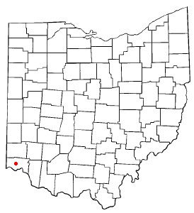
White Oak West was a census-designated place (CDP) in Hamilton County, Ohio, United States. The population was 2,932 at the 2000 census. As of the 2010 census it had been merged into the larger White Oak CDP.

References

  1. "2020 U.S. Gazetteer Files". United States Census Bureau. Retrieved April 26, 2022.
  2. "US Gazetteer files: 2010, 2000, and 1990". United States Census Bureau. February 12, 2011. Retrieved April 23, 2011.
  3. Caves of Maryland; Franz/Slifer, 1971
  4. USGS Myserville Topographic Quadrangle, 1994
  5. "CENSUS OF POPULATION AND HOUSING (1790-2000)". U.S. Census Bureau . Retrieved July 17, 2010.
  6. Most of the census area in 1990 is now in Robinwood.
  7. "U.S. Census website". United States Census Bureau . Retrieved January 31, 2008.
  8. Highland View Academy website Archived 2008-08-01 at the Wayback Machine