Leitersburg, Maryland

Last updated

Leitersburg, Maryland
[[Census-designated place|CCP]
Leitersburg, Maryland 01.JPG
Washington County Maryland Incorporated and Unincorporated areas Leitersburg Highlighted.svg
Location of Leitersburg, Maryland
Coordinates: 39°41′26″N77°37′32″W / 39.69056°N 77.62556°W / 39.69056; -77.62556
CountryUnited States
State Maryland
County Washington
Area
[1]
  Total1.75 sq mi (4.54 km2)
  Land1.75 sq mi (4.54 km2)
  Water0.00 sq mi (0.00 km2)
Elevation
[2]
594 ft (181 m)
Population
 (2020)
  Total569
  Density324.77/sq mi (125.42/km2)
Time zone UTC−5 (Eastern (EST))
  Summer (DST) UTC−4 (EDT)
ZIP code
21742 [3]
Area code(s) 240 and 301
FIPS code 24-46400
GNIS feature ID2390055 [2]

Leitersburg is a census-designated place (CDP) in Washington County, Maryland, United States. The population was 523 at the 2000 census.

Contents

History

Bell-Varner House, Huckleberry Hall, and Leitersburg Historic District are listed on the National Register of Historic Places. [4]

Geography

According to the United States Census Bureau, the CDP has a total area of 1.8 square miles (4.7 km2), all land.

Demographics

Historical population
CensusPop.Note
2020 569
U.S. Decennial Census [5]

At the 2000 census there were 523 people, 218 households, and 163 families living in the CDP. The population density was 297.3 inhabitants per square mile (114.8/km2). There were 226 housing units at an average density of 128.5 per square mile (49.6/km2). The racial makeup of the CDP was 97.13% White, 0.96% African American, 0.19% Asian, 1.34% from other races, and 0.38% from two or more races. Hispanic or Latino of any race were 1.72%. [6]

Of the 218 households 27.5% had children under the age of 18 living with them, 63.8% were married couples living together, 5.0% had a female householder with no husband present, and 24.8% were non-families. 21.1% of households were one person and 8.7% were one person aged 65 or older. The average household size was 2.38 and the average family size was 2.70.

The age distribution was 20.5% under the age of 18, 5.4% from 18 to 24, 28.7% from 25 to 44, 28.1% from 45 to 64, and 17.4% 65 or older. The median age was 42 years. For every 100 females, there were 100.4 males. For every 100 females age 18 and over, there were 99.0 males.

The median household income was $44,135 and the median family income was $43,929. Males had a median income of $30,735 versus $19,800 for females. The per capita income for the CDP was $22,662. None of the families and 5.8% of the population were living below the poverty line, including no under eighteens and 9.6% of those over 64.

Related Research Articles

<span class="mw-page-title-main">Nice, California</span> Census-designated place in California, United States

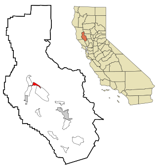
Nice is a census-designated place (CDP) in Lake County, California, United States. Nice is located 4.5 miles (7.2 km) southeast of Upper Lake, at an elevation of 1362 feet. The population was 2,731 at the 2010 census, up from 2,509 at the 2000 census.

<span class="mw-page-title-main">North El Monte, California</span> Census-designated place in California, United States

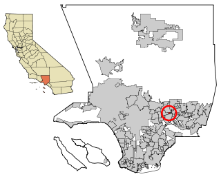
North El Monte is a census-designated place (CDP) in the San Gabriel Valley, in Los Angeles County, California, United States. The population was 3,723 at the 2010 census, up from 3,703 at the 2000 census.

<span class="mw-page-title-main">Ferndale, Maryland</span> Census-designated place in Maryland, United States

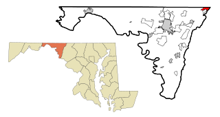
Ferndale is a census-designated place (CDP) in Anne Arundel County, Maryland, United States. At the 2010 census, the population was 16,746.

<span class="mw-page-title-main">Mayo, Maryland</span> Census-designated place in Maryland, United States

Mayo is a census-designated place (CDP) in Anne Arundel County, Maryland, United States. The population was 8,298 in the 2010 census. The Mayo CDP of 2010 includes all of the area that used to be counted as the Selby-on-the-Bay CDP. The beach in Mayo used to be a popular weekend resort.

<span class="mw-page-title-main">Naval Academy, Maryland</span> Census-designated place in Maryland, United States

Naval Academy is a census-designated place (CDP) in Anne Arundel County, Maryland, United States, which covers the campus of the United States Naval Academy. The population was 4,802 at the 2010 census.

<span class="mw-page-title-main">Riva, Maryland</span> Census-designated place in Maryland, United States

Riva is a census-designated place (CDP) in Anne Arundel County, Maryland, United States. The population was 4,257 at the 2020 census. The area is scenic, especially where the two-lane Riva Road crosses the South River on a bridge. The area is growing with large new homes as the suburbs of Annapolis grow outward. Riva is bordered by Annapolis to the north, Edgewater to the east, and Davidsonville to the west.

<span class="mw-page-title-main">South Gate, Maryland</span> Former census-designated place in Maryland, United States

South Gate was a census-designated place (CDP) in Anne Arundel County, Maryland, United States, for the 2000 census, at which time its population was 28,672. It was added primarily to the Glen Burnie CDP for the 2010 census.

<span class="mw-page-title-main">East Riverdale, Maryland</span> Census-designated place in Maryland, United States

East Riverdale is an unincorporated area and census-designated place (CDP) in Prince George's County, Maryland, United States. The population was 18,459 at the 2020 census.

<span class="mw-page-title-main">Rosaryville, Maryland</span> Census-designated place in Maryland, US

Rosaryville is an unincorporated area and census-designated place (CDP) in Prince George's County, Maryland, United States, located south of Cinton and Upper Marlboro beside U.S. Route 301. Per the 2020 census, the population was 11,548. including housing developments and rural open space. It was named for a local Roman Catholic church. Close to Rosaryville are the Marlton housing development, Maryland Veterans Cemetery, the Southern Maryland Farmers Market, and Rosaryville State Park.

<span class="mw-page-title-main">Fairmount, Maryland</span> CDP in Maryland, United States

Fairmount is a census-designated place (CDP) in Somerset County, Maryland, United States. The population was 537 at the 2000 census. It is included in the Salisbury, Maryland-Delaware Metropolitan Statistical Area.

<span class="mw-page-title-main">Mount Vernon, Maryland</span> CDP in Maryland, United States

Mount Vernon is a census-designated place (CDP) in Somerset County, Maryland, United States. The population was 761 at the 2000 census. It is included in the Salisbury, Maryland-Delaware Metropolitan Statistical Area.

<span class="mw-page-title-main">Highfield-Cascade, Maryland</span> CDP in Maryland, United States

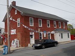
Highfield-Cascade is a census-designated place (CDP) in Washington County, Maryland, United States. The CDP is, however, more commonly referred to as just Cascade, MD. The official CDP name encompasses two closely-spaced unincorporated communities, Highfield and Cascade. The population of the CDP was 1,141 at the 2000 census.

<span class="mw-page-title-main">Paramount-Long Meadow, Maryland</span> CDP in Maryland, United States

Paramount-Long Meadow is a census-designated place (CDP) in Washington County, Maryland, United States. The population was 2,722 at the 2000 census.

<span class="mw-page-title-main">San Mar, Maryland</span> CDP in Maryland, United States

San Mar is a census-designated place (CDP) in Washington County, Maryland, United States. The population was 515 at the 2000 census.

<span class="mw-page-title-main">Newark, Maryland</span> CDP in Maryland, United States

Newark is a census-designated place (CDP) in Worcester County, Maryland, United States. The population was 339 at the 2000 census. It is part of the Salisbury, Maryland-Delaware Metropolitan Statistical Area.

<span class="mw-page-title-main">Christie, Oklahoma</span> CDP in Oklahoma, United States

Christie is a census-designated place (CDP) in Adair County, Oklahoma, United States. The population was 218 at the 2010 census, a 31.3 percent increase over the figure of 166 recorded in 2000.

<span class="mw-page-title-main">Hiller, Pennsylvania</span> Census-designated place in Pennsylvania, United States

Hiller is an unincorporated community and census-designated place in Fayette County, Pennsylvania, United States. As of the 2010 census, it had a population of 1,155, down from 1,234 at the 2000 census.

<span class="mw-page-title-main">Donaldson, Pennsylvania</span> CDP in Pennsylvania, United States

Donaldson is a census-designated place (CDP) in Frailey Township, Schuylkill County, Pennsylvania, United States. The population was 325 at the 2000 census.

<span class="mw-page-title-main">Ratamosa, Texas</span> Census-designated place in Texas, United States

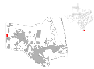
Ratamosa is a census-designated place (CDP) in Cameron County, Texas, United States. The population was 197 at the 2020 census. It is part of the Brownsville–Harlingen Metropolitan Statistical Area.

<span class="mw-page-title-main">Warm Beach, Washington</span> CDP in Washington, United States

Warm Beach is a census-designated place (CDP) in Snohomish County, Washington, United States. The population was 2,990 at the 2020 census.

References

  1. "2020 U.S. Gazetteer Files". United States Census Bureau. Retrieved April 26, 2022.
  2. 1 2 U.S. Geological Survey Geographic Names Information System: Leitersburg, Maryland
  3. "Leitersburg MD ZIP Code". zipdatamaps.com. 2023. Retrieved April 18, 2023.
  4. "National Register Information System". National Register of Historic Places . National Park Service. July 9, 2010.
  5. "Census of Population and Housing". Census.gov. Retrieved June 4, 2016.
  6. "U.S. Census website". United States Census Bureau . Retrieved January 31, 2008.