Related Research Articles

Heber is a census-designated place (CDP) in Imperial County, California. Heber is located 4.5 miles (7 km) north-northwest of Calexico. The population was 4,275 at the 2010 census, up from 2,566 in 2000.
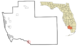
Plantation Island is a census-designated place (CDP) in Collier County, Florida, United States. The population was 119 at the 2020 census, down from 163 at the 2010 census. It is part of the Naples–Marco Island Metropolitan Statistical Area.

Edgemere is an unincorporated community and census-designated place in Baltimore County, Maryland, United States. The population was 8,669 at the 2010 census. Founded in 1899 as Edgemere being renamed from previous name "Fitzell". Meeting held at the Fitzell Farm which was situated where the old Rheem plant was located.

Garrison is a census-designated place (CDP) in Baltimore County, Maryland, United States, adjacent to Owings Mills. It consists mainly of the McDonogh area and Valley Centre. The population was 8,823 at the 2010 census.

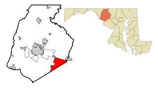
Rossville is an unincorporated community and census-designated place in Baltimore County, Maryland, United States. The population was 15,147 at the 2010 census.
Green Valley is an unincorporated area and census-designated place (CDP) in southern Frederick County, Maryland, United States. The population was 12,643 at the 2020 census. The area was listed as a census-designated place in 2000 but not listed as part of any CDP at the 2010 census. It was re-designated a census-designated place for the 2020 census.

Ashton-Sandy Spring is a census-designated place (CDP) in Montgomery County, Maryland, United States. The CDP is designated to include the two unincorporated communities of Ashton and Sandy Spring, as well as the smaller community of Brinklow. It had a population of 5,746 as of the 2020 census.

South Laurel is an unincorporated area and census-designated place (CDP) in Prince George's County, Maryland, United States. Per the 2020 census, the population was 29,602.

Kingstown is a census-designated place (CDP) in Queen Anne's County, Maryland, United States. The population was 1,644 at the 2000 census.

Fairmount is a census-designated place (CDP) in Somerset County, Maryland, United States. The population was 537 at the 2000 census. It is included in the Salisbury, Maryland-Delaware Metropolitan Statistical Area.

Frenchtown-Rumbly is a census-designated place in Somerset County, Maryland, United States. The population was 96 at the 2000 census. It is included in the Salisbury, Maryland-Delaware Metropolitan Statistical Area.

Cavetown is a census-designated place (CDP) in Washington County, Maryland, United States. The population was 1,486 at the 2000 census.
Chewsville is a census-designated place (CDP) in Washington County, Maryland, United States. The population was 293 at the 2000 census.

Fountainhead-Orchard Hills is a census-designated place (CDP) in Washington County, Maryland, United States. The population was 3,861 at the 2000 census.

Maugansville is a census-designated place (CDP) in Washington County, Maryland, United States. The population was 2,295 at the 2000 census.

Mount Lena is a census-designated place (CDP) in Washington County, Maryland, United States. The population was 501 at the 2000 census.

Paramount-Long Meadow is a census-designated place (CDP) in Washington County, Maryland, United States. The population was 2,722 at the 2000 census.

Robinwood is a census-designated place (CDP) in Washington County, Maryland, United States. The population was 4,731 at the 2000 census. It is a part of the Hagerstown Metropolitan Area. Robinwood is home to Hagerstown Community College.

St. James is a census-designated place (CDP) in Washington County, Maryland, United States. The population was 1,657 at the 2000 census. It is also the home of St. James School, Hagerstown, a small, Episcopalian, boarding school. St. James was formerly named "Lydia."

Wilson-Conococheague is a census-designated place (CDP) in Washington County, Maryland, United States. The population was 2,262 at the 2020 census.
References
- ↑ "2020 U.S. Gazetteer Files". United States Census Bureau. Retrieved April 26, 2022.
- 1 2 U.S. Geological Survey Geographic Names Information System: Halfway, Maryland
- ↑ "Census of Population and Housing". Census.gov. Retrieved June 4, 2016.
- ↑ "Halfway Maryland Population Statistics". US Census Bureau. Retrieved April 1, 2013.
- ↑ "U.S. Census website". United States Census Bureau . Retrieved January 31, 2008.
