Queen Anne, Maryland

Last updated
Queen Anne, Maryland
Queen Anne MD.jpg
MD 303 in Queen Anne.jpg
Grain elevators at the edge of town and Main Street in Queen Anne
Queen Anne's County Maryland Incorporated and Unincorporated areas Queen Anne Highlighted.svg
Location of Queen Anne, Maryland
USA Maryland location map.svg
Red pog.svg
Queen Anne
Location within the U.S. state of Maryland
Usa edcp location map.svg
Red pog.svg
Queen Anne
Queen Anne (the United States)
Coordinates: 38°55′9″N75°57′10″W / 38.91917°N 75.95278°W / 38.91917; -75.95278 Coordinates: 38°55′9″N75°57′10″W / 38.91917°N 75.95278°W / 38.91917; -75.95278
Country United States of America
State Maryland
Counties Talbot, Queen Anne's
Incorporated 1953 [1]
Area
[2]
  Total0.14 sq mi (0.36 km2)
  Land0.14 sq mi (0.36 km2)
  Water0.00 sq mi (0.00 km2)
Elevation
30 ft (9 m)
Population
 (2020)
  Total192
  Density1,391.30/sq mi (538.61/km2)
Time zone UTC-5 (Eastern (EST))
  Summer (DST) UTC-4 (EDT)
ZIP code
21657
Area code 410
FIPS code 24-64500
GNIS feature ID0597934

Queen Anne is a town in Queen Anne's and Talbot counties in the U.S. state of Maryland. The population was 222 at the 2010 census. [3]

Contents

Geography

Queen Anne is located at 38°55′09″N75°57′10″W / 38.919039°N 75.952827°W / 38.919039; -75.952827 (38.919039, -75.952827). [4]

According to the United States Census Bureau, the town has a total area of 0.13 square miles (0.34 km2), all land. [5]

Tuckahoe Creek passes by the town. The likely birthplace of Frederick Douglass is 2-3 miles south, near the banks of the Tuckahoe. [6] Maryland Route 404 passes to the north of town. Tuckahoe State Park is a short ride north of MD 404. The border between Talbot County and Queen Anne's County runs through the middle of town.

History

According to the Maryland Municipal League: [7]

In the 1850s, the area that is now the town of Queen Anne, was part of a 225-acre farm owned by Jacob Morgan. Initially, the town nucleus was nothing but a 1½-story dwelling, but in 1864 Mr. Morgan built a more substantial place—it was known locally as “the mansion house,” and the locale was known as Morganville. [8]
At that time, the Pennsylvania Railroad had been laid as far south as Greensboro and, a little later, to Ridgely and Hillsboro and thence across Tuckahoe Creek. In 1878, the railroad purchased a site for a station across the creek in Queen Anne’s County, and, quite logically, named it Queen Anne when the station was finally put into service about 1882.

Transportation

MD 404 Alternate in Queen Anne 2022-06-21 15 34 08 View east along Maryland State Route 404 Alternate (Talbot Avenue) at Chaires Street in Queen Anne, Talbot County, Maryland.jpg
MD 404 Alternate in Queen Anne

The primary means of travel to and from Queen Anne is by road. Maryland Route 404 Alternate, Maryland Route 303 and Maryland Route 518 are the state highways directly serving the town. Maryland Route 404 and Maryland Route 309 pass just outside the town corporate limits to the north and west.

Demographics

Historical population
CensusPop.
1880 58
1960 283
1970 2923.2%
1980 259−11.3%
1990 250−3.5%
2000 176−29.6%
2010 22226.1%
2020 192−13.5%
U.S. Decennial Census [9]

2010 census

As of the census [10] of 2010, there were 222 people, 83 households, and 54 families living in the town. The population density was 1,707.7 inhabitants per square mile (659.3/km2). There were 89 housing units at an average density of 684.6 per square mile (264.3/km2). The racial makeup of the town was 94.6% White, 2.3% African American, 1.8% Asian, and 1.4% from two or more races.

There were 83 households, of which 42.2% had children under the age of 18 living with them, 54.2% were married couples living together, 8.4% had a female householder with no husband present, 2.4% had a male householder with no wife present, and 34.9% were non-families. 24.1% of all households were made up of individuals, and 9.6% had someone living alone who was 65 years of age or older. The average household size was 2.67 and the average family size was 3.28.

The median age in the town was 34.8 years. 27% of residents were under the age of 18; 10% were between the ages of 18 and 24; 27% were from 25 to 44; 26.2% were from 45 to 64; and 9.9% were 65 years of age or older. The gender makeup of the town was 48.2% male and 51.8% female.

2000 census

As of the census [11] of 2000, there were 176 people, 67 households, and 52 families living in the town. The population density was 1,425.0 inhabitants per square mile (550.2/km2). There were 72 housing units at an average density of 583.0 per square mile (225.1/km2). The racial makeup of the town was 97.16% White, 0.57% African American, 0.57% Native American, 1.14% Asian and 0.57% Pacific Islander.

There were 67 households, out of which 43.3% had children under the age of 18 living with them, 62.7% were married couples living together, 10.4% had a female householder with no husband present, and 20.9% were non-families. 16.4% of all households were made up of individuals, and 7.5% had someone living alone who was 65 years of age or older. The average household size was 2.63 and the average family size was 2.89.

In the town, the population was spread out, with 30.1% under the age of 18, 3.4% from 18 to 24, 29.0% from 25 to 44, 24.4% from 45 to 64, and 13.1% who were 65 years of age or older. The median age was 39 years. For every 100 females, there were 107.1 males. For every 100 females age 18 and over, there were 98.4 males.

The median income for a household in the town was $45,000, and the median income for a family was $55,417. Males had a median income of $31,806 versus $23,542 for females. The per capita income for the town was $16,016. About 2.0% of families and 4.0% of the population were below the poverty line, including 6.8% of those under the age of eighteen and none of those 65 or over.

Related Research Articles

<span class="mw-page-title-main">Caroline County, Maryland</span> County in Maryland, United States

Caroline County is a rural county located in the U.S. state of Maryland on its Eastern Shore. As of the 2020 census, the population was 33,293. Its county seat is Denton.

<span class="mw-page-title-main">Queen Anne's County, Maryland</span> County in Maryland, United States

Queen Anne's County is located on the Eastern Shore of the U.S. state of Maryland. As of the 2020 census, the population was 49,874. Its county seat and most populous municipality is Centreville. The census-designated place of Stevensville is the county's most populous place. The county is named for Queen Anne of Great Britain, who reigned when the county was established in 1706 during the colonial period.

<span class="mw-page-title-main">Midland, Maryland</span> Town in Maryland, United States

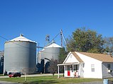
Midland is a town in Allegany County, Maryland, United States, along the Georges Creek Valley. It is part of the Cumberland, MD-WV Metropolitan Statistical Area. The population was 446 at the 2010 census. Midland was founded in 1850 as a coal-mining community, though today only some strip mining remains.

<span class="mw-page-title-main">Denton, Maryland</span> Town in Maryland

Denton is a town in Caroline County, Maryland, United States. The population of Denton was 4,418 as of the 2010 United States Census, and it is the county seat of Caroline County.

<span class="mw-page-title-main">Hillsboro, Maryland</span> Town in Maryland

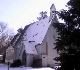
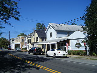
Hillsboro is a town in Caroline County, Maryland, United States. The population was 161 at the 2010 United States Census. Daffin House and St. Paul's Episcopal Church were listed on the National Register of Historic Places in 1975.

<span class="mw-page-title-main">Ridgely, Maryland</span> Town in Maryland

Ridgely is a town in Caroline County, Maryland, United States. The population was 1,639 at the 2010 census.

<span class="mw-page-title-main">North East, Maryland</span> Town in Maryland, United States

North East is a town in Cecil County, Maryland, United States. It is located between Philadelphia and Baltimore. The population was 3,572 at the 2010 census.

<span class="mw-page-title-main">Laytonsville, Maryland</span> Town in Maryland, United States

Laytonsville is a town in Montgomery County, Maryland, United States. The population was 353 at the 2010 census. Laytonsville was incorporated in 1892.

<span class="mw-page-title-main">Barclay, Maryland</span> Town in Maryland, United States

Barclay is a town in Queen Anne's County, Maryland, United States. The population was 120 at the 2010 census.

<span class="mw-page-title-main">Centreville, Maryland</span> Incorporated town in Queen Annes County, Maryland, United States

Centreville is an incorporated town in Queen Anne's County, Maryland, United States on the Delmarva Peninsula. Incorporated in 1794, it is the county seat of Queen Anne's County. The population was 4,285 at the 2010 census. The ZIP code is 21617 and the area codes are 410 and 443. The primary local telephone exchange is 758. It hosts the Queen Anne's County Fair each summer and was home to three franchises during the existence of the Eastern Shore Baseball League—the Colts, Red Sox, and Orioles.

<span class="mw-page-title-main">Queenstown, Maryland</span> Town in Maryland, United States

Queenstown is a town in Queen Anne's County, Maryland, United States. The population was 664 at the 2010 census.

<span class="mw-page-title-main">Sudlersville, Maryland</span> Town in Maryland, United States

Sudlersville is a town in the far northeastern corner of Queen Anne's County, Maryland, United States. The ZIP code is 21668 and the area code is 410. The population was 497 at the 2010 census. It is perhaps best known as the hometown of Baseball Hall Of Fame slugger Jimmie Foxx. Other famous residents include astronomer and mathematician Simon Newcomb.

<span class="mw-page-title-main">Cordova, Maryland</span> Village in Maryland, United States

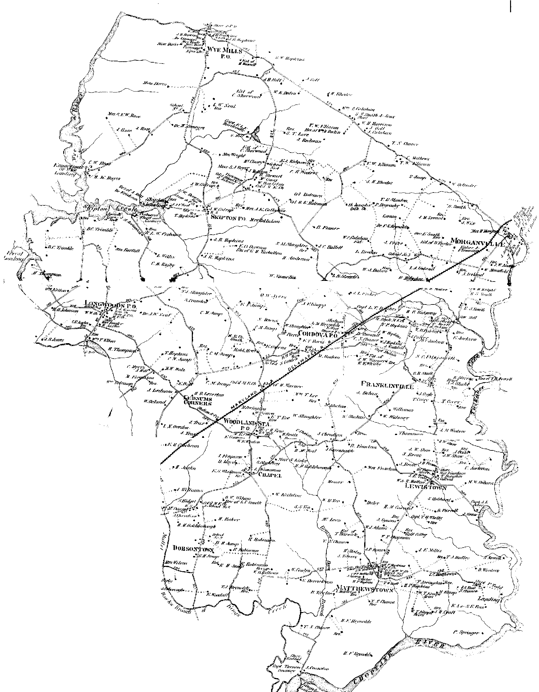
Cordova is a village in Talbot County, Maryland, United States. The population was 592 at the 2000 census.

<span class="mw-page-title-main">Oxford, Maryland</span> Town in Maryland, United States

Oxford is a waterfront town and former colonial port in Talbot County, Maryland, United States. The population was 651 at the 2010 census.

<span class="mw-page-title-main">Trappe, Maryland</span> Town in Maryland, United States

Trappe is a town in Talbot County, Maryland, United States. The population was 1,077 at the 2010 census. It is the site of one of the largest mixed-use developments on the U.S. East Coast called Trappe East or "Lakeside" with controversy arising over its wastewater treatment.

<span class="mw-page-title-main">East Harwich, Massachusetts</span> Census-designated place in Massachusetts, United States

East Harwich is a census-designated place (CDP) and village in the town of Harwich in Barnstable County, Massachusetts, United States. The population was 4,872 at the 2010 census.

<span class="mw-page-title-main">Carpendale, West Virginia</span> Town in West Virginia, United States

Carpendale is a town in Mineral County, West Virginia, United States, and part of the Cumberland, MD-WV Metropolitan Statistical Area'. The population was 861 at the 2020 census. Carpendale was incorporated on January 2, 1990, by the Circuit Court. The town is a combination of three subdivisions of which its name reflects: Carpenters Addition, Millerdale I, and Millerdale II. There are no stores in Carpendale and there is only one road in and out of the town.

<span class="mw-page-title-main">Hampstead, Maryland</span> Town in Maryland, United States

Hampstead is a town in Carroll County in the U.S. state of Maryland. The population was 6,323 at the 2010 census.

<span class="mw-page-title-main">Templeville, Maryland</span> Town in Maryland, United States

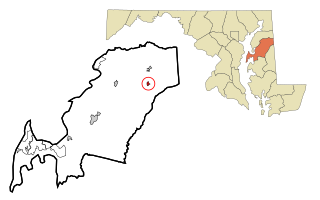
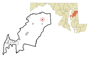
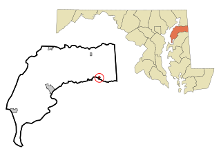
Templeville is a town in Caroline and Queen Anne's counties, Maryland, United States. Templeville is located near the Maryland-Delaware line. The population was 138 at the 2010 census. It was known as Bullock Town until the name was changed in 1847. The name Templeville derives from the Temple family, whose most famous member was Governor William Temple of Delaware.

<span class="mw-page-title-main">Millington, Maryland</span> Town in Maryland, United States

Millington is a town in Kent and Queen Anne's counties in the U.S. state of Maryland. The population was 642 at the 2010 census. Millington is the head of navigation for the Chester River.

References

  1. "Queen Anne". Maryland Manual. Retrieved 27 June 2017.
  2. "2020 U.S. Gazetteer Files". United States Census Bureau. Retrieved April 26, 2022.
  3. "2010 Census Interactive Population Search" . Retrieved 28 June 2012.
  4. "US Gazetteer files: 2010, 2000, and 1990". United States Census Bureau. 2011-02-12. Retrieved 2011-04-23.
  5. "US Gazetteer files 2010". United States Census Bureau. Archived from the original on January 12, 2012. Retrieved 2013-01-25.
  6. Amanda Barker (1996). "The Search for Frederick Douglass' Birthplace" . Retrieved January 8, 2012.
  7. "Queen Anne, Maryland" . Retrieved Sep 28, 2010.
  8. Note that the Maryland Municipal League page for Queen Anne says the town was named "Morgansville", but see this map: "1876 Maps of Maryland's Eastern Shore" . Retrieved 28 July 2011. Look at the east-northeast corner of this 1876/1877 map of the northeast section of Talbot County.
  9. "Census of Population and Housing". Census.gov. Retrieved June 4, 2015.
  10. "U.S. Census website". United States Census Bureau . Retrieved 2013-01-25.
  11. "U.S. Census website". United States Census Bureau . Retrieved 2008-01-31.