
The Choptank River is a major tributary of the Chesapeake Bay and the largest river on the Delmarva Peninsula. Running for 71 miles (114 km), it rises in Kent County, Delaware, runs through Caroline County, Maryland, and forms much of the border between Talbot County, Maryland, on the north, and Caroline County and Dorchester County on the east and south. It is located north of the Nanticoke River, and its mouth is located south of Eastern Bay. Cambridge, the county seat of Dorchester County, and Denton, the county seat of Caroline County, are located on its south shore.
Wye Mills is an unincorporated community in Talbot County, Maryland, United States, located at an altitude of 20 feet (6.1 m). Wye Mills is located at the intersection of Maryland routes 404 and 662, just south of the Queen Anne's County border.
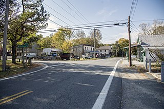
American Corner is a populated place in Caroline County, Maryland, United States. American Corner is home to Colonel Richardson High School and Colonel Richardson Middle School. On older maps, it is sometimes referred to as American Corners. There was formerly a post office, cannery, blacksmith, and a store located there, as seen on the 1875 and 1897 Maps of Caroline County, Maryland.

The Eastern Bay is a tributary of the Chesapeake Bay located between Queen Anne's County, Maryland and Talbot County, Maryland on the Eastern Shore. Its main tributaries include the Miles River and the Wye River. It is located south of the Chester River and north of the Choptank River and is connected to the Chester River via Kent Narrows.

Maryland Route 329 is a state highway in the U.S. state of Maryland. Known as Royal Oak Road, the state highway runs east-west 3.29 miles (5.29 km) through Royal Oak in western Talbot County, connecting with MD 33 at both termini. MD 329, which formed part of the original road between Easton and Saint Michaels, was constructed as a shell road by the time it was brought under Maryland State Roads Commission maintenance in the mid-1920s.
Newcomb Bay is a sheltered bay about 1 mile (1.6 km) in extent, between Clark Peninsula and Bailey Peninsula in the Windmill Islands area.

Clark Peninsula is a rocky peninsula, about 3 km (2 mi) long and wide, lying 5 km (3 mi) north-east of Australia's Casey Station at the north side of Newcomb Bay on the Budd Coast of Wilkes Land in Antarctica.
Sherwood is an unincorporated community in Talbot County, Maryland, United States. Sherwood is located along Maryland Route 33 on the eastern shore of the Chesapeake Bay, south of Claiborne and north of Tilghman Island. USPS has assigned Sherwood the ZIP Code 21665. The Sandy, a log canoe ported in Sherwood, was listed on the National Register of Historic Places in 1985.

The Tred Avon River is a main tributary of the Choptank River in Talbot County on Maryland's Eastern Shore. The river is 17 miles (27 km) long.
Wittman is an unincorporated community in Talbot County, Maryland, United States. Wittman is located at the intersection of Pot Pie Road, New Road, and Cummings Road south of Claiborne. Wittman has a post office, with the ZIP code 21676. The Flying Cloud was listed on the National Register of Historic Places in 1985.
Bozman is an unincorporated community in Talbot County, Maryland, United States. Bozman is located along Maryland Route 579, southwest of St. Michaels.
Neavitt is an unincorporated community in Talbot County, Maryland, United States. Neavitt is located at the southern terminus of Maryland Route 579 on the north bank of the Choptank River, south-southwest of St. Michaels and northeast of Tilghman Island.
Royal Oak is an unincorporated community in Talbot County, Maryland, United States. Royal Oak is located at the intersection of Maryland Route 329 and Bellevue Road, southeast of St. Michaels.
McDaniel is an unincorporated community in Talbot County, Maryland, United States. McDaniel is located along Maryland Route 33, south of Claiborne and a short distance east of the Chesapeake Bay.

Henderson Lake is a lake in the Adirondack mountains in the town of Newcomb, Essex County, New York in the United States. It was named in 1826 after David Henderson, one of the founders of the Elba Iron Works near Lake Placid, New York, and of the Upper Works at Tahawus, New York. The lake is mainly cited by cartographers as the place where the Hudson River as named officially begins, flowing out of the eastern end and outlet of the lake. Unofficially, the source of the river is traced up Indian Pass Brook and other watercourses to Lake Tear of the Clouds.
Tunis Mills is an unincorporated community in Talbot County, Maryland, United States. Tunis Mills is located on the southeast bank of Leeds Creek, 5.8 miles (9.3 km) west-northwest of Easton.
Copperville is an unincorporated community in Talbot County, Maryland, United States. Copperville is located on the northeast bank of Leeds Creek, 6.2 miles (10.0 km) west-northwest of Easton.
Lloyd Landing is an unincorporated community in Talbot County, Maryland, United States.
Doncaster is an unincorporated community in Talbot County, Maryland, United States. Doncaster is located along Maryland Route 33, 3 miles (4.8 km) west of Easton.
Island Creek is a stream in Talbot County, Maryland, in the United States.


