Pittsville, Maryland | |
---|---|
Coordinates: 38°23′41″N75°24′33″W / 38.39472°N 75.40917°W | |
Country | United States |
State | Maryland |
County | Wicomico |
Incorporated | 1906 [1] |
Area | |
• Total | 1.56 sq mi (4.04 km2) |
• Land | 1.56 sq mi (4.04 km2) |
• Water | 0.00 sq mi (0.00 km2) |
Elevation | 52 ft (16 m) |
Population (2020) | |
• Total | 1,636 |
• Density | 1,048.72/sq mi (404.81/km2) |
Time zone | UTC-5 (Eastern (EST)) |
• Summer (DST) | UTC-4 (EDT) |
ZIP code | 21850 |
Area code(s) | 410, 443 |
FIPS code | 24-62025 |
GNIS feature ID | 0591023 |
Website | pittsvillemd |
Pittsville is a town in Wicomico County, Maryland, United States. The population was 1,417 at the 2010 census. It is included in the Salisbury, Maryland-Delaware Metropolitan Statistical Area.
Pittsville is located at 38°23′41″N75°24′33″W / 38.394815°N 75.409288°W . [3]
According to the United States Census Bureau, the town has a total area of 1.68 square miles (4.35 km2), all land. [4]
Pittsville played the part of the backwater Iowa town in the 1974 made-for-TV movie The Rimers of Eldritch starring Rue McClanahan and Susan Sarandon. [5]
Census | Pop. | Note | %± |
---|---|---|---|
1910 | 300 | — | |
1920 | 368 | 22.7% | |
1930 | 436 | 18.5% | |
1950 | 497 | — | |
1960 | 488 | −1.8% | |
1970 | 477 | −2.3% | |
1980 | 519 | 8.8% | |
1990 | 602 | 16.0% | |
2000 | 1,182 | 96.3% | |
2010 | 1,417 | 19.9% | |
2020 | 1,636 | 15.5% | |
U.S. Decennial Census [6] |
As of the census [7] of 2010, there were 1,417 people, 591 households, and 382 families living in the town. The population density was 843.5 inhabitants per square mile (325.7/km2). There were 668 housing units at an average density of 397.6 per square mile (153.5/km2). The racial makeup of the town was 90.3% White, 4.8% African American, 0.1% Native American, 1.6% Asian, 0.6% from other races, and 2.6% from two or more races. Hispanic or Latino of any race were 1.9% of the population.
There were 591 households, of which 33.5% had children under the age of 18 living with them, 45.3% were married couples living together, 14.6% had a female householder with no husband present, 4.7% had a male householder with no wife present, and 35.4% were non-families. 28.3% of all households were made up of individuals, and 9.7% had someone living alone who was 65 years of age or older. The average household size was 2.40 and the average family size was 2.93.
The median age in the town was 39.1 years. 23.4% of residents were under the age of 18; 7.8% were between the ages of 18 and 24; 27.4% were from 25 to 44; 28.9% were from 45 to 64; and 12.6% were 65 years of age or older. The gender makeup of the town was 47.6% male and 52.4% female.
As of the census [8] of 2000, there were 1,182 people, 477 households, and 321 families living in the town. The population density was 677.3 inhabitants per square mile (261.5/km2). There were 506 housing units at an average density of 289.9 per square mile (111.9/km2). The racial makeup of the town was 87.56% White, 6.60% African American, 0.17% Native American, 3.89% Asian, 0.08% from other races, and 1.69% from two or more races. Hispanic or Latino of any race were 1.61% of the population.
There were 477 households, out of which 36.7% had children under the age of 18 living with them, 45.7% were married couples living together, 16.1% had a female householder with no husband present, and 32.5% were non-families. 26.6% of all households were made up of individuals, and 8.2% had someone living alone who was 65 years of age or older. The average household size was 2.48 and the average family size was 2.93.
In the town, the population was spread out, with 26.8% under the age of 18, 9.6% from 18 to 24, 34.1% from 25 to 44, 20.5% from 45 to 64, and 9.0% who were 65 years of age or older. The median age was 32 years. For every 100 females, there were 88.5 males. For every 100 females age 18 and over, there were 84.0 males.
The median income for a household in the town was $32,500, and the median income for a family was $39,375. Males had a median income of $31,141 versus $20,759 for females. The per capita income for the town was $15,966. About 8.3% of families and 9.3% of the population were below the poverty line, including 9.7% of those under age 18 and 8.2% of those age 65 or over.
Desert View Highlands is a census-designated place (CDP) in Los Angeles County, California, United States. The population was 2,360 at the 2010 census, up from 2,337 at the 2000 census. It is surrounded by the City of Palmdale.
Goldsboro is a town in Caroline County, Maryland, United States. William James Yeager is the current mayor. The population was 246 at the 2010 United States Census. The zip code is 21636. First known as Oldtown, it was renamed in 1870 for the prominent Goldsborough family who owned land in the area. Castle Hall was listed on the National Register of Historic Places in 1975.
Preston is a town in Caroline County, Maryland, United States. The population was 719 at the 2010 census.
EldoradoEL-də-RAY-doh is a town in Dorchester County, Maryland, United States. The population was 45 at the 2020 census, making it the second smallest town in Maryland.
Hurlock is a town in Dorchester County, Maryland, United States. The population was 2,092 at the 2010 census.
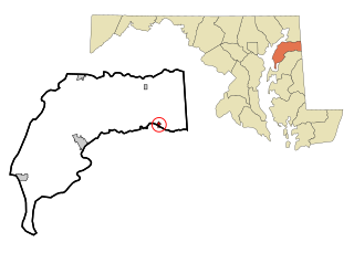
Secretary is a town in Dorchester County, Maryland, United States. The population was 535 at the 2010 census.
Friendsville is a town in Garrett County, Maryland, United States. The population was 438 at the 2020 census.
Kitzmiller is a town in Garrett County, Maryland, United States. The population was 321 at the 2010 census.
Loch Lynn Heights is a town in Garrett County, Maryland, United States. The population was 493 at the 2020 census.
Sudlersville is a town in the far northeastern corner of Queen Anne's County, Maryland, United States. The ZIP code is 21668 and the area code is 410. The population was 497 at the 2010 census. It is perhaps best known as the hometown of Baseball Hall Of Fame slugger Jimmie Foxx. Other famous residents include astronomer and mathematician Simon Newcomb.
Mardela Springs is a town in Wicomico County, Maryland, United States. The population was 357 at the 2010 census. It is included in the Salisbury, Maryland-Delaware Metropolitan Statistical Area.
Sharptown is a town in Wicomico County, Maryland, United States. The population was 651 at the 2010 census. It is included in the Salisbury, Maryland-Delaware Metropolitan Statistical Area.
Willards is a town in Wicomico County, Maryland, United States. The population was 958 at the 2010 census. It is included in the Salisbury, Maryland-Delaware Metropolitan Statistical Area.
Martiny Township is a civil township of Mecosta County in the U.S. state of Michigan. The population was 1,594 at the 2020 census.
Haviland is a community and census-designated place (CDP) in Dutchess County, New York, United States. The population was 4,174 at the 2020 census. It is part of the Poughkeepsie–Newburgh–Middletown, NY Metropolitan Statistical Area as well as the larger New York–Newark–Bridgeport, NY-NJ-CT-PA Combined Statistical Area.
North Union Township is a township that is located in Schuylkill County, Pennsylvania, United States. The population was 1,417 at the time of the 2020 census.
Pittsville is a city in Wood County, Wisconsin, United States. Located in a rural part of the county, Pittsville is surrounded by parks and public land, including; North Wood County Park and Campground, Powers Bluff, Dexter County Park and Campground, Sherwood County Park and Campground, Wood County Forest, Sandhill State Wildlife Area, and Black River State Forest. The population was 874 at the 2010 census and was 813 at the 2020 census.
Templeville is a town in Caroline and Queen Anne's counties, Maryland, United States. Templeville is located near the Maryland-Delaware line. The population was 138 at the 2010 census. It was known as Bullock Town until the name was changed in 1847. The name Templeville derives from the Temple family, whose most famous member was Governor William Temple of Delaware.
Millington is a town in Kent and Queen Anne's counties in the U.S. state of Maryland. The population was 642 at the 2010 census. Millington is the head of navigation for the Chester River.
Hillsboro is a city in Vernon County, Wisconsin, United States. The population was 1,397 at the 2020 Census. The city is located within the Town of Hillsboro. Hillsboro is known as the Czech Capital of Wisconsin.