Lanham is an unincorporated community and census-designated place in Prince George's County, Maryland, United States. As of the 2020 United States Census it had a population of 11,282. The New Carrollton station as well as an Amtrak station are across the Capital Beltway in New Carrollton, Maryland. Doctors Community Hospital is located in Lanham.
Williston is an unincorporated town and census-designated place on the Eastern Shore of the U.S. state of Maryland, in Caroline County. As of the 2010 census it had a population of 155. It is situated between Maryland Route 16 on its eastern edge and the Choptank River on its west. It was originally known as Potter's Landing for its first resident, Zabdiel Potter. His home, Potter Hall, was listed on the National Register of Historic Places in 1982.

Quantico is an unincorporated community and census-designated place in Wicomico County, Maryland, United States, along the former stage route from Vienna to the port of Whitehaven on the Wicomico River. It consists of approximately 35 homes on the Quantico Creek. The community lies four miles (6 km) from Hebron along Maryland Route 347. There are two churches, a general store, and a post office in the community. It is part of the Salisbury, Maryland-Delaware Metropolitan Statistical Area.

Flintstone is an unincorporated community and census-designated place (CDP) in Allegany County, Maryland, United States. As of the 2010 census it had a population of 177. It is part of the Cumberland, MD-WV Metropolitan Statistical Area.
Bivalve is an unincorporated community and census-designated place along the eastern shore of the lower Nanticoke River, near its mouth on the Chesapeake Bay, in Wicomico County, Maryland, United States. Its population was 201 as of the 2010 census. Bivalve takes its name from the oyster, upon which the town's economy once depended. It is part of the Salisbury, Maryland-Delaware Metropolitan Statistical Area.

Taylors Island is an unincorporated community and census-designated place in Dorchester County, Maryland, United States, in the state's Eastern Shore region. The population was 173 at the 2010 census. It is known for hunting, crabbing and fishing. Ridgeton Farm was listed on the National Register of Historic Places in 1977. Bethlehem Methodist Episcopal Church and Grace Episcopal Church Complex were listed in 1979.

Fairplay is an unincorporated community and census-designated place (CDP) in Washington County, Maryland, United States. Its population was 580 as of the 2010 census. It is sometimes recognized, along with neighboring Tilghmanton, as Fairplay-Tilghmanton; the two communities share a post office as well as a fire company. Fairplay is located between Hagerstown and Sharpsburg, along Maryland Route 65 and is part of the Hagerstown Metropolitan Area. Marsh Mills was listed on the National Register of Historic Places in 1996.
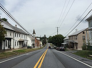
Still Pond is a census-designated place in Kent County, Maryland, United States. Still Pond is located at the intersection of Maryland routes 292 and 566 on Still Pond Neck, south-southeast of Betterton and north of Chestertown. Much of the community is included in the Still Pond Historic District and it is notable as the first place in Maryland in which women gained the right to vote.
Worton is an unincorporated community and census-designated place (CDP) in Kent County, Maryland, United States. As of the 2010 census it had a population of 249.
Swanton is an unincorporated area and census-designated place (CDP) in Garrett County, Maryland, United States. Swanton is close to several recreation areas, such as Deep Creek Lake State Park and Jennings Randolph Lake. A church and a post office are located in the downtown area. The population was 58 at the 2010 census.

Kennedyville is an unincorporated community and census-designated place in Kent County, Maryland, United States. As of the 2010 census it had a population of 199.
Fairlee is an unincorporated community and census-designated place in Kent County, Maryland, United States. Its population was 490 as of the 2010 census.

Croom is an unincorporated community and census-designated place in Southern Prince George's County, Maryland, United States. As of the 2020 census it had a population of 2,720. Croom largely consists of former tobacco farms and forests converted to Washington bedroom subdivisions such as nearby Marlton. The main part of Patuxent River Park is in Croom.

Bryantown is an unincorporated community and census-designated place in Charles County, Maryland, United States, adjacent to Maryland Route 5. As of the 2010 census, it had a population of 655.
West Denton is an unincorporated community and census-designated place (CDP) in Caroline County, Maryland, United States. As of the 2010 census it had a population of 52.
Libertytown is an unincorporated community and census-designated place (CDP) in Frederick County, in the U.S. state of Maryland. As of the 2010 census it had a population of 950. The Abraham Jones House was listed on the National Register of Historic Places in 1973.

Sabillasville is an unincorporated community and census-designated place in Frederick County, Maryland, United States. As of the 2010 census it had a population of 354.
Antietam is an unincorporated community and census-designated place in Washington County, Maryland, United States. Its population was 89 as of the 2010 census. It is the site of Antietam Iron Furnace Site and Antietam Village, added to the National Register of Historic Places in 1975.

Allen is an unincorporated community and census-designated place in Wicomico County, Maryland, United States. Its population was 210 as of the 2010 census. It is part of the Salisbury, Maryland-Delaware Metropolitan Statistical Area.

Whitehaven is an unincorporated community and census-designated place in Wicomico County, Maryland, United States. Its population was 43 as of the 2010 census. It is part of the Salisbury, Maryland-Delaware Metropolitan Statistical Area.


